ATLAS of ANTIENT GEOGRAPHY by SAMUEL BUTLER 1843John McInnis Auctioneers,LLC4.5(505)See Sold PriceFeb 24, 2024
18TH C. ANTIQUE MAP: FRENCH & INDIAN WAR, FRAMEDThomaston Place Auction Galleries4.4(393)See Sold PriceFeb 24, 2024
Rand McNally Railroad Map Cabinet w/ 21 Railroad MapsRail & Road Auctions4.6(165)See Sold PriceMar 08, 2024
Keith Haring - Ink on New York Map, Best Buddies, Inscribed, Signed, and DatedSapphire Auction Gallery4.1(67)See Sold PriceMar 02, 2024
LATE 17TH C. FRENCH MAP OF THE NEW WORLD BY ALEXIS-HUBERT JAILLOT (1632-1712)Thomaston Place Auction Galleries4.4(393)See Sold PriceFeb 24, 2024
Central Railroad of New Jersey Map of Sandy Hook Route-ca. 1903JM Hobby Supply and Railroad Artifact Auctions4.4(127)See Sold PriceFeb 24, 2024
Lot of Six Mixed Atlas Box Cars-HO Scale-New in BoxJM Hobby Supply and Railroad Artifact Auctions4.4(127)See Sold PriceFeb 25, 2024
Rand McNally/Santa Fe Railroad Map of Iowa-1912JM Hobby Supply and Railroad Artifact Auctions4.4(127)See Sold PriceFeb 24, 2024
NICOLAES VISSCHER (NETHERLANDS, 1618-1709) MAP OF THE NEW WORLDThomaston Place Auction Galleries4.4(393)See Sold PriceFeb 24, 2024
17TH C. WORLD MAP BY NICOLAES VISSCHER (NETHERLANDS, 1618-1709)Thomaston Place Auction Galleries4.4(393)See Sold PriceFeb 24, 2024
Lot of Six Mixed Atlas Cabooses-HO Scale-New in BoxJM Hobby Supply and Railroad Artifact Auctions4.4(127)See Sold PriceFeb 25, 2024
SoldEngraved Maps, Lot of 3, 18th c.Lot of 3 engraved maps, including: *** AN ACCURATE MAP OF EUROPE. Emanuel Bowen, ca. 1747. Image 7.75" x 6". Hand-colored. Creasing and soiling. *** AN ACCURATE MAP OF ASIA. [Emanuel Bowen, ca. 1747.]See Sold Price
Sold3 18th C. Engraved Maps of FranceLot of three engraved maps of France, 20 1/4"h x 24 1/2"w (largest). Creases and toning.See Sold Price
Lot of 18th C. MapsMAP LOT. Lot of three 18th C. British maps. Double framed county maps, "Essex" and "Hereford Shire", published Sept 29, 1741, engraved by W.H. Toms, 6" x 5 3/4" viewed; "Survey of the road from ExeterSee Sold Price
Sold[Christianity, Lot of 3 Titles, 18th c.]Including: ***** 1: L'OFFICE DE LA SEMAINE-SAINTE…. Paris, 1748. 8vo. Frontis plus additional engraved title, 720 pp. 8vo, period calf with some soiling, contents clean, Very Good. ****** 2: THESee Sold Price
SoldSet of three copper engraved maps(lot of 3) Copper engraved 18th century maps with hand coloring, depicting Italy, Switzerland, Sweden, and Norway and all with later French text, two dated 1766, all by St. BrionSee Sold Price
SoldFramed engraved maps, Johannes Blaeu(lot of 3) Framed engraved 18th century maps by Johannes Blaeu and Martino Martini of Chinese provinces (Hunan and Xansi)See Sold Price
Soldengraved maps, Johannes Blaeu, China(lot of 3) Framed engraved 18th century maps by Johannes Blaeu and Martino Martini of the Chinese provinces (Hunan and Xansi)See Sold Price
SoldSet of three copper engraved maps(lot of 3) Copper engraved 18th century maps with hand coloring, depicting Italy, Switzerland, Sweden, and Norway and all with later French text, two dated 1766, all by St. BrionSee Sold Price
SoldCopper engraved map group(lot of 3) Copper engraved 18th century maps with hand coloring, depicting the European, South American, and African continents including Egypt, Italy, etc. All by St. Brion and dated 1766See Sold Price
LOT (3) FOLIO ENGRAVED MAPS, FRENCH PROVINCESLOT (3) FOLIO ENGRAVED MAPS, FRENCH PROVINCES, 17/18TH CENTURY. 19 1/2 X 24" (AGE CONDITIONS)See Sold Price
SoldBurgandy France Antique MapComitatus Burgundiae. Hand-colored engraved map. French wine region. J.B. Homann, Nuremberg, 18th C. 24 3/4" x 21".See Sold Price
Sold(3) ANTIQUE MAPS, BRAZIL, PERU, AMAZON, 18TH C.(lot of 3) Antique maps, including: (1) "Carte de la Terre Ferme du Perou, du Bresil, et du Pays des Amazones," (Peru, Brazil, Amazon), c.1725, Coven & Mortiers Publishers, based on the cartography ofSee Sold Price
Sold(3) ANTIQUE MAPS, SPAIN, PORTUGAL, SAXONY, 18TH C.(lot of 3) Antique maps, including: (1) "Saxonie Inferioris Circulus...," c.1730, Georg Matthaus Seutter (German, 1678-1757), hand colored, approx 20.5"h, 23.75"w; (1) "La Catalogna Li Regni Di AragonSee Sold Price
(3) ANTIQUE MAPS, GERMANY, 17TH & 18TH C.(lot of 3) Antique maps, including: (1) "Dithmarshen" (Northern Germany), with inset maps of "Brunsbuttel, 1644" and "Meldorpia, 1500," Johannes Mejer (German, c.1606-1674), hand colored, including seSee Sold Price
Sold18th c. Florida Map - Herman MollFLORIDA, CALLED BY YE FRENCH LOUISIANA & C., hand colored engraved map by Herman Moll (1688-1732), originally appeared in Moll's Atlas Minor (1736). 8 1/8" x 11" plate, 8 3/8" x 11 1/8" sight, 15" x 1See Sold Price
Sold18th c. Map of America- Emanuel Bowen18th c. Map- ''A New and Accurate Map of America''- engraved map, 1748, from John Harris- ''Complete Collection of Voyages and Travels'', short repaired separation at top of centerfold. 14 3/8 x 17 5/See Sold Price
SoldHERMAN MOLL HAND COLORED ENGRAVED MAPS 18TH C. TWOHERMAN MOLL, HAND COLORED ENGRAVED MAPS, 18TH C., TWO, GREAT BRITAIN, IRELAND, GALLOWAY:Under glass and matted in matched frames. Lyons Ltd., Antique Prints label. Visible image size 7 3/4" x 10 1/4".See Sold Price
Lot of 18th c. British Maps.MAP LOT. Lot of three 18th c. British maps: County of Kent, 1765, 6 1/2" x 7 3/4" viewed; J. Gibson, 6 1/4" x 8" viewed; Berk Shire 1765, 6 1/2" x 7 3/4" viewed; Oxford Shire 1765, 8 " x 6 1/2" viewedSee Sold Price
SoldCollection of 18thC Engraved MapsCollection of approximately 200+ 18th century engraved maps on laid paper, with Latin descriptions, each 8 3/4" x 11 1/8" (sheet).See Sold Price
SoldLOT (3) INCLUDING HAND COLORED COPPER ENGRAVED MAPLOT (3) INCLUDING HAND COLORED COPPER ENGRAVED MAP, JOHN SPEEDE, A COAT OF ARMS AND A MAP OF WESTPHALIA, 17/18TH CENTURYSee Sold Price
SoldLot of Antique GlassComprising; a footed vase engraved with tropical fauna, 3 18thc. Wines and a pair of cut crystal candlesticks (one with broken foot) Vase is 8 in.h. Condition: One candlestick broken at footSee Sold Price
SoldNicolas Sanson/ Pierre Mortier, engraving mapNicolas Sanson/ Pierre Mortier , "Gallia Vetus...", 18th c., printed in Amsterdam, engraved map of France, outline color, elaborate cartouche, sight 20 1/4 in. x 16 3/4 in., framed * NO RETURNS ARE ACSee Sold Price
SoldHand-Colored Copper Engraved Antique Maps(lot of 2) Matthäus Seutter III (German, 1678-1757), Roterodami Delineatio Ichnographica et Scenographica opera, and Heredibus Homanni (18th c.), Haga Comitum (Prospect von Graven Haag), hand-coloredSee Sold Price
Sold[West Indies, Engravings, 18th c.]Lot of 3 engravings related to events in the West Indies. Late 18th century, on folio sheets, 2 sheets measuring 13.5" x 8.75", 1 sheet 11.5" x 8.25". One engraved for Raymond's History of England, twSee Sold Price
Box Lot #11 This lot consists of 3 antique Nepalese metal pieces, one Burmese 18thC Fine metalThe Buddha Gallery4.4(29)See Sold PriceMar 13, 2024
18TH C. ENGLISH PEWTER PLATES & PLATTERS BY ROBERT NICHOLSONThomaston Place Auction Galleries4.4(393)See Sold PriceFeb 24, 2024
Three 18th C. Chinese Export Porcelain CupsEpic Auctions and Estate Sales4.6(210)See Sold PriceMar 02, 2024
Baker 18th C. Style 3 Drawer Bombe ChestEpic Auctions and Estate Sales4.6(210)See Sold PriceMar 02, 2024
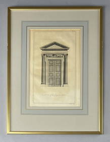
18th C. Etching "A Door of the Composite Order"Epic Auctions and Estate Sales4.6(210)See Sold PriceMar 02, 2024
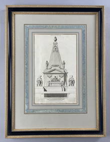
18th C. French Neoclassical Tomb Print IEpic Auctions and Estate Sales4.6(210)See Sold PriceMar 02, 2024
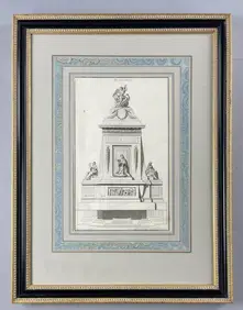
18th C. French Neoclassical Tomb PrintEpic Auctions and Estate Sales4.6(210)See Sold PriceMar 02, 2024
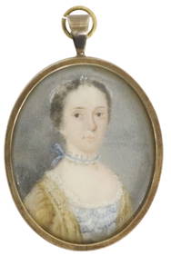
SAMUEL COLLINS (ATTRIB) PORTRAIT MINIATURE, 18TH C.Austin Auction Gallery4.7(1.2k)See Sold PriceFeb 25, 2024
18th Century Hess Germany Hand colored Engraved MapGlobal Auctions Company4.3(36)See Sold PriceMar 03, 2024
Two (2) Antique 18th C. Copper Engraved Framed Maps - America & EuropeMagnusson Art Group4.5(53)See Sold PriceMar 14, 2024
Two 18thC brass candlesticks with knop decoration to stem. Largest approx. 6 3/4" high (2) PleaseClaydon Auctioneers Ltd4.3(125)See Sold PriceFeb 26, 2024
Map: An 18thC engraved and hand coloured map of Buckinghamshire after Robert Morden. Approx. 8 1/4"Claydon Auctioneers Ltd4.3(125)See Sold PriceFeb 26, 2024
Map: An 18thC engraved and hand coloured map of Northamptonshire, with description ofClaydon Auctioneers Ltd4.3(125)See Sold PriceFeb 26, 2024
Map: A 17thC engraved map of the British Isles titled A Generall Mapp of the Isles of GreatClaydon Auctioneers Ltd4.3(125)See Sold PriceFeb 26, 2024
Map: An 18thC engraved and hand coloured map of North America and South America, titled DeClaydon Auctioneers Ltd4.3(125)See Sold PriceFeb 26, 2024
Map: An 18thC engraved map of Bedfordshire titled An Accurate Map of the County of Bedford DividedClaydon Auctioneers Ltd4.3(125)See Sold PriceFeb 26, 2024
Map: An 18thC engraved map titled A New and Improved Map of Oxfordshire.. after Thomas Kitchin.Claydon Auctioneers Ltd4.3(125)See Sold PriceFeb 26, 2024
1675 ELZEVIER JULIUS CAESAR antique ILLUSTRATED w/ MAPS ROMAN HISTORYJasper524.5(9.9k)See Sold PriceFeb 27, 2024
FOUR ANTIQUE ENGLISH STERLING SILVER SPOONS 18TH CAntique Arena Inc.4.5(878)See Sold PriceMar 02, 2024
Chinese Export Porcelain Teapots, Creamer & Plate, Ca. 18th C., H 5.75" W 4.5" L 6" 4 pcsDuMouchelles4.6(830)See Sold PriceMar 14, 2024


![[Christianity, Lot of 3 Titles, 18th c.] (1 of 9)](https://p1.liveauctioneers.com/3532/91776/46880636_1_x.jpg?height=282&quality=70&version=1469669287)


![[West Indies, Engravings, 18th c.] (1 of 5)](https://p1.liveauctioneers.com/3532/176090/88636478_1_x.jpg?height=282&quality=70&version=1596942787)