SoldSet of three copper engraved maps(lot of 3) Copper engraved 18th century maps with hand coloring, depicting Italy, Switzerland, Sweden, and Norway and all with later French text, two dated 1766, all by St. BrionSee Sold Price
SoldSet of three copper engraved maps(lot of 3) Copper engraved 18th century maps with hand coloring, depicting Italy, Switzerland, Sweden, and Norway and all with later French text, two dated 1766, all by St. BrionSee Sold Price
Set of three colored copper engraved geographical,Set of three colored copper engraved geographical, historical and statistical maps of Virginia, Maryland, and Delaware. sight size: 17" x 21 1/4".See Sold Price
SoldSet of 3 U.S. Geological Survey Copper Map PlatesRare Vintage Set of Three United States Geological Survey (USGS) Copper Map Plates, each of the three engraved plates illustrating a topographical map of Holston Valley, the tri-city region of KingspoSee Sold Price
SoldThree Rare US Geological Survey Copper Map PlatesRare Vintage Set of Three United States Geological Survey (USGS) Copper Map Plates, each of the three engraved plates illustrating a topographical map of Holston Valley, the tri-city region of KingspoSee Sold Price
SoldThree Rare US Geological Survey Copper Map PlatesRare Antique Set of Three United States Geological Survey (USGS) Copper Map Plates, each of the three engraved plates illustrating a topographical map of Continental, Ohio, 4100 N latitude and 8415 WSee Sold Price
Sold3 Maps of Louisiana and the Mississippi BasinThree Hand-Colored Copper Engraved Maps of Louisiana and the Mississippi Basin by Jacques-Nicolas Bellin (French, 1703-1772), from Le Petit Atlas Maritime, vol. 1, published Paris, 1764, including "SuSee Sold Price
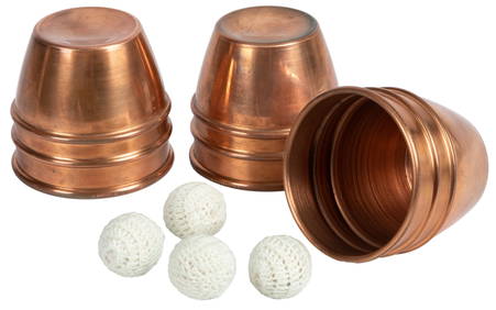
Sold“Vernon” Cups. London, Unique Magic Studio (Harry“Vernon” Cups. London, Unique Magic Studio (Harry Stanley), ca. 1957. Set of three copper cups with engraved design meant to mimic the look of Dai Vernon’s own set of cups. Opening 3 ” in diamSee Sold Price
Sold“Vernon” Cups. London, Unique Magic Studio (Harry“Vernon” Cups. London, Unique Magic Studio (Harry Stanley), ca. 1957. Set of three copper cups with engraved design meant to mimic the look of Dai Vernon’s own set of cups. Opening 3 ¼” in diSee Sold Price
Sold3 ANTIQUE HAND COLORED COPPER ENGRAVED MAPSA collection of three antique hand colored copper engraved maps. Ht: 20.75" Wd: 25.75" (largest, framed)See Sold Price
SoldFour 18th century maps by Zatta & Euler(lot of 4) Group of 18th century copper engraved maps, each handcolored, three maps produced under the supervision of Leonard Euler (1707-1783), the Swiss mathematician, including Regni Hiberniae (IreSee Sold Price
SoldSouth America C1830-1890s Lot of 5 MapsIncl South America Continent, Brazil, and Columbia/Venezuela/Ecuador/Peru/Bolivia. Three Lithograph Maps and One Hand Colored Copper Engraved Map Published C1835, London for "A Complete and UniversalSee Sold Price
SoldEncyclo. Britannica C1830 Set 2 Maps of Spain PortugalCopper Engraved Maps Published 1830-42, Edinburgh for "Encyclopedia Britannica" Seventh Edition. Centre fold as issued. Paper Size: 16 x 11 inch (40 x 28cm) Some toning, otherwise fineSee Sold Price
SoldEncyclo. Britannica C1830 Set of 2 Maps of the USACopper Engraved Maps Published 1830-42, Edinburgh for "Encyclopedia Britannica" Seventh Edition. Centre fold as issued. Paper Size: 16 x 11 inch (40 x 28cm) Some toning/offsetting, otherwise fineSee Sold Price
SoldToms & Badeslade 1742 Hand Coloured Map of Worcester"A Map of Worcestershire" Hand Coloured Copper Engraved Map Published 1742, London for "Chorographia Britanniae, or a set of maps of all the counties in England and Wales" by Thomas Badeslade & WilliaSee Sold Price
SoldToms & Badeslade C1742 Hand Col Map of StaffordshireHand Colored Copper Engraved Map Published C1742, London for "Chorographia Britanniae, or a Set of Maps of all the Counties in England and Wales" by Thomas Badeslade and William Henry Toms. Paper SizeSee Sold Price
Sold3 Bellin Maps, incl. Louisiana, Florida, 1760sThree (3) Jacques-Nicolas Bellin (1703-1772) copper plate engraved maps with hand coloring and decorative cartouches on laid paper, all from "Le Petit Atlas Maritime", 1764. 1st item: Embouchures du FSee Sold Price
SoldSet of four colored copper engraved geographical,Set of four colored copper engraved geographical, historical and statistical map of New Hampshire, Florida, Indiana and Michigan. sight size: 17" x 21 1/4"See Sold Price
SoldA Voyage to the Pacific Ocean...for making DiscovAuthor: Cook, James and James King Description: Three text volumes and Atlas volume. Text Volumes: [8], xcvi, 421; [12], 549; [12], 558, + [1] ad pp. Illustrated with 24 copper-engraved maps, charts aSee Sold Price
SoldEPHEMERA GROUP includes Smith's 1835 School AtlasEPHEMERA GROUP includes Smith's 1835 School Atlas with twelve hand-colored copper engraved maps (tears, student writing and drawing - but maps are clean), three unframed Japanese woodblock prints, larSee Sold Price
SoldCellarius THE MOTIONS OF THE THREE OUTER PLANETS 1660Details: CELLARIUS, Andreas (c.1596-1665). [The Motions of the Three Outer Planets] Theoria trium superiorum planetarum . Amsterdam: Jan Jansson, [1660]. Copper-engraved celestial map, with full origSee Sold Price
SoldJohnny Thompson’s Engraved Cups and Balls. Set ofJohnny Thompson’s Engraved Cups and Balls. Set of three finely engraved silver-plated copper “Miller” cups owned and used by Johnny Thompson – aka The Great Tomsoni – forSee Sold Price
SoldChinese antique red lacquer hanging rackChinese antique red lacquer hanging rack (60.5"Hx68.5"x14") with three sets of antique bells (22"x7"dia, 19"x6"dia, 10"x4.7"dia), the ends decorated with engraved copper finalsSee Sold Price
SoldSet of three Swords and knivesSudan. Set of three swords and knives. Iron, engraved. Wooden sheaths covered with lizard skin, incl. head and claws. Two small knifes, engraved, wooden hilts with copper wire. Sheaths also covered wiSee Sold Price
VENET / DEBUCOURT (1755-1832) Set 3 x Aquatint Engraved Hunting Scenes 23" x 16"Luis Porretta Fine Arts4.3(10)See Sold PriceMar 02, 2024
“Vernon” Cups. London: Unique Magic Studio (Harry Stanley),...Potter & Potter Auctions4.6(545)See Sold PriceFeb 24, 2024
Churchill & Nieuhof 1744 Folio Map. Cape of Good Hope, South AfricaAlbion Auctions4.7(341)See Sold PriceMar 01, 2024
Churchill & Nieuhof 1744 Folio Map. Batavia Indonesia East IndiesAlbion Auctions4.7(341)See Sold PriceMar 01, 2024
Churchill & Nieuhof 1744 Map. Batavia Jakarta IndonesiaAlbion Auctions4.7(341)See Sold PriceMar 01, 2024
Cooke, George 1801 Antique Map. United States of AmericaAlbion Auctions4.7(341)See Sold PriceMar 01, 2024
Cooke, George 1801 Antique Map. Italy, Sicily, Sardinia & CorsicaAlbion Auctions4.7(341)See Sold PriceMar 01, 2024
Paterson & Mogg 1822 Pair of British Road Maps. Isle of Thanet & WightAlbion Auctions4.7(341)See Sold PriceMar 01, 2024
Paterson & Mogg 1822 Pair of British Road Maps. Rye, Eastbourne, SouthamptonAlbion Auctions4.7(341)See Sold PriceMar 01, 2024
Paterson & Mogg 1822 Pair of British Road Maps. Deal, Hythe, Shoreham, ChichesterAlbion Auctions4.7(341)See Sold PriceMar 01, 2024
Rees & Macpherson 1820 Lot of 6 Ancient Geography MapsAlbion Auctions4.7(341)See Sold PriceMar 01, 2024