SoldDunn (Samuel) The Seven United ProvincesDunn (Samuel) The Seven United Provinces,showing the Netherlands, the North Sea and part of England and France, engraved map with original outline hand-colouring, 305 x 435mm., small repair toSee Sold Price
SoldDunn (Samuel) The Seven United ProvincesDunn (Samuel) The Seven United Provincesshowing the Netherlands, the North Sea and part of England and France, engraved map with original outline hand-colouring, 305 x 435mm., small repair toSee Sold Price
SoldMap of Seven United Provinces, 1836Original engraving by Samuel Walker, 1836. Dimensions: 12” x 16” No Reserve Buyer pays shipping - ships from Ocean View, DESee Sold Price
Map of Seven United Provinces, 1836Original engraving by Samuel Walker, 1836. Dimensions: 12” x 16” No Reserve This item ships from Ocean View, DE.See Sold Price
Map of Seven United Provinces, 1836Original engraving by Samuel Walker, 1836. Dimensions: 12” x 16”See Sold Price
Map of Seven United Provinces, 1836Original engraving by Samuel Walker, 1836. Dimensions: 12” x 16” This item ships from Ocean View, DE.See Sold Price
Holland Or the Seven United Provinces, And theTitle: Holland Or the Seven United Provinces, And the Netherlands Date: 1814 Cartographer: LEWIS, SAMUEL Publisher: M. CAREY Size: 16Height - 13.1Width Provenance: Wide margins. Browned. Reserve: $60.See Sold Price
Map of Seven United Provinces, 1836Original engraving by Samuel Walker, 1836. Dimensions: 12” x 16”See Sold Price
Sold[Holland] The Seven United Provinces. From the bestTitle: [Holland] The Seven United Provinces. From the best authorities. Publication Date: c1789 Size: 7.3Height - 8.5Width Additional Information: Plate XII. From an unidentified English atlas ReserveSee Sold Price
Sold1783 Folding Map of Seven United ProvincesA New Map of the Seven United Provinces, by J. Bayley, printed at London in 1783, published by Harrison and Co. Folding map measuring 16 x 10". Fine condition. Reserve: $15.00 Shipping: Domestic: FlatSee Sold Price
SoldSeven United Provinces With The Austrian, French &Title: Seven United Provinces With The Austrian, French & Dutch Netherlands. Publication Date: c1763 Cartographer: JEFFERYS, T. Size: 7.1Height - 7.1Width Reserve: $45.00 Shipping: Domestic: Flat-rSee Sold Price
SoldTthe Seven United Provinces, & Netherlands, from TheTitle: Tthe Seven United Provinces, & Netherlands, from The Latest Authorities Publication Date: 1790 Cartographer: CONDER, T. Publisher: C. DILLY Size: 7.25Height - 8.5Width Additional Information: ISee Sold Price
c.1800 American Made Map, The Seven United Provinces,The Seven United Provinces. ( Europe / Netherlands ). Issued c.1800 New York. Engraved for Payne's Geography, Published by J. Low. Very early American produced map of the Netherlands. EngravSee Sold Price
1783 Map of the Seven United ProvincesA New Map of the Seven United Provinces, by J. Bayley, printed at London in 1783, published by Harrison and Co. Folding map measuring 16 x 10". Fine condition. Please note that this lot has a confidenSee Sold Price
Seven United Provinces, With Their Roads and DivisionsTitle: Seven United Provinces, With Their Roads and Divisions Publication Date: 1780-03-02 Cartographer: SAYER, ROBERT Publisher: ROBERT SAYER Size: 18.6X22.25 Stained upper margin. Map 13 from SayerSee Sold Price
c.1800 American Made Map, The Seven United Provinces,The Seven United Provinces. ( Europe / Netherlands ). Issued c.1800 New York. Engraved for Payne's Geography, Published by J. Low. Very early American produced map of the Netherlands. Engraved, possibSee Sold Price
c.1800 American Made Map, The Seven United Provinces,The Seven United Provinces. ( Europe / Netherlands ). Issued c.1800 New York. Engraved for Payne's Geography, Published by J. Low. Very early American produced map of the Netherlands. Engraved,See Sold Price
c.1800 American Made Map, The Seven United Provinces,The Seven United Provinces. ( Europe / Netherlands ). Issued c.1800 New York. Engraved for Payne's Geography, Published by J. Low. Very early American produced map of the Netherlands. Engraved,See Sold Price
Seven United Provinces, & Netherlands, from The LatestTitle/Content of Map: Seven United Provinces, & Netherlands, from The Latest Authorities. Date: 1791 Cartographer: CONDER, T. sculpt. Size: 7.3Height - 8.5Width Publisher: R. WILKINSON Illustration maSee Sold Price
1800 Payne Map of The Netherlands -- Seven United ProvincesTitle: 1800 Payne Map of The Netherlands -- Seven United Provinces Cartographer: J Payne Year / Place: 1800, New York Map Dimension (in.): 7.1 X 8.1 in. This is a handsome map of the Netherlands. DetaSee Sold Price
c.1800 American Made Map, The Seven United Provinces,The Seven United Provinces. ( Europe / Netherlands ). Issued c.1800 New York. Engraved for Payne's Geography, Published by J. Low. Very early American produced map of the Netherlands. Engraved,See Sold Price
The Seven United Provinces with the Land of DrentTITLE/CONTENT OF MAP: 'A map of the Seven United Provinces with the Land of Drent and the Generality Lands' The top image on the right hand side shows the entire map. To view a close up of the map shoSee Sold Price
Seven United Provinces, & Netherlands, from The LatestTitle: Seven United Provinces, & Netherlands, from The Latest Authorities. Cartographer: CONDER, T. sculpt. Publisher: R. WILKINSON Brief Description: Light offsetting. Height X Width: 7.3x 8.5 ReservSee Sold Price
1834 Malte-Brun Map of the Netherlands -- The Seven United Provinces with their DependenciesTitle: 1834 Malte-Brun Map of the Netherlands -- The Seven United Provinces with their Dependencies Cartographer: M. Malte-Brun / S. Walker Year / Place: 1834, Boston Map Dimension (in.): 9.3 x 7.5 inSee Sold Price
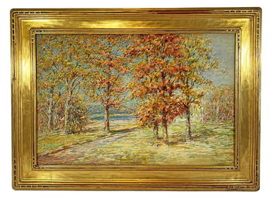
Samuel Joseph Clark (UK,1834-1912) oil painting antiqueBroward Auction Gallery4.8(277)See Sold PriceMar 17, 2024
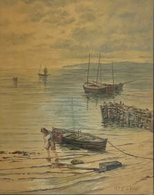
Judson Tunison American Landscape Watercolor PaintingNapoleon's Fine Art4.4(75)See Sold PriceFeb 25, 2024
SAMUEL ALITO UNITED STATES SUPREME COURT JUSTICE BECKETT/COA SIGNED 8X10 PHOTOMynt Auctions4.6(680)See Sold PriceFeb 23, 2024
JACKSON, Samuel L., ed. Jackson's International Almanac: A Pocket Encyclopedia of the Negro. [NewFreeman's | Hindman4.4(1.6k)See Sold PriceFeb 27, 2024
Arrowsmith & Lewis - Map of the United StatesTrillium Antique Prints & Rare Books4.5(30)See Sold PriceFeb 24, 2024
7PC 1993 GI Joe Battle Corps Backblast MOSC GroupBruneau & Co. Auctioneers4.5(491)See Sold PriceFeb 24, 2024
7PC WOTC Transformers TCG Booster Boxes SealedBruneau & Co. Auctioneers4.5(491)See Sold PriceFeb 24, 2024
Cooke, George 1801 Antique Map. United States of AmericaAlbion Auctions4.6(336)See Sold PriceMar 01, 2024
Samuel Gillespie Prout (1822 - 1911) United KingdomCutler Bay Auctions4.5(168)See Sold PriceFeb 29, 2024
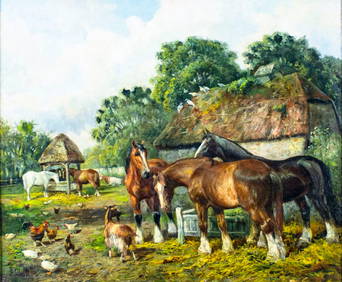
Mauritz Frederik Hendrick De Haas (1832 - 1895) New York/ HollandCutler Bay Auctions4.5(168)See Sold PriceFeb 29, 2024
Set of 4 Maps - Netherlands - Seven United Provinces - Germany - Sweden, Denmark, Norway, FinlandProverde Auctions4.3(3)See Sold PriceFeb 28, 2024
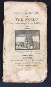
The Seven Wonders Of The World Antique PublicationRapid Estate Liquidators and Auction Gallery4.5(1.1k)See Sold PriceFeb 28, 2024
Map of the United Provinces of the Netherlands, 1798 PrintAntiques Online Auctions4.6(407)See Sold PriceMar 14, 2024
Hiroshige II Woodblock Print, Seven-Mile Beach in SagamiLion and Unicorn4.7(1.8k)See Sold PriceMar 14, 2024


![[Holland] The Seven United Provinces. From the best (1 of 1)](https://p1.liveauctioneers.com/5584/139429/70692708_1_x.jpg?height=282&quality=70&version=1554845662)