ATLAS of ANTIENT GEOGRAPHY by SAMUEL BUTLER 1843John McInnis Auctioneers,LLC4.6(502)See Sold PriceFeb 24, 2024
18TH C. ANTIQUE MAP: FRENCH & INDIAN WAR, FRAMEDThomaston Place Auction Galleries4.4(386)See Sold PriceFeb 24, 2024
Rand McNally Railroad Map Cabinet w/ 21 Railroad MapsRail & Road Auctions4.6(165)See Sold PriceMar 08, 2024
Keith Haring - Ink on New York Map, Best Buddies, Inscribed, Signed, and DatedSapphire Auction Gallery4(67)See Sold PriceMar 02, 2024
LATE 17TH C. FRENCH MAP OF THE NEW WORLD BY ALEXIS-HUBERT JAILLOT (1632-1712)Thomaston Place Auction Galleries4.4(386)See Sold PriceFeb 24, 2024
Central Railroad of New Jersey Map of Sandy Hook Route-ca. 1903JM Hobby Supply and Railroad Artifact Auctions4.4(126)See Sold PriceFeb 24, 2024
Lot of Six Mixed Atlas Box Cars-HO Scale-New in BoxJM Hobby Supply and Railroad Artifact Auctions4.4(126)See Sold PriceFeb 25, 2024
Rand McNally/Santa Fe Railroad Map of Iowa-1912JM Hobby Supply and Railroad Artifact Auctions4.4(126)See Sold PriceFeb 24, 2024
NICOLAES VISSCHER (NETHERLANDS, 1618-1709) MAP OF THE NEW WORLDThomaston Place Auction Galleries4.4(386)See Sold PriceFeb 24, 2024
17TH C. WORLD MAP BY NICOLAES VISSCHER (NETHERLANDS, 1618-1709)Thomaston Place Auction Galleries4.4(386)See Sold PriceFeb 24, 2024
Lot of Six Mixed Atlas Cabooses-HO Scale-New in BoxJM Hobby Supply and Railroad Artifact Auctions4.4(126)See Sold PriceFeb 25, 2024
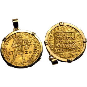
SoldTthe Seven United Provinces, & Netherlands, from TheTitle: Tthe Seven United Provinces, & Netherlands, from The Latest Authorities Publication Date: 1790 Cartographer: CONDER, T. Publisher: C. DILLY Size: 7.25Height - 8.5Width Additional Information: ISee Sold Price
Seven United Provinces, & Netherlands, from The LatestTitle/Content of Map: Seven United Provinces, & Netherlands, from The Latest Authorities. Date: 1791 Cartographer: CONDER, T. sculpt. Size: 7.3Height - 8.5Width Publisher: R. WILKINSON Illustration maSee Sold Price
Seven United Provinces, & Netherlands, from The LatestTitle: Seven United Provinces, & Netherlands, from The Latest Authorities. Cartographer: CONDER, T. sculpt. Publisher: R. WILKINSON Brief Description: Light offsetting. Height X Width: 7.3x 8.5 ReservSee Sold Price
Antique Map - Map of the Seven United Provinces - Netherlands - North Sea - Thomas Bowen"A Map of the Seven United Provinces: with the Dutch, Austrian, and French Netherlands." Size: 13” x 10” inches / 34 cm x 26 cm. Date: 1778. Artist: Thomas Bowen.See Sold Price
Antique Map of Europe - The Seven United Provinces - Netherlands - BelgiumTitle: Antique Map of Europe - The Seven United Provinces - Netherlands - Belgium Date: 1806 Material: Paper Dimensions: 10” x 8” inches / 25 cm x 21 cm Descritpion: Antique map of The SevSee Sold Price
Seven United Provinces, & Netherlands, from The LatestPublication Date: 1791 Title: Seven United Provinces, & Netherlands, from The Latest Authorities. Cartographer: CONDER, T. sculpt. Publisher: R. WILKINSON Height: 7.3 Width: 8.5 Light offsetting. ReseSee Sold Price
c.1800 American Made Map, The Seven United Provinces,The Seven United Provinces. ( Europe / Netherlands ). Issued c.1800 New York. Engraved for Payne's Geography, Published by J. Low. Very early American produced map of the Netherlands. EngravSee Sold Price
c.1800 American Made Map, The Seven United Provinces,The Seven United Provinces. ( Europe / Netherlands ). Issued c.1800 New York. Engraved for Payne's Geography, Published by J. Low. Very early American produced map of the Netherlands. Engraved, possibSee Sold Price
c.1800 American Made Map, The Seven United Provinces,The Seven United Provinces. ( Europe / Netherlands ). Issued c.1800 New York. Engraved for Payne's Geography, Published by J. Low. Very early American produced map of the Netherlands. Engraved,See Sold Price
c.1800 American Made Map, The Seven United Provinces,The Seven United Provinces. ( Europe / Netherlands ). Issued c.1800 New York. Engraved for Payne's Geography, Published by J. Low. Very early American produced map of the Netherlands. Engraved,See Sold Price
c.1800 American Made Map, The Seven United Provinces,The Seven United Provinces. ( Europe / Netherlands ). Issued c.1800 New York. Engraved for Payne's Geography, Published by J. Low. Very early American produced map of the Netherlands. Engraved,See Sold Price
SoldSet of five framed Carey's Atlas maps including HollandSet of five framed Carey's Atlas maps including Holland or the Seven United Provinces and the Netherlands, Scotland with the Principal Roads, England and Wales, Ireland, and Africa, all framed and matSee Sold Price
SoldDunn (Samuel) The Seven United ProvincesDunn (Samuel) The Seven United Provinces,showing the Netherlands, the North Sea and part of England and France, engraved map with original outline hand-colouring, 305 x 435mm., small repair toSee Sold Price
Holland Or the Seven United Provinces, And theTitle: Holland Or the Seven United Provinces, And the Netherlands Date: 1814 Cartographer: LEWIS, SAMUEL Publisher: M. CAREY Size: 16Height - 13.1Width Provenance: Wide margins. Browned. Reserve: $60.See Sold Price
Scarce 1816 map of Holland and The Netherlands“Holland or the Seven United Provinces and the Netherlands” from the very scarce 1816 edition of Mathew Carey’s General Atlas. Highly detailed with roads, lakes, islands, bays, coastSee Sold Price
Map of Europe, showing its Political Divisions by S. Augustus Mitchell 1869TITLE/CONTENT OF MAP: Les Sept Provinces Unies des Pays-Bas, ou la Hollande avec les Pays-Bas Autrichiens [The Seven United Provinces of the Netherlands or Holland, with the Austrian Netherlands] DATESee Sold Price
1800 Payne Map of The Netherlands -- Seven United ProvincesTitle: 1800 Payne Map of The Netherlands -- Seven United Provinces Cartographer: J Payne Year / Place: 1800, New York Map Dimension (in.): 7.1 X 8.1 in. This is a handsome map of the Netherlands. DetaSee Sold Price
SoldMillar: Antique Map Netherlands Belgium Luxenburg, 1768Title/Content of Map: 1768 Millar Map of Netherlands, Belgium, Luxenburg -- A New and Accurate Map of the Seven United Provinces Imcluding the Dutch Netherlands & e. Date Printed: 1768 Cartographer: GSee Sold Price
Millar Map of Netherlands, Belgium, Luxembourg 1768Map: 1768 Millar Map of Netherlands, Belgium, Luxembourg -- A New and Accurate Map of the Seven United Provinces Including the Dutch Netherlands & e. Cartographer: G Millar Year / Place: 1768 (pencileSee Sold Price
1834 Malte-Brun Map of the Netherlands -- The Seven United Provinces with their DependenciesTitle: 1834 Malte-Brun Map of the Netherlands -- The Seven United Provinces with their Dependencies Cartographer: M. Malte-Brun / S. Walker Year / Place: 1834, Boston Map Dimension (in.): 9.3 x 7.5 inSee Sold Price
Sold1772 Sayer Map of the Netherlands -- The Seven UnitedReserve Reduced! Title/Content of Map: 1772 Sayer Map of the Netherlands -- The Seven United Provinces, with their Roads and Divisions Date: 1772, London Cartographer: R Sayer Size: 18.5 x 22.5 in. ASee Sold Price
Sayer: Antique Map of the Netherlands, 1772Title/Content of Map: 1772 Sayer Map of the Netherlands -- The Seven United Provinces, with their Roads and Divisions Date Printed: 1772, London Cartographer: R Sayer Size: 18.5 x 22.5 in. A highly deSee Sold Price
1834 Malte-Brun Map of the Netherlands -- The SevenTitle/Content of Map: 1834 Malte-Brun Map of the Netherlands -- The Seven United Provinces with their Dependencies Date: 1834, Boston Cartographer: M. Malte-Brun / S. Walker Size: 9.3 x 7.5 in. An attSee Sold Price
1772 Sayer Map of the Netherlands -- The Seven UnitedTitle/Content of Map: 1772 Sayer Map of the Netherlands -- The Seven United Provinces, with their Roads and Divisions Date: 1772, London Cartographer: R Sayer Size: 18.5 x 22.5 in. A highly detailed,See Sold Price
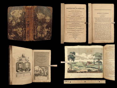
1816 Napoleon 1ed EARLY Battle at Waterloo Account Napoleonic Wars FranceSchilb Antiquarian Rare Books4.8(421)See Sold PriceMar 10, 2024
7PC 1993 GI Joe Battle Corps Backblast MOSC GroupBruneau & Co. Auctioneers4.5(491)See Sold PriceFeb 24, 2024
7PC WOTC Transformers TCG Booster Boxes SealedBruneau & Co. Auctioneers4.5(491)See Sold PriceFeb 24, 2024
Michael Goddard Praying For Seven 24 x 36 Poster PrintMynt Auctions4.6(680)See Sold PriceMar 01, 2024
Cooke, George 1801 Antique Map. United States of AmericaAlbion Auctions4.6(336)See Sold PriceMar 01, 2024
Mauritz Frederik Hendrick De Haas (1832 - 1895) New York/ HollandCutler Bay Auctions4.5(168)See Sold PriceFeb 29, 2024
Set of 4 Maps - Netherlands - Seven United Provinces - Germany - Sweden, Denmark, Norway, FinlandProverde Auctions4.3(3)See Sold PriceFeb 28, 2024
Map of the United Provinces of the Netherlands, 1798 PrintAntiques Online Auctions4.6(407)See Sold PriceMar 14, 2024
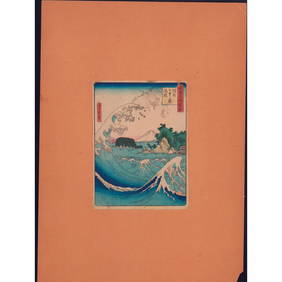
Hiroshige II Woodblock Print, Seven-Mile Beach in SagamiLion and Unicorn4.7(1.8k)See Sold PriceMar 14, 2024
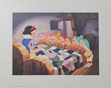
Disney's, Snow White and The Seven Drawfs, 'Meeting the Dwarfs', Exclusive Lithograph, 2001White Knight Auction, Inc4.7(248)See Sold PriceFeb 29, 2024