1952 ROBERT F. KENNEDY HANDWRITTEN LETTERJohn McInnis Auctioneers,LLC4.6(504)See Sold PriceFeb 25, 2024
CASED PRESENTATION HALF HULL MODEL OF THE BARQUE "HAWTHORNBANK" Last Quarter of the 19th CenturyEldred's4.7(418)See Sold PriceFeb 27, 2024
Lot Of 14 Jack Daniels And Country Club Glass Spirit BottlesRbfinearts4.4(575)See Sold PriceFeb 24, 2024
PR OF 17TH C. SPANISH BRASS CANDLESTICKSThomaston Place Auction Galleries4.4(389)See Sold PriceFeb 24, 2024
Lake Shore and Michigan Southern RR Special Excursions Timetable-July 7-13, 1892JM Hobby Supply and Railroad Artifact Auctions4.4(126)See Sold PriceFeb 24, 2024
Tiffany & Co. Sterling Silver Corkscrew Bottle OpenerSJ Auctioneers4.5(166)See Sold PriceMar 03, 2024
SoldCrepy Map of AmericasCREPY, Jean-Baptiste (1753 - 1790) after POPPLE, Henry. Carte Generale De L'Amerique Septentrionale.Engraved map with hand color in outline. Paris: after 1756.20 1/2" x 20" sheet. Decorative cartoucheSee Sold Price
SoldOriginal Copper Engraving ANTIQUE MAP AMERICAS 1817Details: Original Copper Engraving ANTIQUE MAP AMERICAS 1817 John & George Menzies Engravers John Thomson New General Atlas Political Borders British Territory Spain British Canada Atlas Original HanSee Sold Price
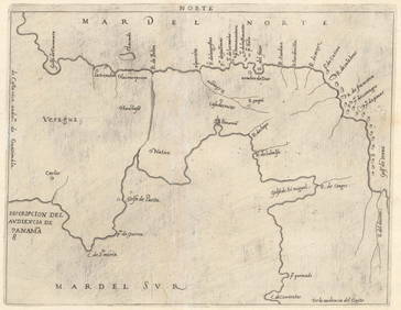
SoldLarge Lot of Maps AmericasLarge group of maps including maps of the South Seas, North and South America, the Azore Islands, a province of Peru, Lima, Cayenne Island, Suriname, a world map, the cost of Peru, and Pisco. SKU: 034See Sold Price
Sold[MAP - AMERICAS]. BRION DE LA TOUR, Louis[MAP - AMERICAS]. BRION DE LA TOUR, Louis (1743?-1803). L'Amerique Dressee pour l'etude de la Geographie. Paris, 1764. Engraved map with hand-coloring in wash and outline, visible area 515 x 610 mSee Sold Price
SoldEarly Americas Map [Americas Map]20th-century (exact date unknown) of early Americas geology. Beautiful colors and detail. Measures 15.125-in. x 19.625-in. sheet size. In VG/EX condition, with warping upper and lower margins. UnframeSee Sold Price
SoldAmerica Noviter Delineata Map [Americas Map]Jodicus Hondius (1563-1811), 'America Noviter Delineata Auct: Henrico Hondio, 1631' map. Exact date unknown; this restrike appears to be the right-side 2/3rds of original map. Beautiful colors and detSee Sold Price
Sold1779 French Engraved Framed Map Americas NR1779 French engraved framed map of North & Central America (probably printed about 100 years later) (Center fold with small, minor tears & holes; nice old appearance; frame much later; Old Print ShopSee Sold Price
SoldMap: Americas Showing The Island Of CaliforniaHistoric MapsMap Of The Americas Showing The Island Of California c. 1700, Map of the Americas, Titled "Americae Tam Septentrionalis Quam Meridionalis," by A. F. Zurner, published by P. SchenkSee Sold Price
SoldMap: Americas Showing The Island Of CaliforniaMapsMap Of The Americas Showing The Island Of California c.1700, Map of the Americas, Titled “Americae Tam Septentrionalis Quam Meridionalis,” by A. F. Zurner, published by P. Schenk in AmSee Sold Price
SoldMap: Americas Showing The Island Of CaliforniaHistoric MapsMap Of The Americas Showing The Island Of California c. 1700, Map of the Americas, Titled Americae Tam Septentrionalis Quam Meridionalis," by A. F. Zurner, published by P. Schenk in AmsteSee Sold Price
SoldAmerica Septentrio Map [Americas Map]America Septentrio Map, printed 20th-century, exact date unknown. Beautiful colors and detail. Measures 19.5-in. x 24.5-in. sheet size. In VG/EX condition. Unframed, loose and not glued or mounted. IfSee Sold Price
Sold18th and 19th century maps Americas18th and 19th century maps, Americas: "America Divided Into North and South…", Lourie & Whittle, London, 1794, native tribes noted, 19-3/4 x 21-3/4 in. (sight), [separated at central fold]; "The WorSee Sold Price
Sanson: Map of Americas with Mythical Atlantis, 1699Map: 1699 Sanson Map of Americas with Mythical Atlantis -- Atlantis Insula, a Nicolao Sanson Antiquitati Restituta; nunc demum Majori Forma Delineata, et in Decem Regna, iuxta Decem Neptuni Filios DisSee Sold Price
SoldSanson: Antique Map of Americas with Atlantis, 1699Map: 1699 Sanson Map of Americas with Mythical Atlantis and California as Island -- Atlantis Insula, a Nicolao Sanson Antiquitati Restituta; nunc demum Majori Forma Delineata, et in Decem Regna, iuxtaSee Sold Price
Sold17TH C. MAP OF AMERICAS NICOLAUM VISSCHER(1618-1679):17th century map of Americas by Nicolaum Visscher. Also known as: Nicolaes Visscher Among the many great Dutch map publishers active in the seventeenth century were the Visscher family, begun by ClaesSee Sold Price
SoldDanckerts' Map of Americas Circa 169021" X 24" matted and in a 27" X 30" wood frame, under glass, Map of the Americas, Circa 1690, an interesting version in this series of maps inspired by Nicolas Visscher in 1658. Danckerts' map followsSee Sold Price
Guillaume Delisle, map of AmericasGuillaume Delisle, map of Americas, Guillaume Delisle (French, 1675-1726), "Carte d'Amerique, dressee pour l'usage du Roy", c. 1739, engraving with period country boundaries outlined in color, 21.25"hSee Sold Price
SoldFrancois Santini, map of AmericasFrancois Santini, map of Americas, Francois Santini (Venetian, fl. 1776-84), "L' Amerique divisee en fes principaux Etats…", c. 1776, hand-colored engraving, 19"h x 26"w (sight), 25.25"h x 32"wSee Sold Price
SoldMAP OF AMERICAS AFTER HONDIUSA version of 1641 original map. This is identified on back as a third printing done in the 18th century, (Approx. 1788 can't read that date well). Hand laid paper, very fine condition except for the bSee Sold Price
SoldRARE EARLY MAP OF AMERICAS WITH LATER NOTATION -RARE EARLY MAP OF AMERICAS WITH LATER NOTATION - "Americae, nova Tabula" by Willem Janszoon Blaeu, Amsterdam, circa 1650, hand colored engraving on two joined sheets, printed prior to the 1700 editionSee Sold Price
1699 Sanson Map of Americas with Mythical AtlantisItem: 1699 Sanson Map of Americas with Mythical Atlantis Description: This map is Sanson's unusual composition showing ancient geography within a contemporary outline of the Americas. The cartouche noSee Sold Price
de Vaugondy: Antique Map of Americas & Caribbean, 1771Map: Amerique ou Indes Occidentales Cartographer: Robert de Vaugondy Place & Date: Paris / 1771 Size: 25" x 20" Condition: outline color; light overall age toning; minor staining along outer edges ofSee Sold Price
SoldScarce Large 1634 Map of Americas by M. MerianRare Large Copperplate Engraved Map of the Americas Entitled "America Nouiter Delineata" by Matthäeus Merian (1593-1650) | | Title: America nouiter delineata Title (alt.): America noviter delineata |See Sold Price
LATE 17TH C. FRENCH MAP OF THE NEW WORLD BY ALEXIS-HUBERT JAILLOT (1632-1712)Thomaston Place Auction Galleries4.4(389)See Sold PriceFeb 24, 2024
18TH C. ANTIQUE MAP: FRENCH & INDIAN WAR, FRAMEDThomaston Place Auction Galleries4.4(389)See Sold PriceFeb 24, 2024
Keith Haring - Ink on New York Map, Best Buddies, Inscribed, Signed, and DatedSapphire Auction Gallery4.1(67)See Sold PriceMar 02, 2024
Rand McNally Railroad Map Cabinet w/ 21 Railroad MapsRail & Road Auctions4.6(165)See Sold PriceMar 08, 2024
Chatelain - Map of the Americas and Details and Insets of Government CounselsTrillium Antique Prints & Rare Books4.5(30)See Sold PriceFeb 24, 2024
Chatelain - 3 Maps of the British Isles (England, Ireland, Scotland)Trillium Antique Prints & Rare Books4.5(30)See Sold PriceFeb 24, 2024
Putnam - First Map of the State of Ohio by Rufus PutnamTrillium Antique Prints & Rare Books4.5(30)See Sold PriceFeb 24, 2024
Audubon - 8 Quadruped LithographsTrillium Antique Prints & Rare Books4.5(30)See Sold PriceFeb 24, 2024
NASA Facts JFK Space Center Booklet And MoreRapid Estate Liquidators and Auction Gallery4.5(1.1k)See Sold PriceFeb 24, 2024
William H. Bartlett - Set of 12 views of America - Susquehanna - City of Louisville - ColoradoProverde Auctions4.3(3)See Sold PriceFeb 28, 2024
William H. Bartlett - Set of 12 views of America - Golden Gate from Telegraph Hill - West Point andProverde Auctions4.3(3)See Sold PriceFeb 28, 2024


![[MAP - AMERICAS]. BRION DE LA TOUR, Louis (1 of 1)](https://p1.liveauctioneers.com/197/161882/81723400_1_x.jpg?height=282&quality=70&version=1581711364)
![Early Americas Map [Americas Map] (1 of 4)](https://p1.liveauctioneers.com/5755/154409/77936932_1_x.jpg?height=282&quality=70&version=1573094011)
![America Noviter Delineata Map [Americas Map] (1 of 3)](https://p1.liveauctioneers.com/5755/154409/77936930_1_x.jpg?height=282&quality=70&version=1573094011)


![America Septentrio Map [Americas Map] (1 of 3)](https://p1.liveauctioneers.com/5755/154409/77936931_1_x.jpg?height=282&quality=70&version=1573094011)