ATLAS of ANTIENT GEOGRAPHY by SAMUEL BUTLER 1843John McInnis Auctioneers,LLC4.5(505)See Sold PriceFeb 24, 2024
18TH C. ANTIQUE MAP: FRENCH & INDIAN WAR, FRAMEDThomaston Place Auction Galleries4.4(393)See Sold PriceFeb 24, 2024
Rand McNally Railroad Map Cabinet w/ 21 Railroad MapsRail & Road Auctions4.6(165)See Sold PriceMar 08, 2024
Keith Haring - Ink on New York Map, Best Buddies, Inscribed, Signed, and DatedSapphire Auction Gallery4.1(67)See Sold PriceMar 02, 2024
LATE 17TH C. FRENCH MAP OF THE NEW WORLD BY ALEXIS-HUBERT JAILLOT (1632-1712)Thomaston Place Auction Galleries4.4(393)See Sold PriceFeb 24, 2024
Central Railroad of New Jersey Map of Sandy Hook Route-ca. 1903JM Hobby Supply and Railroad Artifact Auctions4.4(127)See Sold PriceFeb 24, 2024
Lot of Six Mixed Atlas Box Cars-HO Scale-New in BoxJM Hobby Supply and Railroad Artifact Auctions4.4(127)See Sold PriceFeb 25, 2024
Rand McNally/Santa Fe Railroad Map of Iowa-1912JM Hobby Supply and Railroad Artifact Auctions4.4(127)See Sold PriceFeb 24, 2024
NICOLAES VISSCHER (NETHERLANDS, 1618-1709) MAP OF THE NEW WORLDThomaston Place Auction Galleries4.4(393)See Sold PriceFeb 24, 2024
17TH C. WORLD MAP BY NICOLAES VISSCHER (NETHERLANDS, 1618-1709)Thomaston Place Auction Galleries4.4(393)See Sold PriceFeb 24, 2024
Lot of Six Mixed Atlas Cabooses-HO Scale-New in BoxJM Hobby Supply and Railroad Artifact Auctions4.4(127)See Sold PriceFeb 25, 2024
Color map of Berkeley subdivision, 1878Heading: (California - Berkeley) Author: Title: Map of Peralta Park, Berkeley, Alameda County, Cal. Subdivided October 1878. M.C. King, C.E. Scale 80 Feet to One Inch. Property of M.B. Curtis. PlaceSee Sold Price
Map of Afghanistan, 19th c.Smith & Sons Special Map of Afghanistan. W.H. Smith and Son, 1878. Folding map in color, overall sheet 34" x 22.25". Rare.See Sold Price
Sold[Ireland] Savage, John, Thomas Kelly, New York, 1878,[Ireland] Savage, John, Thomas Kelly, New York, 1878, Picturesque Ireland with 33 color maps and 29 engraved plates; large, thick quarto, contemporary three-quarter green morocco, bevelled boards, raiSee Sold Price
Sold1878 Swinton's Complete Course GeographyDescription: 1878 edition of Swinton's Complete Course Geography; hardcover. With 2 color maps, folded; issues reflective of age including loose binding and wear. Material: paper. Measurement: approxiSee Sold Price
1878 Swinton's Complete Course GeographyDescription: 1878 edition of Swinton's Complete Course Geography; hardcover. With 2 color maps, folded; issues reflective of age including loose binding and wear. Material: paper. Measurement: approxiSee Sold Price
1878 Swinton's Complete Course GeographyDescription: 1878 edition of Swinton's Complete Course Geography; hardcover. With 2 color maps, folded; issues reflective of age including loose binding and wear. Material: paper. Measurement: approxiSee Sold Price
1878 SwintonDescription: 1878 edition of Swinton's Complete Course Geography; hardcover. With 2 color maps, folded; issues reflective of age including loose binding and wear. Material: paper. Measurement: approxiSee Sold Price
1878 Swinton's Complete Course GeographyDescription: 1878 edition of Swinton's Complete Course Geography; hardcover. With 2 color maps, folded; issues reflective of age including loose binding and wear. Material: paper. Measurement: approxiSee Sold Price
1878 Swinton's Complete Course GeographyDescription: 1878 edition of Swinton's Complete Course Geography; hardcover. With 2 color maps, folded; issues reflective of age including loose binding and wear. Material: paper. Measurement: approxiSee Sold Price
1878 Swinton's Complete Course GeographyDescription: 1878 edition of Swinton's Complete Course Geography; hardcover. With 2 color maps, folded; issues reflective of age including loose binding and wear. Material: paper. Measurement: approxiSee Sold Price
Stieler: Antique Map of Australia, 1878Map: 1878 Stieler Map of Australia -- Australien Date/Place: 1878, Gotha Cartographer: A Stieler Size: 12.8 x 15.8 in. Condition: Very Good to Excellent. Slight age toning in the margins. Color outlinSee Sold Price
SoldJAPANESE WOODBLOCK MAP; AUTHOR UNKNOWNTitle: Japanese Imperial Army Map of Japan from Meiji period Date: 1878 [Meiji Jun Nen] Color woodblock map. 122 x 115 cm. (48x45 1/4"), folding into covers, 7 1/2 x5 when folded. Large and very preciSee Sold Price
Warner Beers: Antique Map of Western Hemisphere, 1878Map: 1878 Warner Beers Western Hemisphere -- Western Hemisphere Date/Place: c. 1878, Chicago Cartographer: Warner Beers Size: 14.5 x 17.5 in. Condition: Very good. Nice color, sharp print. Marginal toSee Sold Price
Warner Beers: Antique Map of Eastern Hemisphere, 1878Map: 1878 Warner Beers Eastern Hemisphere -- Eastern Hemisphere Date/Place: c. 1878, Chicago Cartographer: Warner Beers Size: 14.5 x 17.5 in. Condition: Very good. Nice color, sharp print. Marginal toSee Sold Price
Sold1878 MAP OF NORTH WESTERN ARABIA - FOLDS BUT OTHERWISE1878 MAP OF NORTH WESTERN ARABIA - FOLDS BUT OTHERWISE GOOD CONDITION VERY GOOD COLORSee Sold Price
SoldA Map of Berkeley, Oakland & AlamedaHeading: (California - Alameda County) Author: Title: A Map of Berkeley, Oakland & Alameda Place Published: Berkeley Publisher:Sather Lane Bookshop Date Published: [c.1930] DescriptionSee Sold Price
SoldColor pictorial map of mother lode of California andHeading: (California - Mother Lode) Author: Cormak, Robert Title: Mother Lode Map Incorporating Mother Lodes of California and Nevada, Scenes of the "Romantic Days of Gold" Place Published: Berkeley,See Sold Price
SoldHAWAIIAN GOVERNMENT SURVEY. Lanai. Government Survey.HAWAIIAN GOVERNMENT SURVEY. Lanai. Government Survey. 1878. [Updated to 1906]. Washington, D. C.: Andrew B. Graham Photo-Lithographers, 1906. Color lithographed map, image 500 x 668 mm (548 x 704 mm sSee Sold Price
SoldRare map of Verano subdivision of Sonoma 1888Title: Map of Verano, Sonoma Valley, California - on sheet with color lithographed scenes and views Author: Davis, P.R., County Surveyor Description: Map is 23x45 cm. (9x17¾"), on sheet 52x72 cm. (21See Sold Price
SoldMaps and Panoramas 1878 U.S.G.&G. SurveyTitle: Maps and Panoramas. Twelfth Annual Report of the United States Geological and Geographical Survey of the Territories, 1878 Author: Hayden, Ferdinand V. Description: 11 folding color lithographeSee Sold Price
Troon Golf Club: Its History from 1878 signedTitle: Troon Golf Club: Its History from 1878 Author: Mackintosh, Ian M., comp. Description: xiv, 137 pp. Illustrated from photos, folding plates from facsimile golf course maps, drawings; color frontSee Sold Price
Two Michigan Central RR Annual Reports-June 1860 and December 31, 1897JM Hobby Supply and Railroad Artifact Auctions4.4(127)See Sold PriceFeb 24, 2024
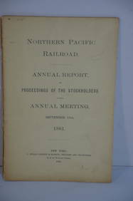
Northern Pacific RR 17th Annual Report-Version 1-September 15, 1881JM Hobby Supply and Railroad Artifact Auctions4.4(127)See Sold PriceFeb 24, 2024
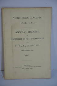
Northern Pacific RR 17th Annual Report-Version 2-September 15, 1881JM Hobby Supply and Railroad Artifact Auctions4.4(127)See Sold PriceFeb 24, 2024
American Express/New York Central Railroad Map of the United States-1934JM Hobby Supply and Railroad Artifact Auctions4.4(127)See Sold PriceFeb 24, 2024
Cincinnati Hamilton and Dayton RR Map -USGC 1889JM Hobby Supply and Railroad Artifact Auctions4.4(127)See Sold PriceFeb 24, 2024
Crams Map of North Dakota-Complete Railroad System and County Map-1907JM Hobby Supply and Railroad Artifact Auctions4.4(127)See Sold PriceFeb 24, 2024
Crams Railroad Map of New York-1881JM Hobby Supply and Railroad Artifact Auctions4.4(127)See Sold PriceFeb 24, 2024
Crams Township and Railroad Map of New York-1890JM Hobby Supply and Railroad Artifact Auctions4.4(127)See Sold PriceFeb 24, 2024
Hammonds Map of Kentucky and Tennessee Railroads-1910JM Hobby Supply and Railroad Artifact Auctions4.4(127)See Sold PriceFeb 24, 2024
Kenyons Pocket Map and Shippers Guide of Wisconsin-1914JM Hobby Supply and Railroad Artifact Auctions4.4(127)See Sold PriceFeb 24, 2024
Map of Missouri Highways and Railroads-1921JM Hobby Supply and Railroad Artifact Auctions4.4(127)See Sold PriceFeb 24, 2024
Chicago Milwaukee and St Paul RY Panama Pacific Exposition Brochure-1915JM Hobby Supply and Railroad Artifact Auctions4.4(127)See Sold PriceFeb 24, 2024
1855 Guide for the Pennsylvania Railroad with an Extensive Map from the Pennsylvania RailroadRail & Road Auctions4.6(165)See Sold PriceMar 07, 2024
Oyster Bay Long Island NY Vintage Color Reproduction Map 12 x 18Mynt Auctions4.6(697)See Sold PriceFeb 23, 2024


![[Ireland] Savage, John, Thomas Kelly, New York, 1878, (1 of 1)](https://p1.liveauctioneers.com/197/143669/72658568_1_x.jpg?height=282&quality=70&version=1559851603)