ATLAS of ANTIENT GEOGRAPHY by SAMUEL BUTLER 1843John McInnis Auctioneers,LLC4.5(505)See Sold PriceFeb 24, 2024
18TH C. ANTIQUE MAP: FRENCH & INDIAN WAR, FRAMEDThomaston Place Auction Galleries4.4(394)See Sold PriceFeb 24, 2024
Rand McNally Railroad Map Cabinet w/ 21 Railroad MapsRail & Road Auctions4.6(165)See Sold PriceMar 08, 2024
Keith Haring - Ink on New York Map, Best Buddies, Inscribed, Signed, and DatedSapphire Auction Gallery4.1(67)See Sold PriceMar 02, 2024
LATE 17TH C. FRENCH MAP OF THE NEW WORLD BY ALEXIS-HUBERT JAILLOT (1632-1712)Thomaston Place Auction Galleries4.4(394)See Sold PriceFeb 24, 2024
Central Railroad of New Jersey Map of Sandy Hook Route-ca. 1903JM Hobby Supply and Railroad Artifact Auctions4.4(127)See Sold PriceFeb 24, 2024
Lot of Six Mixed Atlas Box Cars-HO Scale-New in BoxJM Hobby Supply and Railroad Artifact Auctions4.4(127)See Sold PriceFeb 25, 2024
Rand McNally/Santa Fe Railroad Map of Iowa-1912JM Hobby Supply and Railroad Artifact Auctions4.4(127)See Sold PriceFeb 24, 2024
NICOLAES VISSCHER (NETHERLANDS, 1618-1709) MAP OF THE NEW WORLDThomaston Place Auction Galleries4.4(394)See Sold PriceFeb 24, 2024
17TH C. WORLD MAP BY NICOLAES VISSCHER (NETHERLANDS, 1618-1709)Thomaston Place Auction Galleries4.4(394)See Sold PriceFeb 24, 2024
Lot of Six Mixed Atlas Cabooses-HO Scale-New in BoxJM Hobby Supply and Railroad Artifact Auctions4.4(127)See Sold PriceFeb 25, 2024
Coast Chart No. 31 Chesapeake Bay from Head of Bay toTitle: Coast Chart No. 31 Chesapeake Bay from Head of Bay to Magothey River Publication Date: 1861 Cartographer: BACHE, A.D. Publisher: U.S. COAST SURVEY Height: 29.9 Width: 37.1 Extremely detailed maSee Sold Price
Coast Chart No. 31 Chesapeake Bay from Head of Bay toTitle/Content of Map: Coast Chart No. 31 Chesapeake Bay from Head of Bay to Magothy River... Publication Date: 1861 Cartographer: Publisher: U.S COAST SURVEY Description: Size/Dimensions: 29.7Height -See Sold Price
Coast Chart No. 36 Chesapeake Bay from Head of Bay toTitle: Coast Chart No. 36 Chesapeake Bay from Head of Bay to Magothy River... 1863 Publication Date: 1885 Cartographer: BACHE, A.D./HASSLER, F.R. Publisher: U.S. COAST & GEODETIC SURVEY Description: SSee Sold Price
Coast Chart No. 36 Chesapeake Bay from Head of Bay to Magothy RiverPublication Date: 1885 Title: Coast Chart No. 36 Chesapeake Bay from Head of Bay to Magothy River Cartographer: BACHE, A.D./HASSLER, F.R. Publisher: U.S. COAST & GEODETIC SURVEY Height: 29.1 Width: 37See Sold Price
Coast Chart No. 36 Chesapeake Bay from Head of Bay toTitle: Coast Chart No. 36 Chesapeake Bay from Head of Bay to Magothy River... 1863 Publication Date:1885 Cartographer: BACHE, A.D./HASSLER, F.R. Publisher: U.S. COAST & GEODETIC SURVEY Brief DescriptiSee Sold Price
Coast Chart No.131 Chesapeake Bay Sheet No.1 York River Hampton Roads Chesapeake EntrancePublication Date: 1888 Title: Coast Chart No.131 Chesapeake Bay Sheet No.1 York River Hampton Roads Chesapeake Entrance Cartographer: HASSLER, J.J.S./G.D. WISE/J. SEIB/J.W. DONN Publisher: U.S. COASTSee Sold Price
Coast Chart No.131 Chesapeake Bay Sheet No.1 York RiverReserve Reduced! Title: Coast Chart No.131 Chesapeake Bay Sheet No.1 York River Hampton Roads Chesapeake Entrance Publication Date: 1888 Cartographer: HASSLER, J.J.S./G.D. WISE/J. SEIB/J.W. DONN PubliSee Sold Price
Coast Chart No.131 Chesapeake Bay Sheet No.1 York RiverTitle: Coast Chart No.131 Chesapeake Bay Sheet No.1 York River Hampton Roads Chesapeake Entrance Publication Date:1888 Cartographer: HASSLER, J.J.S./G.D. WISE/J. SEIB/J.W. DONN Publisher: U.S. COAST &See Sold Price
Coast Chart No.131 Chesapeake Bay Sheet No.1 York RiverTitle: Coast Chart No.131 Chesapeake Bay Sheet No.1 York River Hampton Roads Chesapeake Entrance Publication Date: 1888 Publisher: U.S. COAST & GEODETIC SURVEY Size: 25 x 37.75 "From a trogonometric sSee Sold Price
SoldChart of Chesapeake Bay 1863Title: Coast Chart No.36 Chesapeake Bay Sheet No.6 from the Mouth of York River to the Entrance to Bay Author: U.S. Coast Survey Description: Lithographed chart, modern hand-coloring. 64x91 cm. (25x26See Sold Price
Coast Chart No.33. Chesapeake Bay from Choptank RiverPublication Date: 1862 Title: Coast Chart No.33. Chesapeake Bay from Choptank River to Potomac River... Cartographer: HASSLER, J.J.S./G.D. WISE/R.D. CUTTS Publisher: U.S. COAST SURVEY Height: 29.5 WidSee Sold Price
Antique Coast Chart of VA Chesapeake Bay Entrance, 1852Map: Coast Chart of Virginia, Chesapeake Bay Entrance Date: 1852 Original lithograph by Yeager, Barnard & Petersen Dimensions: 22 1/2" x 30 1/4" Please note that this lot has a confidential reserve. WSee Sold Price
Rare Captain's Charts of Chesapeake BayBache, Alexander D. (1806-1867). Coast Chart No. 34 Chesapeake Bay from Choptank River to Potomac River... 1863. Lithographed map. U.S. Coast and Geodetic Survey, 1885. 29 ¼" x 37 ½" sheet. ScarSee Sold Price
Coast Chart No. 36 Chesapeake Bay Sheet No. 6 from theTitle: Coast Chart No. 36 Chesapeake Bay Sheet No. 6 from the Mouth of the York River to The Entrance to Bay. ... Cartographer: HASSLET, J.J.S./G.D. WISE Publisher: U.S. COAST SURVEY Size: 25.1 X 36 CSee Sold Price
Coast Chart No. 33 Chesapeake Bay from Choptank RiverPublication Date: 1862 Title: Coast Chart No. 33 Chesapeake Bay from Choptank River to Potomac River... Cartographer: HASSLER, J.J.S./G.D. WISE ET AL Publisher: U.S. COAST SURVEY Height: 29.8 Width: 3See Sold Price
Coast Chart No. 34 Chesapeake Bay from Choptank RiverTitle: Coast Chart No. 34 Chesapeake Bay from Choptank River to Potomac River... 1863 Publication Date:1885 Cartographer: BACHE, A.D. Publisher: U.S. COAST & GEODETIC SURVEY Brief Description: ScarceSee Sold Price
Preliminary Chart of Chesapeake Bay.Title: Preliminary Chart of Chesapeake Bay. Cartographer: E. BLUNT, J.E. HILGARD, J.S. WILLIAMS AND D. CUTTS, et al. Date: 1857 Publisher: U.S. COAST SURVEY Size: 29.5Height - 37Width Additional Info:See Sold Price
Sold1938 Chart of Chesapeake BayChesapeake Bay chart from Wolf Point to Smith Point by the US Coast and Geodetic survey, dated 1938. Set into a gold frame. 36" high x 46" wide.See Sold Price
SoldThree Framed Maps of Delaware/Chesapeake BaysPreliminary Chart of Delaware and Chesapeake Bays and the Sea Coast from Cape Henlopen to Cape Charles, Coast Survey Office, 1855, including tide chart and sailing directions, colored highlights, withSee Sold Price
Sold(2) Charts, Suisun/Vallejo Bays, Coast of SpainTwo (2) charts, including: "Suisun & Vallejo Bays, California", circa 1850, 21" x 31" (overall), staining, foxing, tears (longest 1 3/4"); "La Costa di Spagna" (and Barbary Coast), 19 3/4" x 27" (overSee Sold Price
Sold1885 Chart of Narraganset BayU.S. Coast and geodetic survey chart titled Cuttyhunk to Block Island including Narraganset Bay, this being a 1891 edition. Heavily stained. Framed in black. 31” x 42”. Also included with this lotSee Sold Price
SoldAntique Coast Survey Map of the Atchafalaya BayAntique Coast Survey Map of the Atchafalaya Bay , "Preliminary Chart of Atchafalaya Bay Louisiana... A.D. Bache, Superintendant", 1858, lithograph, with later hand-coloring, sight 24 1/2 in. x 31 1/4See Sold Price
Rare Captain's Chart With Detailed City Plan ofBache, Alexander D. (1806-1867), & Hassler, Ferdinand R. (1770-1843). Coast Chart No. 36 Chesapeake Bay... Lithographed map. U.S. Coast and Geodetic Survey, 1885. 29 1/8" x 37 1/2" sheet. Scarce flat,See Sold Price
Rare Captain's Chart With Detailed City Plan ofBache, Alexander D. (1806-1867), & Hassler, Ferdinand R. (1770-1843). Coast Chart No. 36 Chesapeake Bay... Lithographed Map. U.S. Coast and Geodetic Survey, 1885. 29 ⅛" x 37 ½" sheet. ScarceSee Sold Price
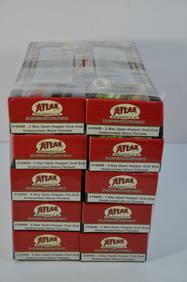
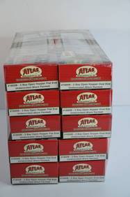
Chesapeake and Ohio RR 10-pack Atlas 2 Bay Open Hoppers-HO Scale-New in BoxJM Hobby Supply and Railroad Artifact Auctions4.4(127)See Sold PriceFeb 25, 2024
Chesapeake and Ohio RR 10-pack Atlas 2 Bay Open Hoppers-HO Scale-New in BoxJM Hobby Supply and Railroad Artifact Auctions4.4(127)See Sold PriceFeb 25, 2024
6-Pack of Mixed Hopper Cars-CO/BO/NYNHH/MEC/THB-Bowser-HO Scale-New in BoxJM Hobby Supply and Railroad Artifact Auctions4.4(127)See Sold PriceFeb 25, 2024
Jules Andre Smith, Robin Hood's BayLotus International Auctions, LLC4.6(153)See Sold PriceMar 03, 2024
Food Spatula, Geelvink Bay, Northwest Coast Papua New Guinea, Early 20th C. or OlderMaterial Culture4.6(780)See Sold PriceFeb 29, 2024
West coast of Africa from Cape Blanco… Arguin bay, Mauritania. LABAT 1745 mapJasper524.5(9.9k)See Sold PriceFeb 28, 2024
South Namibia coast. Walvis Bay-Orange River ADMIRALTY sea chart 1881 (1954) mapJasper524.5(9.9k)See Sold PriceFeb 28, 2024
PINTAIL PAIR, R.M. MITCHELLFrank and Frank Sporting Collectibles LLC4.7(174)See Sold PriceMar 10, 2024
BUFFLEHEAD DRAKE, L. JOHNSONFrank and Frank Sporting Collectibles LLC4.7(174)See Sold PriceMar 10, 2024
Wooden Head Rest Carved in the Shape of a Dog - Ivory CoastKing's Auctions Inc4.2(123)See Sold PriceDec 29, 2024