Sold1938 Chart of Chesapeake BayChesapeake Bay chart from Wolf Point to Smith Point by the US Coast and Geodetic survey, dated 1938. Set into a gold frame. 36" high x 46" wide.See Sold Price
SoldVintage marine navigational chart: Chesapeake BayVintage marine navigational chart: Chesapeake Bay. 37 1/2"h x 47 1/2"w framedSee Sold Price
Preliminary Chart of Chesapeake Bay.Title: Preliminary Chart of Chesapeake Bay. Cartographer: E. BLUNT, J.E. HILGARD, J.S. WILLIAMS AND D. CUTTS, et al. Date: 1857 Publisher: U.S. COAST SURVEY Size: 29.5Height - 37Width Additional Info:See Sold Price
Coast Chart No.131 Chesapeake Bay Sheet No.1 York River Hampton Roads Chesapeake EntrancePublication Date: 1888 Title: Coast Chart No.131 Chesapeake Bay Sheet No.1 York River Hampton Roads Chesapeake Entrance Cartographer: HASSLER, J.J.S./G.D. WISE/J. SEIB/J.W. DONN Publisher: U.S. COASTSee Sold Price
Coast Chart No.131 Chesapeake Bay Sheet No.1 York RiverReserve Reduced! Title: Coast Chart No.131 Chesapeake Bay Sheet No.1 York River Hampton Roads Chesapeake Entrance Publication Date: 1888 Cartographer: HASSLER, J.J.S./G.D. WISE/J. SEIB/J.W. DONN PubliSee Sold Price
Bache: Antique Coastal Chart of Chesapeake Bay, 1862Map: Coastal Chart of Chesapeake Bay Date: 1862 Original lithograph by Bache Dimensions: 32" x 39" Please note that this lot has a confidential reserve. When you leave a bid in advance of the auction,See Sold Price
Sold1931 Chart of Chesapeake BayLarge chart showing the entrance to Chesapeake Bay. Published by the US Department of Commerce dated 1931. 39" high x 49" wide.See Sold Price
Rare Captain's Charts of Chesapeake BayBache, Alexander D. (1806-1867). Coast Chart No. 34 Chesapeake Bay from Choptank River to Potomac River... 1863. Lithographed map. U.S. Coast and Geodetic Survey, 1885. 29 ¼" x 37 ½" sheet. ScarSee Sold Price
Coast Chart No.131 Chesapeake Bay Sheet No.1 York RiverTitle: Coast Chart No.131 Chesapeake Bay Sheet No.1 York River Hampton Roads Chesapeake Entrance Publication Date:1888 Cartographer: HASSLER, J.J.S./G.D. WISE/J. SEIB/J.W. DONN Publisher: U.S. COAST &See Sold Price
Coast Chart No.131 Chesapeake Bay Sheet No.1 York RiverTitle: Coast Chart No.131 Chesapeake Bay Sheet No.1 York River Hampton Roads Chesapeake Entrance Publication Date: 1888 Publisher: U.S. COAST & GEODETIC SURVEY Size: 25 x 37.75 "From a trogonometric sSee Sold Price
SoldChart of Chesapeake Bay 1863Title: Coast Chart No.36 Chesapeake Bay Sheet No.6 from the Mouth of York River to the Entrance to Bay Author: U.S. Coast Survey Description: Lithographed chart, modern hand-coloring. 64x91 cm. (25x26See Sold Price
Coast Chart No.33. Chesapeake Bay from Choptank RiverPublication Date: 1862 Title: Coast Chart No.33. Chesapeake Bay from Choptank River to Potomac River... Cartographer: HASSLER, J.J.S./G.D. WISE/R.D. CUTTS Publisher: U.S. COAST SURVEY Height: 29.5 WidSee Sold Price
Antique Coast Chart of VA Chesapeake Bay Entrance, 1852Map: Coast Chart of Virginia, Chesapeake Bay Entrance Date: 1852 Original lithograph by Yeager, Barnard & Petersen Dimensions: 22 1/2" x 30 1/4" Please note that this lot has a confidential reserve. WSee Sold Price
Sold1938 Chart of Casco Bay36 x 42 inches. Together with a chart of Boston Harbor, 1867, 34 x 40 inches, tear to left side.See Sold Price
Fielding Chart of the Chesapeake BayFIELDING, Lucas Jr. (1781-1854).A Chart of the Chesapeake and Delaware Bays Compiled and Published by Fielding Lucas Junr. Engraved Map with original hand color in outline.Baltimore: Hagger and BrotheSee Sold Price
Coast Chart No. 31 Chesapeake Bay from Head of Bay toTitle: Coast Chart No. 31 Chesapeake Bay from Head of Bay to Magothey River Publication Date: 1861 Cartographer: BACHE, A.D. Publisher: U.S. COAST SURVEY Height: 29.9 Width: 37.1 Extremely detailed maSee Sold Price
Coast Chart No. 36 Chesapeake Bay from Head of Bay toTitle: Coast Chart No. 36 Chesapeake Bay from Head of Bay to Magothy River... 1863 Publication Date: 1885 Cartographer: BACHE, A.D./HASSLER, F.R. Publisher: U.S. COAST & GEODETIC SURVEY Description: SSee Sold Price
Coast Chart No. 31 Chesapeake Bay from Head of Bay toTitle/Content of Map: Coast Chart No. 31 Chesapeake Bay from Head of Bay to Magothy River... Publication Date: 1861 Cartographer: Publisher: U.S COAST SURVEY Description: Size/Dimensions: 29.7Height -See Sold Price
Coast Chart No. 36 Chesapeake Bay Sheet No. 6 from theTitle: Coast Chart No. 36 Chesapeake Bay Sheet No. 6 from the Mouth of the York River to The Entrance to Bay. ... Cartographer: HASSLET, J.J.S./G.D. WISE Publisher: U.S. COAST SURVEY Size: 25.1 X 36 CSee Sold Price
Coast Chart No. 36 Chesapeake Bay from Head of Bay to Magothy RiverPublication Date: 1885 Title: Coast Chart No. 36 Chesapeake Bay from Head of Bay to Magothy River Cartographer: BACHE, A.D./HASSLER, F.R. Publisher: U.S. COAST & GEODETIC SURVEY Height: 29.1 Width: 37See Sold Price
Coast Chart No. 36 Chesapeake Bay from Head of Bay toTitle: Coast Chart No. 36 Chesapeake Bay from Head of Bay to Magothy River... 1863 Publication Date:1885 Cartographer: BACHE, A.D./HASSLER, F.R. Publisher: U.S. COAST & GEODETIC SURVEY Brief DescriptiSee Sold Price
Chesapeake Bay chartLarge chart showing the entrance to Chesapeake Bay. Published by the US Department of Commerce dated 1931. Details include Cape Charles, Fisherman Island, New Pt. Comfort, Hampton Roads, York River, NSee Sold Price
Coast Chart No. 33 Chesapeake Bay from Choptank RiverPublication Date: 1862 Title: Coast Chart No. 33 Chesapeake Bay from Choptank River to Potomac River... Cartographer: HASSLER, J.J.S./G.D. WISE ET AL Publisher: U.S. COAST SURVEY Height: 29.8 Width: 3See Sold Price
Coast Chart No. 34 Chesapeake Bay from Choptank RiverTitle: Coast Chart No. 34 Chesapeake Bay from Choptank River to Potomac River... 1863 Publication Date:1885 Cartographer: BACHE, A.D. Publisher: U.S. COAST & GEODETIC SURVEY Brief Description: ScarceSee Sold Price
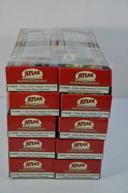
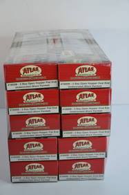
Chesapeake and Ohio RR 10-pack Atlas 2 Bay Open Hoppers-HO Scale-New in BoxJM Hobby Supply and Railroad Artifact Auctions4.4(126)See Sold PriceFeb 25, 2024
Chesapeake and Ohio RR 10-pack Atlas 2 Bay Open Hoppers-HO Scale-New in BoxJM Hobby Supply and Railroad Artifact Auctions4.4(126)See Sold PriceFeb 25, 2024
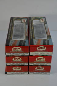
Chesapeake and Ohio RR 6-pack Atlas 2 Bay Open Hoppers-HO Scale-New in BoxJM Hobby Supply and Railroad Artifact Auctions4.4(126)See Sold PriceFeb 25, 2024
Chesapeake and Ohio RR 6-pack Atlas 2 Bay Open Hoppers-HO Scale-New in BoxJM Hobby Supply and Railroad Artifact Auctions4.4(126)See Sold PriceFeb 25, 2024
Chesapeake and Ohio RR 7-pack Atlas 2 Bay Open Hoppers-HO Scale-New in BoxJM Hobby Supply and Railroad Artifact Auctions4.4(126)See Sold PriceFeb 25, 2024
6-Pack of Chesapeake and Ohio/Berwind RR 2 Bay Hoppers-Bowser-HO Scale-New in BoxJM Hobby Supply and Railroad Artifact Auctions4.4(126)See Sold PriceFeb 25, 2024
6-Pack of Mixed Hopper Cars-CO/BO/NYNHH/MEC/THB-Bowser-HO Scale-New in BoxJM Hobby Supply and Railroad Artifact Auctions4.4(126)See Sold PriceFeb 25, 2024
1764 Bellin Chart of Three South Haitian Bays -- Carte des Bayes du Mesle des Flamands et deJasper524.5(9.8k)See Sold PriceFeb 27, 2024
2021-P American Innovation $1 Chesapeake Bay BU (VA)Golden Air Auctions4.4(257)See Sold PriceFeb 26, 2024
Peter Barrett (UK,b 1935) watercolor paintingBroward Auction Gallery4.8(277)See Sold PriceMay 19, 2024
Mary Jane Thomas Stokes - Map of Lighthouses of the Chesapeake Bay. Past and PresentProverde Auctions4.3(3)See Sold PriceFeb 28, 2024
BLUEBILL HEN, CHESAPEAKE BAYFrank and Frank Sporting Collectibles LLC4.7(166)See Sold PriceMar 10, 2024
PINTAIL PAIR, R.M. MITCHELLFrank and Frank Sporting Collectibles LLC4.7(166)See Sold PriceMar 10, 2024
Framed Jane Partin Adorable Puppy Labrador PrintRapid Estate Liquidators and Auction Gallery4.5(1.1k)See Sold PriceMar 03, 2024