SoldBritish Isles.- Mixed group of mapsMixed group of maps of the British Isles,comprising c.65 sectional maps from Cary's New Map of England and Wales, 4to,1794, and c.130 strip road map sheets, most with maps printed both sides,See Sold Price
SoldBritish Isles.- Mixed group of mapsMixed group of maps of the British Isles,including several of the Ports and Harbours of the Coast of England, by Fullarton, the Channel Isles by Rapkin, county maps by Moule, Cary, and othersSee Sold Price
SoldBritish Isles.- a mixed group of mapsBritish Isles.- a mixed group of maps,including the Isle of Wight, the Isle of Man, 13 Bowen road maps, and with a group of county maps, including Dorset, Devon, Cornwall, Warwickshre, and othSee Sold Price
SoldA mixed group of county mapsBritish Isles.- A mixed group of county maps, Worcestershire, Devonshire, Westmoreland, Shropshire, Derbyshire, Middlesex, Northumberland, Durham, Glocestershire, Shropshire, for or by W.Kip,See Sold Price
SoldA small, mixed group of mapsBritish Isles.- A small, mixed group of maps, of Europe, the Middle East, India, Russia, Brazil and the world, engravings, from 180 x 110 to 200 x 510mm., various conditions, mostly 19th centuSee Sold Price
SoldA small, mixed group of maps and town plans of EnBritish Isles.- A small, mixed group of maps and town plans of England and Scotland, including several of Kent and the Isle of Thannet, the Isle of White, road maps and town plans, including TSee Sold Price
SoldMaps British A small, mixed group of mapsBritish Isles.- A small, mixed group of maps,including Scotland, Essex, Glocester & Monmouth, Nottinghamshire, and others, six engraved maps, and one chart, from 450 x 380 to 380 x 570mm., eacSee Sold Price
SoldA small, mixed group of national maps and town plBritish Isles.- A small, mixed group of national maps and town plans, including plans of New York, Brussels, Liverpool, Odessa and others, mostly European, engraved and lithographic maps, someSee Sold Price
Soldgroup of folding British regional mapsBritish Isles.- a small, mixed, group of folding maps,including Great Northern Railway, from Bridlington to Basingstoke, from Wrexham to Great Yarmouth, 1898; Black's Road & Railway TravellingSee Sold Price
SoldA small, mixed group of mapsA small, mixed group of British Isles maps, including Barkshire, Buckinghamshire, Brittania Romana, and others, by various authors, including J. Speed, H. Moll, and others, engravings, v.s. fSee Sold Price
Soldworld.- a small mixed group of mapsWorld.- a small mixed group of maps,including the British Isles, by Sebastian Munster, hand-coloured woodcut map, 80 x 130mm., mounted close, framed and glazed, c.1545 or later; 2 woodblock maSee Sold Price
SoldBellin (J N) 6 maps of the British IslesBellin (J N) A small, mixed group of maps of the British Isles, including maps of Kingsaill and Galloway, Plymouth, Yarmouth, Huntingdonshire, and northern England, engravings, most with hand-See Sold Price
SoldA Small Group Of Maps Of The British IslesA Small, Mixed Group Of Maps Of The British Isles, including several of Scotland (7), Ireland (5), England and Wales (12), by S.Hall, J. Bartholemew, and others, lithographs and engravings, vSee Sold Price
SoldA mixed group of maps of the British IslesA large mixed group of maps of the British Isles, including several county maps, small road maps (10), and others of England, Wales, Scotland and Ireland, engravings and lithographs, severalSee Sold Price
SoldBritain.- a mixed group of mapsa mixed group of maps, the entire British Isles, also national and regional maps of England and Wales, Scotland, and Ireland, by or after Rapin, Macpherson, Dower and others, engraved or lithSee Sold Price
SoldA Mixed Group Of Loose British Isles MapsA Mixed Group Of Loose Maps Of The British Isles, including 9 Emanuel Bowen county maps of Lancashire, Herefordshire, Bedford, Hartfordshire, Shropshire, Cambridgshire and others, engraved mSee Sold Price
SoldA mixed group of 10 manuscript maps,3 similar decorative French maps of the British Isles, France and Italy, 5 others, similar, of Africa, North America, Brazil, Scandinavia and Switzerland, with one of Europe and another of Italy, penSee Sold Price
SoldBritish Isles.- - A mixed group of British topograincluding a view of Snowdon by De Loutherbourg and other views of Wales, views of London, Warwickshire and elsewhere in England, and several of Scotland, engravings and lithographs, some with hand-coSee Sold Price
SoldBritish maps. A small, mixed group of mapsA small, mixed group of maps,including, Notingamiae, Lancashire, Westmoreland, and others, by several artists including, J. Cary, engraved maps, from 205 x 260mm to 385 x 545mm., various condSee Sold Price
SoldBritish Isles.- - a large group of county maps and cityfrom various atlases and other publication, c.150 engraved or lithographed maps of which some hand-coloured and some colour-printed, v.s., c. 140 x 85mm. to c. 290 x 440mm., some double-page, occasionSee Sold Price
SoldA small, mixed group of mapsBritish maps. A small, mixed group of maps,including, Notingamiae, Lancashire, Westmoreland, and others, by several artists including, J. Cary, engraved maps, from 205 x 260mm to 385 x 545mm.,See Sold Price
Group of Maps, British Isles, Massachusetts Harbors,Group of maps, to include: The British Isles; Bass River Harbor, Massachusetts; Monomoy Harbor, Massachusetts; Britannia Romana; Massachusetts, Connecticut & Rhode Island Railroad Routes. Largest 19"See Sold Price
SoldMorden (Robert) MiddlesexBritish maps A small, mixed group of British maps,including Middlesex, Robert Morden, engraved map with hand-colouring, 170 x 208mm., central vertical fold, 1695 or later; with other regionalSee Sold Price
SoldBritish topography.- A large mixed group of prints ofNO RESERVE British topography.- A large mixed group of prints of the British Isles, approximately 150, including Robert Sayer's 'A prospect of Stone-Henge From the west', a single landscape vignette oSee Sold Price
LATE 17TH C. FRENCH MAP OF THE NEW WORLD BY ALEXIS-HUBERT JAILLOT (1632-1712)Thomaston Place Auction Galleries4.4(393)See Sold PriceFeb 24, 2024
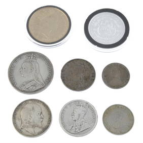
World Coins - British Empire - Mixed Pennies Group [6]TimeLine Auctions Ltd.4.6(183)See Sold PriceMar 09, 2024
Mixed Group of Railroad Paper - 1895 Telegraph Registers, Art Prints, Profile Blueprint, Way-Bills,Rail & Road Auctions4.6(165)See Sold PriceMar 07, 2024
Assortment of Railroad Paper - Rule Books, Stationary, Ink Blotter, Map, Timetables, and MoreRail & Road Auctions4.6(165)See Sold PriceMar 07, 2024
Mixed Group of Railroad Paper, Cross Sections, and Ephemera - Pennsylvania, Reading, Union Pacific,Rail & Road Auctions4.6(165)See Sold PriceMar 07, 2024
Group of Ten Railroad Photographs, Maps, and Prints - New Jersey, Long Island, and New YorkRail & Road Auctions4.6(165)See Sold PriceMar 07, 2024
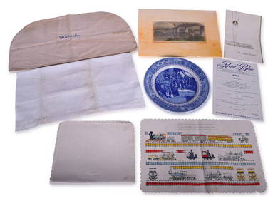
Mixed Group of Railroad Items - Baltimore & Ohio Railroad Menus, Sesquicentennial Plate, WabashRail & Road Auctions4.6(165)See Sold PriceMar 08, 2024
AN ANTIQUE FOLDING MAP OF THE BRITISH ISLES DATED 1873Hutchinson Scott Auctioneers4.4(42)See Sold PriceFeb 28, 2024
Chatelain - 3 Maps of the British Isles (England, Ireland, Scotland)Trillium Antique Prints & Rare Books4.5(32)See Sold PriceFeb 24, 2024
De Jode, Rare, pub. 1593 - Map of the British Isles [England, Scotland, Ireland] (Angliae Scotiae etTrillium Antique Prints & Rare Books4.5(32)See Sold PriceFeb 24, 2024
Map: A 17thC engraved map of the British Isles titled A Generall Mapp of the Isles of GreatClaydon Auctioneers Ltd4.3(125)See Sold PriceFeb 26, 2024
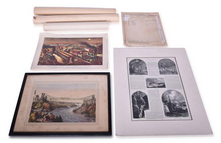
VARIOUS ARTISTS [BRITISH TRAVEL GUIDES]. Group of 6 map booklets and flyers. 1930s.Swann Auction Galleries4.4(70)See Sold PriceFeb 29, 2024
Mixed group of Lionel postwar O accessoriesToystrainsandotheroldstuff LLC4.8(444)See Sold PriceMar 02, 2024
Mixed Group of Ten American Federal Carved Mahogany Dining Chair, early 19th c., Largest Armchair-Crescent City Auction Gallery4.3(231)See Sold PriceMar 09, 2024
Large Group of Mixed Dates UK and Territories Coinage Australia New Zealand Hong KongGCB Estate Sales4.5(86)See Sold PriceMar 02, 2024
Stanford, Edward 1901 Large Map. Geological Map of the British IslesAlbion Auctions4.6(341)See Sold PriceMar 01, 2024
Stanford, Edward 1901 Large Map. Hydrographical Map of the British IslesAlbion Auctions4.6(341)See Sold PriceMar 01, 2024
Stanford, Edward 1901 Large Map. Stereographical Map of The British IslesAlbion Auctions4.6(341)See Sold PriceMar 01, 2024
Paterson & Mogg 1822 Pair of British Road Maps. Isle of Thanet & WightAlbion Auctions4.6(341)See Sold PriceMar 01, 2024
Mixed Group of Small Steiff - Mouse, Hedgehog, Pig and MoreAmanda Auction Gallery, LLC4.4(23)See Sold PriceMar 03, 2024


![World Coins - British Empire - Mixed Pennies Group [6] (1 of 1)](https://p1.liveauctioneers.com/1191/317894/170617541_1_x.jpg?height=282&quality=70&version=1706620797)


![De Jode, Rare, pub. 1593 - Map of the British Isles [England, Scotland, Ireland] (Angliae Scotiae et (1 of 2)](https://p1.liveauctioneers.com/6581/319571/171593327_1_x.jpg?height=282&quality=70&version=1707853304)

![VARIOUS ARTISTS [BRITISH TRAVEL GUIDES]. Group of 6 map booklets and flyers. 1930s. (1 of 2)](https://p1.liveauctioneers.com/199/319703/171640571_1_x.jpg?height=282&quality=70&version=1707943705)