SoldA mixed group of maps of South AmericaA small, mixed group of maps of South America, including British Guiana, Ucayali & Amazon, several of the Falkland Islands, including one plan of Port Louis, lithographs, v.s., from 480 x 600See Sold Price
SoldEurope.- a small mixed group of mapsEurope.- a small mixed group of maps,including 5 maps of Spain and Portugal, and maps of Greece, Sicily, and Corsica, by or after Vandermaelen, Tardieu, Alt, and others, engravings, some hand-See Sold Price
SoldWest Indies.- - A small mixed group of maps,comprising A New and Accurate Map of the Island of Antigua or Antego, by Emanuel Bowen; Map of the Island of Tobago, by Bryan Edwards; The Island of St Christophers alias St. Kits, by Herman Moll; PiaSee Sold Price
SoldA small, mixed group of maps of RussiaRussia.- A small, mixed group of maps of Russia, including regional maps, several of Russia in Europe, one of the Kamtchatka Peninsula, and a Sketch map of the Districts of St Petersburg, andSee Sold Price
West Indies.- - A small mixed group of maps,comprising A New and Accurate Map of the Island of Antigua or Antego, by Emanuel Bowen; Map of the Island of Tobago, by Bryan Edwards; The Island of St Christophers alias St. Kits, by Herman Moll; PiaSee Sold Price
A small, mixed, group of maps of EgyptEgypt.- a small, mixed, group of maps of Egypt,including Professor Long's map for the S.D.U.K., 3 maps of Egypt and Middle East after D'Anville for Rollin's Antient History, and 3 others, engrSee Sold Price
SoldA Small, Mixed Group of MapsSchenk (Petrus) Portugalliae et Algarve, Portugal with decorative title cartouche, engraved map with hand-colouring, 580 x 490mm., central horizontal fold, a small map of central Europe attachSee Sold Price
SoldA small, mixed, group of maps of Cumbria, WestmorA small, mixed, group of maps of Cumbria, Westmorland, Durham and Northumberland,including the Saxton/Kip maps of Cumbria and Westmorlandiæ, Drayton's Poly-Olbion map of Northumberland/The BiSee Sold Price
Soldgroup of maps of southern Germany-. A small, mixed group of maps of southern Germany,including the regions of Bavaria, Souabe, Franconia, by H. Jaillot, N. Visscher, Peter Schenk, 7 engraved maps, each with central vertical fSee Sold Price
SoldA Mixed Group Of Maps Of N. and S. AmericaA Small, Mixed Group Of Maps Of North and South America, by Thos. Kitchin, J. Migeon, S. Hall and others, engravings and lithographs, v.s., from 180 x 130mm. to 350 x 450mm., several with hanSee Sold Price
SoldA group of Australia-related maps, printsA small, mixed group of maps and prints, Australia and New Zealand-related subjects, including several from the London Illustrated News, lithographs and engravings, some hand-coloured, v.s.,See Sold Price
Sold7 maps of south east EnglandEngland.- A small, mixed group of maps of south east England, including Essex, Surrey (3), Sussex (2), 7 engraved maps, from 380 x 520mm. to 685 x 980mm., dissected and linen-backed, one withSee Sold Price
SoldA mixed group of small maps of the continent,by or after Porro, Ortelius, van den Keere, Vrints, Morden, Bion, and Mercator, engraved maps, some with text below or on verso, v.s., 85 x 120mm. to 165 x 200mm., occasional slight browning, late 16tSee Sold Price
SoldA small, mixed group of world maps-. A small, mixed group of world maps, including eastern and western hemispheres, the Ancient World, an isothermic map of the world, by A. Bovet, J. Bartholemew, A.K. Johnston, Letts & co., anSee Sold Price
SoldBritish Isles.- Mixed group of mapsMixed group of maps of the British Isles,comprising c.65 sectional maps from Cary's New Map of England and Wales, 4to,1794, and c.130 strip road map sheets, most with maps printed both sides,See Sold Price
SoldAntique Printed Europe Map Group18th-19th century AD. A mixed group comprising: a small map of the 'South East part of Germany', by Gibson (1774); a double-page coloured map of 'Prussia' by J. Rapkin; a hand-coloured map of 'FranceSee Sold Price
SoldCornwall.- - A mixed group of road maps and smallcomprising 2 strip maps by Ogilby, The Continuation of the Extended Road from Barstable to Truro, and The Continuation of the Road from London to the Lands-End, with a reduced version of the latter bySee Sold Price
SoldA small, mixed group of prints and mapsA small, mixed group of prints, views and maps, including views of Bristol, Gloucester and Portsmouth, Hogarth's The Bench, two birds after Lear, E. Bowen's New and Accurate Map of SwitzerlanSee Sold Price
SoldA mixed group of county mapsBritish Isles.- A mixed group of county maps, Worcestershire, Devonshire, Westmoreland, Shropshire, Derbyshire, Middlesex, Northumberland, Durham, Glocestershire, Shropshire, for or by W.Kip,See Sold Price
Solda mixed group of maps and plansa mixed group of maps and plans,including maps by or after Blome, Bowen, Arrowsmith, and others, mainly of the Middle East, particularly of the Levant, with a small section of plates relatingSee Sold Price
SoldMaps 19th Cent. Mixed Lot of 9Incl France, British Isles, Holland/Belgium, North Pole, Chile, Buckinghamshire, India, Africa/Libya, and Switzerland. Paper Size: Up to 23 x 18.5 inch (59 x 47cm) Most with small faultsSee Sold Price
Sold(WEST INDIES.) Group of 20 engraved maps of th(WEST INDIES.) Group of 20 engraved maps of the West Indies or portions thereof, extracted from various British magazines, generally small sizes, but several larger, generally ample margins; conditionSee Sold Price
SoldGreek Islands.- a mixed group of maps and plansGreek Islands.- a mixed group of maps and plans,including Tobias Conrad Lotter's Graeciae Antiquae Designatio Nova ..., and with maps by or after Kauffer, Tardieu, d'Anville, and others, engraSee Sold Price
Soldmixed group of maps (A)mixed group of maps (A)including a Seutter map, Ducatus Sabaudiae Principat Pedemonti, and antique and modern maps of Italy, by or after Seale, Neele, and others, v.s., largest 500 x 590mm.,See Sold Price
Ancient Roman Imperial Coins - Unresearched - Mixed AE3/4 Coin Group [250+]TimeLine Auctions Ltd.4.6(183)See Sold PriceMar 09, 2024
World Coins - British Empire - Mixed Pennies Group [6]TimeLine Auctions Ltd.4.6(183)See Sold PriceMar 09, 2024
Assortment of Railroad Paper - Rule Books, Stationary, Ink Blotter, Map, Timetables, and MoreRail & Road Auctions4.6(165)See Sold PriceMar 07, 2024
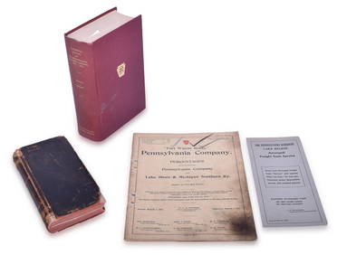
Four Pennsylvania Railroad Paper Items - 1906 CT 1000 Manual, 1913 Percentages, 1949 CentennialRail & Road Auctions4.6(165)See Sold PriceMar 07, 2024
Group of Ten Railroad Photographs, Maps, and Prints - New Jersey, Long Island, and New YorkRail & Road Auctions4.6(165)See Sold PriceMar 07, 2024
VARIOUS ARTISTS [BRITISH TRAVEL GUIDES]. Group of 6 map booklets and flyers. 1930s.Swann Auction Galleries4.4(70)See Sold PriceFeb 29, 2024
Mixed Group of Small Steiff - Mouse, Hedgehog, Pig and MoreAmanda Auction Gallery, LLC4.4(23)See Sold PriceMar 03, 2024


![Ancient Roman Imperial Coins - Unresearched - Mixed AE3/4 Coin Group [250+] (1 of 1)](https://p1.liveauctioneers.com/1191/317894/170617375_1_x.jpg?height=282&quality=70&version=1706620797)
![World Coins - British Empire - Mixed Pennies Group [6] (1 of 1)](https://p1.liveauctioneers.com/1191/317894/170617541_1_x.jpg?height=282&quality=70&version=1706620797)


![VARIOUS ARTISTS [BRITISH TRAVEL GUIDES]. Group of 6 map booklets and flyers. 1930s. (1 of 2)](https://p1.liveauctioneers.com/199/319703/171640571_1_x.jpg?height=282&quality=70&version=1707943705)


