ATLAS of ANTIENT GEOGRAPHY by SAMUEL BUTLER 1843John McInnis Auctioneers,LLC4.5(505)See Sold PriceFeb 25, 2024
18TH C. ANTIQUE MAP: FRENCH & INDIAN WAR, FRAMEDThomaston Place Auction Galleries4.4(393)See Sold PriceFeb 24, 2024
Rand McNally Railroad Map Cabinet w/ 21 Railroad MapsRail & Road Auctions4.6(165)See Sold PriceMar 08, 2024
Keith Haring - Ink on New York Map, Best Buddies, Inscribed, Signed, and DatedSapphire Auction Gallery4(67)See Sold PriceMar 02, 2024
LATE 17TH C. FRENCH MAP OF THE NEW WORLD BY ALEXIS-HUBERT JAILLOT (1632-1712)Thomaston Place Auction Galleries4.4(393)See Sold PriceFeb 24, 2024
Central Railroad of New Jersey Map of Sandy Hook Route-ca. 1903JM Hobby Supply and Railroad Artifact Auctions4.4(127)See Sold PriceFeb 24, 2024
Lot of Six Mixed Atlas Box Cars-HO Scale-New in BoxJM Hobby Supply and Railroad Artifact Auctions4.4(127)See Sold PriceFeb 25, 2024
Rand McNally/Santa Fe Railroad Map of Iowa-1912JM Hobby Supply and Railroad Artifact Auctions4.4(127)See Sold PriceFeb 24, 2024
NICOLAES VISSCHER (NETHERLANDS, 1618-1709) MAP OF THE NEW WORLDThomaston Place Auction Galleries4.4(393)See Sold PriceFeb 24, 2024
17TH C. WORLD MAP BY NICOLAES VISSCHER (NETHERLANDS, 1618-1709)Thomaston Place Auction Galleries4.4(393)See Sold PriceFeb 24, 2024
Lot of Six Mixed Atlas Cabooses-HO Scale-New in BoxJM Hobby Supply and Railroad Artifact Auctions4.4(127)See Sold PriceFeb 25, 2024
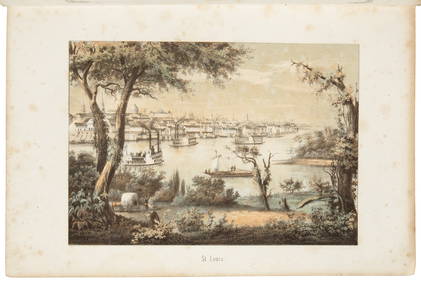
SoldBOOKS: Valley of the Mississippi 1832 Color MapsBOOKS: Valley of the Mississippi 1832 Color Maps, View of the Valley of the Mississippi: or the Emigrant's and Traveller's Guide to the West. H. S. Tanner, Philadelphia. 1832. Hardcover. 4 1/2 x 7 1/4See Sold Price
Sold1846 1ed Mississippi Exploration Monette Indian Wars1846 1ed Mississippi Exploration Monette Indian Wars Color MAP Western Americana John Monette’s ‘History of the discovery and settlement of the valley of the Mississippi’ is the history of the ASee Sold Price
SoldPicket UNIVERSAL SCHOOL ATLAS 1832 28 Color MapsTitle: The Universal School Atlas Publisher: A. and E. Picket Printing Year: 1832 Condition/Details: Bound in illustrated softcover, this antique book is a very scarce atlas featuring twenty-nine ofSee Sold Price
SoldBook: "Ancient MonumentsBook: "Ancient Monuments of the Mississippi Valley" Squire and davis 1848, Washington D.C. Rare! Book 306 p. color plates, binding looseSee Sold Price
Sold10V HISTORY OF HUDSON VALLEY NEW YORK Author‾10V HISTORY OF HUDSON VALLEY NEW YORK Author‾Signed Vintage and Antique Architecture Estates Catskills Wood Engravings Harper’s Weekly Wallace Bruce Fold‾Out Color Maps Leila PhilipSee Sold Price
SoldBook: Meyer's Zeiturigs Atlas, 1849, Color MapsMeyer's Zeiturigs Atlas, Halbkugel Der Erde, Die Oestliche and Westliche. 1849. Hand Colored Maps of the World. Marbelized cover with leather corners and spine cover.Dimensions: 13" x 10 7/8"ConditionSee Sold Price
Sold3Pcs Florida Mississippi FRAMED ENGRAVED MAPS OF THEDetails: This lot consists of the framed engraved United States maps shown in the corresponding images.These three well-preserved color maps from the late 19th century are matted and housed in decoraSee Sold Price
(MIDWEST) A group of 5 books.(MIDWEST) A group of five books. Motoring in Wisconsin. By Victor F. Pettric. S.l.: Wisconsin Motorists Association, 1922. With fold-out map. The Valley of the Mississippi Illustrated. By Henry LSee Sold Price
SoldBest Map of the Mississippi River during the Civil WarMAGNUS, Charles (19th Century). Panorama of the Mississippi Valley and its Fortifications.>br>Lithograph with original hand color. New York: C. Magnus, 1863.23 7/8" x 25 3/4" sheet; 36" x 38" framed.See Sold Price
SoldJ.B. HOMANN ANTIQUE MAP OF MEXICO & NEW SPAINJ. B. Homann's map of Mexico, Florida, New England, the West Indies, and the Mississippi Valley. Dimensions: (Frame) H 20.5" x W 24.5", (Sight) H 18.5" x W 22..25" Condition: Colors faded. Some wear tSee Sold Price
SoldHeap, Gwinn Harris. Central Route to the PacificEarliest Published Map to Show the Death Valley Pioneer Route(Wheat) 31. HEAP, Gwinn Harris. Central Route to the Pacific, from the Valley of the Mississippi to California: Journal of the Expedition oSee Sold Price
Sold17 1800's/1900's book plate maps17 1800's/1900's book plate maps including Arkansas Mississippi and Louisiana; Arizona; South Carolina; Ontario; Dominion of Canada; Mexico Central America and West Indies; West Virginia. Most are RanSee Sold Price
SoldEnzyklopaedie der IbejiEnzyklopaedie der Ibeji Fausto Polo Lehig Valley: Ibeji Art. ISBN: 978-1-60643-817-6 German text 660 pages text 510 color phots on full pages 19 color photos with detais 17 maps Hardcover 31 x 24 cm 4See Sold Price
SoldBook: St. Petersburg, G. Dobson, 1910Yellow Cloth cover with gilded design on spine & front cover. Many color and black & whiteplates. Fold out map intact. Condition: Good. Wear to bottom edge noted as well as bottom corners.See Sold Price
Sold10V ANTIQUE ATLASES & GEOGRAPHY BOOKS Color Maps10V ANTIQUE ATLASES & GEOGRAPHY BOOKS Color Maps Cartography Kansas City Journal Dollar Atlas Harpers Introductory Geography Harper′s School Geography Comprehensive James Monteith WorldSee Sold Price
SoldForepaugh-Sells Circus Route Diary 1901.Forepaugh-Sells Circus Route Diary 1901. Leather softcovers stamped "Forepaugh—Sells Circus/Season 1901". Stock date-book with color maps of the United States, route of engagements from April 22 toSee Sold Price
SoldVintage Chinese Book with Asian Color Maps (35)Vintage Chinese pocket book of thirty-five color maps each measuring 5 in. x 7.25 in. and are folded at center. Text pages between maps. Pages are loosening at spine. Paperboard covers. Measures 5.25See Sold Price
SoldTransportaion display match boxes.10 transportation display match boxes including Gray Line sightseeing and 1 book, 2 San Francisco cable cars, Maislin and one match book, 5 Union Pacific and three books, Mississippi Valley Barge; AniSee Sold Price
Sold18th C. Engraved / Colored Map of Central AmericaNorthern Europe, United Kingdom or colonies, ca. 18th to early 19th century CE. An engraved page from a book showing a color map of "Mexico or New Spain" clearly labeled in English. "The Pacific or SoSee Sold Price
18th C. Engraved / Colored Map of Central AmericaNorthern Europe, United Kingdom or colonies, ca. 18th to early 19th century CE. An engraved page from a book showing a color map of "Mexico or New Spain" clearly labeled in English. "The Pacific or SoSee Sold Price
18th C. Engraved / Colored Map of Central America**Originally Listed At $300** Northern Europe, United Kingdom or colonies, ca. 18th to early 19th century CE. An engraved page from a book showing a color map of "Mexico or New Spain" clearly labeledSee Sold Price
Albert Perry Signed Brigham Commercial Geography1923A Rare Commercial Geography-1923-Signed by Albert Perry. Signed "Sincere Regards Albert Perry Brigham". This book comes with color maps. Published by The Athenæum Press and it measures approx. 8 inchSee Sold Price
Albert Perry Signed Brigham Commercial Geography1923A Rare Commercial Geography-1923-Signed by Albert Perry. Signed "Sincere Regards Albert Perry Brigham". This book comes with color maps. Published by The Athenæum Press and it measures approx. 8 inchSee Sold Price
Crams Map of North Dakota-Complete Railroad System and County Map-1907JM Hobby Supply and Railroad Artifact Auctions4.4(127)See Sold PriceFeb 24, 2024
Crams Township and Railroad Map of New York-1890JM Hobby Supply and Railroad Artifact Auctions4.4(127)See Sold PriceFeb 24, 2024
Kenyons Pocket Map and Shippers Guide of Wisconsin-1914JM Hobby Supply and Railroad Artifact Auctions4.4(127)See Sold PriceFeb 24, 2024
Chicago Milwaukee and St Paul RY Why and Wherefore Book-1886JM Hobby Supply and Railroad Artifact Auctions4.4(127)See Sold PriceFeb 24, 2024
1849 Mitchell School ATLAS 24 MAPS America Holy Land France Africa Egypt AsiaSchilb Antiquarian Rare Books4.8(428)See Sold PriceMar 31, 2024
ANTIQUE ILLUSTRATED HANDBOOK OF GEOGRAPHY AND TRAVEL IN ASIA, VOLUME 2, 1896NY Elizabeth 4.2(86)See Sold PriceMar 03, 2024