ATLAS of ANTIENT GEOGRAPHY by SAMUEL BUTLER 1843John McInnis Auctioneers,LLC4.6(502)See Sold PriceFeb 24, 2024
18TH C. ANTIQUE MAP: FRENCH & INDIAN WAR, FRAMEDThomaston Place Auction Galleries4.4(386)See Sold PriceFeb 24, 2024
Rand McNally Railroad Map Cabinet w/ 21 Railroad MapsRail & Road Auctions4.6(165)See Sold PriceMar 08, 2024
Keith Haring - Ink on New York Map, Best Buddies, Inscribed, Signed, and DatedSapphire Auction Gallery4(67)See Sold PriceMar 02, 2024
LATE 17TH C. FRENCH MAP OF THE NEW WORLD BY ALEXIS-HUBERT JAILLOT (1632-1712)Thomaston Place Auction Galleries4.4(386)See Sold PriceFeb 24, 2024
Central Railroad of New Jersey Map of Sandy Hook Route-ca. 1903JM Hobby Supply and Railroad Artifact Auctions4.4(126)See Sold PriceFeb 24, 2024
Lot of Six Mixed Atlas Box Cars-HO Scale-New in BoxJM Hobby Supply and Railroad Artifact Auctions4.4(126)See Sold PriceFeb 25, 2024
Rand McNally/Santa Fe Railroad Map of Iowa-1912JM Hobby Supply and Railroad Artifact Auctions4.4(126)See Sold PriceFeb 24, 2024
NICOLAES VISSCHER (NETHERLANDS, 1618-1709) MAP OF THE NEW WORLDThomaston Place Auction Galleries4.4(386)See Sold PriceFeb 24, 2024
17TH C. WORLD MAP BY NICOLAES VISSCHER (NETHERLANDS, 1618-1709)Thomaston Place Auction Galleries4.4(386)See Sold PriceFeb 24, 2024
Lot of Six Mixed Atlas Cabooses-HO Scale-New in BoxJM Hobby Supply and Railroad Artifact Auctions4.4(126)See Sold PriceFeb 25, 2024
Bolivia or Upper Peru. Chili. United Provinces of LaTITLE/CONTENT OF MAP: 'Bolivia, or Upper Peru; Chili and the United Provinces of South America, or La Plata' The top image on the right hand side shows the entire map. To view a close up of the map shSee Sold Price
SoldSidney Hall: Antique Map of Chili Bolivia Peru, 1829Title: Map of Chili, La Plata, and Bolivia or Upper Peru by Sidney Hall Date: c. 1829 Medium: Copper Engraving Dimensions (in): 19 x 24 Condition: Good Condition, small rip on the right No Reserve:See Sold Price
SoldTallis (John) South AmericaTallis (John) South America; Central America; Falkland Islands and Patagonia; Peru & Bolivia; Chili and La Planta; British Guayana; Brazil; Isthmus of Panama, and Venezuela, New Granada, Equador, anSee Sold Price
SoldThomson: Map of Peru Chili & La Plata, 1817TITLE/CONTENT OF MAP: 'Peru, Chili and La Plata' Viceroyalty. Argentina Chile Bolivia. This map is folding hence the centrefold line may show on the image below DATE PRINTED: 1817 IMAGE SIZE: Approx 6See Sold Price
South America | Brazil Bolivia La Plata ParaguayTitle: South America | Brazil Bolivia La Plata Paraguay Uruguay Chili and part of Peru | New Granada Venezuela Guiana Equador Cartographer: A. Meinadier Publication Date: 1857 Publisher:ARTHUR B. GRISSee Sold Price
South America | Brazil Bolivia La Plata ParaguayTitle/Content of Map: South America | Brazil Bolivia La Plata Paraguay Uruguay Chili and part of Peru | New Granada Venezuela Guiana Equador Date: 1857 Cartographer: A. Meinadier Size: 6.5Height - 5WiSee Sold Price
Morse & Gaston Map of Southern South AmericaMORSE, Sidney & GASTON, Samuel. Brazil, Bolivia, La Plata, Paraguay, Uruguay, Chili, and part of Peru. Lithographed map with original hand color. New York, 1856. 7 1/4" x 6 1/4" sheet.See Sold Price
Map of Peru, Chili & La Plata, 1816Original copper engraving by John Carey, 1815. Map highlights several key areas. Dimensions: 28 1/2" x 21" Shipping Domestic: Shipping rates are determind by destination. International: Foreign shippiSee Sold Price
Map of Peru, Chili & La Plata, 1816Original copper engraving by John Carey, 1815. Map highlights several key areas. Dimensions: 28 1/2" x 21" No Reserve This item ships from Ocean View, DESee Sold Price
Map of Peru, Chili & La Plata, 1816Original copper engraving by John Carey, 1815. Map highlights several key areas. Dimensions: 28 1/2" x 21" No ReserveSee Sold Price
Map of Peru, Chili & La Plata, 1816Original copper engraving by John Carey, 1815. Map highlights several key areas. Dimensions: 28 1/2" x 21" This item ships from Ocean View, DE.See Sold Price
Map of Peru, Chili & La Plata, 1816Original copper engraving by John Carey, 1815. Map highlights several key areas. Dimensions: 28 1/2" x 21" This item ships from Ocean View, DE.See Sold Price
Map of Peru, Chili & La Plata, 1816Original copper engraving by John Carey, 1815. Map highlights several key areas. Dimensions: 28 1/2" x 21" No Reserve Buyer pays shipping. This item ships from Ocean View, DE.See Sold Price
Arrowsmith Map of the United Provinces of La PlataMap of the United Provinces of La Plata, the Banda Oriental, & Chile. John Arrowsmith (1790–1873). Engraved map with hand color in outline. London, 1834. 27 1/2 x 21 1/2 inches sheetSee Sold Price
Thomson: Antique Map of Peru, Chile, Argentina, 1816Map: Peru, Chili, and La Plata Cartographer: Thomson Place & Date: Edinburgh / 1816/1817 Size: 19 5/8" x 24 1/4" Condition: outline color; overprinting and some staining and browning along centerfoldSee Sold Price
Thomson: Peru, Chile, ArgentinaReserve Reduced! Map Title: Peru, Chili, and La Plata Cartographer: Thomson Place/Date: Edinburgh / 1816/1817 Size: 19 5/8" x 24 1/4" Condition: outline color; overprinting and some staining and brownSee Sold Price
Thomson: Peru, Chile, Part of ArgentinaMap Title: Peru, Chili, and La Plata Cartographer: Thomson Place/Date: Edinburgh / 1816/1817 Size: 19 5/8" x 24 1/4" Condition: overall age toning; staining and browning in margins; edges of margins nSee Sold Price
Thomson: Antique Map of Peru, Chile, Argentina, 1816Peru, Chili, and La Plata The large, detailed, double-page map of Peru, Chile, and Argentina (La Plata, not including Magellanica), from Thomson's New General Atlas. Cartographer: Thomson Place & DateSee Sold Price
Arrowsmith Map of ArgentinaARROWSMITH, John (1790-1873).Map of the United Provinces of La Plata...Engraved map with original hand color in outline.London, 1834.27 1/2" x 21 1/2" sheet.This work, derived from the manuscript by WSee Sold Price
Thomson: Peru, Chile, Part of ArgentinaMap Title: Peru, Chili, and La Plata Cartographer: Thomson Place & Date: Edinburgh / 1816/1817 Size: 19 5/8" x 24 1/4" Condition: overall age toning; staining and browning in margins; edges of marginsSee Sold Price
SoldBernardino RivadaviaTurner (Charles) Bernardino Rivadavia, a seated portrait of the first President of the United Provinces of La Plata, Argentina, mezzotint, 510 x 370mm., full margins, some water staining insidSee Sold Price
1802 Manuscript Colonial Peru Bolivia La PazManuscript Colonial Peru during the revolutionary period dated 1801/1802 regarding land holdings in La Paz. With Spanish stamps to first page, ten pages, signatures at end, followed by blank leaf. FinSee Sold Price
United Provinces Chili & Patagonia.Title/Content of Map: United Provinces Chili & Patagonia. Date Printed: 1835 Cartographer: Bradford, T.G. Size: 7.75X10 Shows all of southern South America. 76. Engraved by G.W. Boynton? Margins foxedSee Sold Price
1802 Colonial Peru La Paz Bolivia Important Manuscript1802 manuscript document of eight pages pertaining to property in Nuestra Senora deLa Paz in modern day Bolivia, this document penned during the revolution period from Spanish rule. On stamped paper oSee Sold Price
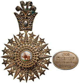
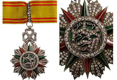
Imperial Order of Aghdas (Nishan–i–Aqdas, or “Most Sacred Order??)LA GALERIE NUMISMATIQUE4.2(149)See Sold PriceFeb 25, 2024
Ceremonial Woman's Mantle, Bolivia, Late 18th - Early 19th C.Material Culture4.6(765)See Sold PriceFeb 29, 2024
Incuna, Achacachi, Dept of La Paz, Bolivia, 19th C., Aymara, CamelidMaterial Culture4.6(765)See Sold PriceFeb 29, 2024
Ahuayo, Sica Sica, Dept of La Paz, Bolivia, 19th C. Aymara, CamelidMaterial Culture4.6(765)See Sold PriceFeb 29, 2024
Incuna, Lake Titicaca region, Dept of La Paz, Bolivia, 19th C., AymaraMaterial Culture4.6(765)See Sold PriceFeb 29, 2024
Ahuayo Ingavi Province, Dept. of La Paz, Bolivia, 19th C. Aymara, CamelidMaterial Culture4.6(765)See Sold PriceFeb 29, 2024
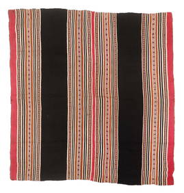
Urcu, Calamarca, Dept. of La Paz, Bolivia, Early 19th C., AymaraMaterial Culture4.6(765)See Sold PriceFeb 29, 2024
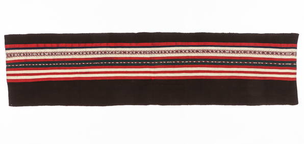
Poncho, Ulla Ulla Area, Charazani Region, Dept of La Paz, Bolivia, C. 1880-1920, AymaraMaterial Culture4.6(765)See Sold PriceFeb 29, 2024
[ENSLAVEMENT & ABOLITION]. "Agreement of Registry" regarding the lease of lands and employment ofFreeman's | Hindman4.4(1.6k)See Sold PriceFeb 27, 2024
JULES CHERET FRENCH BELLE EPOQUE LITHOGRAPH POSTERAntique Arena Inc.4.5(852)See Sold PriceMar 02, 2024
1936 EARLY EDITION AND TRANSLATIONS OF XEREZ CONQUISTA DEL PERU ALEXANDER POGOJasper524.5(9.8k)See Sold PriceFeb 27, 2024


![[ENSLAVEMENT & ABOLITION]. "Agreement of Registry" regarding the lease of lands and employment of (1 of 2)](https://p1.liveauctioneers.com/197/319238/171468066_1_x.jpg?height=282&quality=70&version=1707520367)