ATLAS of ANTIENT GEOGRAPHY by SAMUEL BUTLER 1843John McInnis Auctioneers,LLC4.5(505)See Sold PriceFeb 24, 2024
18TH C. ANTIQUE MAP: FRENCH & INDIAN WAR, FRAMEDThomaston Place Auction Galleries4.4(393)See Sold PriceFeb 24, 2024
Rand McNally Railroad Map Cabinet w/ 21 Railroad MapsRail & Road Auctions4.6(165)See Sold PriceMar 08, 2024
Keith Haring - Ink on New York Map, Best Buddies, Inscribed, Signed, and DatedSapphire Auction Gallery4(67)See Sold PriceMar 02, 2024
LATE 17TH C. FRENCH MAP OF THE NEW WORLD BY ALEXIS-HUBERT JAILLOT (1632-1712)Thomaston Place Auction Galleries4.4(393)See Sold PriceFeb 24, 2024
Central Railroad of New Jersey Map of Sandy Hook Route-ca. 1903JM Hobby Supply and Railroad Artifact Auctions4.4(127)See Sold PriceFeb 24, 2024
Lot of Six Mixed Atlas Box Cars-HO Scale-New in BoxJM Hobby Supply and Railroad Artifact Auctions4.4(127)See Sold PriceFeb 25, 2024
Rand McNally/Santa Fe Railroad Map of Iowa-1912JM Hobby Supply and Railroad Artifact Auctions4.4(127)See Sold PriceFeb 24, 2024
NICOLAES VISSCHER (NETHERLANDS, 1618-1709) MAP OF THE NEW WORLDThomaston Place Auction Galleries4.4(393)See Sold PriceFeb 24, 2024
17TH C. WORLD MAP BY NICOLAES VISSCHER (NETHERLANDS, 1618-1709)Thomaston Place Auction Galleries4.4(393)See Sold PriceFeb 24, 2024
Lot of Six Mixed Atlas Cabooses-HO Scale-New in BoxJM Hobby Supply and Railroad Artifact Auctions4.4(127)See Sold PriceFeb 25, 2024
Blaeu: Antique Map of Amazon & Mythical Incan City 1631Title: Guiana sive Amazonum Regio Map maker: Willem Blaeu Place and Year: Amsterdam, 1631 Dimensions: 49.3 x 37.6 cm (19.4 x 14.8 in) Technique: Copperplate engraving Coloring: Hand color Condition RaSee Sold Price
SoldBlaeu: Antique Map of Colombia / Panama, 1631Map: Terra Firma et Novum Regnum Granatense et Popayan Cartographer: Willem Blaeu Place & Date: Amsterdam / 1631/1650 Size: 19" x 15" Condition: outline color; overall age-toning; three small worm holSee Sold Price
SoldGroup of Three Antique Maps, consisting of JohannesGroup of Three Antique Maps, consisting of Johannes Blaeu (1599-1673), "Map of Peru," 17th c; Jean Baptiste d'Anville (1699-1763), "Aegyptus Antiquae," 1765; and Jean Baptiste D'Anville (1699-1763), "See Sold Price
SoldBlaeu: Antique Map of Europe, 1650Title/Content of Map: Highly decorative Map by Blaeu Date Printed: c1650 Cartographer: W. Blaeu Material/Medium: Paper Size: 19" x 24" Hand colored engraved Map. French text on Verso. Magnificent examSee Sold Price
Blaeu: Antique Map of Europe, 1650Title/Content of Map: Europe by Blaeu Date Printed: c1650 Cartographer: W. Blaeu Material/Medium: Paper Size: 19" x 24" Hand colored engraved Map. French text on verso. Magnificent example of Dutch goSee Sold Price
Blaeu: Antique Map of Majorca, Minorca, Ibiza, 1645Title/Content of Map: Insulae Balearides et Pytiusae. Cartographer: Willem Blaeu Place & Date: Amsterdam / 1645 Size: 19 1/2" x 15" Condition: outline color; overall age toning, some creasing in margiSee Sold Price
Blaeu: Antique Map of Anglo-Saxon Britian, 1645Title/Content of Map: Anglo-Saxon Britian by Blaeu Date Printed: 1645 Cartographer: W. Blaeu Material/Medium: Paper Size: 19" x 23" Hand colored, copperplate engraved. Published in Amsterdam. Latin teSee Sold Price
Blaeu: Antique Map of Iceland, 1640Title: Tabula Islandiae. Decorative c. 1640 map of Iceland with original coloring Map maker: Willem Blaeu Place and Year: Amsterdam, c. 1640 Dimensions: 37.5 x 49.5 cm (14.8 x 19.5 in) Technique: CoppSee Sold Price
Blaeu: Antique Map of England and Wales, 1640Title: Anglia Regnum. 1640 W. Blaeu decorative map of England and Wales Map maker: Willem Blaeu Place and Year: Amsterdam, c. 1640 Dimensions: 38.5 x 49.8 cm (15¼ x 19½ in) Technique: CopperplatSee Sold Price
Blaeu: Antique Map of Italy & Islands, 1635Title: "Nova Italiae Delineatio", Beautiful mid-17th century hand-colored map of Italy and surrounding islands Map maker: Willem Janszoon Blaeu Place and Year: Amsterdam, c. 1635 Dimensions: 51.0 x 59See Sold Price
SoldBlaeu: Antique Map of Iceland, 1630Map: Tabula Islandia Cartographer: Blaeu Place & Date: Amsterdam / 1630/1690 Size: 19 1/2" x 15" Condition: b&w, very light overall age toning; some slight staining along outer edges of wide margins ASee Sold Price
SoldBlaeu: Antique Map of Anglo Saxon Britain, 1645Title/Content of Map: Map of Anglo Saxon Britian Date Printed: 1645 Cartographer: W. Blaeu Material/Medium: Paper Size: 19" x 23" Anglo Saxon Britian. Hand colored copperplate engraved. Latin text onSee Sold Price
SoldBlaeu: Antique Map of Brazil, 1634Map: Novus Brasiliae Typus Cartographer: Blaeu Place & Date: Amsterdam / 1634 (circa) Size: 19 1/2" x 15" Condition: b&w; cleaned; some minor spotting; centerfold reinforced Blaeu's superb, Hondius-deSee Sold Price
SDUK: Antique Map City Plan of New York City, 1847Title/Content of Map: 'NEW YORK' Antique town city map plan. Manhattan Brooklyn Jersey. Date Printed: 1847 Image Size: Approx 33.0 x 39.0cm, 13 x 15.25 inches (Large) Type: Antique steel engraved mapSee Sold Price
SoldFramed Antique Map Of City & HarborsCities include Boston, New York, Baltimore, Portland, Hudson River, and Philadelphia. Type along top reads ‘Northern Ports & Harbours in the United States, By J. Bartholomew.’ Map is set behind glSee Sold Price
SDUK: Antique City Map of Warsaw, 1847Title/Content of Map: 'WARSAW (WARSZAWA)' antique town city map plan. Building profiles. Colour. Date Printed: 1847 Image Size: Approx 31.5 x 39.5cm, 12.5 x 15.5 inches (Large) Type: Antique steel engSee Sold Price
SoldLetts: Calcutta Kolkata Antique City Map Plan, 1889Map: 'Plan of the City of Calcutta' Date Printed: 1889 Image Size: Approx 28.5 x 43.0cm, 11.25 x 16.75 inches (Large) Type: Antique colour atlas map Condition: Good; suitable for framing. Artist/CartoSee Sold Price
SDUK: Antique Map of New York City, 1847Title/Content of Map: 'NEW YORK' Antique town city map plan. Manhattan Brooklyn Jersey. Date Printed: 1847 Image Size: Approx 33.0 x 39.0cm, 13 x 15.25 inches (Large) Type: Antique steel engraved mapSee Sold Price
SoldTanner: Antique Map of New York City, 1843Title/Content of Map: New York City by Tanner Date Printed: 1843 Cartographer: based on the work of H.C. Tanner Material/Medium: Paper Size: 17" x 14" Hand colored engraved Map. From the first editionSee Sold Price
Antique Map Shows New York City in 1776, Marshall, 1807Antique Map Showing New York City in 1776 -- Ile de New-York. Partie de Long-Island ou de l'Ile Longue, et Positions des Armees Americaine et Britannique, apres le Combat Livre sur Hauteurs, le 27 AouSee Sold Price
SoldJohnson: Antique Map of New York City, 1866Title/Content of Map: 1866 Johnson Map of New York City -- Johnson's New York and Brooklyn Date Printed: 1866, New York Cartographer: A Johnson Size: 22.8 x 16.3 in Condition: Very good. Age toning noSee Sold Price
Marshall: Antique Map Showing New York City in 1776Map: 1807 Marshall Map Showing New York City in 1776 -- Ile de New-York. Partie de Long-Island ou de l'Ile Longue, et Positions des Armees Americaine et Britannique, apres le Combat Livre sur HauteursSee Sold Price
SoldEight Antique Maps by BlaeuEight Antique Maps by Blaeu , 17th c., hand-colored engravings, incl. Holland, Frankfort, Austria, Umbria, and others, sheets 19 1/2 in. x 23 in Provenance: Property deaccessioned from the Louisiana SSee Sold Price
SDUK: Map of New York City, 1847Title/Content of Map: 'NEW YORK', Antique town city map plan. Manhattan Brooklyn Jersey Date Printed: 1847 Image Size: Approx 33.0 x 39.0cm, 13 x 15.25 inches (Large) Type: Antique steel engraved mapSee Sold Price
Christo Vladimirov Javacheff (1935-2020) and Jeanne-Claude Denat de Guillebon (1935-2009), known asNeely Auction4.6(224)See Sold PriceFeb 25, 2024
Antique German Kampen Town Color Copper EtchingHill Auction Gallery 4.7(1k)See Sold PriceFeb 28, 2024
ANDREW RAYMOND JANSON OIL ON BOARD ADIRONDACKSCharleston Estate Services Ltd.4.5(69)See Sold PriceMar 03, 2024
Chinese Qing Famille Verte Porcelain Dishes, 2Auctions at Showplace4.6(740)See Sold PriceMar 17, 2024
Johann Homann Hand-Colored Map Engraving, c. 1730Auctions at Showplace4.6(740)See Sold PriceMar 17, 2024
Willem Blaeu, Etc. 17th C. Antiquarian Maps, 2Auctions at Showplace4.6(740)See Sold PriceMar 17, 2024
Strickler, Rare - San Francisco, CaliforniaTrillium Antique Prints & Rare Books4.5(32)See Sold PriceFeb 24, 2024
William H. Bartlett - Set of 12 views of America - Susquehanna - City of Louisville - ColoradoProverde Auctions4.3(3)See Sold PriceFeb 28, 2024
Vintage Street Map of Pittsburgh, Pennsylvania - Rand McNallyProverde Auctions4.3(3)See Sold PriceFeb 28, 2024
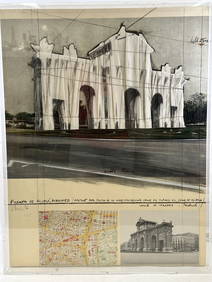
Vintage Map of Roman Forum - Vatican City - Versailles parkProverde Auctions4.3(3)See Sold PriceFeb 28, 2024
Hudson River Map & North American Postcards, 45Auctions at Showplace4.6(740)See Sold PriceFeb 13, 2025