ATLAS of ANTIENT GEOGRAPHY by SAMUEL BUTLER 1843John McInnis Auctioneers,LLC4.6(502)See Sold PriceFeb 24, 2024
18TH C. ANTIQUE MAP: FRENCH & INDIAN WAR, FRAMEDThomaston Place Auction Galleries4.4(386)See Sold PriceFeb 24, 2024
Rand McNally Railroad Map Cabinet w/ 21 Railroad MapsRail & Road Auctions4.6(165)See Sold PriceMar 08, 2024
Keith Haring - Ink on New York Map, Best Buddies, Inscribed, Signed, and DatedSapphire Auction Gallery4(67)See Sold PriceMar 02, 2024
LATE 17TH C. FRENCH MAP OF THE NEW WORLD BY ALEXIS-HUBERT JAILLOT (1632-1712)Thomaston Place Auction Galleries4.4(386)See Sold PriceFeb 24, 2024
Central Railroad of New Jersey Map of Sandy Hook Route-ca. 1903JM Hobby Supply and Railroad Artifact Auctions4.4(126)See Sold PriceFeb 24, 2024
Lot of Six Mixed Atlas Box Cars-HO Scale-New in BoxJM Hobby Supply and Railroad Artifact Auctions4.4(126)See Sold PriceFeb 25, 2024
Rand McNally/Santa Fe Railroad Map of Iowa-1912JM Hobby Supply and Railroad Artifact Auctions4.4(126)See Sold PriceFeb 24, 2024
NICOLAES VISSCHER (NETHERLANDS, 1618-1709) MAP OF THE NEW WORLDThomaston Place Auction Galleries4.4(386)See Sold PriceFeb 24, 2024
17TH C. WORLD MAP BY NICOLAES VISSCHER (NETHERLANDS, 1618-1709)Thomaston Place Auction Galleries4.4(386)See Sold PriceFeb 24, 2024
Lot of Six Mixed Atlas Cabooses-HO Scale-New in BoxJM Hobby Supply and Railroad Artifact Auctions4.4(126)See Sold PriceFeb 25, 2024
SDUK: Antique City Map of Warsaw, 1847Title/Content of Map: 'WARSAW (WARSZAWA)' antique town city map plan. Building profiles. Colour. Date Printed: 1847 Image Size: Approx 31.5 x 39.5cm, 12.5 x 15.5 inches (Large) Type: Antique steel engSee Sold Price
SoldSDUK: Antique City Map Plan of Amsterdam, 1847Title/Content of Map: 'AMSTERDAM.; inset environs of Amsterdam' Date Printed: 1847 Image Size: Approx 34.5 x 40.5cm, 13.5 x 15.75 inches (Large) Type: Antique steel engraved map with original outlineSee Sold Price
SoldSDUK: Antique City Map Plan of Lisbon, 1847Title/Content of Map: 'LISBON (LISBOA); inset environs of Lisbon' Antique town city map plan. Panorama. Date Printed: 1847 Image Size: Approx 33.5 x 40.0cm, 13.25 x 15.75 inches (Large) Type: AntiqueSee Sold Price
SoldSDUK: Antique Map, City Plan of Athens, 1847Title/Content of Map: 'ATHENS.; inset Acropolis' Antique town city map plan Date Printed: 1847 Image Size: Approx 35.5 x 41.0cm, 14 x 16 inches (Large) Type: Antique steel engraved map with original oSee Sold Price
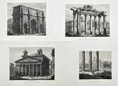
SoldSDUK: Antique Map, City Plan of Philadelphia, 1847Title/Content of Map: 'PHILADELPHIA' Antique town city map plan. Inset US Bank, Exchange. Date Printed: 1847 Image Size: Approx 39.5 x 31.5cm, 15.5 x 12.5 inches (Large) Type: Antique steel engraved mSee Sold Price
SDUK: Antique Map, City Plan of Porto, 1847Title/Content of Map: 'OPORTO (PORTO).; inset environs of Oporto' Antique town city map plan & panorama. Date Printed: 1847 Image Size: Approx 33.5 x 39.5cm, 13.25 x 15.5 inches (Large) Type: AntiqueSee Sold Price
SDUK: Antique Map City Plan of New York City, 1847Title/Content of Map: 'NEW YORK' Antique town city map plan. Manhattan Brooklyn Jersey. Date Printed: 1847 Image Size: Approx 33.0 x 39.0cm, 13 x 15.25 inches (Large) Type: Antique steel engraved mapSee Sold Price
SoldHAMBURG. Antique town city map plan. SDUK, 1847TITLE/CONTENT OF MAP: 'HAMBURG' DATE PRINTED: 1847 IMAGE SIZE: Approx 33.5 x 40.0cm, 13.25 x 15.75 inches (Large) TYPE: Antique steel engraved map with original outline hand colouring CONDITION: Good;See Sold Price
HAMBURG. Antique town city map plan. SDUK, 1847TITLE/CONTENT OF MAP: 'HAMBURG' Date: 1847 IMAGE SIZE: Approx 33.5 x 40.0cm, 13.25 x 15.75 inches (Large) TYPE: Antique steel engraved map with original outline hand colouring CONDITION: Good; suitablSee Sold Price
HAMBURG. Antique town city map plan. SDUK, 1847Title/Content of Map: 'HAMBURG' Date Printed: 1847 Image Size: Approx 33.5 x 40.0cm, 13.25 x 15.75 inches (Large) Type: Antique steel engraved map with original outline hand colouring Condition: Good;See Sold Price
SoldSDUK: Antique Map of Boston & Charlestown, 1847Title/Content of Map: 'BOSTON WITH CHARLESTOWN AND ROXBURY' Antique town city map plan Date Printed: 1847 Image Size: Approx 39.0 x 32.0cm, 15.25 x 12.75 inches (Large) Type: Antique steel engraved maSee Sold Price
WARSAW WARSZAWA antique town city map plan. BuildingTITLE/CONTENT OF MAP: 'WARSAW (WARSZAWA)' Date: 1847 IMAGE SIZE: Approx 31.5 x 39.5cm, 12.5 x 15.5 inches (Large) TYPE: Antique steel engraved map with original outline hand colouring. Inset: DiagrammSee Sold Price
SDUK: Antique Map of Hamburg, Germany, 1847TITLE/CONTENT OF MAP: 'HAMBURG' Antique town city map plan. DATE PRINTED: 1847 IMAGE SIZE: Approx 33.5 x 40.0cm, 13.25 x 15.75 inches (Large) TYPE: Antique steel engraved map with original outline hanSee Sold Price
SDUK: Antique Map of Saint Petersburg, Russia, 1847Title/Content of Map: 'ST PETERSBURG' Antique town city map plan. Panorama Date Printed: 1847 Image Size: Approx 34.0 x 40.0cm, 13.25 x 15.75 inches (Large) Type: Antique steel engraved map with origiSee Sold Price
SDUK: Antique Map of New York City, 1847Title/Content of Map: 'NEW YORK' Antique town city map plan. Manhattan Brooklyn Jersey. Date Printed: 1847 Image Size: Approx 33.0 x 39.0cm, 13 x 15.25 inches (Large) Type: Antique steel engraved mapSee Sold Price
S.D.U.K: City Map Plan of St Petersburg, 1847Title/Content of Map: 'ST PETERSBURG' Санкт-Петербург. Antique town city map plan. Panorama. Date Printed: 1847 ImagSee Sold Price
SDUK: Antique Map of Parma, Italy, 1847Title/Content of Map: 'PARMA'. Antique town city map plan & panorama. Parme. Date Printed: 1847 Image Size: Approx 34.0 x 39.0cm, 13.25 x 15.25 inches (Large) Type: Antique steel engraved map with oriSee Sold Price
SDUK: Antique Map of Parma, Italy, 1847TITLE/CONTENT OF MAP: 'PARMA' Antique town city map plan & panorama. Parme. DATE PRINTED: 1847 IMAGE SIZE: Approx 34.0 x 39.0cm, 13.25 x 15.25 inches (Large) TYPE: Antique steel engraved map with origSee Sold Price
WARSAW WARSZAWA. Antique town city map plan. Building profiles.Colour.SDUK 1844Title: WARSAW WARSZAWA. Antique town city map plan. Building profiles.Colour.SDUK 1844 Description: WARSAW (WARSZAWA)' by Cartography by WB Clarke; engraved by TE Nicholson (This map was originally puSee Sold Price
SDUK: Map of New York City, 1847Title/Content of Map: 'NEW YORK', Antique town city map plan. Manhattan Brooklyn Jersey Date Printed: 1847 Image Size: Approx 33.0 x 39.0cm, 13 x 15.25 inches (Large) Type: Antique steel engraved mapSee Sold Price
S.D.U.K: City Map Plan of Ancient Rome, 1847Title/Content of Map: 'PLAN OF ANCIENT ROME'. antique town city map plan. Original hand colouring. Date Printed: 1847. Image Size: Approx 32.5 x 40.0cm, 12.75 x 15.75 inches (Large). Type: Antique steSee Sold Price
SDUK: Antique Map of Marseille, France, 1847Title/Content of Map: 'MARSEILLE. ANCIENT MASSILIA'. Antique town city map. Date Printed: This map was originally published in 1840. This date is printed on the map. This edition of the map was publisSee Sold Price
SDUK: Antique Map, City Plan of Lisbon, 1844Title/Content of Map: 'LISBON (LISBOA); inset environs of Lisbon' Antique town city map plan. Panorama. Date Printed: This map was originally published by Baldwin & Cradock in 1833; this date is printSee Sold Price
SDUK: Antique Astronomy Celestial Star Map, 1847Title/Content of Map: '[STARS. IV., Winter Solstice]' ASTRONOMY CELESTIAL. Star map. Star chart. IV. Winter Solstice Date Printed: The alignment of the constellations is shown as at 1830; this date isSee Sold Price
Mitchell - Map of the City of Washington (Washington, DC)Trillium Antique Prints & Rare Books4.5(30)See Sold PriceFeb 24, 2024
WEST AFRICA Explorers' routes Senegal Ashanti. Mountains of Kong. SDUK 1857 mapJasper524.5(9.8k)See Sold PriceFeb 28, 2024
AFRICA. Map pre-dating much exploration. Mountains of Kong. SDUK 1851 oldJasper524.5(9.8k)See Sold PriceFeb 28, 2024
NORTH AFRICA OF BABRBARY V Parts of Tripoli & Egypt. Libya Tribes. SDUK 1846 mapJasper524.5(9.8k)See Sold PriceFeb 28, 2024
COLONIAL TOGO & BENIN (Dahomey). Porto Novo & Lomé city ville plans 1929 mapJasper524.5(9.8k)See Sold PriceFeb 28, 2024
WEST AFRICA explorers' routes. Beaufort Gray Park Dochard Caillie. SDUK 1874 mapJasper524.5(9.8k)See Sold PriceFeb 28, 2024
NORTH AFRICA BARBARY. Parts of Tripoli (Libya) & Egypt. Tribes. SDUK 1844 mapJasper524.5(9.8k)See Sold PriceFeb 28, 2024
WEST AFRICA I Explorers' routes Senegal Ashanti Ivory Gold Coast. SDUK 1851 mapJasper524.5(9.8k)See Sold PriceFeb 28, 2024
NORTH AFRICA BARBARY. Parts of Tripoli (Libya) & Egypt. Tribes. SDUK 1844 mapJasper524.5(9.8k)See Sold PriceFeb 28, 2024
NIGERIA explorers' routes. Lander Clapperton Oudney Denham Allen. SDUK 1874 mapJasper524.5(9.8k)See Sold PriceFeb 28, 2024
WEST AFRICA II. NIGERIA. Bight of Benin-Lake Chad. Yariba Houssa. SDUK 1851 mapJasper524.5(9.8k)See Sold PriceFeb 28, 2024
NORTH AFRICA OF BABRBARY V Parts of Tripoli & Egypt. Libya Tribes. SDUK 1851 mapJasper524.5(9.8k)See Sold PriceFeb 28, 2024
NIGERIA early explorers' routes. Lake Chad. Yariba Houssa Borgou SDUK 1844 mapJasper524.5(9.8k)See Sold PriceFeb 28, 2024
COLONIAL TOGO & BENIN (Dahomey). Porto Novo & Lomé city ville plans 1931 mapJasper524.5(9.8k)See Sold PriceFeb 28, 2024
NORTH AFRICA BARBARY. Parts of Tripoli (Libya) & Egypt. Tribes. SDUK 1848 mapJasper524.5(9.8k)See Sold PriceFeb 28, 2024
COLONIAL TOGO & BENIN (Dahomey). Porto Novo & Lomé city ville plans 1938 mapJasper524.5(9.8k)See Sold PriceFeb 28, 2024
WEST AFRICA showing early explorers' routes & Mountains of Kong. SDUK 1844 mapJasper524.5(9.8k)See Sold PriceFeb 28, 2024
James Ridgway (1815 - 1847) - Antique Fruit Print of CherryProverde Auctions4.3(3)See Sold PriceFeb 28, 2024
Domenico Amici - Set of 4 prints - Tempio di Giove Statore - Arco di Costantino in Rome, ItalyProverde Auctions4.3(3)See Sold PriceFeb 28, 2024
Vintage Street Map of Pittsburgh, Pennsylvania - Rand McNallyProverde Auctions4.3(3)See Sold PriceFeb 28, 2024