ATLAS of ANTIENT GEOGRAPHY by SAMUEL BUTLER 1843John McInnis Auctioneers,LLC4.5(505)See Sold PriceFeb 24, 2024
18TH C. ANTIQUE MAP: FRENCH & INDIAN WAR, FRAMEDThomaston Place Auction Galleries4.4(393)See Sold PriceFeb 24, 2024
Rand McNally Railroad Map Cabinet w/ 21 Railroad MapsRail & Road Auctions4.6(165)See Sold PriceMar 08, 2024
Keith Haring - Ink on New York Map, Best Buddies, Inscribed, Signed, and DatedSapphire Auction Gallery4(67)See Sold PriceMar 02, 2024
LATE 17TH C. FRENCH MAP OF THE NEW WORLD BY ALEXIS-HUBERT JAILLOT (1632-1712)Thomaston Place Auction Galleries4.4(393)See Sold PriceFeb 24, 2024
Central Railroad of New Jersey Map of Sandy Hook Route-ca. 1903JM Hobby Supply and Railroad Artifact Auctions4.4(127)See Sold PriceFeb 24, 2024
Lot of Six Mixed Atlas Box Cars-HO Scale-New in BoxJM Hobby Supply and Railroad Artifact Auctions4.4(127)See Sold PriceFeb 25, 2024
Rand McNally/Santa Fe Railroad Map of Iowa-1912JM Hobby Supply and Railroad Artifact Auctions4.4(127)See Sold PriceFeb 24, 2024
NICOLAES VISSCHER (NETHERLANDS, 1618-1709) MAP OF THE NEW WORLDThomaston Place Auction Galleries4.4(393)See Sold PriceFeb 24, 2024
17TH C. WORLD MAP BY NICOLAES VISSCHER (NETHERLANDS, 1618-1709)Thomaston Place Auction Galleries4.4(393)See Sold PriceFeb 24, 2024
Lot of Six Mixed Atlas Cabooses-HO Scale-New in BoxJM Hobby Supply and Railroad Artifact Auctions4.4(127)See Sold PriceFeb 25, 2024
SoldGroup of Twenty-Four Hand-Colored MapsGroup of Twenty-Four Antique Hand-Colored Maps , 17th to 19th c., majority showing provinces of Europe, unframed. Provenance: Property deaccessioned from the Louisiana State Museum, proceeds to be useSee Sold Price
SoldH. ARNOUX - Authentic Antique 19th C. Photograph EgyptVintage Orientalist print by Hyppolite Arnoux circa 1870. Dimensions are about 10.50" x 8.50".See Sold Price
SoldAntique 19th C French Hand Colored Map of CalvadosAntique 19th C map of the French area of Calvados. This area of France is known for its production of Calvados. The engraving is surrounded by scenes showing the region and its products. Published bySee Sold Price
19th C Antique Map of British IndiaMap: Map of British India Maker: John Rapkin Date: 19th century Map Size: 14.5 x 11 inches Frame Size: 22 x 18 inches John Rapkin (1815-1876) drew and engraved the maps for John Tallis’ renowned "IlSee Sold Price
SoldAntique 19th C French Hand Colored Map of AriegeAntique 19th C French Hand Colored Map of Ariege. Hand colored well detailed engraving showing the French department of Ariege with scenes of regional trade, products and life along with a coat of armSee Sold Price
SoldLarge Antique 19th c 7.5" Authentic Whale's ToothLarge impressive specimen. Wonderful old patina. Measures 7 1/2" x 3" and weighs 864 grams. Good condition with honest wear. Small chips to root area rim. Inked initials MHW inside cavity. In house USSee Sold Price
SoldFour Antique Continental MapsFour Antique Continental Maps , 17th to 19th c., incl. map of Ireland, British Colonies, Virginia, and two bird's-eye-views, largest 18 3/4 in. x 26 in Provenance: Property deaccessioned from the LouiSee Sold Price
French antique fountain authentic Durenne signed 19thCThis exceptional and rare French antique fountain is authentic from France, signed "Durenne".Best foundry for iron art work, all art work is seen all over the city of Paris, France. It was made in theSee Sold Price
SoldAntique Russian Wooden Icon 19-20th c, Maria & JesusAntique Authentic Russian Wooden Icon 19th-20th c, Maria & Jesus child; Size: 7.5 inches x 6 inches = 19 cm x 15 cm; Thickness: 0.8 inch = 2 cm; Weight: 11 oz. = 320 g; Age: possibly end of 19th - begSee Sold Price
SoldAntique Chinese Low TableLow Square Antique Table. China, Shandong Province, 19th c. Dimensions: 18-1/2 x 39 x 39 inches.See Sold Price
Sold19TH C MAP OF FRANCE BEFORE THE REVOLUTIONAntique Map of France before the Revolution divided into Military Governments engraved for J. Bradley's Elements of Geography. Professionally framed and triple matte, silk mat. In frame 17 1/2"x16"x1"See Sold Price
SoldAuthentic Antique Igbo Mask West AfricaLikely 19th C. Remains of lime coating. 14 1/2"HSee Sold Price
SoldPAINTED TAPESTRY PANEL MEDIEVAL SOLDIERS, 19TH C.19th CENTURY PAINTED TAPESTRY PANEL EUROPEAN MEDIEVAL ARMORED SOLDIERS, HAND WOVEN WALL HANGING PANEL This authentic, antique hand woven 19th century painted tapestry depicts several Medieval SoldiersSee Sold Price
SoldAntique 19th C French Silk Brocade ArmchairAntique 19th C French Napoleon III Style Silk Brocade Armchair. Measures 37 x 23 x 24 inches. Purchased by consignor at Provinces de France in Greenwich, CT for $5,000. From a designer decorated WiltoSee Sold Price
SoldCOLLECTION OF 4 LATE 19TH C MAPS AND 2 ENGRAVINGSINCLUDING 2 LARGE MAPS OF MIDDLEBOROUGH; 1 OF FREETOWN; 2 OF LAKEVILLE AND 2 ENGRAVINGS OF MIDDLEBOROUGH; SOME STAININGSee Sold Price
Antique 19th C French Silk Brocade ArmchairAntique 19th C French Napoleon III Style Silk Brocade Armchair. Measures 37 x 23 x 24 inches. Purchased by consignor at Provinces de France in Greenwich, CT for $5,000. From a designer decorated WiltoSee Sold Price
SoldAntique 19th c. Rand McNally & Co. UNIVERSAL ATLAS OF THE WORLDLarge Antique 19th c. Rand McNally & Co. UNIVERSAL ATLAS OF THE WORLD | Published: Chicago & New York, Rand, McNally & Company, 1898 | Folio Size, Bound in quarter leather with green cloth boards | InSee Sold Price
SoldThree 18th and 19th c. maps, Ireland and UK(Lot of 3) Framed 18th and 19th century maps, ''Buckingham Shire'' by Robert Morden, ''Seven United Provinces'' by Eman Bowen, and ''Ireland'' by Herman Moll 1732, largest overall: 19.5''h x 22''wSee Sold Price
Sold7 19th C. MapsLot of seven 19th century maps, "The Seven Provinces" having the Austrian French and Dutch Netherlands African, T. Jeffery's geographer, "States of America from the Beft. Authorities", stamped lower rSee Sold Price
Sold19TH C MAP OF NEW BEDFORD CITY, FAIRHAVEN ANDOXFORD, HAND COLORED, SHOWS SLIGHT CREASING. SIGHT SIZE 9 1/2" X 10 1/2". FRAMED AND UNDER GLASS. PROVENANCE: FROM THE MICHAEL IPPOLITO ESTATE.See Sold Price
SoldTwo 19th c. Maps, Tennessee & KentuckyTwo nineteenth century maps, both hand-colored, in matching molded natural color wood frames with green painted rabbet edges and gilt liners. 1st item: Map of Tennessee & Kentucky engraved by G. W. BoSee Sold Price
Sold2 Antique 19thC. Leather Family Bibles 1825Lot of two antique Bibles. With ornate gold embossed details on spine, gorgeous marbled endpapers. Marked Family Bibles of previous owners. Includes maps, charts, and etchings. Publisher: BrattleboroSee Sold Price
SoldPair of 19thc Maps, Turkey In Europe & Turkey In Asia1856 J. H Colton map of Turkey in Asia & The Caucasian Provinces Of Russia, along with an 1881 map of Turkey in Europe, including The Bosphorus & Candia or Crete. * both maps with minor issues - olderSee Sold Price
Map: A 19thC engraved and hand coloured map of South America. Published by the Society for theClaydon Auctioneers Ltd4.3(125)See Sold PriceFeb 26, 2024
Map: A 19thC engraved and hand coloured map of St. Petersburg / Sanktpeterburga by W. B. Clarke.Claydon Auctioneers Ltd4.3(125)See Sold PriceFeb 26, 2024
Map: A 19thC engraved map titled Gloucestershire from the Best Authorities, after John Cary. Approx.Claydon Auctioneers Ltd4.3(125)See Sold PriceFeb 26, 2024
Map: A 19thC engraved and hand coloured map of Buckingham titled A New Map of BuckinghamshireClaydon Auctioneers Ltd4.3(125)See Sold PriceFeb 26, 2024
Map: A 19thC engraved map of West Riding, titled A Map of the North Part of the West Riding ofClaydon Auctioneers Ltd4.3(125)See Sold PriceFeb 26, 2024
1722 POMPONII MELA De Situ Orbis ARMORIAL VELLUM BINDING antiqueJasper524.5(9.9k)See Sold PriceFeb 27, 2024
1816 MAP SOUTHERN PART OF RUSSIA or MUSCOVY in EUROPE copper engraving ANTIQUEJasper524.5(9.9k)See Sold PriceFeb 27, 2024
1744 ROMAN HISTORY ARMORIAL VELLUM BINDING ILLUSTRATED w/ MAP antique by FLORUSJasper524.5(9.9k)See Sold PriceFeb 27, 2024
1816 MAP NORTHERN PART OF RUSSIA or MUSCOVY in EUROPE copper engraving ANTIQUEJasper524.5(9.9k)See Sold PriceFeb 27, 2024
1758 MAP PARTIE DE LA MER GLACIALE contenants La Nouvelle Zemble RUSSIA antiqueJasper524.5(9.9k)See Sold PriceFeb 27, 2024
1749 MAP CARTE DE LA TARTARIE ORIENTALE RUSSIA & CHINA antique EASTERN TARTARYJasper524.5(9.9k)See Sold PriceFeb 27, 2024
1675 ELZEVIER JULIUS CAESAR antique ILLUSTRATED w/ MAPS ROMAN HISTORYJasper524.5(9.9k)See Sold PriceFeb 27, 2024
1704 DESCRIPTION OF ALL THE SEATS OF THE PRESENT WARS OF EUROPE antique w/ MAPSJasper524.5(9.9k)See Sold PriceFeb 27, 2024
18th century MAP of ARMENIA GEORGIA NATOLIA BLACK SEA ASIA MINOR antiqueJasper524.5(9.9k)See Sold PriceFeb 27, 2024
1925 MAP of EXPEDITION ANTARCTIQUE FRANCAISE SHETLANDS DE SUD antiqueJasper524.5(9.9k)See Sold PriceFeb 27, 2024
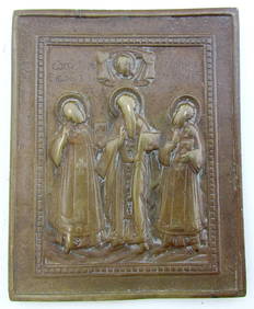
RUSSIAN BRONZE ICON of SELECTED SAINTS ST. JOHN BASIL & GREGORY antiqueJasper524.5(9.9k)See Sold PriceFeb 27, 2024
West Africa. Sahara caravan routes. Tribes Kingdoms Empires. LIZARS 1842 mapJasper524.5(9.9k)See Sold PriceFeb 28, 2024
Afrique Ancienne. Ancient North Africa. MALTE-BRUN c1871 old antique map chartJasper524.5(9.9k)See Sold PriceFeb 28, 2024
Cooke, George 1801 Antique Map. United States of AmericaAlbion Auctions4.6(341)See Sold PriceMar 01, 2024
19th C. ENGLISH WEDGWOOD MAJOLICA BIRD & FAN DESIGN Creamer 5"Jasper524.5(9.9k)See Sold PriceMar 07, 2024
19TH C CHINESE ANCESTOR WATERCOLOR PAINTING SCROLLAntique Arena Inc.4.5(878)See Sold PriceJun 15, 2024
19TH C CHINESE ANCESTOR WATERCOLOR PAINTING SCROLLAntique Arena Inc.4.5(878)See Sold PriceJun 15, 2024