ATLAS of ANTIENT GEOGRAPHY by SAMUEL BUTLER 1843John McInnis Auctioneers,LLC4.6(502)See Sold PriceFeb 24, 2024
18TH C. ANTIQUE MAP: FRENCH & INDIAN WAR, FRAMEDThomaston Place Auction Galleries4.4(386)See Sold PriceFeb 24, 2024
Rand McNally Railroad Map Cabinet w/ 21 Railroad MapsRail & Road Auctions4.6(165)See Sold PriceMar 08, 2024
Keith Haring - Ink on New York Map, Best Buddies, Inscribed, Signed, and DatedSapphire Auction Gallery4(67)See Sold PriceMar 02, 2024
LATE 17TH C. FRENCH MAP OF THE NEW WORLD BY ALEXIS-HUBERT JAILLOT (1632-1712)Thomaston Place Auction Galleries4.4(386)See Sold PriceFeb 24, 2024
Central Railroad of New Jersey Map of Sandy Hook Route-ca. 1903JM Hobby Supply and Railroad Artifact Auctions4.4(126)See Sold PriceFeb 24, 2024
Lot of Six Mixed Atlas Box Cars-HO Scale-New in BoxJM Hobby Supply and Railroad Artifact Auctions4.4(126)See Sold PriceFeb 25, 2024
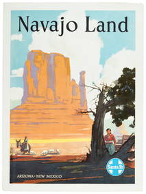
Rand McNally/Santa Fe Railroad Map of Iowa-1912JM Hobby Supply and Railroad Artifact Auctions4.4(126)See Sold PriceFeb 24, 2024
NICOLAES VISSCHER (NETHERLANDS, 1618-1709) MAP OF THE NEW WORLDThomaston Place Auction Galleries4.4(386)See Sold PriceFeb 24, 2024
17TH C. WORLD MAP BY NICOLAES VISSCHER (NETHERLANDS, 1618-1709)Thomaston Place Auction Galleries4.4(386)See Sold PriceFeb 24, 2024
Lot of Six Mixed Atlas Cabooses-HO Scale-New in BoxJM Hobby Supply and Railroad Artifact Auctions4.4(126)See Sold PriceFeb 25, 2024
SoldAntique Map of Southwestern US & MexicoTitle/Content of Map: Important Southwestern U.S., Texas to CA with Mexico and Guatemala Date Printed: 1843 Cartographer: Based on the work of H.C. Tanner Material/Medium: Paper Size: 17" x 14" Hand cSee Sold Price
SoldRadefeld/Meyer: Antique Map of U.S. & Mexico, 1852Vereinigte Staaten von Nord-America und Mexico. A highly detailed map of the United States and Mexico from Meyer's Groschen-Atlas, showing the pre-Gadsen Purchase border between the U.S. and Mexico anSee Sold Price
SoldLaPie / Tardieu: Antique Map of US, Texas, Mexico, 1809Map: Mexique Cartographer: P. LaPie / Tardieu Place & Date: Paris / 1809/1812 Size: 11 7/8" x 8 3/4" Condition: outline color; light overall age toning, otherwise beautifully preserved A detailed mapSee Sold Price
SoldSDUK: Antique Map of Southwestern USA, 1846CENTRAL AMERICA, SHEET II., INCLUDING TEXAS, CALIFORNIA AND THE NORTHERN STATES OF MEXICO' The map, published in 1846, shows the Republic of Texas as an independent state as it existed between 1836 anSee Sold Price
Johnson: Antique Map of North America, 1850TITLE/CONTENT OF MAP: 'North America' The map shows the borders between the US and Mexico before the Mexican-American war, with much of the present-day western United States as part of Mexico. The RepSee Sold Price
Sold[MAP]. RADEFELD. Texas Nach den besten Quellen... 1846355. [MAP]. RADEFELD, [C.C.F.]. Texas Nach den besten Quellen.... Hildburghausen, 1846. Engraved map of Texas and most of the southwestern U.S. and northern Mexico, neat line to neat line: 29.3 x 35.1See Sold Price
Soldvan der Aa: Antique Map of Southeast US, 1713Map: La Floride Suivant les Nouvelles Observations de Messrs. de l'Academie Royale des Sciences (eastern seaboard to New Mexico) Cartographer: van der Aa Place & Date: Leiden / 1713 Size: 14 7/8" x 10See Sold Price
Brué/Levasseur: Antique Map of Mexico/Southwest US 1876Carte Generale du Mexique et de la Partie Sud-Ouest des Etats Unis Brue's important map of post-independence Mexico, revised by Levasseur to reflect Mexico's losses in the Mexican-American War and theSee Sold Price
MAPS IN BOOK, Southwestern US, EmorySouthwestern United States. William Hemsley Emory, [Maps with Report] Map of the Territory of New Mexico... [and] Sketch of Part of the March & Wagon Road of Lt. Colonel Cooke... [accompanying] NotesSee Sold Price
SoldMitchell/Cowperthwait: Antique Map of the West US, 1850Title: Map of California, Oregon, Utah, and New Mexico by Mitchell and Cowperthwait Date: 1850 Medium: Lithograph Dimensions (in): 13.5 x 17 Condition: Good Condition with a little of foxing Samuel AuSee Sold Price
Sold18th century MapAn 18th century Map of the US and Mexico. Hand colored engraving on paper, by Covens & Mortimer, Amsterdam, 1722 entitled "Tabula Geographica Mexicae Et Floridar & C". Some discoloration, center foldSee Sold Price
SoldAntique U.S. + Foreign Framed Maps-1800(3) Antique U.S. + Foreign frames maps - 1800's of Mass. + Rhode Island, Kansas City, MO, Philadelphia, Cincinnati, Detroit, New Mexico & Texas--example of misc. map sizes 8 3/4" x 9 3/4", 13 1/4" x 9See Sold Price
SoldANTIQUE MAP OF MEXICO THE DIEGO PROVENCEThe Diego Provence. 14 1/4" X 12" $100 - $200 Please contact us for high resolution images of this lot. Shipping: We are able to pack and ship this itemSee Sold Price
SoldMAP IN BOOK, US & Mexico, KitchinSouthwestern United States & Mexico. Thomas Kitchin, Mexico oder Neu Spanien zu Campens Entdekkung von America [bound in] Die Entdeckung von Amerika..., 1808 (published). Black & White. This attractivSee Sold Price
MAP, US & Mexico, Von EulerSouthwestern United States & Mexico. Leonhard von Euler, Americae Septentrionalis Pars III, from Atlas Geographicus Omnes Orbis Terrarum…, 1760 (circa). Hand Color. This scarce map is one sheet of vSee Sold Price
SoldTwo Maps of Southwestern American InterestTwo Maps of Southwestern American Interest comprising the Map Of The Route Pursued In 1849 By The U.S. Troops, Under the Command of Bvt. Lieut. Col. Jno. M. Washington, Governor [of] New Mexico, in anSee Sold Price
Sold3 Southwestern Maps3 Framed Southwestern Maps. 1st item: Map showing the Southern boundary of New Mexico, agreed upon by Commissioners Bartlett & Conde, February 7, 1853. 11 1/4" x 7 1/2" sight, 19 1/2" x 15 3/4" mattedSee Sold Price
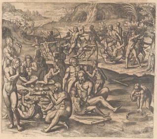
SoldRaphael Semmes SERVICE AFLOAT AND ASHORE DURING THERaphael Semmes SERVICE AFLOAT AND ASHORE DURING THE MEXICAN WAR 1851 Very Rare Antique US History Navy Battles Mexico Fold‾Out Map Engraved Illustrated Plates Geography Santa Anna Texas San JaciSee Sold Price
SoldFramed Antique Map, Mexico & FloridaFramed antique map of Mexico and Florida. Plate marks visible. hand-colored. Map is set behind glass in wood frame in two-tone wood style frame. Measures approximately 23 inches in height by 28 inchesSee Sold Price
Brockhaus: Antique Map Mexico & Central America, 1885Title/Content of Map: 1885 Brockhaus Map of Mexico, Central America and Parts of Texas -- Mexiko und Centralamerica Date Printed: 1885 Leipzig Cartographer: F Brockhaus Size: 11 x 8.4 in. A very niceSee Sold Price
SoldMAP, US & Mexico, TallisSouthern United States & Mexico. John Tallis, Mexico, California and Texas, from Illustrated Atlas and Modern History of the World, 1850 (circa). Hand Color. This is the second, and most desirable, stSee Sold Price
SoldAntique Map US Rail Roads and Wagon Roads"Map of the Untied States showing the Limits Within Which Land Grants were Made by the Federal Government to Aid in the Construction of Railroads and Wagon Roads". Engraved and printed for the 9th CenSee Sold Price
SoldAN ANTIQUE MAP, "Mexico," JOHN ARROWSMITH (1790-1873),AN ANTIQUE MAP, "Mexico," JOHN ARROWSMITH (1790-1873), LONDON, PUBLISHED FEBRUARY 15, 1834, hand colored engraving on paper, a fragment from London Atlas, showing Texas on the eve of independenceSee Sold Price
SoldANTIQUE MAP, MEXICO, BY ABRAHAM ORTELIENS, (1527-1ANTIQUE MAP, MEXICO, BY ABRAHAM ORTELIENS, (1527-1598) BELGIUM, APPX. 8" X 9.75". HAND COLORED. GOOD COND.See Sold Price
SOUTHWESTERN NATIVE AMERICAN WOOD KACHINA DOLLS BOATAntique Arena Inc.4.5(852)See Sold PriceJun 15, 2024


![[MAP]. RADEFELD. Texas Nach den besten Quellen... 1846 (1 of 2)](https://p1.liveauctioneers.com/514/38482/16500410_1_x.jpg?height=282&quality=70&version=1363615005)