Amerique Meridionale'. South America. Spanish New World
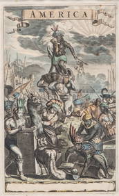
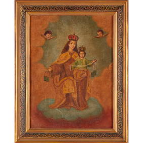
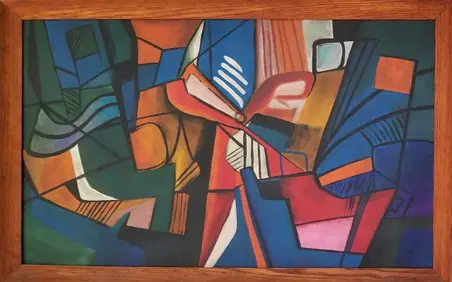
LATE 17TH C. FRENCH MAP OF THE NEW WORLD BY ALEXIS-HUBERT JAILLOT (1632-1712)Feb 24, 2024LARGE EARLY 18TH C. DUTCH CHART OF UPPER NORTH AMERICA, PIERRE MORTIER (1661-1711), FRAMEDFeb 24, 2024ANONYMOUSMar 03, 2024Antique Hand Colored Print "America" by Jacob van MeursMar 01, 2024Large and exquisite Archangel Saint Michael subduing the Devil, 18th century Cusco colonial school,Feb 28, 2024Arrowsmith & Lewis - Map of the World on Mercator's ProjectionFeb 24, 2024Carey, pub. 1796 - A Chart of the West IndiesFeb 24, 2024Carey, pub. 1796 - Map of the State of MarylandFeb 24, 2024Carey, pub. 1796 - Map of GeorgiaFeb 24, 2024Carey, pub. 1796 - Map of The State of South CarolinaFeb 24, 2024Carey, pub. 1796 - Map of KentuckyFeb 24, 2024Carey, pub. 1796 - Map of the Tennassee State formerly part of North Carolina (Tennessee)Feb 24, 2024Map: An 18thC engraved and hand coloured map of North America and South America, titled DeFeb 26, 202416th C. Spanish Silver Cob Coin (Macuquina) - 0.9 gFeb 26, 2024Spanish Colonial School, Virgen del CarmenMar 06, 2024Amazing Roberto Burle Marx Acrylic CanvasMar 02, 2024MAP, World, BaschlinMar 12, 2024MAP, Cartagena, FerMar 12, 2024MAP, Cartagena, TirionMar 12, 2024MAP, South America, AaMar 12, 2024MAP, Tierra del Fuego, BlaeuMar 12, 2024ENGRAVING, South America, MalletMar 12, 2024MAP, Portugal, SeutterMar 12, 2024Post-Conquest Inca Stone Llama Conopa Offering EffigyMar 01, 2024