SoldAfter J and C Walker Handcoloured Map of Hunts with plaAfter J and C Walker Handcoloured Map of Hunts with places of meeting of foxhounds Shows Mr Drake, Mr Phillips, Old Berkshire , Heythrop 15 1/4 x 12 3/4"See Sold Price
SoldJ AND C WALKER FOX HUNTING MAP OF SUFFOLKJ and C Walker Fox Hunting Map of Suffolk hand coloured engraved map dissected and backed onto linen 33 x 40cmSee Sold Price
SoldMaps: A framed, hand coloured county map ofMaps: A framed, hand coloured county map of Buckinghamshire drawn by R. Creighton and engraved by J. & C. Walker for 'Lewis' Topographical Dictionary', aperture approx. 9'' x 7''; together with a framSee Sold Price
SoldMaps: A framed, hand coloured county map ofMaps: A framed, hand coloured county map of Buckinghamshire drawn by R. Creighton and engraved by J. & C. Walker for 'Lewis' Topographical Dictionary', aperture approx. 9'' x 7''; together with a framSee Sold Price
SoldMaps: A framed, hand coloured county map ofMaps: A framed, hand coloured county map of Buckinghamshire drawn by R. Creighton and engraved by J. & C. Walker for 'Lewis' Topographical Dictionary', aperture approx. 9'' x 7''; together with a framSee Sold Price
SoldMaps: A framed, hand coloured county map ofMaps: A framed, hand coloured county map of Buckinghamshire drawn by R. Creighton and engraved by J. & C. Walker for 'Lewis' Topographical Dictionary', aperture approx. 9'' x 7''; together with a framSee Sold Price
SoldMaps: A framed, hand coloured county map ofMaps: A framed, hand coloured county map of Buckinghamshire drawn by R. Creighton and engraved by J. & C. Walker for 'Lewis' Topographical Dictionary', aperture approx. 9'' x 7''; together with a framSee Sold Price
Gilt framed 19th Century hand coloured map ofGilt framed 19th Century hand coloured map of Westmorland, by J. and C. Walker, 13ins x 15insSee Sold Price
SoldWillem Kip, Dutch act 1588-1635- ''SuffolciaeWillem Kip, Dutch act 1588-1635- ''Suffolciae Comitatus'' after Christopher Saxon, c.1607-1637; hand-coloured engraved map, 27.5x37.9cm: J C Walker, British 19th century- ''Suffolk''; hand-coloured enSee Sold Price
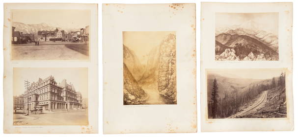
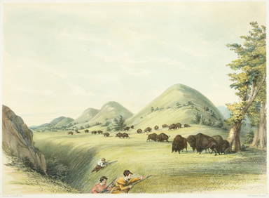
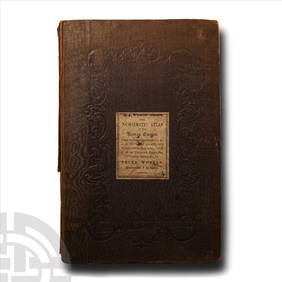
SoldWALKER, John and Charles.WALKER, John and Charles. Hobson's Fox-Hunting Atlas. London: J. and C. Walker, [ca 1868-1871]. Folio (368 x 242 mm). 42 engraved or lithographic double-page maps hand-colored in outline, hunts stampeSee Sold Price
SoldC & J GreenwoodC & J Greenwood Map of the County of Hertford; Map of the County of Buckingham hand coloured stipple engravings by J & C Walker, 1834, 61 x 70cm, and 63 x 77cm (sheet) (2)See Sold Price
C & J GreenwoodC & J Greenwood Map of the County of Cambridge hand coloured stipple engraving by J & C Walker, 1834, 57 x 71cm; and Emanuel Bowen An Accurate Map of the County of Huntingdon 18th century engraving wiSee Sold Price
SoldJ & C Walker Map of England & Wales, 52 x 41 ins.J & C Walker divided coloured engraving, Map of England & Wales, The Grand Trigonometrical Survey, 1840, 52 x 41 ins. Original cloth cover.See Sold Price
SoldJ & C Walker Map of the County Palatine of DurhamJ & C Walker coloured engraving, Map of the County Palatine of Durham, 1840, 32 x 40 ins. canvas backed, slip case.See Sold Price
SoldWalker (J. & C.) - Walker's Map of the Great Westernshowing from London to Bristol, lithographed map, 150 x 760 mm., light offsetting, spotting and surface dirt, folding concertina style into contemporary cloth covered boards, with printed label attachSee Sold Price
SoldJ&C WALKER, MAP OF FLORIDA dated 1834 sight: 12"xJ&C WALKER, MAP OF FLORIDA dated 1834 sight: 12"x 16"See Sold Price
SoldDorsetshire.- Morden (Robert) - Dorset Shire,with large title cartouche upper left, engraved map with hand-colouring, 365 x 430mm., faint central vertical fold, Abel Swale, Awnsham and John Churchill, c.1695; with a J. & C. Walker map of HampsSee Sold Price
IRELAND on 2 sheets conjoined 62x50 cm. Round towers Cloigthithe. SDUK 1844 mapTitle: IRELAND on 2 sheets conjoined 62x50 cm. Round towers Cloigthithe. SDUK 1844 map Description: IRELAND' by Engraved by J & C Walker (This map was originally published by The Society for the DiffuSee Sold Price
IRELAND on 2 sheets conjoined 62x50 cm. Round towers Cloigthithe. SDUK 1844 mapTitle: IRELAND on 2 sheets conjoined 62x50 cm. Round towers Cloigthithe. SDUK 1844 map Description: IRELAND' by Engraved by J & C Walker (This map was originally published by The Society for the DiffuSee Sold Price
SoldFour 19th century maps, Southeast"North America, Sheet XII, Georgia with parts of North & South Carolina, Tennessee, Alabama & Florida", by J. & C. Walker, from [Maps of the Society for the Diffusion of Useful Knowledge. Vol. 1,] pubSee Sold Price
SoldJ & C Walker World Folding Map, laid on canvas andJ & C Walker World Folding Map, laid on canvas and framed, "To her most Gracious Majesty, Queen Victoria. This map of the world on mercator's projection is most respectfully dedicated by her devoted sSee Sold Price
SoldANTIQUE FLORIDA MAP, J & C Walker, 20 x 16 inches,ANTIQUE FLORIDA MAP, J & C Walker, 20 x 16 inches, overall framed size 22 x 18 inchesSee Sold Price
SoldGeological map.- Walker (J. & C.) A Geological Map ofGeological map.- Walker (John & Charles, publishers) A Geological Map of England and Wales, First edition, second state, 'showing also the Inland Navigation by means of Rivers & Canals, with their EleSee Sold Price
SoldWalker (J & C) Map of the Peninsula of IndiaWalker (John & Charles) engravers. Map of the Peninsula of India, comprising the whole of the Madras Presidency, and portions of the adjacent territories of Bengal and Bombay,second edition, eSee Sold Price
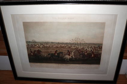
HENRY ALKEN / LEWIS Original 1835 Hand Colored Engraving Quorn Hunt DrawingLuis Porretta Fine Arts4.3(10)See Sold PriceMar 02, 2024
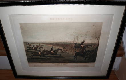
HENRY ALKEN / LEWIS Original 1835 Hand Colored Engraving Quron Hunt Snob Is BeatLuis Porretta Fine Arts4.3(10)See Sold PriceMar 02, 2024
Numismatic Books - Whelan - The Numismatic Atlas of the Roman EmpireTimeLine Auctions Ltd.4.6(183)See Sold PriceMar 09, 2024
1960's Cleveland Indians Team Signed BaseballDana J. Tharp Auctions4.7(271)See Sold PriceFeb 24, 2024
[BUSINESS -- WALKER, Madam C.J. (born Sarah Breedlove, 1867-1919)]. The Madam C.J. Walker BeautyFreeman's | Hindman4.4(1.6k)See Sold PriceFeb 27, 2024
Map: A 19thC engraved and hand coloured map of Buckingham titled A New Map of BuckinghamshireClaydon Auctioneers Ltd4.3(125)See Sold PriceFeb 26, 2024
1675 ELZEVIER JULIUS CAESAR antique ILLUSTRATED w/ MAPS ROMAN HISTORYJasper524.5(9.9k)See Sold PriceFeb 27, 2024
[Graham (Elizabeth Susanna Davenport)] "Lemuel Gulliver". The Eo-Nauts, or The Spirit of Delusion,Forum Auctions4.3(53)See Sold PriceFeb 29, 2024
Railways & Transport.- [Prospectus] The Dorking, Brighton, and Arundel Atmospheric Railway, byForum Auctions4.3(53)See Sold PriceFeb 29, 2024
Tour of the Dutch East Indies, with exceptional platesPBA Galleries4.7(385)See Sold PriceMar 07, 2024
THE WHOLE CHRONICLE OF POLYBIUS ANCIENT IN ENGLISH, 1756NY Elizabeth 4.2(86)See Sold PriceMar 03, 2024
1675: ANTIQUE ILLUSTRATED JULIUS CAESAR MAPS OF ROMAN HISTORYNY Elizabeth 4.2(86)See Sold PriceMar 03, 2024
Carl J. Sundevall (1801 - 1875) Set of 4 Bird Prints - Dove - Woodpecker - DuckProverde Auctions4.3(3)See Sold PriceFeb 28, 2024
TWO ANTIQUE JEWISH NATIONAL FUND CHARITY BOXES. The first one made in Berlin c. 1920J. Greenstein & Co., Inc.4.2(55)See Sold PriceApr 16, 2024


![[BUSINESS -- WALKER, Madam C.J. (born Sarah Breedlove, 1867-1919)]. The Madam C.J. Walker Beauty (1 of 9)](https://p1.liveauctioneers.com/197/319238/171467936_1_x.jpg?height=282&quality=70&version=1708470653)


![[Graham (Elizabeth Susanna Davenport)] "Lemuel Gulliver". The Eo-Nauts, or The Spirit of Delusion, (1 of 1)](https://p1.liveauctioneers.com/5458/319736/171654607_1_x.jpg?height=282&quality=70&version=1708010439)
![Railways & Transport.- [Prospectus] The Dorking, Brighton, and Arundel Atmospheric Railway, by (1 of 1)](https://p1.liveauctioneers.com/5458/319736/171654703_1_x.jpg?height=282&quality=70&version=1708010439)