SoldA quantity of books including Ordnance Survey, Atlas ofA quantity of books including Ordnance Survey, Atlas of England and Wales, Phillips Student Atlas, Phillips Handy General Atlas of the World, two bound volumes of The London Illustrated News and JohnsSee Sold Price
SoldA large quantity of ordnance survey maps, includingA large quantity of ordnance survey maps, including Peak District National Park examples.See Sold Price
SoldA quantity of folding ordnance survey maps, includingA quantity of folding ordnance survey maps, including examples by Bacon, Ward, Lock & Co., Gall & Inglis and Bartholomew. To include, Motoring and Touring Map of England, Map and Guide to London, HertSee Sold Price
SoldFurniture - A mahogany table bookcase, with archeFurniture - A mahogany table bookcase, with arched ends containing a quantity of leather bound books including poetry, atlases, two Bystanders Bairnsfather volumes, editions of contemporary newspapersSee Sold Price
SoldFurniture - A mahogany table bookcase, with archeFurniture - A mahogany table bookcase, with arched ends containing a quantity of leather bound books including poetry, atlases, two Bystanders Bairnsfather volumes, editions of contemporary newspapersSee Sold Price
SoldQuantity of Ordnance Survey and other folding maps,Quantity of Ordnance Survey and other folding maps, various road atlases, etcSee Sold Price
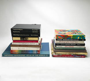
SoldQuantity of hard & soft back World Railway BooksA quantity of hard and soft back World Railway Books including World Atlas of Railways, North American Railways, Twilight of South African Steam amongst others. Good. (30+)See Sold Price
SoldBooks Vintage Ordnance Survey Maps and Others20th century AD. A mixed group of travel documents comprising: an Ordnance Survey map sheet 38 (Solent, Isle of Wight), 1912 edition; Bartholomew's reduced survey map, sheet 20 (Suffolk); one similar,See Sold Price
SoldLarge quantity of Ordnance Survey maps with variousLarge quantity of Ordnance Survey maps with various dates circa 1910 to '74See Sold Price
SoldMaps : A quantity of early to mid 20thC Ordnance SurveyMaps : A quantity of early to mid 20thC Ordnance Survey maps including British County maps for Gloucester, Middlesex etc., and for Ireland and America, Michelin French maps, a number of Air Force WarSee Sold Price
SoldMaps : A quantity of mid to late 20thC illustrated mapsMaps : A quantity of mid to late 20thC illustrated maps and touring guides for the USA, Australia, Europe, Great Britain, including Bartholomew's guides and Ordnance Survey maps. (approx. 26) £25 - 3See Sold Price
Sold2 boxes of ordnance survey maps including library2 boxes of ordnance survey maps including library editions.See Sold Price
SoldA quantity of 1960s One-Inch Ordnance Survey / OS maps,A quantity of 1960s One-Inch Ordnance Survey / OS maps, together with some older examples and some loose sheet maps.See Sold Price
SoldA quantity of assorted 20thC Ordnance Survey maps.A quantity of assorted 20thC Ordnance Survey maps.See Sold Price
SoldEngland.- A group of 16 Ordnance Survey maps, mainlyEngland.- A group of 16 Ordnance Survey maps, including a Col. Mudge map of Kent showing Whitstable, Ramsgate and Dover, 4 Col. Colby maps sold by Letts, Son & Co. of Essex, Kent, Berkshire, and HampsSee Sold Price
SoldMiscellaneous books, a quantity, including Musgrave,Miscellaneous books, a quantity, including Musgrave, Sir Richard Memoirs of the Different Rebellions if Ireland. Dublin: J. Archer, 1802. Third edition, 2 volumes, 8vo, 9 maps and plans (of 10, lackinSee Sold Price
Book of Kent and Sussex ordnance survey maps, 82cm xBook of Kent and Sussex ordnance survey maps, 82cm x 60cmSee Sold Price
SoldBox containing a quantity of various 20th CenturyBox containing a quantity of various 20th Century Ordnance Survey road maps, various cloth cased road maps and various guides and ephemeraSee Sold Price
Maps – A Selection of various Ordnance Survey...Maps – A Selection of various Ordnance Survey maps/plans including Lancashire 1932 Ribbleton, Hothersall, Osbaldeston, Balderstone, Ribchester and Fulwood Row, some tears to edges, otherwise A/G conSee Sold Price
SoldQuantity of Books and Catalogues on Asian Art,including \'Ching Official and Popular Ware, A Survey of Chinese Cermics\'by Liu Liang-yu, \'The Fayerman Collection\'catalouge, \'Imperial China, the Living Past\', (qtySee Sold Price
SoldOrdnance Survey maps,South West England and Wales, late 19th century, double page coastal maps/charts, including Falmouth Harbour, Menai Strait 1464, Newquay to Holyhead 1411, Milford Haven, Bristol Channel 1179, TrevoseSee Sold Price
SoldOrdnance Survey maps,West Coast of Scotland, late 19th century with some revisions, approx 60 sheets, some with vignettes, including Lochs, Western Isles, Skye, Harris, Hebrides etc, condition varies (c.60)See Sold Price
SoldA quantity of assorted Oxford postcards, together withA quantity of assorted Oxford postcards, together with a 1921 ordnance survey map of Oxford, a coloured street plan of Oxford, a contoured road map of Oxford, and Wembley Exhibition Edition of Bacon'sSee Sold Price
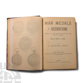
Numismatic Books - Irwin - War Medals and Decorations Issued to the British Military and NavalTimeLine Auctions Ltd.4.6(184)See Sold PriceMar 09, 2024
Rand McNally & Co's New Ideal State and County Survey and Atlas 1911North American Artifact Auctions4.7(201)See Sold PriceApr 20, 2024
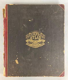
1872 New Combination Atlas of Lee County Illinois BookMatthew Bullock Auctioneers4.7(1.9k)See Sold PriceFeb 24, 2024
Chatelain - Map of the Americas and Details and Insets of Government CounselsTrillium Antique Prints & Rare Books4.5(33)See Sold PriceFeb 24, 2024
Chatelain - 3 Maps of the British Isles (England, Ireland, Scotland)Trillium Antique Prints & Rare Books4.5(33)See Sold PriceFeb 24, 2024
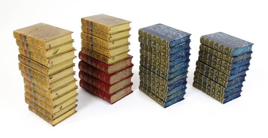
Books : a quantity of Victorian books with leatherbound gold-tooled covers, including Sir WalterClaydon Auctioneers Ltd4.3(125)See Sold PriceFeb 26, 2024
1816 MAP SOUTHERN PART OF RUSSIA or MUSCOVY in EUROPE copper engraving ANTIQUEJasper524.5(9.9k)See Sold PriceFeb 27, 2024
Nottingham.- Ordnance Survey Office (publisher) Collection 8 geological maps on the environs ofForum Auctions4.4(54)See Sold PriceFeb 29, 2024
Marvel Comics "X-Men vs. Agents of Atlas #1" Numbered Limited Edition Giclee on Canvas by CarloRobinhood Auctions4.7(800)See Sold PriceFeb 29, 2024
Marvel Comics "X-Men vs. Agents of Atlas #2" Numbered Limited Edition Giclee on Canvas by CarloRobinhood Auctions4.7(800)See Sold PriceFeb 29, 2024
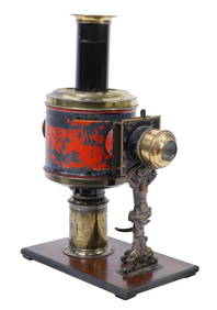
(3) MAGIC LANTERNS, J.S. SCHOENNER, GLOBUS MODELSAustin Auction Gallery4.7(1.2k)See Sold PriceApr 12, 2024
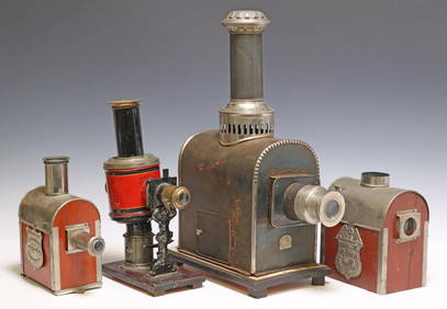
(4) MAGIC LANTERNS, JEAN SCHONNER, TWO BIJOUSAustin Auction Gallery4.7(1.2k)See Sold PriceApr 12, 2024
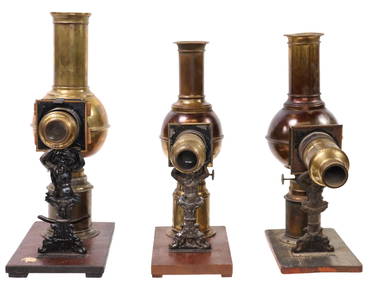
(3) MAGIC LANTERNS BY JEAN SCHOENNER, GERMANYAustin Auction Gallery4.7(1.2k)See Sold PriceApr 12, 2024
X-Men vs. Agents of Atlas #2 by Marvel ComicsSeized Assets Auctioneers4.3(602)See Sold PriceFeb 28, 2024
X-Men vs. Agents of Atlas #1 by Marvel ComicsSeized Assets Auctioneers4.3(602)See Sold PriceFeb 28, 2024