SoldA 1662 J. BLEAU MAP OF THE DNIEPER RIVERA 1662 J. BLEAU MAP OF THE DNIEPER RIVER. Comprising an early map of the Dnieper River entitled "Tractus Borysthenis Vulgo Dniepr" by Dutch cartographer Joan Blaeu. The map shows the upper part of thSee Sold Price
SoldBleau Map of Flanders hand-colored by master coloristExtrema Americae versus Boream, ubi Terra Nova Nova Francia, adjacentiag... Johannes Blaeu (1596-1673). Engraved map with original hand color in full. Amsterdam: J. Blaeu, c. 1662. 21 x 24 3/4 inchesSee Sold Price
SoldA 1660 J. BLEAU MAP OF SOUTHERN RUSSIAA 1660 J. BLEAU MAP OF SOUTHERN RUSSIA. Comprising an early map of Russia entitled "Rvssiae Vulgo Moscovia Australis" by Dutch cartographer Joan Bleau. The map displays colored border lines and threeSee Sold Price
SoldTwo Early Framed Engraved MapsA lot of two early hand-colored engraved maps to include a W. J. Bleau map of Amsterdam, ca. 1634-1635, "Sabaudia Ducatus Savoye", together with a John Speed map of Britain, ca. 1611-1614, "DevonshireSee Sold Price
SoldSteward (J.H.) [Map of the River Thames]Steward (J.H.) [Map of the River Thames]lithographed strip map mounted on wooden roller, with compass and measurement scales, in original leather wallet with straps for bicycle saddle, rubbedSee Sold Price
Sold(MAP, SCOTLAND) BLEAU, J. A group of 2 hand-colore(MAP, SCOTLAND) BLEAU, J. A group of two hand-colored copper engraved maps of British Isles. (Amsterdam: J. Blaeu, 1654). Each with richly hand-colored borders, forests, mountain ranges and towns, decSee Sold Price
Sold(MAP, SCOTLAND) BLEAU, J. Scotia Antiqua. (Amsterd(MAP, SCOTLAND) BLEAU, J. Scotia Antiqua, qualis priscis temporibus, Romanis praesertim, cognita fuit quam in lucem eruere conabatur. (Amsterdam, 1643 or later). Hand-colored copper engraved map of ScSee Sold Price
SoldAntique topographical map of Dockum, J Bleau from 1649,Antique topographical map of Dockum, J Bleau from 1649, 41x54 cmSee Sold Price
SoldNetherclift (J.) The Angler's Map of the River ThaNetherclift (J.) The Angler's Map of the River Thames, from Richmond to Henley,Shewing the various Fishing Stations and the nearest Approaches to them, together with the Principal Deeps and thSee Sold Price
Map, Wagria by J. Blaeu. 1662Map of Wagria "Pars Septentrionalis, cum praefectura Cismar et Oldenburg". Copper engraving by J. Blaeu at Mejer, Amsterdam, 1662. Some damp stains to corners notedSee Sold Price
Map, Wagria by J. Blaeu. 1662Map of Wagria "Pars Septentrionalis, cum praefectura Cismar et Oldenburg". Copper engraving by J. Blaeu at Mejer, Amsterdam, 1662. Some damp stains to corners notedSee Sold Price
Map, Wagria by J. Blaeu. 1662Map of Wagria "Pars Septentrionalis, cum praefectura Cismar et Oldenburg". Copper engraving by J. Blaeu at Mejer, Amsterdam, 1662. Some damp stains to corners notedSee Sold Price
Map, Wagria by J. Blaeu. 1662Map of Wagria "Pars Septentrionalis, cum praefectura Cismar et Oldenburg". Copper engraving by J. Blaeu at Mejer, Amsterdam, 1662. Some damp stains to corners notedSee Sold Price
Radziwill Lithuania Lithuanian BelarusDuke Mikolaj Krzysztof Radziwll 1613 m. Lietuvos Map of the Grand Duchy and the Dnieper River.Amsterdam, 1631-1647 m. Watercolor copper engraving, 75,5 x 74, 75,5 x 33 Willem Janszoon Blaeu and Joan BSee Sold Price
SoldLLOYD, J. T. Lloyd's Map of the Lower MississiLLOYD, J. T. Lloyd's Map of the Lower Mississippi River from St. Louis to the Gulf of Mexico. With--Lloyd's New Map of the United States, the Canadas and New Brunswick. Together, 2 lithographed wall mSee Sold Price
Circa 1815 Engraved Map A Plan of the Grand of the New Townships on the Grand or Ottawa RiverCirca 1815 A Plan of the Grand of the New Townships on the Grand or Ottawa River. London 1815. Engraved map by J. Walker. From Joseph Bouchette's book. "Joseph Bouchette's books played an important paSee Sold Price
Sold(MAP, EUROPE) A group of two engraved maps of Cent(MAP, EUROPE) A group of two engraved maps of Central Europe. Lotharingia Ducatus; vulgo Lorraine. By J. Bleau. Amsterdam, (1635). Hand-colored borders and coat-of-arms to lower right corner. Full marSee Sold Price
Sold1 piece. Hand-Colored Engraved Map. (Bleau, Joan.1 piece. Hand-Colored Engraved Map. (Bleau, Joan.) Nova Aegypti Tabula." (Amsterdam), (1662). 17 1/4 x 20 1/2 inches (438 x 546 mm), full margins. Old or orig. color. Latin text on verso. Slightly toSee Sold Price
SoldRuff (E., & Co.) Publisher. Map of London[Greenwood (C. & J.)] Map of London, from Actual Survey Comprehending the Various Improvements to 1835, from Dalston to Denmark Hill, and High Street Kensington to the River Lea, with inset viSee Sold Price
Sold[Oregon] Oregon Souvenir Playing Cards. San Francisco:[Oregon] Oregon Souvenir Playing Cards. San Francisco: Edward H. Mitchell, 1902. 52 + J + Map Card + OB. Gilt edges. Oval halftones of Oregon’s mountain ranges, Columbia River, towns and cities,See Sold Price
River Neva With The Situation of Petersburgh CronslotTitle/Content of Map: River Neva With The Situation of Petersburgh Cronslot and Sleutelbourg Date: 1744 Cartographer: HULETT, J. Size: 4.8Height - 6Width Publisher: LE BRUYN The situation of Saint PetSee Sold Price
A PLAN OF THE RIVER THAMES[MAP – RIVER THAMES]. 16 ½" x 8 ¼". "A Plan of the River Thames, from Boulters Lock to Mortlake in Surry; From an Actual Survey taken in 1770". Very Fine.See Sold Price
A PLAN OF THE RIVER THAMES[MAP – RIVER THAMES]. 16 ½" x 8 ¼". "A Plan of the River Thames, from Boulters Lock to Mortlake in Surry; From an Actual Survey taken in 1770". Very Fine.See Sold Price
Sebastian Munster: Map of Poland & Hungary. 1542, BaselPolonia Et Ungaria XV Nova Tabula. One of the earliest maps of Poland, with Lithuania to the North, south of the Danube, east to the Black Sea with river Dnieper basin and Bessarabia. CARTOGRAPHER SebSee Sold Price
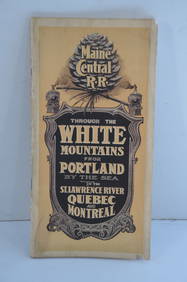
Maine Central RR Through the White Mtns-Portland to the St Lawrence River Book-1901JM Hobby Supply and Railroad Artifact Auctions4.4(127)See Sold PriceFeb 24, 2024
1.7/8" Quartz Fluted Clovis, Franklin Co VA, Pigg River, Personal Finds of Dr. J Francis Amos,Heartland Artifact Auctions4.6(800)See Sold PriceFeb 25, 2024
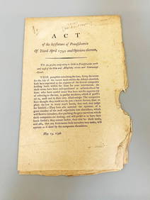
Holland Land Company: Act of the Legislature of PA. of 3rd April to the Persons Emigrating to LandsDana J. Tharp Auctions4.7(271)See Sold PriceFeb 24, 2024
Three Rivers Stadium Pittsburgh Steelers Autographed Football Cards DisplayDana J. Tharp Auctions4.7(271)See Sold PriceFeb 24, 2024
Pair of Early Railroad Maps - 1874 Delaware, Lackawanna & Western and 1876 Pennsylvania RailroadRail & Road Auctions4.6(165)See Sold PriceMar 07, 2024
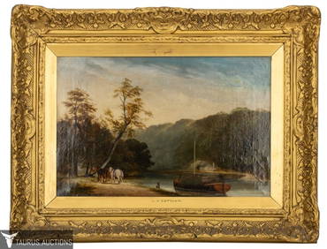
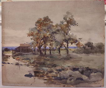
J Francis Murphy W/C New England Landscape PaintingHeritage Gallery Auctions4.4(63)See Sold PriceMar 10, 2024
Iron Mountain Of Long Island Sound Litho J GleasonThe Benefit Shop Foundation Inc.4.3(3k)See Sold PriceMar 06, 2024
1977 JRR Tolkien 1st ed Silmarillion Lord of the Rings Middle Earth + MAPSchilb Antiquarian Rare Books4.8(431)See Sold PriceMar 31, 2024
[ABOLITIONISTS]. JAY, John II (1817-1894). ALS ("John Jay"), to J. Dewitt Miller. Katonah, [NY],Freeman's | Hindman4.4(1.6k)See Sold PriceFeb 27, 2024
1764 Bellin Map of Lesser Antilles Northern Portion -- Petites Antilles ou Isles du Vent 3e. Partie.Jasper524.5(9.9k)See Sold PriceFeb 27, 2024
1764 Bellin Chart of Three South Haitian Bays -- Carte des Bayes du Mesle des Flamands et deJasper524.5(9.9k)See Sold PriceFeb 27, 2024
WEST AFRICA Explorers' routes Senegal Ashanti. Mountains of Kong. SDUK 1857 mapJasper524.5(9.9k)See Sold PriceFeb 28, 2024
BLACK DUCK, DELAWARE RIVERFrank and Frank Sporting Collectibles LLC4.7(174)See Sold PriceMar 10, 2024
John Senex Map of Louisiana & Mississippi RiverWillow Auction House4.5(292)See Sold PriceMar 14, 2024
Hudson River Map & North American Postcards, 45Auctions at Showplace4.6(744)See Sold PriceFeb 13, 2025


![Steward (J.H.) [Map of the River Thames] (1 of 1)](https://p1.liveauctioneers.com/410/34074/13887956_1_x.jpg?height=282&quality=70&version=1351258095)


![[Oregon] Oregon Souvenir Playing Cards. San Francisco: (1 of 2)](https://p1.liveauctioneers.com/928/188932/95239658_1_x.jpg?height=282&quality=70&version=1609352044)


![[ABOLITIONISTS]. JAY, John II (1817-1894). ALS ("John Jay"), to J. Dewitt Miller. Katonah, [NY], (1 of 2)](https://p1.liveauctioneers.com/197/319238/171468084_1_x.jpg?height=282&quality=70&version=1707520367)