ATLAS of ANTIENT GEOGRAPHY by SAMUEL BUTLER 1843John McInnis Auctioneers,LLC4.5(494)See Sold PriceFeb 24, 2024
18TH C. ANTIQUE MAP: FRENCH & INDIAN WAR, FRAMEDThomaston Place Auction Galleries4.4(386)See Sold PriceFeb 24, 2024
Rand McNally Railroad Map Cabinet w/ 21 Railroad MapsRail & Road Auctions4.6(165)See Sold PriceMar 08, 2024
Keith Haring - Ink on New York Map, Best Buddies, Inscribed, Signed, and DatedSapphire Auction Gallery3.9(67)See Sold PriceMar 02, 2024
LATE 17TH C. FRENCH MAP OF THE NEW WORLD BY ALEXIS-HUBERT JAILLOT (1632-1712)Thomaston Place Auction Galleries4.4(386)See Sold PriceFeb 24, 2024
Central Railroad of New Jersey Map of Sandy Hook Route-ca. 1903JM Hobby Supply and Railroad Artifact Auctions4.4(126)See Sold PriceFeb 24, 2024
Lot of Six Mixed Atlas Box Cars-HO Scale-New in BoxJM Hobby Supply and Railroad Artifact Auctions4.4(126)See Sold PriceFeb 25, 2024
Rand McNally/Santa Fe Railroad Map of Iowa-1912JM Hobby Supply and Railroad Artifact Auctions4.4(126)See Sold PriceFeb 24, 2024
NICOLAES VISSCHER (NETHERLANDS, 1618-1709) MAP OF THE NEW WORLDThomaston Place Auction Galleries4.4(386)See Sold PriceFeb 24, 2024
17TH C. WORLD MAP BY NICOLAES VISSCHER (NETHERLANDS, 1618-1709)Thomaston Place Auction Galleries4.4(386)See Sold PriceFeb 24, 2024
Lot of Six Mixed Atlas Cabooses-HO Scale-New in BoxJM Hobby Supply and Railroad Artifact Auctions4.4(126)See Sold PriceFeb 25, 2024
Sold7 19thc School Atlas or Geography map books.A group of 7 American 19th c school atlas or geography books including Mitchell's School Atlas 1839 complete, partial 1829 school atlas, 1854 Smith's Atlas of Modern and ancient geography, 1855 CornelSee Sold Price
Sold7 19th Century School Atlases & Geographies.7 19th Century School Atlases & Geographies.-- Dimensions: ---See Sold Price
Sold10V ANTIQUE ATLASES & GEOGRAPHY BOOKS Color Maps10V ANTIQUE ATLASES & GEOGRAPHY BOOKS Color Maps Cartography Kansas City Journal Dollar Atlas Harpers Introductory Geography Harper′s School Geography Comprehensive James Monteith WorldSee Sold Price
SoldCartography13. Cartography.School Atlas to Cummings' Ancient and Modern Geography Improved. 9 engraved maps (2 double-page), outlined in color. 4to, printed wrappers (stained); stain to double-page world map, geSee Sold Price
SoldButler, George 1874 Pair of Maps. Australia New ZealandLithograph Maps Published 1874, London for "The Public School Atlas of Modern Geography" by Rev. George Butler. Paper Size: 11 x 7 inch (28 x 17cm) Good ConditionSee Sold Price
SoldSmith's Geography with colored maps, 1848Heading: (School Atlas) Author: Smith, Roswell C. Title: Smith's Quarto, or Second Book in Geography. A Concise and Practical System of Geography, for Schools, Academies, and Families Place Published:See Sold Price
Smith's Geography with colored maps, 1848Heading: (School Atlas) Author: Smith, Roswell C. Title: Smith's Quarto, or Second Book in Geography. A Concise and Practical System of Geography, for Schools, Academies, and Families Place Published:See Sold Price
SoldMaps ‐ ORBIS TERRARUM ANTIQUUS SCHUL&Maps ‐ ORBIS TERRARUM ANTIQUUS SCHUL‐ATLAS DER ALTEN WELT c1842 Hand‐Tinted Engraved Maps Outline Ancient Geography Dr. J. H. Moller Justus Perthes School Atlas of the OlSee Sold Price
Sold1843 Folding Color German World Maps Europe Americas1843 Folding Color German World Maps Europe Americas Geography Austria RARE Three 19th-century world maps published in Vienna in 1843! Published for use in Austrian high schools, this atlas includes fSee Sold Price
Sold1857 ATLAS Colton Fitch COLOR MAPS School Geography1857 ATLAS Colton Fitch COLOR MAPS School Geography Cotton Slavery Illustrated “Colton and Fitch’s Modern School Geography” is an interesting school text for children to teach geography of the dSee Sold Price
SoldBooks: Various titlesBooks: Various titles Woodbridge, William C. SCHOOL ATLAS TO ACCOMPANY WOODBRIDGES RUDIMENTS OFGEOGRAPHY. Hartford, CT: Oliver D. Cooke & Sons, 1821. 5th edition. Containsseven maps; Adams, E.C.L., NISee Sold Price
7 maps of the United States from school atlasesTitle: Seven maps of the United States from school atlases Author: ** Description: Includes: Map of the United States and Texas Engraved to Illustrated Mitchell's School and Family Geography. With insSee Sold Price
Sold7 maps of the United States from school atlasesTitle: Seven maps of the United States from school atlases Author: ** Description: Includes: Map of the United States and Texas Engraved to Illustrated Mitchell's School and Family Geography. With insSee Sold Price
SoldColton's SCHOOL ATLAS c1860 37 Color MapsTitle: J. H. Colton's School Atlas, designed to accompany Colton's American School Geography Author: G. Woolworth Colton Publisher: Ivison, Phinney & Co. Printing Year: c1860 Details/Condition: BoSee Sold Price
Sold2 books: Mitchell's Atlas and Maury's Geography1st item: S. Augustus Mitchell's SCHOOL ATLAS: COMPRISING THE MAPS AND TABLES DESIGNED TO ACCOMPANY MITCHELL'S SCHOOL AND FAMILY GEOGRAPHY REVISED EDITION. Philadelphia, E. H. Butler & Co., 1871. InclSee Sold Price
SoldJH Colton's Atlas #58969Circa 1865 Atlas by JH Coulton, called the American School Quarto Geography. Published in New York. 118 pages plus appendix. Many many maps. The book dates to approximately 1865, though the maps dateSee Sold Price
Late 19thc Map of the Parthian Empire, Persia, IranBlack & white "Map of the Parthian Empire", page from a 19th-century history book, "Universal History - The Ancient World." Ancient Iran, Persian empire. 7" X 10".ÂSee Sold Price
SoldLate 19thc Early 20thc Maps of AsiaTwo maps of Asia from the late 19th century. Book atlas maps. One of them marked pg. 74 from an 1874 edition of a text book entitled, "A Brief Course In Geography" published in Philadelphia by CowpertSee Sold Price
Sold3V Geography ANTIQUE ATLASES Ginn US GeologicalThis auction lot includes the following group of titles: - Ginn & Company's Classical Atlas - Dated 1886 by Ginn & Company - color maps - Harper's School Geography - Dated 1879 by Harper - TwentySee Sold Price
SoldBook: Rare and early D'Anville atlasBook: Rare and early D'Anville atlas D'Anville, Jean Baptiste Bourguignon. ATLAS OF ANCIENT GEOGRAPHY. London: Laurie & Whittle, c. 1771(?)Comprising 7 maps:GERMANIE, FRANCE, ITALIE, ESPAGNE, ISLES BRSee Sold Price
Late 19thc Early 20thc Maps of AsiaTwo maps of Asia from the late 19th century. Book atlas maps. One of them marked pg. 74 from an 1874 edition of a text book entitled, "A Brief Course In Geography" published in Philadelphia by CowpertSee Sold Price
Late 19thc Early 20thc Maps of AsiaTwo maps of Asia from the late 19th century. Book atlas maps. One of them marked pg. 74 from an 1874 edition of a text book entitled, "A Brief Course In Geography" published in Philadelphia by CowpertSee Sold Price
Late 19thc Early 20thc Maps of AsiaTwo maps of Asia from the late 19th century. Book atlas maps. One of them marked pg. 74 from an 1874 edition of a text book entitled, "A Brief Course In Geography" published in Philadelphia by CowpertSee Sold Price
Late 19thc Early 20thc Maps of AsiaTwo maps of Asia from the late 19th century. Book atlas maps. One of them marked pg. 74 from an 1874 edition of a text book entitled, "A Brief Course In Geography" published in Philadelphia by CowpertSee Sold Price
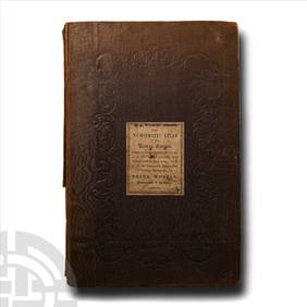
Numismatic Books - Whelan - The Numismatic Atlas of the Roman EmpireTimeLine Auctions Ltd.4.5(183)See Sold PriceMar 09, 2024
1818 RARE Geography Made Easy MAPS Jedidiah Morse Boston Indians Atlas AsiaSchilb Antiquarian Rare Books4.8(415)See Sold PriceMar 31, 2024
1849 Mitchell School ATLAS 24 MAPS America Holy Land France Africa Egypt AsiaSchilb Antiquarian Rare Books4.8(415)See Sold PriceMar 31, 2024
Battle of the Nile: Disposition of the English & French Fleets, at the Commencement of the Action,Trillium Antique Prints & Rare Books4.5(28)See Sold PriceFeb 24, 2024
Mitchell - Map of the City of Washington (Washington, DC)Trillium Antique Prints & Rare Books4.5(28)See Sold PriceFeb 24, 2024
1816 MAP SOUTHERN PART OF RUSSIA or MUSCOVY in EUROPE copper engraving ANTIQUEJasper524.5(9.7k)See Sold PriceFeb 27, 2024
1816 MAP NORTHERN PART OF RUSSIA or MUSCOVY in EUROPE copper engraving ANTIQUEJasper524.5(9.7k)See Sold PriceFeb 27, 2024
Francis McNally - Antique Map of Nebraska, Kansas, Dakota, Colorado & MontanaProverde Auctions4.3(3)See Sold PriceFeb 28, 2024
Francis McNally - Antique Map of California & MinnesotaProverde Auctions4.3(3)See Sold PriceFeb 28, 2024
Francis McNally - Antique Map of Ohio, Indiana & KentuckyProverde Auctions4.3(3)See Sold PriceFeb 28, 2024
Francis McNally - Antique Map of Washington, Oregon, Idaho, Nevada, Utah & ArizonaProverde Auctions4.3(3)See Sold PriceFeb 28, 2024
Francis McNally - Antique Map of Illinois, Missouri & IowaProverde Auctions4.3(3)See Sold PriceFeb 28, 2024