ATLAS of ANTIENT GEOGRAPHY by SAMUEL BUTLER 1843John McInnis Auctioneers,LLC4.5(505)See Sold PriceFeb 25, 2024
18TH C. ANTIQUE MAP: FRENCH & INDIAN WAR, FRAMEDThomaston Place Auction Galleries4.4(393)See Sold PriceFeb 24, 2024
Rand McNally Railroad Map Cabinet w/ 21 Railroad MapsRail & Road Auctions4.6(165)See Sold PriceMar 08, 2024
Keith Haring - Ink on New York Map, Best Buddies, Inscribed, Signed, and DatedSapphire Auction Gallery4(67)See Sold PriceMar 02, 2024
LATE 17TH C. FRENCH MAP OF THE NEW WORLD BY ALEXIS-HUBERT JAILLOT (1632-1712)Thomaston Place Auction Galleries4.4(393)See Sold PriceFeb 24, 2024
Central Railroad of New Jersey Map of Sandy Hook Route-ca. 1903JM Hobby Supply and Railroad Artifact Auctions4.4(127)See Sold PriceFeb 24, 2024
Lot of Six Mixed Atlas Box Cars-HO Scale-New in BoxJM Hobby Supply and Railroad Artifact Auctions4.4(127)See Sold PriceFeb 25, 2024
Rand McNally/Santa Fe Railroad Map of Iowa-1912JM Hobby Supply and Railroad Artifact Auctions4.4(127)See Sold PriceFeb 24, 2024
NICOLAES VISSCHER (NETHERLANDS, 1618-1709) MAP OF THE NEW WORLDThomaston Place Auction Galleries4.4(393)See Sold PriceFeb 24, 2024
17TH C. WORLD MAP BY NICOLAES VISSCHER (NETHERLANDS, 1618-1709)Thomaston Place Auction Galleries4.4(393)See Sold PriceFeb 24, 2024
Lot of Six Mixed Atlas Cabooses-HO Scale-New in BoxJM Hobby Supply and Railroad Artifact Auctions4.4(127)See Sold PriceFeb 25, 2024
Sold3 UNFRAMED MAPS TO INCLUDE TWO 1903 MAPS OFTHE VILLAGE OF MATTAPOISETT, SIGHT SIZE 22" X 31 1/4", FROM A 1903 ATLAS OF PLYMOUTH COUNTY. ONE SHOWS VERY MINOR HOLES. ALONG WITH A MAP OF THE TOWN OF ROCHESTER, MASS., FROM A PLYMOUTH COUNTY MAP BOSee Sold Price
3 UNFRAMED MAPS TO INCLUDE TWO 1903 MAPS OF THEVILLAGE OF MATTAPOISETT, SIGHT SIZE 22" X 31 1/4" FROM A 1903 ATLAS OF PLYMOUTH COUNTY. ONE SHOWS VERY MINOR HOLES. ALONG WITH A MAP OF THE TOWN OF ROCHESTER, PLYMOUTH COUNTY, FROM PLYMOUTH COUNTY MAPSee Sold Price
SoldMap ColllectionCollection of (3) framed maps and (6) unframed maps. Includes Amenia, Dover, Dutchess County, Pleasant Valley, Dover Plains, Washington etc.. Largest frame 24 1/2" x 34 1/2".See Sold Price
SoldGrp: 3 Maps of the Caribbean and BarbadosGroup of three maps of the Caribbean. Includes two maps of the overall region, one by Nicolaes Visscher, which depict the Gulf Coast, Florida, the Caribbean, and northern South America. With one map oSee Sold Price
Collection of 3 Unframed MapsIncludes "Map No. 3 Group Map Showing Percentage Bases for Westbound Rates," "Erie Railroad with Branches and Connections 1915," and a Southwest U.S. map. Toning to each with some repairs and small teSee Sold Price
SoldTwo maps to include: (1) Spanish North America sightTwo maps to include: (1) Spanish North America sight size: 20" x 24 1/2" (2) United States North America According to Calvin, Smith, & Tanner by G.H. Swanston sight size: 21 1/4" x 16 3/4" both pSee Sold Price
SoldANTIQUE MAPS, 3, WH LIZARS, EDINBURGH 15" X 19"ANTIQUE MAPS, 3, W.H. LIZARS, EDINBURGH, 15" X 19", C 1850:Unframed. Each map in two sections. 18" x 21 1/2" sheet size. Image 15 1/2 x 19 1/4". Published by W Lizars, Edinburgh. Samuel Highley, FleetSee Sold Price
SoldMaps and Map Making (9) BooksGroup of nine books of maps and map making. Includes: 1) Two 1978 editions. The Compleat Plattmaker by Norman Thrower. 2) Proceedings of the Vinland Map Conference by Washburn. 1971. 3) American MapsSee Sold Price
SoldGroup of 3 Maps by Giovanni Battista Ramusio SumaGroup of three maps by Giovanni Battista Ramusio (1485-1557). This group includes two woodcuts of Sumatra from "Delle Navigationi et Viaggi," ca. 1565. The third map is a fine example of Rasmusio's inSee Sold Price
SoldLot of 2 Early Engraved MapsLot of two early engraved maps, to include: bird's eye view, "Brugae Flandica Rum Vrbium Decus," city plan of Bruges, Belgium, 9" h x 12" w (view), 17 3/8" h x 20 1/2" w (frame) and Joannes Van KeulenSee Sold Price
SoldTwo Diderot Maps (California / Mexico) 1751-1780Two Diderot Maps (California & Northwest and Mexico) 1751 - 1780. Measure approximately 11 3/8" x 12.75 to 14" image sizes and 16" x 19" sheet sizes. Creased at fold lines. Unframed, loose and not gluSee Sold Price
SoldGroup of three maps to include framed Magna BritanniaGroup of three maps to include framed Magna Britannia Complectens Angliae scotiae......Bapt. Homann and two unframed, Hampshire unframed map, regulated by Astron observations by T Kitchin, improved maSee Sold Price
Group of three maps to include framed Magna BritanniaGroup of three maps to include framed Magna Britannia Complectens Angliae scotiae......Bapt. Homann and two unframed, Hampshire unframed map, regulated by Astron observations by T Kitchin, improved maSee Sold Price
SoldTwo Diderot Maps (Asia) 1751 - 1780Two Diderot Maps (Asia) 1751 - 1780. Measure approximately 11 3/ 8" x 14" image size and 16" x 19" sheet size. Creased at fold lines. Unframed, loose and not glued or mounted. Provenance: C.D. RaymondSee Sold Price
Virginia Maps, 19th CenturyTwo 19th Century Virginia maps to include: 1853 map removed from a U.S. Glossary, measuring 4-3/4" high by 8-1/4" wide; with 1890 Virginia and West Virginia map, with population of each state by countSee Sold Price
Virginia Maps, 19th CenturyTwo 19th Century Virginia maps to include: 1853 map removed from a U.S. Glossary, measuring 4-3/4†high by 8-1/4†wide; with 1890 Virginia and West Virginia map, with population of each stateSee Sold Price
Sold19C 3PC Johnson & Ward Tunison's Maps of Russia,United States,19th Century Group includes a Johnson and Ward and two Tunison's colored maps of Russia.,Paper,J & W Map Frame 23 1/8" x 19 1/2",Tunision's Map Frame 20 3/8" x 26 1/4" From the collectiSee Sold Price
Sold(3) Westermann's Historical Maps Of EuropeThree Westermann 's Classical & Historical Map Series, published by Rand McNally, cloth on two wooden dowels, to include an 1190 map at the time of the Crusades, of Europe & Western Asia, a Medieval CSee Sold Price
Sold3 US MILITARY & FASCIST ITALY ROME MAP WWII EUROPELot of three includes: two (2) 43 X 27 inch Verdun-Wissembourg First Edition, sheet 57, Europe map, and one (1) 34 X 22 inch Pianta Panoramica Di Roma color map. Few wrinkles and tears, overall good cSee Sold Price
SoldLot of 2 Early Hand Colored Engraved MapsLot of two early hand colored engraved maps, to include: "Andegaver Sium Ditionis Vera et Integra Descripto," dated 1579, map of Anjou, France, 13 3/4" h x 18 3/8" w (view), 19" h x 23 5/8" w (frame)See Sold Price
SoldHAND COLORED MAPS OF AMERICA, C. 1800 & LATERHAND COLORED MAPS OF AMERICA, INCLUDES THE US, 4, C. 1800 & LATER, 16 3/4" X 20 5/8" - 18" X 22 1/2":Unframed. Ex. Collection Nancy and the late G. Mennen Williams. Brightly colored map does not haveSee Sold Price
SoldLOT OF 3 ANTIQUE MAPS 1850 FLORIDA SURVEY MAPSTwo 1850's North Florida survey maps, Arredondo Grant and South Boundary of General Coffees Survey. Both framed, measuring 15 X 8 inches. Lot also includes Diagram of Tallahassee Land District map, frSee Sold Price
South America Map and Illustrations - Colburn (3)South America Map with two illustrations published by Henry Colburn. 1838 -1839. Includes: 1) Chart of a Port of South America published by Henry Colburn. 1939. Sheet measures 12 in. x 9.125 in. 2) CoSee Sold Price
SoldFour framed items to include Southern Circumpolar map,Four framed items to include Southern Circumpolar map, F.J. Huntington 1835; two etchings signed Jocelyn Sandor; and a diagram Johnson NY. sight sizes 6" x 5 3/4" to 18" x 15"See Sold Price
An Indiana Jones Adventure Opening Year Field Map.Van Eaton Galleries4.6(99)See Sold PriceMar 02, 2024
Chatelain - 3 Maps of the British Isles (England, Ireland, Scotland)Trillium Antique Prints & Rare Books4.5(32)See Sold PriceFeb 24, 2024
Late 18th century map of England and Wales sampler and two printsFellows4.3(159)See Sold PriceMar 05, 2024
1675: ANTIQUE ILLUSTRATED JULIUS CAESAR MAPS OF ROMAN HISTORYNY Elizabeth 4.2(86)See Sold PriceMar 03, 2024
Robert de Vaugondy - Map of Canada - Mer de l' Ouest or Sea of the West and a Northwest PassageProverde Auctions4.3(3)See Sold PriceFeb 28, 2024
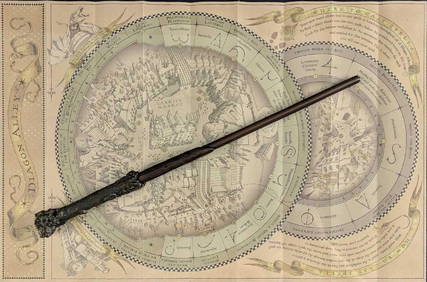
Universal Studios Harry Potter Wand BRapid Estate Liquidators and Auction Gallery4.5(1.1k)See Sold PriceFeb 28, 2024
Antique Map of France, 1703 by Gillaume Del Isle PrintAntiques Online Auctions4.6(415)See Sold PriceMar 14, 2024