Gothic Revival Stained Glass Window of The ResurrectionSchmidt's Antiques Inc. Since 19114.8(431)See Sold PriceMar 02, 2024
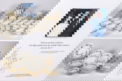
THE FITZGERALD FAMILY TEA and DINNER SERVICEJohn McInnis Auctioneers,LLC4.5(505)See Sold PriceFeb 25, 2024
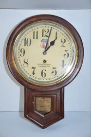
Union Pacific RR Cheyenne, WY Locomotive Shop ClockJM Hobby Supply and Railroad Artifact Auctions4.4(127)See Sold PriceFeb 24, 2024
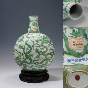
A CHINESE PORCELAIN GREEN ENAMELED DRAGON MOON FLASK BIANHUBerkeley Auction Gallery4.4(16)See Sold PriceMar 03, 2024
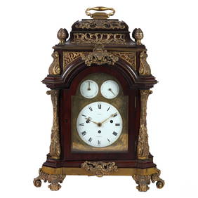
Antique George III Musical Bracket Clock by Hare LondonHill Auction Gallery 4.7(1k)See Sold PriceFeb 28, 2024
No Reserve Early 20th century French / Flemish Design Tapestry 6 ft 2 in x 4 ft 9 in (1.87 m x 1.44Nazmiyal Auctions4.4(34)See Sold PriceFeb 25, 2024
Central Anatolia Konya Antique Rug 4 ft 8 in x 3 ft 8 in (1.42 m x 1.11 m)Nazmiyal Auctions4.4(34)See Sold PriceFeb 25, 2024
PAIR MAGNIFICENT AND LARGE CLOISONNE ENAMEL CRANES INCENSE BURNERSBerkeley Auction Gallery4.4(16)See Sold PriceMar 03, 2024
From Davide Halevim Collection Antique Persian Mohtashem Kashan Rug 10'11" x 7'10" (3.32 m x 2.38 m)Nazmiyal Auctions4.4(34)See Sold PriceFeb 25, 2024
RARE COVENTRY GLASS WORKS MASONIC FLASKJohn McInnis Auctioneers,LLC4.5(505)See Sold PriceFeb 25, 2024
Empire by Buccellati Italy Sterling Silver Flatware Set 99 pieces DinnerBidhaus4.4(762)See Sold PriceFeb 25, 2024
Sold18TH C. HANDCOLORED ENGRAVED MAP OF AMSTERDAMDimensions: (Frame) H 15.75" x W 16", (Sight) H 9.75" x W 10.25" Condition: Some age toning and spotting.See Sold Price
Soldc 1760 Superb Hand-Colored American Northeast MapHistoric Maps Gorgeous Map of the American Northeast With "Neu Jorck sive Neu Amsterdam" with Cityscape Inset c. 1760 mid 18th Century Colonial Era, Hand-Colored Engraved Map of the American NortheastSee Sold Price
Sold18th C. Hand-colored Engraved Map, HaitiAn 18th century hand colored engraved map of what is now Haiti, titled " Carte De La Partie Francoise De St. Domingue", showing the area burned in the slave revolt of 1791. Engraved by Philadelphian JSee Sold Price
SoldTwo 18th C. Hand Colored Engraved Maps.From a Connecticut, CT estate. Dimensions: sheets - 17" high x 24.5" wide and 16.5" high x 25" wide. Condition: Not examined out of frames. Toned paper, trimmed margins, both with center fold creases,See Sold Price
Sold*ZATTA, ANTONIO(18th C. Italian) Handcolored engraved map illustrating Maryland, Jersey, Delaware, Virginia and Carolina settlements, approximate plate size 13 1/4" x 17 1/2", frame 16" x 22 1/2".See Sold Price
Sold18th C. Hand-Colored Map of New EnglandAn 18th C. hand-colored engraved map of New England, Nova Scotia, New France, or Canada, with the Islands of Newfoundland, Cape Breton, St. John's, by Jacques-Nicholas Bellin. Framed under glass. MatSee Sold Price
Sold18th C. Map of LouisianaAn 18th C. hand-colored engraved map by Emanuel Bowen, titled "A New and Accurate Map of Louisiana with Part of Florida and Canada, and the Adjacent Countries", Plate 59. Likely from the "Complete AtlSee Sold Price
SoldAntique French Map of St. AugustineAntique French Map of St. Augustine, "Plan de la Ville et Port de St. Augustin", late 18th/early 19th c., hand-colored engraved map, sight 8 1/2 in. x 12 in., framed. Provenance: Estate of Faith K. TiSee Sold Price
Sold18th c. Map OBSERVATIONS SUR LES POINTS CARDINAUX. LIGNES, ET CIRCLES DE LA SPHÈDescription: 18th c. Hand-colored Engraved Double-page World Map Entitled OBSERVATIONS SUR LES POINTS CARDINAUX. LIGNES, ET CIRCLES DE LA SPHÈRE by Claude Buy de Mornas (17XX-1783), 1761 | One of 1See Sold Price
SoldNicolas Sanson/ Pierre Mortier, engraving mapNicolas Sanson/ Pierre Mortier , "Gallia Vetus...", 18th c., printed in Amsterdam, engraved map of France, outline color, elaborate cartouche, sight 20 1/4 in. x 16 3/4 in., framed * NO RETURNS ARE ACSee Sold Price
Sold(2) 18th C Double-page, hand-colored maps(2) 18th C Double-page, hand-colored etched and engraved maps taken from an atlas, inc the Champagne region of France and Antwerp, largest 16-1/2" x 20-1/2" pl, very good conditionSee Sold Price
SoldHERMAN MOLL HAND COLORED ENGRAVED MAPS 18TH C. TWOHERMAN MOLL, HAND COLORED ENGRAVED MAPS, 18TH C., TWO, GREAT BRITAIN, IRELAND, GALLOWAY:Under glass and matted in matched frames. Lyons Ltd., Antique Prints label. Visible image size 7 3/4" x 10 1/4".See Sold Price
HERMAN MOLL HAND COLORED ENGRAVED MAPS 18TH C. TWOHERMAN MOLL, HAND COLORED ENGRAVED MAPS, 18TH C., TWO, GREAT BRITAIN, IRELAND, GALLOWAY:Under glass and matted in matched frames. Lyons Ltd., Antique Prints label. Visible image size 7 3/4" x 10 1/4".See Sold Price
SoldWillem Blaeu, Cornubia sive Cornwallia, Amsterdam:Willem Blaeu, Cornubia sive Cornwallia, Amsterdam: c.1640, Handcolored engraved map of Cornwall, coats-of-arms, galleons, foxing, and water staining, center creaseSee Sold Price
Sold(MAP) VISSCHER, NICOLAUS. A group of 2 maps, 1678.(MAP) VISSCHER, NICOLAUS A group of two hand-colored engraved maps, [Amsterdam, c. 1678] Magnae Britanniae Tabula, with engraved cartouche featuring Hercules slaying cerebus to the right and an armoriSee Sold Price
Sold(MAP) VISSCHER, NICOLAUS. [Amsterdam, c. 1690](MAP) VISSCHER, NICOLAUS Tabula nova Provinciae Ultrajectinae, [Amsterdam, c. 1690] Hand-colored engraved map showing the areas between Amsterdam, Gouda, Arnheim and Zutphen, including Utrecht and AmeSee Sold Price
Sold18th C. Milan Ducatus Mediterranean Map18th C. framed copper engraved map, hand colored of Milan, Genoa, Lake Como and Mantua Cartouche. By Matthai Serteri, S.C.M. GEOGR Augustani. Visible paper measures approximately 20.25" H X 24" W, witSee Sold Price
[MAP OF CHINA] JOHAN NIEUHOFF:Reys-Kaerte Vande Ambassade Der Nederlantse Oost Indise Compagnie Door China..., hand colored engraved map, Amsterdam, c. 1665, framed with French matting h. 17-1/2 w. 20-1/2 in. (sight) overall dimenSee Sold Price
Sold18th c. Map DIVERSITÉ DES OMBRES ET DIVERSE SITUATION DES HABITANS DE LA TERRE18th c. Antique French Hand-colored Engraved Double-page World Map Entitled DIVERSITÉ DES OMBRES ET DIVERSE SITUATION DES HABITANS DE LA TERRE by Claude Buy de Mornas (17XX-1783), 1761 | One of 17See Sold Price
Sold(2) 18TH C ENGRAVED MAPS - 'Hollandia Comitatus' by(2) 18TH C ENGRAVED MAPS - 'Hollandia Comitatus' by Willem Janszoon Blaeu (1571-1638), Amsterdam, circa 1635. The upper right corner inset with map of the isles Texel, Vlieland and Terschelling; PLUSSee Sold Price
(2) 18TH C ENGRAVED MAPS - 'Hollandia Comitatus' by(2) 18TH C ENGRAVED MAPS - 'Hollandia Comitatus' by Willem Janszoon Blaeu (1571-1638), Amsterdam, circa 1635. The upper right corner inset with map of the isles Texel, Vlieland and Terschelling; PLUSSee Sold Price
SoldFive French Hand-Colored Engraved MapsA Group of Five Antique French Hand-Colored Engraved Maps of the Gulf and Atlantic Coasts, 18th c., by Jacques N. Bellin, the maps as follows: the Gulf Coast from Mobile Bay to Cedar Keys, FL; LouisiaSee Sold Price
SoldA LARGE 18TH C HAND COLORED MAP OF RUSSIAA LARGE 18TH C HAND COLORED MAP OF RUSSIA. Comprising a large finely engraved map entitled "MAPPAE IMPERII MOSCOVITICI PARS SEPTENTRIONALIS," by George Matthäus Seutter (1678-1757) printed in AugsburSee Sold Price
*UNKNOWN ARTIST(Mid 18th C.) "Tableau Chronologique", 2-piece engraved handcolored map, 1761 date hand notation lower right, approximate plate size 15" x 21", total sheet size 20" x 26".See Sold Price
17TH C. WORLD MAP BY NICOLAES VISSCHER (NETHERLANDS, 1618-1709)Thomaston Place Auction Galleries4.4(393)See Sold PriceFeb 24, 2024
EARLY 18TH C. DUTCH CHART OF PACIFIC OCEAN BY FREDERIK DE WIT (1629-1706) WITH CALIFORNIA AS ANThomaston Place Auction Galleries4.4(393)See Sold PriceFeb 24, 2024
EARLY 18TH C. MAP OF ITALY, FRAMEDThomaston Place Auction Galleries4.4(393)See Sold PriceFeb 24, 2024
18TH C. ANTIQUE MAP: FRENCH & INDIAN WAR, FRAMEDThomaston Place Auction Galleries4.4(393)See Sold PriceFeb 24, 2024
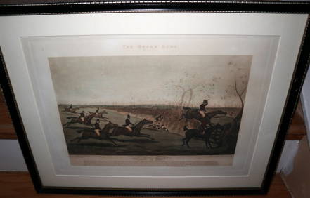
HENRY ALKEN / LEWIS Original 1835 Hand Colored Engraving Quron Hunt Snob Is BeatLuis Porretta Fine Arts4.3(10)See Sold PriceMar 02, 2024
18th Century Hess Germany Hand colored Engraved MapGlobal Auctions Company4.3(36)See Sold PriceMar 03, 2024
Two (2) Antique 18th C. Copper Engraved Framed Maps - America & EuropeMagnusson Art Group4.5(53)See Sold PriceMar 14, 2024
Map: An 18thC engraved and hand coloured map of Buckinghamshire after Robert Morden. Approx. 8 1/4"Claydon Auctioneers Ltd4.3(125)See Sold PriceFeb 26, 2024
Map: An 18thC engraved and hand coloured map of Northamptonshire, with description ofClaydon Auctioneers Ltd4.3(125)See Sold PriceFeb 26, 2024
Map: An 18thC engraved and hand coloured map of North America and South America, titled DeClaydon Auctioneers Ltd4.3(125)See Sold PriceFeb 26, 2024
Map: An 18thC engraved map of Bedfordshire titled An Accurate Map of the County of Bedford DividedClaydon Auctioneers Ltd4.3(125)See Sold PriceFeb 26, 2024
Map: An 18thC engraved map titled A New and Improved Map of Oxfordshire.. after Thomas Kitchin.Claydon Auctioneers Ltd4.3(125)See Sold PriceFeb 26, 2024
1675 ELZEVIER JULIUS CAESAR antique ILLUSTRATED w/ MAPS ROMAN HISTORYJasper524.5(9.9k)See Sold PriceFeb 27, 2024
ANTIQUE ROMAN ARMORIAL VELLUM BINDING, 1744, ILLUSTRATED WITH AN ANTIQUE MAP BY FLORUSNY Elizabeth 4.2(86)See Sold PriceMar 03, 2024
1675: ANTIQUE ILLUSTRATED JULIUS CAESAR MAPS OF ROMAN HISTORYNY Elizabeth 4.2(86)See Sold PriceMar 03, 2024


![(MAP) VISSCHER, NICOLAUS. [Amsterdam, c. 1690] (1 of 1)](https://p1.liveauctioneers.com/197/30916/12134084_1_x.jpg?height=282&quality=70&version=1342619735)

![[MAP OF CHINA] JOHAN NIEUHOFF: (1 of 5)](https://p1.liveauctioneers.com/522/100472/51254602_1_x.jpg?height=282&quality=70&version=1487709981)