ATLAS of ANTIENT GEOGRAPHY by SAMUEL BUTLER 1843John McInnis Auctioneers,LLC4.5(505)See Sold PriceFeb 24, 2024
18TH C. ANTIQUE MAP: FRENCH & INDIAN WAR, FRAMEDThomaston Place Auction Galleries4.4(394)See Sold PriceFeb 24, 2024
Rand McNally Railroad Map Cabinet w/ 21 Railroad MapsRail & Road Auctions4.6(165)See Sold PriceMar 08, 2024
Keith Haring - Ink on New York Map, Best Buddies, Inscribed, Signed, and DatedSapphire Auction Gallery4.1(67)See Sold PriceMar 02, 2024
LATE 17TH C. FRENCH MAP OF THE NEW WORLD BY ALEXIS-HUBERT JAILLOT (1632-1712)Thomaston Place Auction Galleries4.4(394)See Sold PriceFeb 24, 2024
Central Railroad of New Jersey Map of Sandy Hook Route-ca. 1903JM Hobby Supply and Railroad Artifact Auctions4.4(127)See Sold PriceFeb 24, 2024
Lot of Six Mixed Atlas Box Cars-HO Scale-New in BoxJM Hobby Supply and Railroad Artifact Auctions4.4(127)See Sold PriceFeb 25, 2024
Rand McNally/Santa Fe Railroad Map of Iowa-1912JM Hobby Supply and Railroad Artifact Auctions4.4(127)See Sold PriceFeb 24, 2024
NICOLAES VISSCHER (NETHERLANDS, 1618-1709) MAP OF THE NEW WORLDThomaston Place Auction Galleries4.4(394)See Sold PriceFeb 24, 2024
17TH C. WORLD MAP BY NICOLAES VISSCHER (NETHERLANDS, 1618-1709)Thomaston Place Auction Galleries4.4(394)See Sold PriceFeb 24, 2024
Lot of Six Mixed Atlas Cabooses-HO Scale-New in BoxJM Hobby Supply and Railroad Artifact Auctions4.4(127)See Sold PriceFeb 25, 2024
Sold1876 Mitchell Map of New York -- County Map of theReserve Reduced! Title/Content of Map: 1876 Mitchell Map of New York -- County Map of the State of New York Date: 1876 Philadelphia Cartographer: S Mitchell Size: 13.5 x 21.3 in. A very nice, large maSee Sold Price
1878 Mitchell Antique Map of New YorkTitle/Content of Map: 1878 Mitchell Map of New York -- County Map of the State of New York Date Printed: 1878, Philadelphia Cartographer: S Mitchell Size: 13.5 x 21.3 in. A very nice, large map of theSee Sold Price
Sold1876 Mitchell Map of Vermont and New Hampshire --Title/Content of Map: 1876 Mitchell Map of Vermont and New Hampshire -- County and Township Map of New Hampshire and Vermont Date: 1876 Philadelphia Cartographer: S MitchellSize: 14.5 X 20.6 in. ThisSee Sold Price
Sold1876 Mitchell Map of Utah and Nevada [verso] ArizonaTitle/Content of Map: 1876 Mitchell Map of Utah and Nevada [verso] Arizona and New Mexico -- County Map of of Utah and Nevada [verso] County Map Arizona and New Mexico Date: 1876 Philadelphia CartograSee Sold Price
Sold1876 Mitchell Map of Virginia, West Wirginia [verso]Title/Content of Map: 1876 Mitchell Map of Virginia, West Wirginia [verso] New Jersey, Maryland, Delaware -- County Map of Virginia and West Virginia [verso] County Map of New Jersey [and] County MapSee Sold Price
Samuel Augustus Mitchell (1790-1868), "County Map ofSamuel Augustus Mitchell (1790-1868), "County Map of New York, New Hampshire, Vermont, Massachusettes, Rhode Island and Connecticut," 1860, H. - 15 1/4 in., W. - 22 1/2 in.See Sold Price
SoldMitchell: Antique Map of New York State w/ city insetsCounty Map of the State of New York The beautifully detailed and colored county map of New York State from the 1870 edition of Mitchell's popular New General Atlas of the world. Framed by the vine motSee Sold Price
Mitchell: County Map of the State of New YorkDetailed and colored county map of New York State from the 1870 edition of Mitchell's popular New General Atlas of the world. Framed by the vine motif border typical of Mitchell maps of the mid-1860sSee Sold Price
SoldMitchell's County Map of the State of New York 1867Mitchell's County Map of the State of New York, 1867, S.Augustus Mitchell. Has some small tearing where the pages are joined but is in otherwise very good condition. Measures approx. 15" tall x 22" wiSee Sold Price
Sold1876 Mitchell Map of Canadian Maritime Provinces --Title/Content of Map: 1876 Mitchell Map of Canadian Maritime Provinces -- County Map of Nova Scotia, New Brunswick, Cape Breton Id. and Prince Edward's Id. Date: 1876 Philadelphia Cartographer: S MitcSee Sold Price
1876 Warner & Beers Mid-Atlantic & Midwestern MapCounty Map of New York, Pennsylvania, Ohio, Delaware, Virginia, West Virginia and the Province of Ontario. Hand-colored accents, published by Warner & Beers, Chicago. Size : 18" x 22"See Sold Price
SoldMitchell's Large Scale 19C Map of New York 1858Mitchell's Large Scale Map of New York 1858. The large 19th century map is titled Mitchell's County and Township Map of the State of New York Showing the Adjoining Portions of New England New Jersey aSee Sold Price
Map of New York by Mitchell, 1872County Map of the State of New York. Large two-page format hand colored by county. Includes five inset maps: Troy, Albany, Harbor and Vicinity of New York, Buffalo and Rochester. Shows railroads, canaSee Sold Price
Sold1876 Historical Atlas of Yates County, New York1876 Historical Atlas of Yates County, New York, Maps, Lithographic Views, Portraits, Etc., Approx. 17.5" x 14.5"See Sold Price
Sold1860 Mitchell Map of the US Northeast States -- CountyTitle/Content of Map: 1860 Mitchell Map of the US Northeast States -- County Map of the States of New York, New Hampshire, Vermont, Massachusetts, Rhode Id. & Connecticut Date: 1860, Philadelphia CartSee Sold Price
New York by Mitchell, 1872County Map of the State of New York. Large two-page format hand colored by county. Includes five inset maps: Troy, Albany, Harbor and Vicinity of New York, Buffalo and Rochester. Shows railroads, canaSee Sold Price
SoldUncommon 1876 Atlas Map of Yates County, NYpublished by Tho & Hunter Pr. Philadelphia. includes map of Yates County by Cyrus Wheelock, map of New York State by Frank A Gray. great detail and information.See Sold Price
County Map of the States of New York, New Hampshire,Title: County Map of the States of New York, New Hampshire, Vermont. Massachusetts, Rhode Id. and Connecticut. Publication Date: 1861 Cartographer: WILLIAMS, W. Publisher: S. Augustus Mitchell, Jr. BrSee Sold Price
Sought-after 2-pg map of New York, Mitchell 1850Extremely detailed and large map of New York, hand-colored when published. Shows railroads, towns, rivers, canals, steamship routes, and more. Map is framed by population tables for counties and townsSee Sold Price
Mitchell: New York State with city insetsMap: County Map of the State of New York Cartographer: S. A. Mitchell Place/Date: Philadelphia / 1870 Size: 21 1/8" x 13 3/4" Condition: full color; overall age toning; repaired split in lower marginSee Sold Price
SoldMitchell: New York State with City InsetsMap Title: County Map of the State of New York Cartographer: S. A. Mitchell Place & Date: Philadelphia / 1870 Size: 21 1/8" x 13 3/4" Condition: full color; overall age toning; repaired split in lowerSee Sold Price
SoldFolding map of West with railroads 1876Heading: Author: Watson, Gaylord Title: Watson's New County and Railroad Map of the Pacific States Place Published: New York Publisher:Published by G. Watson Date Published: 1876 DescrSee Sold Price
SoldHISTORICAL ATLAS OF DUTCHESS COUNTY NEW YORKHISTORICAL ATLAS OF DUTCHESS COUNTY NEW YORK ILLUSTRATED - READING PUBLISHING HOUSE 1876. IN GOOD ESTATE CONDITION, FROM HOUSE IN STANFORDVILLE, N.Y. BEAUTIFUL MAPS AND ILLUSTRATIONS. HARD ATLAS TO FISee Sold Price
SoldLarge-format Asher & Adams Lithographed Map of OregonOregon. Asher & Adams (19th cent.). Color printed lithograph. New York: Asher & Adams, 1876-77. 16 1/4 x 22 1/2 inches sheet. Interesting large format map of Oregon, hand colored by counties. SeveralSee Sold Price
1892 Adams and Bowles New Road Map of the State of New YorkJM Hobby Supply and Railroad Artifact Auctions4.4(127)See Sold PriceFeb 24, 2024
Crams Railroad Map of New York-1881JM Hobby Supply and Railroad Artifact Auctions4.4(127)See Sold PriceFeb 24, 2024
Crams Township and Railroad Map of New York-1890JM Hobby Supply and Railroad Artifact Auctions4.4(127)See Sold PriceFeb 24, 2024
Vintage County Map Of NY State Plate EngravingThe Benefit Shop Foundation Inc.4.3(3k)See Sold PriceFeb 28, 2024
Portfolio of 15 County Maps by Robert Morden (English 1650-1703)Nadeau's Auction Gallery4.7(410)See Sold PriceFeb 24, 2024
1855 Map of New York & Erie Railroad and 1917 Trespassing On Railway Property Is A MisdemeanorRail & Road Auctions4.6(165)See Sold PriceMar 07, 2024
Keith Haring - Ink on New York Map, Best Buddies, Inscribed, Signed, and DatedSapphire Auction Gallery4.1(67)See Sold PriceMar 02, 2024
1867 Map of the Railroads of The State of New YorkRail & Road Auctions4.6(165)See Sold PriceMar 08, 2024
ANDREW RAYMOND JANSON OIL ON BOARD ADIRONDACKSCharleston Estate Services Ltd.4.5(72)See Sold PriceMar 03, 2024
Keith Haring Artwork Signed on a Shell Oil New York Road Map 18 in. x 24 in.Donny Malone Auctions4.5(1.8k)See Sold PriceMar 04, 2024
Two Hand-Colored 19th Century Maps of New Orleans and Louisiana, Larger- H.- 12 1/2 in., W.- 15 1/2Crescent City Auction Gallery4.3(233)See Sold PriceMar 08, 2024
Map of Yorktown - York County in Virginia - United StatesProverde Auctions4.3(3)See Sold PriceFeb 28, 2024
Black and white map of part of New York City (mostly Manhattan)Proverde Auctions4.3(3)See Sold PriceFeb 28, 2024
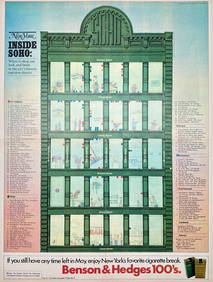
Map Inside Soho - Manhattan - New York Magazine 1974Proverde Auctions4.3(3)See Sold PriceFeb 28, 2024
Laminated Unique Media New York City MapRapid Estate Liquidators and Auction Gallery4.5(1.1k)See Sold PriceFeb 29, 2024


![1876 Mitchell Map of Utah and Nevada [verso] Arizona (1 of 2)](https://p1.liveauctioneers.com/5584/137769/69881187_1_x.jpg?height=282&quality=70&version=1552435690)
![1876 Mitchell Map of Virginia, West Wirginia [verso] (1 of 2)](https://p1.liveauctioneers.com/5584/138985/70465971_1_x.jpg?height=282&quality=70&version=1554250661)