ATLAS of ANTIENT GEOGRAPHY by SAMUEL BUTLER 1843John McInnis Auctioneers,LLC4.6(502)See Sold PriceFeb 24, 2024
18TH C. ANTIQUE MAP: FRENCH & INDIAN WAR, FRAMEDThomaston Place Auction Galleries4.4(386)See Sold PriceFeb 24, 2024
Rand McNally Railroad Map Cabinet w/ 21 Railroad MapsRail & Road Auctions4.6(165)See Sold PriceMar 08, 2024
Keith Haring - Ink on New York Map, Best Buddies, Inscribed, Signed, and DatedSapphire Auction Gallery4(67)See Sold PriceMar 02, 2024
LATE 17TH C. FRENCH MAP OF THE NEW WORLD BY ALEXIS-HUBERT JAILLOT (1632-1712)Thomaston Place Auction Galleries4.4(386)See Sold PriceFeb 24, 2024
Central Railroad of New Jersey Map of Sandy Hook Route-ca. 1903JM Hobby Supply and Railroad Artifact Auctions4.4(126)See Sold PriceFeb 24, 2024
Lot of Six Mixed Atlas Box Cars-HO Scale-New in BoxJM Hobby Supply and Railroad Artifact Auctions4.4(126)See Sold PriceFeb 25, 2024
Rand McNally/Santa Fe Railroad Map of Iowa-1912JM Hobby Supply and Railroad Artifact Auctions4.4(126)See Sold PriceFeb 24, 2024
NICOLAES VISSCHER (NETHERLANDS, 1618-1709) MAP OF THE NEW WORLDThomaston Place Auction Galleries4.4(386)See Sold PriceFeb 24, 2024
17TH C. WORLD MAP BY NICOLAES VISSCHER (NETHERLANDS, 1618-1709)Thomaston Place Auction Galleries4.4(386)See Sold PriceFeb 24, 2024
Lot of Six Mixed Atlas Cabooses-HO Scale-New in BoxJM Hobby Supply and Railroad Artifact Auctions4.4(126)See Sold PriceFeb 25, 2024
Sold1867 Johnson's Antique Map of European RussiaTitle/Content of Map: 1867 Johnson's Map of European Russia -- Johnson's Russia Date Printed: 1867, New York Cartographer: A Johnson Size: 22.5 X 16.8 in. Attractive large atlas map of European portioSee Sold Price
Antique 1867 Johnson's Map of European RussiaTitle/Content of Map: 1867 Johnson's Map of European Russia -- Johnson's Russia Date Printed: 1867, New York Cartographer: A Johnson Size: 22.5 X 16.8 in. Attractive large atlas map of European portioSee Sold Price
Johnson: Antique Map of European Russia, 1867Title/Content of Map: 1867 Johnson's Map of European Russia -- Johnson's Russia Date Printed: 1867, New York Cartographer: A Johnson Size: 22.5 X 16.8 in. Attractive large atlas map of European portioSee Sold Price
Johnson: Antique Map of European Russia, 1867Map: 1867 Johnson's Map of European Russia -- Johnson's Russia Cartographer: A Johnson Year / Place: 1867, New York Map Dimensions: 22.5 X 16.8 in. Condition: Very good, Minor, mostly marginal toning,See Sold Price
Johnson: Antique Map of European Russia, 1867Map: 1867 Johnson's Map of European Russia -- Johnson's Russia Date Printed: 1867, New York Cartographer: A Johnson Size: 22.5 X 16.8 in. Condition: Very good, Minor, mostly marginal toning, a few smaSee Sold Price
Johnson's Map of European Russia, 18671867 Johnson's Map of European Russia. 1867, New York. 22.5 X 16.8 in. Attractive large atlas map of European portion of Russia. Nicely color-coded for selected regions. This map shows the imperial wiSee Sold Price
Johnson's Map of Russia, 1867Map: Johnson's Russia Maker: A Johnson Date: 1867 Origin: New York Date: 22.5 x 16.8 inches Attractive large atlas map of European portion of Russia. Nicely color-coded for selected regions. This mapSee Sold Price
SoldJohnson: Antique Map of Russia, 1868Title/Content of Map: Johnson's Russia Date Printed: 1868 Cartographer: A. J. Johnson Material/Medium: Paper Size: 26" x 18" Hand colored engraved Map. From Johnson's New Illustrated Family Atlas of tSee Sold Price
SoldRobert de Vaugoundy: Antique Map European Russia, 1778Title/Content of Map: 1778 Robert de Vaugoundy Map of European Russia -- Partie Meridionale de la Russie Europeenne, Tartarie Russienne, Petite Tartarie par le Sr. Robert de Vaugoundy Date Printed: 17See Sold Price
SoldThomson: Antique Map of European Russia, 1817Title/Content of Map: 'European Russia' European Russia including Baltics Belarus Ukraine. Date Printed: 1817 Image Size: Approx 62.5 x 52.5cm, 24.75 x 20.75 inches (Large); Please note that this is aSee Sold Price
Thomson: Antique Map of European Russia, 1817Title/Content of Map: 'European Russia' including Baltics Belarus Ukraine Date Printed: 1817 Image Size: Approx 62.5 x 52.5cm, 24.75 x 20.75 inches (Large); Please note that this is a folding map. TypSee Sold Price
Vaugondy: Antique Map of European Russia, 1757Map: Partie Meridionale De La Russie Europeenne Publication Date: 1757 Authors: LES AUTEURS ET BOUDET, ROBERT DE VAUGONDY, DIDIER (1723-1786) Publisher: LES AUTEURS ET BOUDET Size: Elephant Folio �See Sold Price
Thomson: Antique Map of European Russia, 1817Map: European Russia Publication Date: 1817 Authors: JOHN THOMSON, JUNR. & CO., THOMSON, JOHN & CO. Publisher: JOHN THOMSON, JUNR. & CO. Size: Double Folio – 23.30 H x 19.50 W Inches No.17 from ThomSee Sold Price
Vaugoundy: Antique Map of European Russia, 1778Map: 1778 Robert de Vaugoundy Map of European Russia -- Partie Meridionale de la Russie Europeenne, Tartarie Russienne, Petite Tartarie par le Sr. Robert de Vaugoundy Cartographer: Robert de VaugoundySee Sold Price
Johnston: Antique Map of European Russia, 1879TITLE/CONTENT OF MAP: 'European Russia' European Russia. Caucasus Baltic States Ukraine 50x60cm. DATE PRINTED: 1879 IMAGE SIZE: Approx 60.5 x 48.0cm, 23.75 x 18.75 inches (Large); Please note that thiSee Sold Price
Vandermaelen: Antique Map of European Russia, 1827TITLE/CONTENT OF MAP: 'Europe - Partie de la Russie d'Europe - No 11 ' The Russian regions/oblasts of Kirov, Perm, Orenburg & Kazan and adjacent territories DATE PRINTED: 1827 IMAGE SIZE: Approx 71.0See Sold Price
Arrowsmith: Antique Map of European Russia, 1809Title/Content of Map: 1809 Arrowsmith Map of European (South) Russia -- South Part of Russia in Europe Date Printed: 1809, London Cartographer: A Arrowsmith Size: 9.7 X 15.8 in. Attractive map of theSee Sold Price
Malte-Brun: Antique Map of European Russia, 1812Map: 1812 Malte-Brun Map of European Russia -- Russie d'Europe Date Printed: 1812, Paris Cartographer: M Malte-Brun Size: 11.7 x 8.8 in. Condition: Very Good - Excellent. Color outlined on thick paperSee Sold Price
Vaugondy: Antique Map of European Russia, 1757Map: Partie Septentrionale De La Russie Europeenne Publication Date: 1757 Authors: LES AUTEURS ET BOUDET, ROBERT DE VAUGONDY, DIDIER (1723-1786) Publisher: LES AUTEURS ET BOUDET Size: Elephant Folio �See Sold Price
Sold1867 "Johnson's Russia" Map by A.J. Johnson1867 "Johnson's Russia" Map by A.J. Johnson: the map includes bordering countries, seas and oceans. Along with the Act of Congress info on the border is Longitude East 117 From Washington. Now mattedSee Sold Price
Bellin: Antique Maps of European & Asian Russia, 1757Map: 1. Carte de la Siberie et des Pays Voisins 2. Suite de la Carte de la Siberie et le Pays de Kamtschatka Cartographer: Bellin Place & Date: Paris / 1757/1760 Size: 17 3/4" x 11 1/2 (1); 10 1/8" xSee Sold Price
Hand Colored Maps; Johnson's Russia & moreJohnson's Russia by Johnson & Ward hand colored antique map. Russia on Europe hand colored map, and Suite de la Carte de La Siberie. 3 piece map collection.See Sold Price
SoldMaps Johnson's Russia, 1867, Africa, 1922(Lot of 2) Unframed lithographs maps, ''Map of Africa,'' 1922, by National Geographic Society, and ''Johnson's Russia,'' (hand colored) 1867, by A.J. Johnson, largest overall: 32''h x 28''wSee Sold Price
Johann Homann Hand-Colored Map Engraving, c. 1730Auctions at Showplace4.5(726)See Sold PriceMar 17, 2024
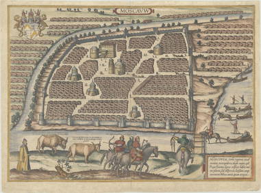
Duval - Pair: Map of Georgia & Map of Moscow, RussiaTrillium Antique Prints & Rare Books4.5(30)See Sold PriceFeb 24, 2024
Audubon, Amsterdam Ed - American Robin. 131Trillium Antique Prints & Rare Books4.5(30)See Sold PriceFeb 24, 2024
1816 MAP SOUTHERN PART OF RUSSIA or MUSCOVY in EUROPE copper engraving ANTIQUEJasper524.5(9.8k)See Sold PriceFeb 27, 2024
1816 MAP NORTHERN PART OF RUSSIA or MUSCOVY in EUROPE copper engraving ANTIQUEJasper524.5(9.8k)See Sold PriceFeb 27, 2024
SECOND WORLD WAR AFRICA. European colonies & German mandates 1940 old mapJasper524.5(9.8k)See Sold PriceFeb 28, 2024
AFRICA. Map pre-dating much exploration. Mountains of Kong. SDUK 1851 oldJasper524.5(9.8k)See Sold PriceFeb 28, 2024
Pre-colonial Africa. Mountains of Kong/Moon. Caravan routes. THOMSON 1817 mapJasper524.5(9.8k)See Sold PriceFeb 28, 2024
AFRICA. European Possessions in Central; map of Zanzibar 1907 old antiqueJasper524.5(9.8k)See Sold PriceFeb 28, 2024
WEST AFRICA. European colonies; Mauritius; Ascension; St Helena 1907 old mapJasper524.5(9.8k)See Sold PriceFeb 28, 2024
Pre-SECOND WORLD WAR AFRICA. European colonies & German mandates 1942 old mapJasper524.5(9.8k)See Sold PriceFeb 28, 2024
Johnson's Africa. Colonies & tribes. Liberia Nile Delta Cape Colony 1866 mapJasper524.5(9.8k)See Sold PriceFeb 28, 2024
SOUTHERN AFRICA.Inset Ascension Is.; European colonies 1914;St Helena 1920 mapJasper524.5(9.8k)See Sold PriceFeb 28, 2024