ATLAS of ANTIENT GEOGRAPHY by SAMUEL BUTLER 1843John McInnis Auctioneers,LLC4.6(502)See Sold PriceFeb 24, 2024
18TH C. ANTIQUE MAP: FRENCH & INDIAN WAR, FRAMEDThomaston Place Auction Galleries4.4(386)See Sold PriceFeb 24, 2024
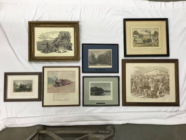
Rand McNally Railroad Map Cabinet w/ 21 Railroad MapsRail & Road Auctions4.6(165)See Sold PriceMar 08, 2024
Keith Haring - Ink on New York Map, Best Buddies, Inscribed, Signed, and DatedSapphire Auction Gallery4(67)See Sold PriceMar 02, 2024
LATE 17TH C. FRENCH MAP OF THE NEW WORLD BY ALEXIS-HUBERT JAILLOT (1632-1712)Thomaston Place Auction Galleries4.4(386)See Sold PriceFeb 24, 2024
Central Railroad of New Jersey Map of Sandy Hook Route-ca. 1903JM Hobby Supply and Railroad Artifact Auctions4.4(126)See Sold PriceFeb 24, 2024
Lot of Six Mixed Atlas Box Cars-HO Scale-New in BoxJM Hobby Supply and Railroad Artifact Auctions4.4(126)See Sold PriceFeb 25, 2024
Rand McNally/Santa Fe Railroad Map of Iowa-1912JM Hobby Supply and Railroad Artifact Auctions4.4(126)See Sold PriceFeb 24, 2024
NICOLAES VISSCHER (NETHERLANDS, 1618-1709) MAP OF THE NEW WORLDThomaston Place Auction Galleries4.4(386)See Sold PriceFeb 24, 2024
17TH C. WORLD MAP BY NICOLAES VISSCHER (NETHERLANDS, 1618-1709)Thomaston Place Auction Galleries4.4(386)See Sold PriceFeb 24, 2024
Lot of Six Mixed Atlas Cabooses-HO Scale-New in BoxJM Hobby Supply and Railroad Artifact Auctions4.4(126)See Sold PriceFeb 25, 2024
Sold1862 Map Of The Erie Canal1862 map of The Erie Canal. Shows old and enlarged Erie Cana West of Montezuma across Cayuga Marshes showing location of Richmond Aqueduct C. 1862. Comstock & Cassidy Albany N.Y.. Folds as issued. AppSee Sold Price
Sold1857 New York Engineering Canals MAPS Erie Canal Survey1857 New York Engineering Canals MAPS Erie Canal Survey LAWS Economics A rare, and relatively obscure mid-19th-century American engineering report from New York. This report, which was published annuaSee Sold Price
Sold1884 New York Canals MAP Engineering Erie Canal Survey1884 New York Canals MAP Engineering Erie Canal Survey LAWS Economics A rare, and relatively obscure mid-19th-century American engineering report from New York. This report, which was published annualSee Sold Price
Sold[Americana - Erie Canal - Maps] 1874 Erie Canal[Americana - Erie Canal - Maps] 1874 Erie Canal Commissioners Report with 41" x 24" Folding Map ANNUAL REPORT OF THE CANAL COMMISSIONERS FOR THE STATE OF NEW YORK (FOR 1874). Albany: Weed, Parsons andSee Sold Price
Sold[Americana - Erie Canal - Map] 34 by 23 inch Hand[Americana - Erie Canal - Map] 34 by 23 inch Hand Colored Map of Erie Canal and Buffalo in 1861 Gardner, H. & Skinner, W. ANNUAL REPORT OF THE CANAL COMMISSIONERS OF THE STATE OF NEW YORK MADE FEBRUARSee Sold Price
Sold1875 Profile Map Western Division Erie Canal"Map and Profile of the Western Division of the Erir Canal". S. H. Sweet and J. D. Fay engineers. Lake Ontario along top of map; Buffalo and Lake Erie at lower left. Lithograph by Weed, Parsons & Co.,See Sold Price
Sold[Americana - Erie Canal - Maps] With 16 Engraved Plans,[Americana - Erie Canal - Maps] With 16 Engraved Plans, Profiles & Maps of New York State Canals for 1859 Van Rensselaer Richmond; Charles Van Benthuysen. ENGRAVINGS OF PLANS, PROFILES AND MAPS,See Sold Price
Sold[Americana - New York Canals - Maps] 4 Large Folding[Americana - New York Canals - Maps] 4 Large Folding Maps of Erie and Champlain Canals - 1892 New York State Parson, Henry C. and Lyon, James B. MAPS ACCOMPANYING THE ANNUAL REPORT OF THE SUPERINTENDESee Sold Price
SoldNew York State CANAL EPHEMERA Graphs Charts ErieThis auction lot includes the following group of antique ephemera relating to the New York State canal system: - Cloth portfolio of antique maps: water surfaces, Erie and Champlain canals, etc.- CanSee Sold Price
SoldLarge Lot of Vintage New York State Books & PamphletsLarge Lot of Vintage New York State Books & Pamphlets. Includes: 2 Rip Van Winkles Books, Washington Irving Maps New York Folklore Quarterly History of Erie Canal New York Historical Society JournSee Sold Price
Sold1834 Map Village of Auburn NY. Published by Hagama1834 Map Village of Auburn NY. Published by Hagaman & Markham 1834. minor staining and old tape repair. In wooden frame under glass. Note "Profile of Grand Erie Canal" 18 1/2"h x 28 1/2"wSee Sold Price
1865 Map of New York Canals and Feeders"Profiles of the New York State Canals and Feeders". Showing the Erie Canal from Lake Erie to the Hudson River. Information insets for the Erie Canal and 9 different feeder canals. Lower right "Map ofSee Sold Price
Sold1862 Map of Virginia Printed in Richmond. 36.5"1862 Map of Virginia Printed in Richmond. 36.5" x 25.5" map titled: "Map of the State of Virginia Containing the Counties, Principal Towns, Railroads, Rivers, Canals & All Other Internal ImprovemeSee Sold Price
Central Europe roads canals railways Germany, Holland & Belgium. HUGHES 1862 mapCAPTION PRINTED BELOW PICTURE: 'Map of Central Europe, embracing Germany, Holland, Belgium, with parts of France & Switzerland; showing the roads, canals and railways' DATE PRINTED: 1862 IMAGE SIZE: ASee Sold Price
SoldConfederate Issued Map of Virginia. 1862.[Virginia] Map of the State of Virginia Containing The Counties, Principal Towns, Railroads, Rivers, Canals & All Other Internal Improvements. Published by West & Johnston. Richmond VA. 1862. 8vo. FirSee Sold Price
1865 Map New York Canals & Railroads"Profiles of the New York State Canals and Feeders Showing the Elevations of the Same above Tide Water and the Junction of the Lateral Canals with the Erie . Wm. B. Taylor State Engr. & Survr. R.H. ShSee Sold Price
UPPER CANADA. Lakes Huron, Erie & ONTARIO. Counties.TITLE/CONTENT OF MAP: 'Upper Canada' DATE PRINTED: 1862 IMAGE SIZE: Approx 32.0 x 44.5cm, 12.5 x 17.5 inches (Large) TYPE: Antique map with original outline colour CONDITION: Good; suitable for framinSee Sold Price
Sold1875 Map fo the Eire Canal, West -- Map and Profile ofTitle: 1875 Map fo the Eire Canal, West -- Map and Profile of the Western Division of the Erie Canal Cartographer: New York State Government Year / Place: 1875 Map Dimension (in.): 24 X 58.6 in. ThisSee Sold Price
Meyer: Antique Map of New York/NYC inset, 1851Neueste Karte von New York The beautifully detailed and colored map of New York "with its canals, streets, railroads," etc., from Meyer's Grosser Zeitungs-Atlas. Includes a profile of the Erie Canal,See Sold Price
SoldPitcher, Blue Staffordshire, Grand Erie CanalPitcher Material: Pearlware Marks: None Colors: Blue Features: Dark Blue Staffordshire Pitcher, Grand Erie Canal, with four small vignette scenes of the canal and boats on rim and front, spread wingedSee Sold Price
Sold1883 America Illustrated Yellowstone Erie Canal Saratoga Springs Niagara Falls1883 America Illustrated Yellowstone Erie Canal Saratoga Springs Niagara Falls “America Illustrated” is a fine 19th-century illustrated history of iconic locations of natural history fromSee Sold Price
SoldMetal Commemorative Erie Canal Medal with Original BoxMetal Commemorative Erie Canal Medal with Original Box Designed by Archibald Robertson and Engraved by Charles Cushing Wright, 1826, Medal for Completion of Erie Canal, obverse depicting "Union of EriSee Sold Price
SoldMetal Commemorative Erie Canal Medal with Original BoxMetal Commemorative Erie Canal Medal with Original Box Designed by Archibald Robertson and Engraved by Charles Cushing Wright, 1826, Medal for Completion of Erie Canal, obverse depicting "Union of EriSee Sold Price
SoldSTAFFORDSHIRE ERIE CANAL PLATEEngland, c. 1830. "Erie Canal at Buffalo Lace Boder" in black transfer. 10.25" diameter. This lot is eligible for pick-up or in-house shipping. Please contact us for a quote.See Sold Price
Erie Railway Tourist Book/Magazine-1874JM Hobby Supply and Railroad Artifact Auctions4.4(126)See Sold PriceFeb 24, 2024
Assortment of Railroad Paper - Rule Books, Stationary, Ink Blotter, Map, Timetables, and MoreRail & Road Auctions4.6(165)See Sold PriceMar 07, 2024
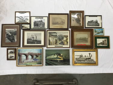
Seven Framed Railroad Lithograph Prints and Art Prints - Baltimore & Ohio, Morristown & Erie, andRail & Road Auctions4.6(165)See Sold PriceMar 07, 2024
1855 Map of New York & Erie Railroad and 1917 Trespassing On Railway Property Is A MisdemeanorRail & Road Auctions4.6(165)See Sold PriceMar 07, 2024
Pair of Early Railroad Maps - 1862 Pittsburgh, Ft. Wayne & Chicago Railway and 1873 PennsylvaniaRail & Road Auctions4.6(165)See Sold PriceMar 07, 2024
Sixteen Framed Railroad Locomotive Photographs and Prints - Nickel Plate Road, Reading, Erie, andRail & Road Auctions4.6(165)See Sold PriceMar 07, 2024
Three Delaware & Hudson Canal Company Railroad Annual Passes - 1884, 1885, and 1886Rail & Road Auctions4.6(165)See Sold PriceMar 08, 2024
A "Red Book" of the Greatest War of History 1914North American Artifact Auctions4.6(182)See Sold PriceApr 20, 2024
Group of 15 Printed or Lithographed Items, including: litho...Potter & Potter Auctions4.6(539)See Sold PriceMar 07, 2024
A MAP OF THE STRAND OF THE NORTH SIDE OF CHANNEL OF RIVER ANNA LIFFE, 1811 Engraving, 680 x 480mmAdam's Auctioneers4.3(5)See Sold PriceFeb 27, 2024
Map of Part of the West Indies, Etc., Showing the Exact Position Of The U.S. War Steamer SanJasper524.5(9.8k)See Sold PriceFeb 27, 2024
A23 United States in the Caribbean Denoyer-Geppert Social Science MapsJasper524.5(9.8k)See Sold PriceFeb 27, 2024
Carte du Canal de Mosambique…. Madagascar Bonne Esperance. BONNE 1780 mapJasper524.5(9.8k)See Sold PriceFeb 28, 2024
Le Canal de Mosambique, l'Isle de Madagascar… Mozambique. Africa. BONNE 1788 mapJasper524.5(9.8k)See Sold PriceFeb 28, 2024
Le Canal de Mosambique, l'Isle de Madagascar… Mozambique. Africa. BONNE 1790 mapJasper524.5(9.8k)See Sold PriceFeb 28, 2024
AFRICA French Congo State Soudan Nile Delta Suez canal by GW BACON 1898 mapJasper524.5(9.8k)See Sold PriceFeb 28, 2024
THOMASON RESTRIKE ERIE CANAL MEDALLION.Amelia Jeffers, Auctioneers & Appraisers4.6(101)See Sold PriceMar 09, 2024
Monmouth, Illinois Vintage Topography MapRapid Estate Liquidators and Auction Gallery4.5(1.1k)See Sold PriceFeb 28, 2024


![[Americana - Erie Canal - Maps] 1874 Erie Canal (1 of 3)](https://p1.liveauctioneers.com/46/113409/58240980_1_x.jpg?height=282&quality=70&version=1512492316)
![[Americana - Erie Canal - Map] 34 by 23 inch Hand (1 of 3)](https://p1.liveauctioneers.com/46/113409/58240981_1_x.jpg?height=282&quality=70&version=1512492316)

![[Americana - Erie Canal - Maps] With 16 Engraved Plans, (1 of 6)](https://p1.liveauctioneers.com/46/113409/58240982_1_x.jpg?height=282&quality=70&version=1512492316)
![[Americana - New York Canals - Maps] 4 Large Folding (1 of 5)](https://p1.liveauctioneers.com/46/113409/58240978_1_x.jpg?height=282&quality=70&version=1512492316)