ATLAS of ANTIENT GEOGRAPHY by SAMUEL BUTLER 1843John McInnis Auctioneers,LLC4.6(504)See Sold PriceFeb 24, 2024
18TH C. ANTIQUE MAP: FRENCH & INDIAN WAR, FRAMEDThomaston Place Auction Galleries4.4(389)See Sold PriceFeb 24, 2024
Rand McNally Railroad Map Cabinet w/ 21 Railroad MapsRail & Road Auctions4.6(165)See Sold PriceMar 08, 2024
Keith Haring - Ink on New York Map, Best Buddies, Inscribed, Signed, and DatedSapphire Auction Gallery4.1(67)See Sold PriceMar 02, 2024
LATE 17TH C. FRENCH MAP OF THE NEW WORLD BY ALEXIS-HUBERT JAILLOT (1632-1712)Thomaston Place Auction Galleries4.4(389)See Sold PriceFeb 24, 2024
Central Railroad of New Jersey Map of Sandy Hook Route-ca. 1903JM Hobby Supply and Railroad Artifact Auctions4.4(126)See Sold PriceFeb 24, 2024
Lot of Six Mixed Atlas Box Cars-HO Scale-New in BoxJM Hobby Supply and Railroad Artifact Auctions4.4(126)See Sold PriceFeb 25, 2024
Rand McNally/Santa Fe Railroad Map of Iowa-1912JM Hobby Supply and Railroad Artifact Auctions4.4(126)See Sold PriceFeb 24, 2024
NICOLAES VISSCHER (NETHERLANDS, 1618-1709) MAP OF THE NEW WORLDThomaston Place Auction Galleries4.4(389)See Sold PriceFeb 24, 2024
17TH C. WORLD MAP BY NICOLAES VISSCHER (NETHERLANDS, 1618-1709)Thomaston Place Auction Galleries4.4(389)See Sold PriceFeb 24, 2024
Lot of Six Mixed Atlas Cabooses-HO Scale-New in BoxJM Hobby Supply and Railroad Artifact Auctions4.4(126)See Sold PriceFeb 25, 2024
Sold1851 Tallis Map of Boston -- BostonTitle/Content of Map: 1851 Tallis Map of Boston -- Boston Date: 1851, London Cartographer: J Tallis Size: 9.5 x 12.5 in. A very attractive map of Boston, offering great deal of detail of streets, railSee Sold Price
1851 Tallis Map of Boston -- BostonTitle/Content of Map: 1851 Tallis Map of Boston -- Boston Date Printed: 1851, London Cartographer: J Tallis Size: 9.5 x 12.5 in. A very attractive map of Boston, offering great deal of detail of streeSee Sold Price
1851 Tallis Map of Boston -- BostonTitle/Content of Map: 1851 Tallis Map of Boston -- Boston Date: 1851, London Cartographer: J Tallis Size: 9.5 x 12.5 in. A very attractive map of Boston, offering great deal of detail of streets, railSee Sold Price
Tallis: Antique Map of Boston, 1851Title/Content of Map: 1851 Tallis Map of Boston -- Boston Date Printed: 1851, London Cartographer: J Tallis Size: 9.5 x 12.5 in. A very attractive map of Boston, offering great deal of detail of streeSee Sold Price
Tallis: Antique Map of Boston, 1851Map: 1851 Tallis Map of Boston -- Boston Cartographer: J Tallis Year / Place: 1851, London Map Dimensions: 9.5 x 12.5 in. Condition: Excellent. Excellent print and hand color. Virtually no toning. A vSee Sold Price
Tallis: Map of Boston, 1851Map: 1851 Tallis Map of Boston -- Boston Cartographer: J Tallis Year / Place: 1851, London Map Dimensions: 9.5 x 12.5 in. Condition: Excellent. Excellent print and hand color. Virtually no toning. A vSee Sold Price
Tallis: Antique Map of Boston, 1851Title/Content of Map: 1851 Tallis Map of Boston -- Boston Date Printed: 1851, London Cartographer: J Tallis Size: 9.5 x 12.5 in. A very attractive map of Boston, offering great deal of detail of streeSee Sold Price
SoldOriginal Map of Boston, 1851Original map of Boston, comprising the whole city with new boundaries of the wards, 1851. Showing landmarks, bays, harbor, and East Boston. Framed in distressed silver. Overall Dimensions: 17.5" H x 1See Sold Price
Original Map of Boston, 1851Original map of Boston, comprising the whole city with new boundaries of the wards, 1851. Showing landmarks, bays, harbor, and East Boston. Framed in distressed silver. Overall Dimensions: 17.5" H x 1See Sold Price
Sold1851 Tallis Map of South America -- South AmericaTitle/Content of Map: 1851 Tallis Map of South America -- South America Date: 1851, London Cartographer: J Tallis Size: 13.5 x 9.4 in. This is a very nice map of South America in the excellent TallisSee Sold Price
Sold1851 Tallis Map of the United States1851 Map of the US by the well known English map and atlas publisher John Tallis and his chief engraver, John Rapkin. Showing the US from Santa Fe North through the Missouri Territory to Canada and EaSee Sold Price
Sold1851 Tallis Map of Islands in the Atlantic1851 Tallis Map of Islands in the Atlantic J. Tallis 1851 London 14 x 10 in. plus matting Beautiful steel engraved map consisting of four maps of the islands: the island groups of Cape Verde, CanariesSee Sold Price
1851 Tallis Map of the Caribbean, West India Islands1851 Tallis Map of the Caribbean -- West India Islands. J. Tallis. 1851 London. 10 x 13 in. This is an ornate and highly decorative map of the Caribbean from the Bahamas to Columbia and Venezuela. TheSee Sold Price
Sold1851 Tallis Map of North America -- North AmericaTitle/Content of Map: 1851 Tallis Map of North America -- North America1851, London Cartographer: J Tallis Size: 14 x 9.5 in. This is a decorative and striking steel engraved map of North America, feaSee Sold Price
Sold1851 Tallis Map of the Arabian Peninsula -- ArabiaTitle/Content of Map: 1851 Tallis Map of the Arabian Peninsula -- Arabia Date: 1851, London Cartographer: J Tallis Size: 10 X 13 in. This is a lovely Tallis map of the Arabian Peninsula. The customarySee Sold Price
Sold1851 Tallis Map of Ceylon / Sri Lanka1851 Tallis Map of Ceylon / Sri Lanka J. Tallis 1851 London 13 x 10 in. This is an ornate and highly decorative map of Sri Lanka (Ceylon) with a great deal of detail. The steel engraved map features fSee Sold Price
1851 Tallis Map of Islands in the Indian Ocean --Title/Content of Map: 1851 Tallis Map of Islands in the Indian Ocean -- Islands in the Indian Ocean Date: 1851, London Cartographer: J Tallis Size: 8.8 x 12 in. This is an excellent map featuring theSee Sold Price
1851 Tallis Map of Islands in the Indian Ocean --Reserve Reduced! Title/Content of Map: 1851 Tallis Map of Islands in the Indian Ocean -- Islands in the Indian Ocean Date: 1851, London Cartographer: J Tallis Size: 8.8 x 12 in. This is an excellent mSee Sold Price
Sold1851 Tallis Map of the Baltic Sea Region -- Baltic SeaReserve Reduced! Title/Content of Map:1851 Tallis Map of the Baltic Sea Region -- Baltic Sea Date:1851, London Cartographer:J Tallis Size:13 X 10 in. This lovely map is of the Baltic Sea and its countSee Sold Price
Sold1851 Tallis Map of Africa -- AfricaTitle: 1851 Tallis Map of Africa -- Africa Cartographer: J. Tallis Year / Place: 1851 London Map Dimension (in.): 10 x 13 in. This is an excellent, ornate and highly decorative map of Africa featuringSee Sold Price
Sold1851 Tallis Map of South America -- South AmericaReserve Reduced! Map Title/Content: 1851 Tallis Map of South America -- South America Cartographer: J Tallis Year / Place: 1851, London Map Dimension (in.): 13.5 x 9.4 in. This is a very nice map of SSee Sold Price
1851 Tallis Map of Southern India and Sri Lanka --Title/Content of Map: 1851 Tallis Map of Southern India and Sri Lanka -- Southern India Date: 1851, London Cartographer: J Tallis Size: 12.5 x 9.1 in. This is a very nice map of map of southern IndiaSee Sold Price
Sold1851 Tallis Map of Sri Lanka / Ceylon -- CeylonTitle: 1851 Tallis Map of Sri Lanka / Ceylon -- Ceylon Date: 1851, London Cartographer: J Tallis Size: 13 x 9.2 in. Additional Information: This is a fantastic map of Ceylon (Sri Lanka), the 'Pearl ofSee Sold Price
1851 Tallis Map of Islands in the Indian Ocean --Title: 1851 Tallis Map of Islands in the Indian Ocean -- Islands in the Indian Ocean Date: 1851, London Cartographer: J Tallis Size: 8.8 x 12 in. Additional Information: This is an excellent map featuSee Sold Price
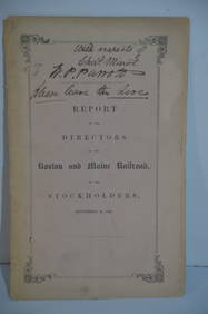
Boston and Maine RR Annual Report-September 12, 1849JM Hobby Supply and Railroad Artifact Auctions4.4(126)See Sold PriceFeb 24, 2024
Troy and Bennington RR Bylaws-1851JM Hobby Supply and Railroad Artifact Auctions4.4(126)See Sold PriceFeb 24, 2024
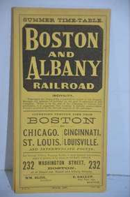
Boston and Albany RR March 17, 1881 Public TimetableJM Hobby Supply and Railroad Artifact Auctions4.4(126)See Sold PriceFeb 24, 2024
WASHINGTON, JACKSON and other HISTORICAL AMERICANAJohn McInnis Auctioneers,LLC4.6(504)See Sold PriceFeb 24, 2024
1818 RARE Geography Made Easy MAPS Jedidiah Morse Boston Indians Atlas AsiaSchilb Antiquarian Rare Books4.8(422)See Sold PriceMar 31, 2024
[DOUGLASS, Frederick (1818-1895)]. [WARREN, George Kendall (1824-1884), attrib.] Silver gelatinFreeman's | Hindman4.4(1.6k)See Sold PriceFeb 27, 2024
NORTHERN AFRICA. Morocco Tunisia Algeria. Caravan routes. RAPKIN/TALLIS 1851 mapJasper524.5(9.8k)See Sold PriceFeb 28, 2024
NORTHERN AFRICA. Morocco Tunisia Algeria. Caravan routes.TALLIS/RAPKIN 1851 mapJasper524.5(9.8k)See Sold PriceFeb 28, 2024
NORTHERN AFRICA. Morocco Tunisia Algeria. Caravan routes. RAPKIN/TALLIS 1851 mapJasper524.5(9.8k)See Sold PriceFeb 28, 2024


![[DOUGLASS, Frederick (1818-1895)]. [WARREN, George Kendall (1824-1884), attrib.] Silver gelatin (1 of 2)](https://p1.liveauctioneers.com/197/319238/171467832_1_x.jpg?height=282&quality=70&version=1707520367)