ATLAS of ANTIENT GEOGRAPHY by SAMUEL BUTLER 1843John McInnis Auctioneers,LLC4.5(505)See Sold PriceFeb 24, 2024
18TH C. ANTIQUE MAP: FRENCH & INDIAN WAR, FRAMEDThomaston Place Auction Galleries4.4(394)See Sold PriceFeb 24, 2024
Rand McNally Railroad Map Cabinet w/ 21 Railroad MapsRail & Road Auctions4.6(165)See Sold PriceMar 08, 2024
Keith Haring - Ink on New York Map, Best Buddies, Inscribed, Signed, and DatedSapphire Auction Gallery4.1(67)See Sold PriceMar 02, 2024
LATE 17TH C. FRENCH MAP OF THE NEW WORLD BY ALEXIS-HUBERT JAILLOT (1632-1712)Thomaston Place Auction Galleries4.4(394)See Sold PriceFeb 24, 2024
Central Railroad of New Jersey Map of Sandy Hook Route-ca. 1903JM Hobby Supply and Railroad Artifact Auctions4.4(127)See Sold PriceFeb 24, 2024
Lot of Six Mixed Atlas Box Cars-HO Scale-New in BoxJM Hobby Supply and Railroad Artifact Auctions4.4(127)See Sold PriceFeb 25, 2024
Rand McNally/Santa Fe Railroad Map of Iowa-1912JM Hobby Supply and Railroad Artifact Auctions4.4(127)See Sold PriceFeb 24, 2024
NICOLAES VISSCHER (NETHERLANDS, 1618-1709) MAP OF THE NEW WORLDThomaston Place Auction Galleries4.4(394)See Sold PriceFeb 24, 2024
17TH C. WORLD MAP BY NICOLAES VISSCHER (NETHERLANDS, 1618-1709)Thomaston Place Auction Galleries4.4(394)See Sold PriceFeb 24, 2024
Lot of Six Mixed Atlas Cabooses-HO Scale-New in BoxJM Hobby Supply and Railroad Artifact Auctions4.4(127)See Sold PriceFeb 25, 2024
Sold1807 Marshall Map Showing New York City in 1776 -- IleTitle/Content of Map: 1807 Marshall Map Showing New York City in 1776 -- Ile de New-York. Partie de Long-Island ou de l'Ile Longue, et Positions des Armees Americaine et Britannique, apres le Combat LSee Sold Price
Marshall: Antique Map Showing New York City in 1776Map: 1807 Marshall Map Showing New York City in 1776 -- Ile de New-York. Partie de Long-Island ou de l'Ile Longue, et Positions des Armees Americaine et Britannique, apres le Combat Livre sur HauteursSee Sold Price
Marshall: Antique Map Showing New York City in 1776Map: 1807 Marshall Map Showing New York City in 1776 -- Ile de New-York. Partie de Long-Island ou de l'Ile Longue, et Positions des Armees Americaine et Britannique, apres le Combat Livre sur HauteursSee Sold Price
Marshall: Antique Map Showing New York City in 1776Title/Content of Map: 1807 Marshall Map Showing New York City in 1776 -- Ile de New-York. Partie de Long-Island ou de l'Ile Longue, et Positions des Armees Americaine et Britannique, apres le Combat LSee Sold Price
Marshall: Antique Map Showing New York City in 1776Title/Content of Map: 1807 Marshall Map Showing New York City in 1776 -- Ile de New-York. Partie de Long-Island ou de l'Ile Longue, et Positions des Armees Americaine et Britannique, apres le Combat LSee Sold Price
Marshall: Antique Map Showing New York City in 1776Title/Content of Map: 1807 Marshall Map Showing New York City in 1776 -- Ile de New-York. Partie de Long-Island ou de l'Ile Longue, et Positions des Armees Americaine et Britannique, apres le Combat LSee Sold Price
Antique Map Shows New York City in 1776, Marshall, 1807Antique Map Showing New York City in 1776 -- Ile de New-York. Partie de Long-Island ou de l'Ile Longue, et Positions des Armees Americaine et Britannique, apres le Combat Livre sur Hauteurs, le 27 AouSee Sold Price
SoldBuache: Antique Map of New York, Long Island, 1807Map: Ile de New-York Partie de Long-Island ou de l'Ile Longue et positions des armées Américaine et Britannique après le combat livré sur les hauteurs, le 27 Août, 1776. Maker: Buache, Jean NicolSee Sold Price
1807 Map NY Island Rev. War Plan C.P. WayneA Plan of New York Island and part of Long Island. Showing the Position of the American and British Armies, before, at, and after the Engagement on the Heights, August 27th, 1776, from a ten map atlasSee Sold Price
SoldHinton, map of New York City, 1776ANONYMOUS (British, Late 18th Century). [Map] A Plan of the City and Environs of New York in North America. Engraving from the Universal Magazine, November 1776. London: J. Hinton, 1776. 12 1/4" x 15See Sold Price
Sold1832 Marshall Revolutionary War Map of New York City --Title/Content of Map: 1832 Marshall Revolutionary War Map of New York City -- Plan of New York Island and Part of Long Island Shewing the Position of the American & British Armies before, at, and afteSee Sold Price
SoldRevolutionary War Map Showing British Troop MovementsRevolutionary War Map Showing British Troop Movements in New York City Areacopperplate engraving, as follows, Map of the Progress of his Majesty's Armies in New York During the late Campaign IllustratSee Sold Price
1807 New England Map: New Jersey, Pennsylvania, NewOriginal lithograph from French edition of Marshall's Life of Washington by John Marshall, 1807. Map displays New Jersey, Pennsylvania, New York, New England states, and southern Canada. Dimensions: 2See Sold Price
Map of New York City from 1859Original map showing the city of New York from 1859. Map reads, "Map of Partition Among the Heirs at Law, Gerald Stuyestant of a Portion of the Lands in the City of New York of which he died siezed."See Sold Price
Map of New York City Showing Portions of Brooklyn,Title: Map of New York City Showing Portions of Brooklyn, Jersey City, and Westchester Co. Publication Date: c1901 Cartographer: RAND, MCNALLY & CO. Publisher: RAND, MCNALLY & CO. Size: 26Height - 19WSee Sold Price
NEW YORK CITY town map plan. Lower/midtown ManhattanTITLE/CONTENT OF MAP: 'New York North Sheet' The top image on the right hand side shows the entire map. To view a close up of the map showing the level of printed detail, please click on the bottom imSee Sold Price
SoldNYC’s early rapid transit system, McNally, 1903Map of New York City Showing Portions of Brooklyn, Jersey City and Westchester Co. This huge map, with a 1903 date, was probably published late in the year pointing to the opening of the city’s rapiSee Sold Price
Sold1901 Map of New York City Transportation1901 Map of New York City showing passenger transportation systems. Map of New York City except Richmond borough showing passenger transportation systems July 1901. Supplement to Street Railway JournaSee Sold Price
Rand McNally: Map of NYC Early Transit System, 1903Scarce map showing NYC’s early rapid transit system. Rand McNally, 1903. 19 x 26 inches. Map of New York City Showing Portions of Brooklyn, Jersey City and Westchester Co. This huge map, with a 1903See Sold Price
Scarce map of NYC’s early rapid transit, McNally 1903Map of New York City Showing Portions of Brooklyn, Jersey City and Westchester Co. This huge map, with a 1903 date, was probably published late in the year pointing to the opening of the city’s rapiSee Sold Price
Scarce map of NYC’s early rapid transit, McNally 1903Reserve Reduced! Map of New York City Showing Portions of Brooklyn, Jersey City and Westchester Co. This huge map, with a 1903 date, was probably published late in the year pointing to the opening ofSee Sold Price
SoldMap of New York City[ANTIQUARIAN MAP; NEW YORK CITY] MAP OF NEW YORK CITY Showing Portions of Brooklyn, Jersey City, and Westchester Co., Rand-McNally & Co., 1899, original large map 27” high x 22” across including aSee Sold Price
SoldMap, Plan and Environs, New York, C. 1776The Unversal Magazine plan of the City of New York is among the earliest obtainable maps of New York City.Appearing only 13 years after Bellin's Ville De Manath ou Nouvelle-Yorc, the earliest obtainabSee Sold Price
Sold1807 New York City plat map,manuscript, "Peter Smith's Lot", adjacent to Washington Street, signed "Charles Loss" as City Surveyor, 12-1/2 x 8 in.; with related New York and Rockland County archive, 1796-1838, 31 indentures andSee Sold Price
Crams Railroad Map of New York-1881JM Hobby Supply and Railroad Artifact Auctions4.4(127)See Sold PriceFeb 24, 2024
Erie Railway Tourist Book/Magazine-1874JM Hobby Supply and Railroad Artifact Auctions4.4(127)See Sold PriceFeb 24, 2024
George Hayward - Map of the City of New York 1854Dane Fine Art Auctions4.4(498)See Sold PriceMar 07, 2024
Vintage County Map Of NY State Plate EngravingThe Benefit Shop Foundation Inc.4.3(3k)See Sold PriceFeb 28, 2024
Pair of The Gateway to a Continent Books - Grand Central Zone and 1939 World's FairRail & Road Auctions4.6(165)See Sold PriceMar 07, 2024
ANDREW RAYMOND JANSON OIL ON BOARD ADIRONDACKSCharleston Estate Services Ltd.4.5(72)See Sold PriceMar 03, 2024
Johann Homann Hand-Colored Map Engraving, c. 1730Auctions at Showplace4.6(744)See Sold PriceMar 17, 2024
Willem Blaeu, Etc. 17th C. Antiquarian Maps, 2Auctions at Showplace4.6(744)See Sold PriceMar 17, 2024
Alfred Salzman, Etc. JNF Tin Tzedakah Boxes, 3Auctions at Showplace4.6(744)See Sold PriceApr 07, 2024
Georg Bockler Map of Ancient Jerulsaem EtchingAuctions at Showplace4.6(744)See Sold PriceApr 07, 2024
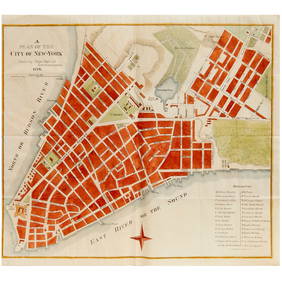
Black and white map of part of New York City (mostly Manhattan)Proverde Auctions4.3(3)See Sold PriceFeb 28, 2024
Laminated Unique Media New York City MapRapid Estate Liquidators and Auction Gallery4.5(1.1k)See Sold PriceFeb 29, 2024
Hudson River Map & North American Postcards, 45Auctions at Showplace4.6(744)See Sold PriceFeb 13, 2025