ATLAS of ANTIENT GEOGRAPHY by SAMUEL BUTLER 1843John McInnis Auctioneers,LLC4.5(505)See Sold PriceFeb 24, 2024
18TH C. ANTIQUE MAP: FRENCH & INDIAN WAR, FRAMEDThomaston Place Auction Galleries4.4(393)See Sold PriceFeb 24, 2024
Rand McNally Railroad Map Cabinet w/ 21 Railroad MapsRail & Road Auctions4.6(165)See Sold PriceMar 08, 2024
Keith Haring - Ink on New York Map, Best Buddies, Inscribed, Signed, and DatedSapphire Auction Gallery4(67)See Sold PriceMar 02, 2024
LATE 17TH C. FRENCH MAP OF THE NEW WORLD BY ALEXIS-HUBERT JAILLOT (1632-1712)Thomaston Place Auction Galleries4.4(393)See Sold PriceFeb 24, 2024
Central Railroad of New Jersey Map of Sandy Hook Route-ca. 1903JM Hobby Supply and Railroad Artifact Auctions4.4(127)See Sold PriceFeb 24, 2024
Lot of Six Mixed Atlas Box Cars-HO Scale-New in BoxJM Hobby Supply and Railroad Artifact Auctions4.4(127)See Sold PriceFeb 25, 2024
Rand McNally/Santa Fe Railroad Map of Iowa-1912JM Hobby Supply and Railroad Artifact Auctions4.4(127)See Sold PriceFeb 24, 2024
NICOLAES VISSCHER (NETHERLANDS, 1618-1709) MAP OF THE NEW WORLDThomaston Place Auction Galleries4.4(393)See Sold PriceFeb 24, 2024
17TH C. WORLD MAP BY NICOLAES VISSCHER (NETHERLANDS, 1618-1709)Thomaston Place Auction Galleries4.4(393)See Sold PriceFeb 24, 2024
Lot of Six Mixed Atlas Cabooses-HO Scale-New in BoxJM Hobby Supply and Railroad Artifact Auctions4.4(127)See Sold PriceFeb 25, 2024
Sold17TH C. MAP OF GERMANY TYPUS FRISIAE ORIENTALISDimensions: (Frame) H 19.5" x W 23.75" (Sight) H 15" x W 19.5" Condition: Holes to map. Discoloration and stains to paper. Wear to frame.See Sold Price
SoldMap, "Typus Frisiae Orientalis", by William Blaeu,Map, "Typus Frisiae Orientalis", by William Blaeu, Amsterdam, c. 1630's, a masterful piece of classic Dutch cartography, this copper plate engraving shows the East Frisian Region of Northewestern GerSee Sold Price
Sold17th C. Map, INDIAE ORIENTALIS, Abraham OrteliusOriginal double folio hand colored map titled, "INDIAE ORIENTALIS INSULARUMQVE ADIACIENTI UM TYPUS" in stylized cartouche. Map printed circa 1587, Amsterdam, from atlas, "Theatrum Orbis Terrarum", theSee Sold Price
SoldBleau map: Typus Frisae Orientalis, c1640-1670[Germany/Lower Saxony]. John Bleau. Typus Frisiae Orientalis. Auctore Ubbone Emmio. Double-page engraved map of East Frisee, with inset of the area affected by the Dollart Flood in 1277. Amst: c.1640-See Sold Price
Sold17th C. Map of Germany17th century, map of Germany, hand-colored, original frame, 19 7/8"h x 23 1/2"w (view), 27 5/8"h x 31"w (frame).See Sold Price
(2) 17thc. Maps of Germany and Italy(2) Circa 1620 Colored Maps of Westphalia and Mantova. 15 x 19 inches each. Framed Condition: GoodSee Sold Price
(3) RARE 17TH C. SANSON MAPS OF GERMANYAlexis-Hubert Jaillot (c. 1632-1712); Nicolas Sanson (1600-1667). All single sheet, including: "Le Duce de Iuliers"; "l'Evesche de Munster"; Le Comte de la Marck", hand colored engravings, published 1See Sold Price
Sold(3) RARE 17TH C. SANSON MAPS OF GERMANYAlexis-Hubert Jaillot (c. 1632-1712); Nicolas Sanson (1600-1667). All single sheet, including: "Le Duce de Iuliers"; "l'Evesche de Munster"; Le Comte de la Marck", hand colored engravings, published 1See Sold Price
17th c. Engraved Map Galliae Veteris Typus, Peter KeereFine 17th Century Engraved Map Galliae Veteris Gaul France by Pieter van den (Peter) Keere (Kaerius), 1661 | Galliae Veteris [Of the Old Gaul], Depicting Gaul, France, British Channel, Belgium, FlandeSee Sold Price
(3) ANTIQUE MAPS, GERMANY, 17TH & 18TH C.(lot of 3) Antique maps, including: (1) "Dithmarshen" (Northern Germany), with inset maps of "Brunsbuttel, 1644" and "Meldorpia, 1500," Johannes Mejer (German, c.1606-1674), hand colored, including seSee Sold Price
Early 18th Century German Map of Frisia, c. 1730Early 18th German Century Map of Frisia, c. 1730, the hand colored map entitled "Tabula Frisiae orientalis: olim Vbbonis Emmii deinde Sansonis et Allardi study notes cum variis autographis denuo sizedSee Sold Price
SoldBook Plate and other mapsincluding; 17th c. (?) book page with Nubie (Africa) book plate, 1902 Rand McNally Middle East map (folded), Palestine map in Greeting from Israel card. map of South America, older map of Germany andSee Sold Price
Sold(2) 17TH C. LATIN AMERICAN MAPS, WILLIEM BLAEUGUIANA fiue AMAZONUM REGIO, 15 by 19.75 in. (sight); the other NOVUS BRASILIA TYPUS, 15 by 20 in. both AMSTELODAMI, GUILJELMUS BLAEUW excudit both matted and framed under glassSee Sold Price
Sold(MAP) ORTELIUS, ABRAHAM. India Orientalis, insularumque(MAP) ORTELIUS, ABRAHAM Indiae Orientalis, insularumque adiacienti um typus. [Amsterdam, c. 1590] Engraved map with later hand-coloring depicting the tip of the Arabian Peninsula, India, China, Japan,See Sold Price
Sold[Map] Virginia and Florida, 17th c.Jannson, Jan. "Virginiae partis australis, et Floridae partis orientalis…." Circa 1640s. Measuring from plate-marks 50.5 x 39cm. Hand-colored. Verso with French text, old stub affixed to crease, andSee Sold Price
MAP OF NORTHERN IRELAND, 17th CBy Henrici Hondi. Ultoniae Orientalis pars sumptibus. Size 38 x 34.5 cm. (14 7/8 x 13 3/4 in.)See Sold Price
Ottens, J&R. Daniae Frisiae Groningae & FrisiaeOttens, Josua & Reinier Daniae, Frisiae, Groningae et Orientalis Frisiae Littora 1745 Copperplate engraving; area coloured Printed area: 55.7 x 48.7 cm; 21.9 x 19.2 in Denmark, northern Germany, southSee Sold Price
SoldMap of Ancient Germany by JanssonHeading: Author: Jansson, Jan Title: Germaniae Veteris, Typus Place Published: Amsterdam Publisher: Date Published: c.1640 Description: Copper-engraved map, hand-colored inSee Sold Price
19 Landkarten: 16./17./18. Jh.19 maps : 16th/17th/18th century 1) Hondius: Franckenlandt. Francia orientalis. 2) Palestine or the Promised Land. 3) Reilly: The Fraenkische Kreis, Nro. 96 Vienna, c. 1790. 4) The Bishopric of BamberSee Sold Price
Sold17TH C MAP OF NEW NETHERLANDS - Novi Belgii Novaeque17TH C MAP OF NEW NETHERLANDS - Novi Belgii Novaeque Angliae: nec non partis Virginiae tabula multis in locis emendata. Amsterdam. Andreas Visscher, 1656. Engraving on laid paper, later hand coloring.See Sold Price
Sold17th c. Map of Ireland17th c. Map of Ireland by William Hole- ''Hiberniae Anglis, Yuerdon Britannis Erin incolis, Ierna, London, later hand-coloring, paper age toned. 11 x 13 1/2''See Sold Price
SoldJohn Speed 17th C Map Europe And The Chief CitiesJohn Speed (English, c.1551–1629). A hand colored 17th century map of Europe titled EUROP, AND THE CHIEFE CITIES, featuring description on verso. Measures 16 in. x 21 in. (sight), 20 1/2 in. x 25 1/See Sold Price
Sold17th C. Map of Guernsey, Jersey Islandsframed, not examined out of frame. Frame size: 18" high, 21 3/4" wide. Stains, toning. Provenance: Property of a Madison, CT Collector. Provenance: Purchased at New Haven Colony Historical Society AucSee Sold Price
Sold17TH C, MAP OF NEW ENGLAND, WILLEM BLAEU. FRAMEDWillem Blaeu (Dutch, 1751-1638). "Nova Belgica et Anglia Nova (Map of New Belgium and New England)" -1638, hand colored engraving. Elaborately framed. Approx. 28.5" X 33" (frame), 15.5" x 20" (sight)See Sold Price
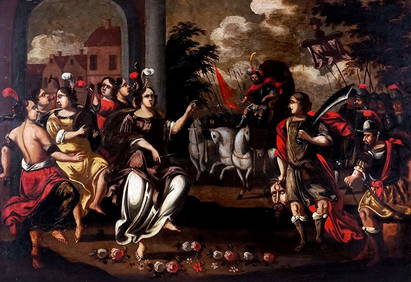
17TH C. ENGLISH CIVIL WAR HISTORY PAINTINGThomaston Place Auction Galleries4.4(393)See Sold PriceFeb 24, 2024
LARGE LATE 17TH C. DUTCH CHART OF CANADA, GREAT LAKES, NEW FRANCE, LABRADOR, HUDSON BAY, BY PIERREThomaston Place Auction Galleries4.4(393)See Sold PriceFeb 24, 2024
17TH C. WORLD MAP BY NICOLAES VISSCHER (NETHERLANDS, 1618-1709)Thomaston Place Auction Galleries4.4(393)See Sold PriceFeb 24, 2024
LATE 17TH C. FRENCH MAP OF THE NEW WORLD BY ALEXIS-HUBERT JAILLOT (1632-1712)Thomaston Place Auction Galleries4.4(393)See Sold PriceFeb 24, 2024
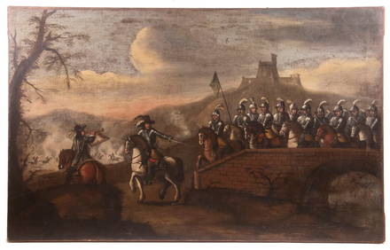
17TH C. ANTIQUE MAP SIEGE OF LA ROCHELLE, FRANCE, FRAMEDThomaston Place Auction Galleries4.4(393)See Sold PriceFeb 24, 2024
17TH C. MAP OF THE BERKSHIRES BY JOHN SPEED, FRAMEDThomaston Place Auction Galleries4.4(393)See Sold PriceFeb 24, 2024
17TH C. ENGLISH LINEAR MAP BY OGILBY, FRAMEDThomaston Place Auction Galleries4.4(393)See Sold PriceFeb 24, 2024
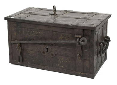
Antique 17th C English Geometric Oak Chest of DrawersKavanagh Auctions4.6(311)See Sold PriceFeb 24, 2024
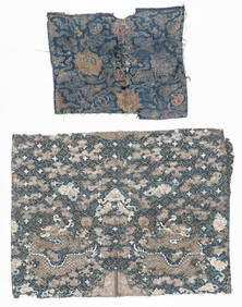
2 Antique Chinese Textile Fragments, 17th C. and 19th C.Material Culture4.6(778)See Sold PriceFeb 29, 2024
17th Century Hand Colored Engraved Map of GermanyGlobal Auctions Company4.3(36)See Sold PriceMar 03, 2024
Willem Blaeu, Etc. 17th C. Antiquarian Maps, 2Auctions at Showplace4.6(740)See Sold PriceMar 17, 2024
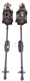
PAIR OF 17th C. STYLE VENETIAN WALL MOUNT LANTERNSLewis & Maese Antiques & Auction4.4(527)See Sold PriceFeb 25, 2024
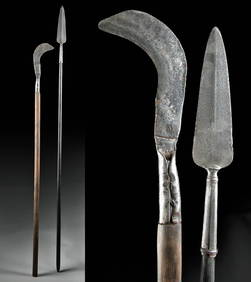
18th C. European Iron Polearms - Spear + BillhookArtemis Fine Arts4.8(1.4k)See Sold PriceFeb 26, 2024
17th C. Niello Plaque + 19th C. Porcelain PaintingArtemis Fine Arts4.8(1.4k)See Sold PriceFeb 26, 2024
1675: ANTIQUE ILLUSTRATED JULIUS CAESAR MAPS OF ROMAN HISTORYNY Elizabeth 4.2(86)See Sold PriceMar 03, 2024


![[Map] Virginia and Florida, 17th c. (1 of 6)](https://p1.liveauctioneers.com/3532/146911/74242490_1_x.jpg?height=282&quality=70&version=1564368564)