ATLAS of ANTIENT GEOGRAPHY by SAMUEL BUTLER 1843John McInnis Auctioneers,LLC4.5(505)See Sold PriceFeb 24, 2024
18TH C. ANTIQUE MAP: FRENCH & INDIAN WAR, FRAMEDThomaston Place Auction Galleries4.4(393)See Sold PriceFeb 24, 2024
Rand McNally Railroad Map Cabinet w/ 21 Railroad MapsRail & Road Auctions4.6(165)See Sold PriceMar 08, 2024
Keith Haring - Ink on New York Map, Best Buddies, Inscribed, Signed, and DatedSapphire Auction Gallery4(67)See Sold PriceMar 02, 2024
LATE 17TH C. FRENCH MAP OF THE NEW WORLD BY ALEXIS-HUBERT JAILLOT (1632-1712)Thomaston Place Auction Galleries4.4(393)See Sold PriceFeb 24, 2024
Central Railroad of New Jersey Map of Sandy Hook Route-ca. 1903JM Hobby Supply and Railroad Artifact Auctions4.4(127)See Sold PriceFeb 24, 2024
Lot of Six Mixed Atlas Box Cars-HO Scale-New in BoxJM Hobby Supply and Railroad Artifact Auctions4.4(127)See Sold PriceFeb 25, 2024
Rand McNally/Santa Fe Railroad Map of Iowa-1912JM Hobby Supply and Railroad Artifact Auctions4.4(127)See Sold PriceFeb 24, 2024
NICOLAES VISSCHER (NETHERLANDS, 1618-1709) MAP OF THE NEW WORLDThomaston Place Auction Galleries4.4(393)See Sold PriceFeb 24, 2024
17TH C. WORLD MAP BY NICOLAES VISSCHER (NETHERLANDS, 1618-1709)Thomaston Place Auction Galleries4.4(393)See Sold PriceFeb 24, 2024
Lot of Six Mixed Atlas Cabooses-HO Scale-New in BoxJM Hobby Supply and Railroad Artifact Auctions4.4(127)See Sold PriceFeb 25, 2024
Sold17th c. J. Blaeu (?) Engraved Map of Asia Minor17th c. J. Blaeu (?), 1596 - 1673 copper engraved map of Asia Minor, hand colored accents including land boarders, cities and sea serpents, hand colored figures and ships, highlighted with gold indicaSee Sold Price
Sold[Blaeu (J & W)] Natolia, quae olim Asia MinorTurkey.- [Blaeu (J & W)] Natolia, quae olim Asia Minor, engraved map of Turkey, showing the Aegean and Mediterranean seas, with numerous islands, including part of Crete, Cyprus, and ships atSee Sold Price
Sold[Blaeu (J & W)] Natolia, quae olim Asia Minor[Blaeu (J & W)] Natolia, quae olim Asia MinorTurkey and surrounding Islands, ornamental cartouche, ships at battle, engraved map with hand-colouring, 385 x 500., French text on verso, centralSee Sold Price
SoldBlaeu (J & W) Natolia, quæ olim Asia MinorBlaeu (Johan and Willem) Natolia, quæ olim Asia Minor,Turkey in Asia, with Cyprus, title banderole above, ships and sea monster, engraved map with hand-colouring in outline, 380 x 495mm., blanSee Sold Price
SoldBlaeu. Natolia, quae olim Asia Minor. c.1640.[Middle East] Blaeu, Willem Jansz. “Natolia, quae olim Asia Minor.” Amsterdam, c.1640. Engraved map. 19 3/4” x 15 1/8”. Text on verso in French. Hand-colored outline. Two cartoSee Sold Price
SoldLOT (2) HANDCOLORED ENGRAVED MAPS, "NAVARRA" ANDLOT (2) HANDCOLORED ENGRAVED MAPS, "NAVARRA" AND "VALENTIA REGNUM", SIGNED G. BLAEU (DUTCH 17TH CENTURY) C.1650. PLATE 15 X 19 3/4"; 16 1/4 X 19 3/4"; FRAMED & GLAZED 25 1/2 X 29 1/2" **DUE TO THE SIZSee Sold Price
SoldBlaeu (J & W) Turcicum ImperiumBlaeu (J & W) Turcicum Imperium, engraved map of Asia, showing part of Europe, Turkey, Egypt, and Arabia, with decorative cartouche, and hand-colouring, 415 x 520mm., Dutch text on verso, someSee Sold Price
Walker: Antique Map of Asia Minor Antiqua, 1852Title/Content of Map: Asia Minor Antiqua Cartographer: WALKER, J. & C./WILLIAM HENRY FRANCIS PLATE Size: 12.25X15.25 "Published under the superintendence of the Society for the Diffusion of Useful KnoSee Sold Price
SoldJ. Blaeu, Antique 17th C. Map of NavarraHand colored engraving. Framed. Approx. 17" H x 20" W w/o frame, 24" H x 27" W framed. From an estate on the Upper West Side. (4050) Some creasing due to age.See Sold Price
Asia Minor AntiquaMap: Asia Minor Antiqua Date: 1852 Cartographer: WALKER, J. & C./WILLIAM HENRY FRANCIS PLATE Publisher: CHARLES KNIGHT/GEORGE COX/S.D.U.K. Size (inches): 12.25X15.25 "Published under the superintendenSee Sold Price
SoldAsia. Willem Blaeu (1571-1638) Asia Noviter DelineAsia. Willem Blaeu (1571-1638) Asia Noviter Delineata. Amsterdam: J. Blaeu, 1635. Engraved copperplate map, colored by hand, printed on two sheets pasted together, matted and framed, 16 x 22 in. NineSee Sold Price
Sold17th C. Hand Colored Engraved Map of Walachia etc.Including parts of Walachia, Serbia, Bulgaria and Romania, from Gerard Mercator's Atlas Minor, published by Jodocus Hondius, Amsterdam, 1610. matted and framed, not examined out of frame / in as-foundSee Sold Price
17th C. Italian Handcolored Map.ENGRAVING. Italian hand colored map, Greek Isles and Asia Minor, Latin inscriptions, by L. Laurenbergio, 17th C. 18" x 21" viewed. Very good condition.See Sold Price
SoldBlaeu (Willem) Comitatus Brechiniae BreknokeBlaeu (Willem) Comitatus Brechiniae Breknoke,engraved map, outline colour, 380 x 500mm., c.1645 § Blaeu (J.) Penbrochia Comitatus et Comitatus Caermaridunum, engraved map, outline colour, 400See Sold Price
Decorative Map of Africa by BlaeuRegna Congo et Angola. Willem Janszoon Blaeu (1571-1638). Engraved map with original hand color in part. Amsterdam: J. Blaeu, c. 1685. 20 1/2 x 23 1/2 inches sheet.See Sold Price
Decorative Map of Africa by BlaeuNigritarum Regio. Johannes Blaeu (1596-1673). Engraved map with original hand color in outline. Amsterdam: J. Blaeu, c. 1650. 20 1/2 x 23 1/2 inches sheet. Decorative map of the western part of AfricaSee Sold Price
Decorative Map of Africa by BlaeuNova Aegypti Tabula. Johannes Blaeu (1596-1673). Engraved map with original hand color in part. Amsterdam, J. Blaeu, c. 1685. 20 1/2 x 23 1/2 inches sheet. A finely engraved and impressive map of EgypSee Sold Price
SoldBleau Map of Flanders hand-colored by master coloristExtrema Americae versus Boream, ubi Terra Nova Nova Francia, adjacentiag... Johannes Blaeu (1596-1673). Engraved map with original hand color in full. Amsterdam: J. Blaeu, c. 1662. 21 x 24 3/4 inchesSee Sold Price
SoldJansson map of Asia Minor c.1650Heading: Author: Jansson, Jan Title: Natolia, quae olim Asia Minor Place Published: Amsterdam Publisher: Date Published: c.1650 Description: Copper-engraved map, hand-colorSee Sold Price
SoldBlaeu (J) BrasiliaBlaeu (J) Brasilia, engraved map of Brazil, with decorative cartouche and hand-colouring, 385 x 494mm., Dutch text on verso, some browning, light text show-through, [Amsterdam], [c.1650].See Sold Price
(MAP) BLAEU, (WILLEM). [Amsterdam, c. 1662].(MAP) BLAEU, (WILLEM) Asia noviter delineata, [Amsterdam, c. 1662]. Engraved map of Asia, hand-colored, featuring ships and sea monsters, and bordered by panels of city views and national costume figuSee Sold Price
SoldOrtelius, ''Graceia, Sophiani''[Greece]. Abraham Ortelius. Graecia, Sophiani. Double-page engraved map of Greece and western Asia Minor, based on an earlier map by Sopianos. c.1579-1607. 13 3/4 x 19 1/2 inches. Latin text on rightSee Sold Price
[NOORD-HOLLAND] – “KAERTE van alle de, Wieringerwaerdt, Zyp ende Kalands-Ooge, genaemt het Koe-Gras, [..]'. Engraved map with cartouche & compass-rose (after C.J. Visscher). (Publ. by J. Blaeu, ca. 1662). Ca. 47 x 56,5 cm. Behind passepaSee Sold Price
SoldCarne, Syria, The Holy Land, Asia Minor, &c.Carne (John) Syria, The Holy Land, Asia Minor, &c.3 vol., engraved additional pictorial titles, 4 maps and 126 plates, occasional spotting, contemporary half calf, spines richly gilt rubbed, 4See Sold Price
1855 Map of New York & Erie Railroad and 1917 Trespassing On Railway Property Is A MisdemeanorRail & Road Auctions4.6(165)See Sold PriceMar 07, 2024
Willem Blaeu, Etc. 17th C. Antiquarian Maps, 2Auctions at Showplace4.6(740)See Sold PriceMar 17, 2024
Map: A 17thC engraved and hand coloured map of Scotland titled Strath-Navernia / Strath Navern afterClaydon Auctioneers Ltd4.3(125)See Sold PriceFeb 26, 2024
1742 BIBLE in FRENCH antique OLD & NEW TESTAMENT leather boundJasper524.5(9.9k)See Sold PriceFeb 27, 2024
1675 ELZEVIER JULIUS CAESAR antique ILLUSTRATED w/ MAPS ROMAN HISTORYJasper524.5(9.9k)See Sold PriceFeb 27, 2024
1704 DESCRIPTION OF ALL THE SEATS OF THE PRESENT WARS OF EUROPE antique w/ MAPSJasper524.5(9.9k)See Sold PriceFeb 27, 2024
Railways & Transport.- [Prospectus] The Dorking, Brighton, and Arundel Atmospheric Railway, byForum Auctions4.3(53)See Sold PriceFeb 29, 2024
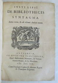
1622 J LIPSIUS WORKS ON THE ALEXANDRIAN LIBRARY & OTHER ANTIQUE VELLUM PLANTINNY Elizabeth 4.2(86)See Sold PriceMar 03, 2024
ANTIQUE JUDAICA VELLUM BINDING, ILLUSTRATED IN DE JURE NATURALI ET GENTIUM (1695).NY Elizabeth 4.2(86)See Sold PriceMar 03, 2024
ANTIQUE BIBLE ANTIQUITIES, 1671, J.C. DIETERICH FOLIO BOUND IN VELLUMNY Elizabeth 4.2(86)See Sold PriceMar 03, 2024
1675: ANTIQUE ILLUSTRATED JULIUS CAESAR MAPS OF ROMAN HISTORYNY Elizabeth 4.2(86)See Sold PriceMar 03, 2024
Antique Map - Views on the coast of Asia. J. Webber del. Engraved after J. Webber and W. Bligh.Proverde Auctions4.3(3)See Sold PriceFeb 28, 2024


![[Blaeu (J & W)] Natolia, quae olim Asia Minor (1 of 1)](https://p1.liveauctioneers.com/410/3027/1300367_1_x.jpg?height=282&quality=70)
![[Blaeu (J & W)] Natolia, quae olim Asia Minor (1 of 1)](https://p1.liveauctioneers.com/410/8611/1592415_1_x.jpg?height=282&quality=70)


![(MAP) BLAEU, (WILLEM). [Amsterdam, c. 1662]. (1 of 1)](https://p1.liveauctioneers.com/197/30916/12134079_1_x.jpg?height=282&quality=70&version=1342619735)

![[NOORD-HOLLAND] – “KAERTE van alle de (1 of 1)](https://p1.liveauctioneers.com/7040/154798/78157470_1_x.jpg?height=282&quality=70&version=1573578708)


![Railways & Transport.- [Prospectus] The Dorking, Brighton, and Arundel Atmospheric Railway, by (1 of 1)](https://p1.liveauctioneers.com/5458/319736/171654703_1_x.jpg?height=282&quality=70&version=1708010439)