ATLAS of ANTIENT GEOGRAPHY by SAMUEL BUTLER 1843John McInnis Auctioneers,LLC4.6(502)See Sold PriceFeb 24, 2024
18TH C. ANTIQUE MAP: FRENCH & INDIAN WAR, FRAMEDThomaston Place Auction Galleries4.4(386)See Sold PriceFeb 24, 2024
Rand McNally Railroad Map Cabinet w/ 21 Railroad MapsRail & Road Auctions4.6(165)See Sold PriceMar 08, 2024
Keith Haring - Ink on New York Map, Best Buddies, Inscribed, Signed, and DatedSapphire Auction Gallery4(67)See Sold PriceMar 02, 2024
LATE 17TH C. FRENCH MAP OF THE NEW WORLD BY ALEXIS-HUBERT JAILLOT (1632-1712)Thomaston Place Auction Galleries4.4(386)See Sold PriceFeb 24, 2024
Central Railroad of New Jersey Map of Sandy Hook Route-ca. 1903JM Hobby Supply and Railroad Artifact Auctions4.4(126)See Sold PriceFeb 24, 2024
Lot of Six Mixed Atlas Box Cars-HO Scale-New in BoxJM Hobby Supply and Railroad Artifact Auctions4.4(126)See Sold PriceFeb 25, 2024
Rand McNally/Santa Fe Railroad Map of Iowa-1912JM Hobby Supply and Railroad Artifact Auctions4.4(126)See Sold PriceFeb 24, 2024
NICOLAES VISSCHER (NETHERLANDS, 1618-1709) MAP OF THE NEW WORLDThomaston Place Auction Galleries4.4(386)See Sold PriceFeb 24, 2024
17TH C. WORLD MAP BY NICOLAES VISSCHER (NETHERLANDS, 1618-1709)Thomaston Place Auction Galleries4.4(386)See Sold PriceFeb 24, 2024
Lot of Six Mixed Atlas Cabooses-HO Scale-New in BoxJM Hobby Supply and Railroad Artifact Auctions4.4(126)See Sold PriceFeb 25, 2024
1783 Delisle/Dezauche Map of Great Lakes and Canada --Title: 1783 Delisle/Dezauche Map of Great Lakes and Canada -- Carte du Canada qui Comprend la Partie Septentrionale des Etars Unis d'Amerique… Cartographer: Delisle/Dezauche Year / Place: 1783, PariSee Sold Price
1783 Delisle/Dezauche Map of Great Lakes and Canada --Title: 1783 Delisle/Dezauche Map of Great Lakes and Canada -- Carte du Canada qui Comprend la Partie Septentrionale des Etars Unis d'Amerique… Cartographer: Delisle/Dezauche Year/Place: 1783, PaSee Sold Price
Soldc. 1755 Handcolored Map: Great Lakes and CanadaHistoric Maps c. 1755 Handcolored Map of The Great Lakes and Canada c. 1755 (1755-Dated) French and Indian War Era, Hand-colored, Copper Plate-engraved, Map, Primarily of North America Great Lakes RegSee Sold Price
Soldc. 1755 Handcolored Map: Great Lakes and CanadaHistoric Maps c. 1755 Handcolored Map of The Great Lakes and Canada c. 1755 (1755-Dated) French and Indian War Era, Hand-colored, Copper Plate-engraved, Map, Primarily of North America Great Lakes RegSee Sold Price
Bonne: Antique Map of the Great Lakes & Canada, 1780Title/Content of Map: 'Partie Occidentale du Canada, Contenant les Cinq Grand Lacs, avec les Pays circonvoisins' A map of the North American Great Lakes, the Mid-West, the Plains States and much of OnSee Sold Price
Bonne: Antique Map of the Great Lakes & Canada, 1780Title/Content of Map: 'Partie Occidentale du Canada, Contenant les Cinq Grand Lacs, avec les Pays circonvoisins' A map of the North American Great Lakes, the Mid-West, the Plains States and much of OnSee Sold Price
SDUK: Antique Map of the Great Lakes, Canada, 1846Title/Content of Map: 'NORTH AMERICA, SHEET III., Upper Canada and New Brunswick with parts of New York, Pennsylvania and Michigan'. The map shows the historic districts of Upper Canada (Ontario) as tSee Sold Price
Bonne Map of Great Lakes & Western CanadaTitle: Partie Occidentale du Canada, contenant les cinq Grand Lacs, avec les Pays Circonvoisins Author: Bonne, Rigobert Description: Copper-engraved map. 20.6x31.2 cm. (8½x12½").From Lake Ontario weSee Sold Price
SDUK: Antique Map of the Great Lakes, Canada, 1844Title/Content of Map: 'NORTH AMERICA, SHEET III., Upper Canada and New Brunswick with parts of New York, Pennsylvania and Michigan' The map shows the historic districts of Upper Canada (Ontario) as thSee Sold Price
SoldBonne Map of Great Lakes & Western CanadaTitle: Partie Occidentale du Canada, contenant les cinq Grand Lacs, avec les Pays Circonvoisins Author: Bonne, Rigobert Description: Copper-engraved map, modern hand-coloring. 20.6x31.2 cm. (8½x12½"See Sold Price
MAPS - Canada & Great Lakes. HildburghausenEastern Canada, Great Lakes. Hildburghausen Biblio Institut, [Lot of 2] Ober- (Upper-) Canada [and] Neueste Karte von Lower Canada. (Unter-Canada)..., 1844-45 (dated). Hand Color. This pair of maps foSee Sold Price
Morden: Map of Florida & Ye Great Lakes of Canada, 1693Map: A Map of Florida and Ye Great Lakes of Canada Cartographer: Robert Morden Publisher: Robert Morden Date: 1693 Size: 5 x 5 inches One of the earliest obtainable English maps of the American coloniSee Sold Price
Santini/d'Anville: Map of Canada Great Lakes, 1784TITLE/CONTENT OF MAP: 'Partie Occidentale du Canada et Septentrionale de la Louisiane avec une Partie de la Pensilvanie par le Sr. d'Anville de l'Academie Rle. des Inscriptions et Belles-Lettres et deSee Sold Price
SDUK: Antique Map of Upper Canada & Great Lakes, 1846Title/Content of Map: 'NORTH AMERICA, SHEET III., Upper Canada and New Brunswick with parts of New York, Pennsylvania and Michigan' The map shows the historic districts of Upper Canada (Ontario) as thSee Sold Price
Sold1749 Robert de Vaugondy Map of Great Lakes Region --Title/Content of Map: 1749 Robert de Vaugondy Map of Great Lakes Region -- Les Lacs du Canada et Nouvelle Angleterre Date: 1749, Paris Cartographer: G Robert de Vaugondy Size: 6.5 X 8,5 in. This is anSee Sold Price
SoldBonne: Map of the Great Lakes, 1880Map: 1880 Bonne Map of the Great Lakes -- Partie Occidentale du Canada, contenant les cinq Grands Lacs, avec les Pays Circonvoisins Cartographer: R. Bonne Year / Place: 1780 Paris Map Dimensions: 8.3See Sold Price
1880 Bonne Map of the Great Lakes1880 Bonne Map of the Great Lakes -- Partie Occidentale du Canada, contenant les cinq Grands Lacs, avec les Pays Circonvoisins R. Bonne 1780 Paris 8.3 x 12.5 in. This French map is one of the most intSee Sold Price
Sold1780 Bonne Map of the Great Lakes -- Partie OccidentaleTitle/Content of Map: 1780 Bonne Map of the Great Lakes -- Partie Occidentale du Canada Contenant les Cinq Grands Lacs, avec les Pays Circonvoisins Date Printed: 1780, Paris Cartographer: R. Bonne SizSee Sold Price
SoldMorden (Robert) - A small group of maps of the Americasincluding the insular California map, 'New Mexico vel New Granata et Marata et California', also 'A Map of Florida and ye Great Lakes of Canada', 'A Map of the Western Islands', Chili and Paragay', anSee Sold Price
SoldMorden: Antique Map of Florida & Great Lakes, 16931693 map of Florida and the Great Lakes by Robert Morden. Measures 5" x 5". One of the very earliest English maps of the American colonies. Titled "A Map of Florida and Ye Great Lakes of Canada." FullSee Sold Price
SoldHand-Colored Engraved Maps - Primarily NHand-Colored Engraved Maps - Primarily North American subjects - Small formats, including: Morden, Rob. "A Map of Florida and the Great Lakes of Canada." * Bonne, Rigobert. "Partie Occidentale du CanaSee Sold Price
SoldAmericana. - A mixed group of United States and Canadaincluding city maps of Detroit, Omaha City, Honolulu and San Francisco, state and regional maps of Nevada, Newfoundland, the Great Lakes, Western Canada, and several others, folding pocket maps and coSee Sold Price
1700 Sanson Map of Great Lakes and American East Coast -- Le Canada, ou Nouvelle France, &c. TireeTitle: 1700 Sanson Map of Great Lakes and American East Coast -- Le Canada, ou Nouvelle France, &c. Tiree de Diverses Relations des Francois, Anglois, Hollandois, &c. Cartographer: N Sanson Year / PlaSee Sold Price
Chatelain Map of the Great Lakes, 17201720 Chatelain Map of the Great Lakes - Carte Particuliere Du Fleuve Saint Louis Dressee Sur Les Lieux Avec Les Noms Des Sauvages Du Pais…. Map of Canada, the Great Lakes and the Course of the MissiSee Sold Price
1875 Rand Avery and Co. Map of Express Companies and Railroads of the USA and CanadaJM Hobby Supply and Railroad Artifact Auctions4.4(126)See Sold PriceFeb 24, 2024
Rand McNally Railroad Map of Arizona-1909JM Hobby Supply and Railroad Artifact Auctions4.4(126)See Sold PriceFeb 24, 2024
Rand McNally Railroad Map of Washington-1906JM Hobby Supply and Railroad Artifact Auctions4.4(126)See Sold PriceFeb 24, 2024
Union Pacific RR Map of the United States-1926JM Hobby Supply and Railroad Artifact Auctions4.4(126)See Sold PriceFeb 24, 2024
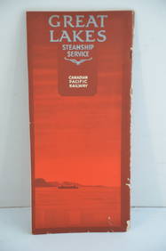
Canadian Pacific RY Great Lakes Steamship 1919 Brochure and TimetableJM Hobby Supply and Railroad Artifact Auctions4.4(126)See Sold PriceFeb 24, 2024
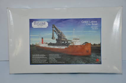
Sylvan Models Great Lakes Ore Boat Kit-HO Scale-New in BoxJM Hobby Supply and Railroad Artifact Auctions4.4(126)See Sold PriceFeb 25, 2024
LATE 18TH C. VERY LARGE CHART OF NORTHEAST CANADA BY DES BARRES (1721-1824), 1780, FRAMEDThomaston Place Auction Galleries4.4(386)See Sold PriceFeb 24, 2024
LARGE LATE 17TH C. DUTCH CHART OF CANADA, GREAT LAKES, NEW FRANCE, LABRADOR, HUDSON BAY, BY PIERREThomaston Place Auction Galleries4.4(386)See Sold PriceFeb 24, 2024
LATE 17TH C. FRENCH MAP OF THE NEW WORLD BY ALEXIS-HUBERT JAILLOT (1632-1712)Thomaston Place Auction Galleries4.4(386)See Sold PriceFeb 24, 2024
DUNLEVIE c1856 Map Counties Of Gaspe & Bonaventure Quebec Canada SCARCE! #2Luis Porretta Fine Arts4.3(10)See Sold PriceMar 02, 2024
[MAP]. [ALBRIZZI, Giambatista, 1698-1777]. Carta Geografica...Potter & Potter Auctions4.6(539)See Sold PriceMar 07, 2024
Audubon, Imperial Folio - Canada Lynx. 16Trillium Antique Prints & Rare Books4.5(30)See Sold PriceFeb 24, 2024
FIVE ANTIQUE STERLING SILVER SOUVENIR TEASPOONS & FORKMannys Jewelry4.6(331)See Sold PriceMar 14, 2024
Robert de Vaugondy - Map of Canada - Mer de l' Ouest or Sea of the West and a Northwest PassageProverde Auctions4.3(3)See Sold PriceFeb 28, 2024
Herman Moll A New Map of Ye North Parts of AmericaWillow Auction House4.5(283)See Sold PriceMar 14, 2024


![[MAP]. [ALBRIZZI, Giambatista, 1698-1777]. Carta Geografica... (1 of 1)](https://p1.liveauctioneers.com/928/318880/171361280_1_x.jpg?height=282&quality=70&version=1707501302)