Soldc. 1755 Handcolored Map: Great Lakes and CanadaHistoric Maps c. 1755 Handcolored Map of The Great Lakes and Canada c. 1755 (1755-Dated) French and Indian War Era, Hand-colored, Copper Plate-engraved, Map, Primarily of North America Great Lakes RegSee Sold Price
Soldc. 1755 Handcolored Map: Great Lakes and CanadaHistoric Maps c. 1755 Handcolored Map of The Great Lakes and Canada c. 1755 (1755-Dated) French and Indian War Era, Hand-colored, Copper Plate-engraved, Map, Primarily of North America Great Lakes RegSee Sold Price
Sold[GREAT LAKES REGION]. ROBERT DE VAUGONDY, Didier[GREAT LAKES REGION]. ROBERT DE VAUGONDY, Didier (1723–1786). Partie De l’Amerique Septent? qui comprend La Nouvelle France ou Le Canada. Paris, 1755. Hand–colored engraved map of eaSee Sold Price
SoldHand-colored map of Western Canada and ThHand-colored map of Western Canada and The Great Lakes from Mitchell's Atlas, c. 1860, in archival frame.See Sold Price
SoldBellin's Map of Canada and the Great Lakes Region,Bellin's Map of Canada and the Great Lakes Region, 1755 Bellin, Jacques Nicolas. Partie Occidentale de la Nouvelle France ou du Canada. Title cartouche hand-colored, lakes outlined. Plate 17.5 x 21.See Sold Price
SoldA Map of the Five Great LakesHeading: Author: London Magazine Title: A Map of the Five Great Lakes with Part of Pensilvania, New York, Canada and Hudsons Bay Territories &c. Place Published: London Publisher: Date PublishedSee Sold Price
SoldHand-Colored Engraved Maps - Primarily NHand-Colored Engraved Maps - Primarily North American subjects - Small formats, including: Morden, Rob. "A Map of Florida and the Great Lakes of Canada." * Bonne, Rigobert. "Partie Occidentale du CanaSee Sold Price
SoldNova Scotia and Cape Breton. Thomas Jeffreys (1719Nova Scotia and Cape Breton. Thomas Jeffreys (1719-1771) A New Map of Nova Scotia and Cape Britain with the adjacent parts of New England and Canada. London, c. 1755. Engraved hand-colored map, printeSee Sold Price
SoldMap of the Basin of the St. Lawrence.[Map] Keefer, Thomas C. Map of the Basin of the St. Lawrence. New York: Ackerman Litho., 1853. Hand-colored map depicting the Great Lakes Region for Isreal de Wolf Andrew’s report for the TreasuSee Sold Price
SoldGREAT LAKES REGION HAND-COLORED MAPS, LOT OF TWO,GREAT LAKES REGION HAND-COLORED MAPS, LOT OF TWO, "A Map of the Five Great Lakes with part of Pensilvania, New York, Canada and Hudsons Bay Territories, etc.", no date evident, and "Les Lacs Du CanadaSee Sold Price
SoldHandcolored Map of North America and CanadaHistoric Maps Lovely Handcolored Map of North America and Canada c. 1755 (1755-Dated) French and Indian War Era, Hand-colored, Copper-engraved, Map of North America and Canada, entitled, “Partie OriSee Sold Price
SoldHandcolored Map of North America and CanadaHistoric Maps Lovely Handcolored Map of North America and Canada c. 1755 (1755-Dated) French and Indian War Era, Hand-colored, Copper-engraved, Map of North America and Canada, entitled, “Partie OriSee Sold Price
SoldHandcolored Map of North America and CanadaHistoric Maps Lovely Handcolored Map of North America and Canada c. 1755 (1755-Dated) French and Indian War Era, Hand-colored, Copper-engraved, Map of North America and Canada, entitled, “Partie OriSee Sold Price
SoldHAND COLORED MAPS OF US NORTHEAST & GREAT LAKESHAND COLORED MAPS OF THE US NORTHEAST & THE GREAT LAKES REGION, 5 FROM THE SAME ATLAS, C. 1800:c. 12 1/4" x 16 1/2"; unframed. Ex. Collection Nancy and the late G. Mennen Williams.See Sold Price
SoldInfluential map of Great Lakes region 1755Heading: Author: Bellin, Jacques Nicolas Title: Partie Occidentale de la Nouvelle France ou du Canada Place Published: Nuremberg Publisher:Homann Heirs Date Published: 1755 DescriptionSee Sold Price
1700 Sanson Map of Great Lakes and American East Coast -- Le Canada, ou Nouvelle France, &c. TireeTitle: 1700 Sanson Map of Great Lakes and American East Coast -- Le Canada, ou Nouvelle France, &c. Tiree de Diverses Relations des Francois, Anglois, Hollandois, &c. Cartographer: N Sanson Year / PlaSee Sold Price
SoldR. Bonne, Partie Occidentale du CanadaRigobert Bonne, French, 1727-1795. Hand colored engraved map entitled "Partie Occidentale du Canada", including the Great Lakes. Not examined out of the frame. Some minor foxing, toning, and creasing.See Sold Price
1754 Bellin Map of the Great Lakes Region -- Carte desTitle/Content of Map: 1754 Bellin Map of the Great Lakes Region -- Carte des Lacs du Canada pour Servir a l'Histoire Generale des Voyages Cartographer: J Bellin Year/Place: 1754 c., Paris Size: 7.7 XSee Sold Price
Sold1754 Bellin Map of the Great Lakes Region -- Carte desTitle: 1754 Bellin Map of the Great Lakes Region -- Carte des Lacs du Canada pour Servir a l'Histoire Generale des Voyages Date: 1754 c., Paris Medium: JBellin Size: 7.7 X 11.4 in. Additional InformatSee Sold Price
1754 Bellin Map of the Great Lakes Region -- Carte desTitle/Content of Map: 1754 Bellin Map of the Great Lakes Region -- Carte des Lacs du Canada pour Servir a l'Histoire Generale des Voyages Cartographer: J Bellin Year/Place: 1754 c., Paris Size: 7.7 XSee Sold Price
Sold1754 Bellin Map of the Great Lakes Region -- Carte desTitle: 1754 Bellin Map of the Great Lakes Region -- Carte des Lacs du Canada pour Servir a l'Histoire Generale des Voyages Cartographer: J Bellin Year/Place: 1754 c., Paris Map Dimensions (in.): 7.7 XSee Sold Price
SoldJACQUES NICOLAS BELLIN (FRENCH, 1703-1772) MAP OF THEJACQUES NICOLAS BELLIN (FRENCH, 1703-1772) MAP OF THE GREAT LAKES, hand-colored engraving on paper, titled "Carte Des Cinq Grands Lacs Du Canada". Published in Paris, 1764. Retains old hand-colored ouSee Sold Price
SoldHighly important map of Canada and the Great LakesLe Canada faict par le Sr. de Champlain. ou sont La Nouvelle France, La Nouvelle Angleterre, La Nouvelle Holande, La Nouvelle Suede, La Virginie &c... Pierre Du Val (1619-1683). Engraved map. 5th StatSee Sold Price
Sold1683 Sanson Map of the Great Lakes and the Upper EastTitle/Content of Map: 1683 Sanson Map of the Great Lakes and the Upper East Coast -- Le Canada, ou Nouvelle France, &c. Tiree de diverses Relations des Francois, Anglois, Hollandois, &c. Date: 1683, PSee Sold Price
1875 Rand Avery and Co. Map of Express Companies and Railroads of the USA and CanadaJM Hobby Supply and Railroad Artifact Auctions4.4(126)See Sold PriceFeb 24, 2024
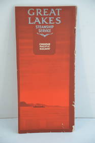
Canadian Pacific RY Great Lakes Steamship 1919 Brochure and TimetableJM Hobby Supply and Railroad Artifact Auctions4.4(126)See Sold PriceFeb 24, 2024
LATE 18TH C. VERY LARGE CHART OF NORTHEAST CANADA BY DES BARRES (1721-1824), 1780, FRAMEDThomaston Place Auction Galleries4.4(386)See Sold PriceFeb 24, 2024
LARGE LATE 17TH C. DUTCH CHART OF CANADA, GREAT LAKES, NEW FRANCE, LABRADOR, HUDSON BAY, BY PIERREThomaston Place Auction Galleries4.4(386)See Sold PriceFeb 24, 2024
LATE 17TH C. FRENCH MAP OF THE NEW WORLD BY ALEXIS-HUBERT JAILLOT (1632-1712)Thomaston Place Auction Galleries4.4(386)See Sold PriceFeb 24, 2024
[MAP]. [ALBRIZZI, Giambatista, 1698-1777]. Carta Geografica...Potter & Potter Auctions4.6(539)See Sold PriceMar 07, 2024
Johann Homann Hand-Colored Map Engraving, c. 1730Auctions at Showplace4.5(726)See Sold PriceMar 17, 2024
Donovan's The Natural History of British Shells - 5 Volumes in 3 Books with 180 EngravingsTrillium Antique Prints & Rare Books4.5(30)See Sold PriceFeb 24, 2024
Boy Scout Council Shoulder Badges Lot Of 24 CRapid Estate Liquidators and Auction Gallery4.5(1.1k)See Sold PriceFeb 25, 2024


![[GREAT LAKES REGION]. ROBERT DE VAUGONDY, Didier (1 of 1)](https://p1.liveauctioneers.com/928/212515/108628837_1_x.jpg?height=282&quality=70&version=1627420959)


![[MAP]. [ALBRIZZI, Giambatista, 1698-1777]. Carta Geografica... (1 of 1)](https://p1.liveauctioneers.com/928/318880/171361280_1_x.jpg?height=282&quality=70&version=1707501302)