ATLAS of ANTIENT GEOGRAPHY by SAMUEL BUTLER 1843John McInnis Auctioneers,LLC4.5(505)See Sold PriceFeb 24, 2024
18TH C. ANTIQUE MAP: FRENCH & INDIAN WAR, FRAMEDThomaston Place Auction Galleries4.4(393)See Sold PriceFeb 24, 2024
Rand McNally Railroad Map Cabinet w/ 21 Railroad MapsRail & Road Auctions4.6(165)See Sold PriceMar 08, 2024
Keith Haring - Ink on New York Map, Best Buddies, Inscribed, Signed, and DatedSapphire Auction Gallery4.1(67)See Sold PriceMar 02, 2024
LATE 17TH C. FRENCH MAP OF THE NEW WORLD BY ALEXIS-HUBERT JAILLOT (1632-1712)Thomaston Place Auction Galleries4.4(393)See Sold PriceFeb 24, 2024
Central Railroad of New Jersey Map of Sandy Hook Route-ca. 1903JM Hobby Supply and Railroad Artifact Auctions4.4(127)See Sold PriceFeb 24, 2024
Lot of Six Mixed Atlas Box Cars-HO Scale-New in BoxJM Hobby Supply and Railroad Artifact Auctions4.4(127)See Sold PriceFeb 25, 2024
Rand McNally/Santa Fe Railroad Map of Iowa-1912JM Hobby Supply and Railroad Artifact Auctions4.4(127)See Sold PriceFeb 24, 2024
NICOLAES VISSCHER (NETHERLANDS, 1618-1709) MAP OF THE NEW WORLDThomaston Place Auction Galleries4.4(393)See Sold PriceFeb 24, 2024
17TH C. WORLD MAP BY NICOLAES VISSCHER (NETHERLANDS, 1618-1709)Thomaston Place Auction Galleries4.4(393)See Sold PriceFeb 24, 2024
Lot of Six Mixed Atlas Cabooses-HO Scale-New in BoxJM Hobby Supply and Railroad Artifact Auctions4.4(127)See Sold PriceFeb 25, 2024
Sold1708 but 1800s Cellarius Celestial Map from SouthernTitle/Content of Map: 1708 but 1800s Cellarius Celestial Map from Southern Hemisphere -- Haemisphaerium Scenographicum Australe Coeli Stellati et Terrae Cartographer: After A Cellarius Year/Place: earSee Sold Price
1708 Cellarius Celestial Map from Southern HemisphereTitle: 1708 Cellarius Celestial Map from Southern Hemisphere -- Haemisphaerium Scenographicum Australe Coeli Stellati et Terrae Date: 1708, Amsterdam Cartographer: A Cellarius Size: 16.8 X 19.1 in. AdSee Sold Price
Sold1708 but 1800s Cellarius Celestial Map from NorthernTitle/Content of Map: 1708 but 1800s Cellarius Celestial Map from Northern Hemisphere -- Hemisphaerii Borealis Coeli et Terrae Sphaeri Cascenographia Cartographer: After A Cellarius Year/Place: earlySee Sold Price
1708 Cellarius Celestial Map from Southern HemisphereReserve Reduced! Title/Content of Map: 1708 Cellarius Celestial Map from Southern Hemisphere -- Haemisphaerium Scenographicum Australe Coeli Stellati et Terrae Date: 1708, Amsterdam Cartographer: A CeSee Sold Price
Sold20th Century hand colour reproduction astrological20th Century hand colour reproduction astrological map engraving after Map of the Southern Hemisphere, from 'The Celestial Atlas, or The Harmony of the Universe' (3) by Andreas Cellarius 1708, framedSee Sold Price
1708 Cellarius Celestial Map from Northern HemisphereTitle: 1708 Cellarius Celestial Map from Northern Hemisphere -- Hemisphaerii Borealis Coeli et Terrae Sphaeri Cascenographia Date: 1708, Amsterdam Cartographer: A Cellarius Size: 16.8 X 19.1 in. AdditSee Sold Price
1708 Cellarius Celestial Map from Northern HemisphereReserve Reduced! Title/Content of Map: 1708 Cellarius Celestial Map from Northern Hemisphere -- Hemisphaerii Borealis Coeli et Terrae Sphaeri Cascenographia Date: 1708, Amsterdam Cartographer: A CellaSee Sold Price
SoldFour 18th Century Celestial MapsAn assembled collection of four antique Celestial maps to include 1) "Theotorium Superiorum Planitarum", Cellarius, Harmonia Macrocosmica, 1708, sight size 17.75" x 20.75", famed 25" x 28.75. Note foxSee Sold Price
Sold1660 Cellarius Celestial Atlas Title Page -- AtlasTitle/Content of Map: 1660 Cellarius Celestial Atlas Title Page -- Atlas Coelestis Seu Harmonia Macrocosmica Date: 1660-1708 Amsterdam Cartographer: A Cellarius / Valk & Schenk Size: 16.7 X 10.2 in. TSee Sold Price
Cellarius: Antique Celestial Chart, 1708Title/Content of Map: Celestial Chart by Cellarius Date Printed: 1708 Cartographer: Andreas Cellarius Material/Medium: Paper Size: 20" x 23" Published in Amsterdam Please note that this lot has a confSee Sold Price
Sold1661/1707 Corporum Coelestium MagnitudinesBy: Andreas Cellarius - pub. by Valk & SchenkDate: 1661 / 1708 (published) AmsterdamDimensions: 16 x 19.5 inches (40.5 x 45.5 cm)Beautiful celestial map by the famous cosmographer Andreas Cellarius, sSee Sold Price
SoldCellarius' Celestial EngravingsHaemisphae Latumau Sphaerarum, Plate 29. Andreas Cellarius (c. 1596-1665). Engraving with original hand color. From Atlas Coelestis seu Hermonia Macrocosmica. Amsterdam: Valk and Shenk, 1708. ApproximSee Sold Price
SoldCellarius' Celestial EngravingsSceno Systematis Ptole..., Plate 2. Andreas Cellarius (c. 1596-1665). Engraving with original hand color. From Atlas Coelestis seu Hermonia Macrocosmica. Amsterdam: Valk and Shenk, 1708. ApproximatelySee Sold Price
Cellarius Celestial EngravingCellarius, Andreas (c. 1596-1665). Haemisphaeria Sphaerarum... Engraving with original hand color in full. From Atlas Coelestis seu Hermonia Macrocosmica. Amsterdam: G. Valk & P. Schenk, 1708. (SecondSee Sold Price
SoldCellarius' Celestial EngravingsSitus Circulis Curcun...,Plate 11. Andreas Cellarius (c. 1596-1665). Engraving with original hand color. From Atlas Coelestis seu Hermonia Macrocosmica. Amsterdam: Valk and Shenk, 1708. ApproximatelySee Sold Price
SoldCellarius Celestial EngravingCELLARIUS, Andreas (c. 1596-1665).Theoria Veneris et Mercurii, Plate 21.Engraving with original hand color in full. From Atlas Coelestis seu Hermonia Macrocosmica.Amsterdam: G. Valk & P. Schenk, 1708See Sold Price
SoldCellarius' Celestial EngravingsHypothesis Ptolemaica..., Plate 14. Andreas Cellarius (c. 1596-1665). Engraving with original hand color. From Atlas Coelestis seu Hermonia Macrocosmica. Amsterdam: Valk and Shenk, 1708. ApproximatelySee Sold Price
SoldMallet: Antique Celestial Map Southern Night Sky 1683TITLE OF MAP (NOT PRINTED ON THE PAGE): '[Planisphere des Constellations Meridionales comme elles sont veuës de la Terre]' SOUTHERN NIGHT SKY. Constellations Meridionales. Man in moon. DATE PRINTED:See Sold Price
SoldMallet: Antique Celestial Map Southern Night Sky, 1683TITLE OF THE MAP: 'Planisphere des Constellations Meridionalles' SOUTHERN NIGHT SKY. Planisphere Constellations Meridionalles. DATE PRINTED: 1683 IMAGE SIZE: Approx Overall page size 13 x 21cm approxiSee Sold Price
SoldTimes Atlas 1895 Celestial Map. Southern ConstellationsLithograph Map Published 1895, London for "The Times Atlas" Paper Size: 10.5 x 8 inch (27 x 21cm) Good ConditionSee Sold Price
SoldChambers (Pub) 1904 Celestial Map. Southern Stars"Star Map: Southern Hemisphere" Lithograph Map with Tissue Guard Key Published 1904 by W. R. Chambers, London for "The Illustrated Chambers Encyclopaedia" Fold as issued. Paper Size: 12.5 x 10.5 inchSee Sold Price
SoldLot (4) Andrea's Cellarius Celestial Maps (1596-1665)Lot (4)Rare Hand Colored Andreas Cellarius Celestial Maps (1596-1665) Image 11 5/8" x 14" w/Margins 16" x 21 1/2" Woven Rag Paper, Incl. Coeli Christi, Harmonia macrocosmica.See Sold Price
SoldPeplicas of Cellarius celestial mapsTitle: Two modern replicas of Cellarius celestial maps from 1661 Author: Cellarius, Andreas Description: Includes: Hemisphaerii Borealis Coeli et Terrae Sphaeri Cascenographia. * Haemisphaerium ScenogSee Sold Price
Cellarius: Map of Southern Siberia, 1774Map: Scythia Et Serica Publication Date: 1774 Author: J.B. GHISI, CELLARIUS, CHRISTOPHORUS (1638-1707) Publisher: J.B. GHISI Size: Folio – 11.75 H x 17.75 W Inches Southern Siberia and Altai at theSee Sold Price
Michigan Southern and Northern Indiana RR 14th Annual Report-February 28, 1869JM Hobby Supply and Railroad Artifact Auctions4.4(127)See Sold PriceFeb 24, 2024
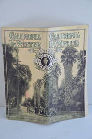
Los Angeles and Salt Lake RR California in Winter Brochure-October 1912JM Hobby Supply and Railroad Artifact Auctions4.4(127)See Sold PriceFeb 24, 2024
Santa Fe RR Summer in Southern California Book-1895JM Hobby Supply and Railroad Artifact Auctions4.4(127)See Sold PriceFeb 24, 2024
Southern Pacific RR Four Gateways to the Pacific Coast Brochure-1917JM Hobby Supply and Railroad Artifact Auctions4.4(127)See Sold PriceFeb 24, 2024
Southern Pacific RR Oregon Outdoors Brochure-May 1916JM Hobby Supply and Railroad Artifact Auctions4.4(127)See Sold PriceFeb 24, 2024
LATE 16TH C. MAP OF SCOTLAND BY MERCATOR, FRAMEDThomaston Place Auction Galleries4.4(393)See Sold PriceFeb 24, 2024
MAP - Dufour, A. H. ( Malte / Brun ) :MAP - ESPAGNE PARTIE SUD DIVISEE EN PROVINCES ANCIENNES ( MAPLuis Porretta Fine Arts4.3(10)See Sold PriceMar 02, 2024
1849 Mitchell School ATLAS 24 MAPS America Holy Land France Africa Egypt AsiaSchilb Antiquarian Rare Books4.8(428)See Sold PriceMar 31, 2024
1904 Pennsylvania Railroad Winter Excursions Book with Fold Out MapRail & Road Auctions4.6(165)See Sold PriceMar 07, 2024
1816 MAP SOUTHERN PART OF RUSSIA or MUSCOVY in EUROPE copper engraving ANTIQUEJasper524.5(9.9k)See Sold PriceFeb 27, 2024
1683 Sanson Map of the Caribbean -- Les Isles Antilles, &c Entre Lesquelles sont les Lucayes, et lesJasper524.5(9.9k)See Sold PriceFeb 27, 2024
1764 Bellin Map of Southern Portion of Martinique -- Partie Meridionale de la MartiniqueJasper524.5(9.9k)See Sold PriceFeb 27, 2024
1764 Bellin Chart of Three South Haitian Bays -- Carte des Bayes du Mesle des Flamands et deJasper524.5(9.9k)See Sold PriceFeb 27, 2024
1849 Orr & Co. Hand Colored Southern Germany MapMatthew Bullock Auctioneers4.7(1.8k)See Sold PriceMar 02, 2024
Colorful Illustrated Map - 1938 Southern California TourismProverde Auctions4.3(3)See Sold PriceFeb 28, 2024