ATLAS of ANTIENT GEOGRAPHY by SAMUEL BUTLER 1843John McInnis Auctioneers,LLC4.6(502)See Sold PriceFeb 24, 2024
18TH C. ANTIQUE MAP: FRENCH & INDIAN WAR, FRAMEDThomaston Place Auction Galleries4.4(386)See Sold PriceFeb 24, 2024
Rand McNally Railroad Map Cabinet w/ 21 Railroad MapsRail & Road Auctions4.6(165)See Sold PriceMar 08, 2024
Keith Haring - Ink on New York Map, Best Buddies, Inscribed, Signed, and DatedSapphire Auction Gallery4(67)See Sold PriceMar 02, 2024
LATE 17TH C. FRENCH MAP OF THE NEW WORLD BY ALEXIS-HUBERT JAILLOT (1632-1712)Thomaston Place Auction Galleries4.4(386)See Sold PriceFeb 24, 2024
Central Railroad of New Jersey Map of Sandy Hook Route-ca. 1903JM Hobby Supply and Railroad Artifact Auctions4.4(126)See Sold PriceFeb 24, 2024
Lot of Six Mixed Atlas Box Cars-HO Scale-New in BoxJM Hobby Supply and Railroad Artifact Auctions4.4(126)See Sold PriceFeb 25, 2024
Rand McNally/Santa Fe Railroad Map of Iowa-1912JM Hobby Supply and Railroad Artifact Auctions4.4(126)See Sold PriceFeb 24, 2024
NICOLAES VISSCHER (NETHERLANDS, 1618-1709) MAP OF THE NEW WORLDThomaston Place Auction Galleries4.4(386)See Sold PriceFeb 24, 2024
17TH C. WORLD MAP BY NICOLAES VISSCHER (NETHERLANDS, 1618-1709)Thomaston Place Auction Galleries4.4(386)See Sold PriceFeb 24, 2024
Lot of Six Mixed Atlas Cabooses-HO Scale-New in BoxJM Hobby Supply and Railroad Artifact Auctions4.4(126)See Sold PriceFeb 25, 2024
SoldHoly Land.- Conder (Thomas) A Map of The Land ofHoly Land.- Conder (Thomas) A Map of The Land of Canaan, engraving with hand-colouring, 350 x 360 mm (13 3/4 x 14 1/8 in), old folds as issued, handling creases, spotting and surface dirt, unframed, CSee Sold Price
SoldHoly Land.- Conder (Thomas) A Map of The Land ofHoly Land.- Conder (Thomas) A Map of The Land of Canaan, engraving with hand-colouring, 350 x 360 mm (13 3/4 x 14 1/8 in), old folds as issued, handling creases, spotting and surface dirt, unframed, CSee Sold Price
SoldWright, Paul 1782 Holy Land Map. Canaan, Israelites"A Map of the Land of Canaan" and "The Journeyings of the Israelites thro the Wilderness to Canaan" by Thomas Conder. Folio Copper Plate Published 1782, London for "The Complete British Family Bible��See Sold Price
SoldThomas Bowen map, Holy LandMap, Thomas Bowen (1749-1790), An Accurate Map of the Holy Land, with the Adjacent Countries, circa 1770, London, copper plate engraving, with partial color, sight: 12''h x 7.5''w, frame: 16.25''h x 1See Sold Price
SoldWright, Paul 1782 Holy Land Map. Jerusalem"A Correct Plan of the Antient City of Jerusalem" by Thomas Conder. Folio Copper Plate Published 1782, London for "The Complete British Family Bible…" by Paul Wright. Paper Size: 14.5 x 9.5 inch (37See Sold Price
SoldWright, Paul 1782 Holy Land Map. Apostles Travels etcTwo maps on one sheet by Thomas Conder "A Map of the Countries where the Apostles Travell'd…" and "A Map of the more remote Places mentioned in the New Testament" Folio Copper Plate Published 1782,See Sold Price
Fuller (Thomas) The Holy LandFuller (Thomas) The Holy Land,two maps from A Pisgah-Sight of Palestine, each with ornamental title and scale cartouches, each with pairs of compasses, engraved maps, each 280 x 335mm., each wSee Sold Price
SoldHoly Land.- Conder (Lt. C.R.) & H. H. Kitchener. Map ofHoly Land.- Conder (Lt. C.R.) & H. H. Kitchener. Map of Western Palestine in 26 Sheets, title and 26 elephant folio sheets only, photozincographed and printed in colour, each sheet approx. 540 x 695 mSee Sold Price
Sold(HOLY LAND.) Fuller, Thomas. Confinia Palestin(HOLY LAND.) Fuller, Thomas. Confinia Palestinae. Double-page engraved map, 295x345 mm, wide margins; topographical and pictorial elements hand-colored. London, 1650 All items are offered for sale suSee Sold Price
Map of the North of the Holy Land. Thomas Fuller.Naphtali. Map of the north of the Holy Land, the land of Naphtali and its neighbors: Asher, Dan, Levi, Zebulen. The Jerusalem-Damascus route is marked. By: Thomas Fuller. From: A Pisgah sight of PalesSee Sold Price
An Accurate Map of the Holy LandAn Accurate Map of the Holy Land, 1813A map, laid onto linen of the Holy Land and its adjacent countries by Thomas Bowen and Edward Kipton7 x 11.25 inchesSee Sold Price
Sold(HOLY LAND.) Fuller, Thomas. Group of 4 hand-colored(HOLY LAND.) Fuller, Thomas. Group of 4 hand-colored double-page engraved maps, from A Pisgah-Sight of Palestine. Approximately 13x15 inches each sheet size, wide margins; only minor flaws. - London,See Sold Price
SoldHoly land. 1850 by Thomas.Title: Holy land. 1850 by Thomas. Date/Period: c1850. Materials: Hand colored steel engraved Size: 16 1/2 x 13 1/2 inches. c1850 by Thomas, Cowperthwait & Co. From 'A New Universal Atlas' Published inSee Sold Price
Bannister (J.T.) A Survey of the Holy Land,Bannister (J.T.) A Survey of the Holy Land, engraved plates and maps, some folding, contemporary calf, gilt, slightly rubbed, Bath, 1844 ? Conder (Claude.R.) Tent Work in Palestine, 2 vol., neSee Sold Price
SoldCarne (John) Syria, The Holy Land & Asia MinorCarne (John) Syria, The Holy Land & Asia Minor,3vol., additional engraved titles, 2 maps, 120 plates, by W.H.Bartlett, Thomas Allom, &c, occasional spotting, hinges cracked, vol. 1 spine detatSee Sold Price
SoldCARNE, John (1789-1844) - Syria, the Holy Land & AsiaCARNE, John (1789-1844) - Syria, the Holy Land & Asia Minor illustrated in a series of views drawn from nature by W.H. Bartlett, William Purser and Thomas Allom. London: Fisher, Son and Co., [1840-42?See Sold Price
SoldCarne (John) Syria, the Holy Land...Carne (John) Syria, the Holy Land, Asia Minor Illustrated,3 vol. in 1, engraved portrait, 3 engraved titles, 3 maps (1 folding) and 116 plates after W.H.Bartlett, Thomas Allom and others, lateSee Sold Price
SoldCarne.Syria, the Holy Land, Asia Minor,Carne (John) Syria, the Holy Land, Asia Minor, &c.,3 vol. in 2, first edition, additional engraved titles, 2 maps and 117 plates after W.H.Bartlett, Thomas Allom and others, tissue guards, somSee Sold Price
SoldCarne.Syria, the Holy Land, Asia Minor, n.d.Carne (John) Syria, the Holy Land, Asia Minor Illustrated,3 vol. in 1, engraved portrait, additional engraved titles, 3 maps (1 folding) and 116 plates after W.H.Bartlett, Thomas Allom and othSee Sold Price
SoldCarne (John) Syria, the Holy Land,Carne (John) Syria, the Holy Land, Asia Minor Illustrated,3 vol. in 1, engraved portrait, 3 engraved titles, 3 maps (1 folding) and 116 plates after W.H.Bartlett, Thomas Allom and others, someSee Sold Price
SoldCarne.Syria, the Holy Land, Asia Minor,3vCarne (John) Syria, the Holy Land, Asia Minor &c. Illustrated,3 vol. in 2, engraved frontispiece, additional vignette titles, 2 maps and 116 plates after W.H.Bartlett, Thomas Allom and others,See Sold Price
Syria, the Holy Land, Asia Minor, &C. Illustrated: In aW. H. BARTLETT, William PURSER & Thomas ALLOM (illustrators). - John CARNE. Syria, the Holy Land, Asia Minor, &C. Illustrated: In a Series of Views Drawn from Nature, by W.H. Bartlett, WiSee Sold Price
SoldTobias Conrad Lotter 19th C. Israel Holy Land MapTobias Conrad Lotter (German, 1717-1777). A 19th Century map of the Holy Land in its twelve tribal divisions, based on the work of Lotter, one of the best known 18th century German mapmakers. MeasuresSee Sold Price
SoldSouthwell & G. Rollos 1774 Pair of Holy Land Maps"A Map of the Land of Canaan" and "A Map of the Situation of the Garden of Eden" Copper Engraved Maps Published 1774, London for "The Universal Family Bible: Or, Christian's Divine Library" by the RevSee Sold Price
DAVID ROBERTS - Holy Land / Syria / Egypt etc. 3 x Folio Volumes 1849 Very RareLuis Porretta Fine Arts4.3(10)See Sold PriceMar 02, 2024
Jerusalem Map for British Soldiers in Palestine - WW2Levy Auction House4.3(11)See Sold PriceFeb 27, 2024
Collection of 10 Maps of Cities in Israel for TouristsLevy Auction House4.3(11)See Sold PriceFeb 27, 2024
Excursions to Palestine - Thomas Cook - 19th CenturyLevy Auction House4.3(11)See Sold PriceFeb 27, 2024
The Holy Land Tours - Hamburg American Line - 1911Levy Auction House4.3(11)See Sold PriceFeb 27, 2024
1849 Mitchell School ATLAS 24 MAPS America Holy Land France Africa Egypt AsiaSchilb Antiquarian Rare Books4.8(421)See Sold PriceMar 31, 2024
1872 Holy BIBLE & Hitchcock Analysis Gruden Concordance Theology MAPS Holy LandSchilb Antiquarian Rare Books4.8(421)See Sold PriceMar 31, 2024
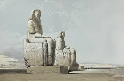
David Roberts - Obelisk of LuxorTrillium Antique Prints & Rare Books4.5(30)See Sold PriceFeb 24, 2024
David Roberts - Approach of the Simoom, Desert of GizehTrillium Antique Prints & Rare Books4.5(30)See Sold PriceFeb 24, 2024
Byzantine Stamped Glass Intaglio - Madonna and ChildArtemis Fine Arts4.8(1.4k)See Sold PriceFeb 26, 2024
TWO ANTIQUE JEWISH NATIONAL FUND CHARITY BOXES. The first one made in Berlin c. 1920J. Greenstein & Co., Inc.4.3(55)See Sold PriceApr 16, 2024