ATLAS of ANTIENT GEOGRAPHY by SAMUEL BUTLER 1843John McInnis Auctioneers,LLC4.6(502)See Sold PriceFeb 24, 2024
18TH C. ANTIQUE MAP: FRENCH & INDIAN WAR, FRAMEDThomaston Place Auction Galleries4.4(386)See Sold PriceFeb 24, 2024
Rand McNally Railroad Map Cabinet w/ 21 Railroad MapsRail & Road Auctions4.6(165)See Sold PriceMar 08, 2024
Keith Haring - Ink on New York Map, Best Buddies, Inscribed, Signed, and DatedSapphire Auction Gallery4(67)See Sold PriceMar 02, 2024
LATE 17TH C. FRENCH MAP OF THE NEW WORLD BY ALEXIS-HUBERT JAILLOT (1632-1712)Thomaston Place Auction Galleries4.4(386)See Sold PriceFeb 24, 2024
Central Railroad of New Jersey Map of Sandy Hook Route-ca. 1903JM Hobby Supply and Railroad Artifact Auctions4.4(126)See Sold PriceFeb 24, 2024
Lot of Six Mixed Atlas Box Cars-HO Scale-New in BoxJM Hobby Supply and Railroad Artifact Auctions4.4(126)See Sold PriceFeb 25, 2024
Rand McNally/Santa Fe Railroad Map of Iowa-1912JM Hobby Supply and Railroad Artifact Auctions4.4(126)See Sold PriceFeb 24, 2024
NICOLAES VISSCHER (NETHERLANDS, 1618-1709) MAP OF THE NEW WORLDThomaston Place Auction Galleries4.4(386)See Sold PriceFeb 24, 2024
17TH C. WORLD MAP BY NICOLAES VISSCHER (NETHERLANDS, 1618-1709)Thomaston Place Auction Galleries4.4(386)See Sold PriceFeb 24, 2024
Lot of Six Mixed Atlas Cabooses-HO Scale-New in BoxJM Hobby Supply and Railroad Artifact Auctions4.4(126)See Sold PriceFeb 25, 2024
1574 MAP of AFRICA antique TABULA APHRICA I by GirolamoBy Girolamo Ruscelli Venice, 1574 Latin text on the verso Girolamo Ruscelli (1500-1566) was a cartographer, humanist, and scholar from Tuscany. Ruscelli was a prominent writer and editor in his time,See Sold Price
1574 MAP of AFRICA antique TABULA APHRICA I by GirolamoBy Girolamo Ruscelli Venice, 1574 Latin text on the verso Girolamo Ruscelli (1500-1566) was a cartographer, humanist, and scholar from Tuscany. Ruscelli was a prominent writer and editor in his time,See Sold Price
1574 MAP of AFRICA antique TABULA APHRICA I by GirolamoBy Girolamo Ruscelli Venice, 1574 Latin text on the verso Girolamo Ruscelli (1500-1566) was a cartographer, humanist, and scholar from Tuscany. Ruscelli was a prominent writer and editor in his time,See Sold Price
1574 MAP of AFRICA antique TABULA APHRICA I by GirolamoBy Girolamo Ruscelli Venice, 1574 Latin text on the verso Girolamo Ruscelli (1500-1566) was a cartographer, humanist, and scholar from Tuscany. Ruscelli was a prominent writer and editor in his time,See Sold Price
1574 MAP of AFRICA antique TABULA APHRICA I by GirolamoBy Girolamo Ruscelli Venice, 1574 Italian text on the verso Girolamo Ruscelli (1500-1566) was a cartographer, humanist, and scholar from Tuscany. Ruscelli was a prominent writer and editor in his timeSee Sold Price
SoldRuscelli: Antique Map Tabula Asiae II, 1561Map: Tabula Asiae II (authentic antique map) Cartographer: Girolamo Ruscelli Illustrator: Girolamo Ruscelli Edition: First Edition Date: 1561 Size: 7 x 9.75 inches Ptolemaic map of the Silk Road regioSee Sold Price
Group of Antique Maps Africa, Europe and AsiaGroup of Maps Africa, Europe and Asia. Lots include 1) Tabula Europae VIII; 2) Aphricae Tabula IIII; 3) Tabula Asiae XII (Sri Lanka) and ; 4) Gulf of Mexico. 1,2,3) 12.75 in. H x 16 in. W. 4)See Sold Price
Group of Antique Maps Africa, Europe and AsiaGroup of Maps Africa, Europe and Asia. Lots include 1) Tabula Europae VIII; 2) Aphricae Tabula IIII; 3) Tabula Asiae XII (Sri Lanka) and ; 4) Gulf of Mexico. 1,2,3) approx. 12.75 in. H x 16 in. W; 4)See Sold Price
SoldRuscelli, Girolamo. Nueva Hispania Tabula Nova.Ruscelli, Girolamo. Nueva Hispania Tabula Nova. Venecia, 1574. engraved map, 27 x 20 cm. Framed.See Sold Price
SoldPtolemaic map of northern Africa 1674Heading: Author: Ruscelli, Girolamo Title: Tabula Africa IIII Place Published: Venice Publisher: Date Published: 1574 Description: Engraved map. 18x24 cm (7x9½"). <See Sold Price
SoldVisscher: Antique Map of Africa, 1670Title: Africæ Accurata Tabula. 17th century Visscher map of Africa Map maker: Nicolas Visscher Place and Year: Amsterdam, c. 1670 Dimensions: 43.5 x 54 cm (17¼ x 21¼ in) Technique: Copperplate engrSee Sold Price
Sold1588 Africae Tabula NovaBy: Abraham OrteliusDate: 1588 (published) AntwerpDimensions: 14.5 x 18 inches (36.83 x 45.72 cm)This is an authentic antique map of Africa was published by Abraham Ortellius in 1588. It was taken froSee Sold Price
SoldRuscelli (Girolamo) Africa Nuova TabulaRuscelli (Girolamo) Africa Nuova Tabula,the southern half of Africa with Madagascar and other islands, engraved map, 190 x 260mm., Italian text on verso, slight browning on central fold, paleSee Sold Price
SoldRuscelli: Antique Map of Greece, 1561Map: Tabula Europae X (authentic Antique Map of Greece) Cartographer: Girolamo Ruscelli Illustrator: Girolamo Ruscell Edition: First Edition Date: 1561 Size: 7.25 x 9.75 inches Authentic sixteenth cenSee Sold Price
1745 In Notitiam Ecclesiasticam Africae TabulaBy: Jean Covens & Corneille MortierDate: 1745 (circa) AmsterdamDimensions: 15.5 x 20.75 inches (39.4 x 52.7 cm)This is an authentic antique map of Northern Africa, the Mediterranean, and Southern EuroSee Sold Price
1745 In Notitiam Ecclesiasticam Africae TabulaBy: Jean Covens & Corneille Mortier Date: 1745 (circa) Amsterdam Dimensions: 15.5 x 20.75 inches (39.4 x 52.7 cm) This is an authentic antique map of Northern Africa, the Mediterranean, and Southern ESee Sold Price
SoldOrtelius map, Africae Tabulae Nova, c.1574[Africa]. Ortelius. Africae Tabula Nova. Double-page engraved map of Africa including Madagascar and Cape Horn, from Abraham Ortelius's ''Theatrum Orbis Terrarum,'' Antwerp: 1574. 14 5/8 x 18 3/4 in.See Sold Price
Ruscelli (Girolamo) - Tabula Asiæ VI,the Arabian peninsula and the Horn of Africa from Libro Quarto of Della Geografia di Tolomeo, title above, engraved map with hand-colouring, 195 x 260mm., faint central vertical fold, Italian text verSee Sold Price
SoldPtolomaeus and Ruscelli]Tabula Europæ llPtolomaeus (Claudius) and [Girolamo Ruscelli] Tabula Europæ ll,Spain and Portugal, with the north coast of Africa, ship and sea monsters, woodcut map, 180 x 250mm., central vertical fold, LatiSee Sold Price
SoldRuscelli (Girolamo) Carta Marina Nova TabulaRuscelli (Girolamo) Carta Marina Nova TabulaEurope, Africa, South America, Tierra del Fuego merging in to part of Antarctica, North America merging in to Asia, engraved map, 130 x 170mm., centSee Sold Price
SoldTabula Europae I.[British Isles]Giordano Ziletti / Claudius Ptolemy, Tabula Europae I.[British Isles], engraving, from 1574 revised edition by Girolamo Ruscelli of Ptolemy's Geografia., 10.5 x 7.5 10.5 x 7.5See Sold Price
1680 RUSSIAN MAP ANTIQUE TABULA RUSSIA VULGO MOSCOVIAVery good condition Size 19 3/4 by 24" (19) Please note that this lot has a confidential reserve. When you leave a bid in advance of the auction, submit your maximum. The bidder who has submitted theSee Sold Price
SoldFramed Antique 18th C R Reynolds Map of AfricaFramed Antique 18th C R Reynolds Map of Africa. Antique 18th century hand colored engraving. With certificate in envelope on back. Measures 13.5 x 16.75 inches.See Sold Price
SoldMap Hispania, Nova, Tabula girolamo Ruscell, 1599Map Hispania, Nova, Tabula girolamo Ruscell, 1599See Sold Price
NORTHERN AFRICA. Morocco Tunisia Algeria. Caravan routes. RAPKIN/TALLIS 1851 mapJasper524.5(9.8k)See Sold PriceFeb 28, 2024
WEST AFRICA Explorers' routes Senegal Ashanti. Mountains of Kong. SDUK 1857 mapJasper524.5(9.8k)See Sold PriceFeb 28, 2024
COLONIAL NIGERIA & CAMEROON. "Sudan" Dahomey (Benin) Togo, Kamerun 1906 mapJasper524.5(9.8k)See Sold PriceFeb 28, 2024
WEST AFRICA Niger/Gambia rivers tribes towns. 'Pays des Negres'. MALLET 1683 mapJasper524.5(9.8k)See Sold PriceFeb 28, 2024
NORTH & WEST AFRICA. Sahara Niger river 'Zaara ou le Desert'. MALLET 1683 mapJasper524.5(9.8k)See Sold PriceFeb 28, 2024
CENTRAL EAST AFRICA French Belgian Congo British German Kenya Tanzania 1909 mapJasper524.5(9.8k)See Sold PriceFeb 28, 2024
EARLY COLONIAL WEST AFRICA. Empires of Sokoto Gando Mas.Tribes.Fellatah 1882 mapJasper524.5(9.8k)See Sold PriceFeb 28, 2024
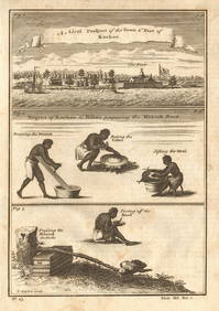
Guinea-Bissau Cacheu town Fortaleza de São José da Amura Preparing cassava 1745Jasper524.5(9.8k)See Sold PriceFeb 28, 2024
AFRICA. Antiqua; Rome Carthage, start Punic War 1908 old antique map chartJasper524.5(9.8k)See Sold PriceFeb 28, 2024
Pre-colonial Africa. Mountains of Kong/Moon. Caravan routes. THOMSON 1817 mapJasper524.5(9.8k)See Sold PriceFeb 28, 2024
AFRICA. Pre 'Scramble for Africa'. BARTHOLOMEW 1876 old antique map plan chartJasper524.5(9.8k)See Sold PriceFeb 28, 2024
La Barbarie de la Nigritie et de la Guinée'. West Africa. DE L’ISLE 1745 mapJasper524.5(9.8k)See Sold PriceFeb 28, 2024
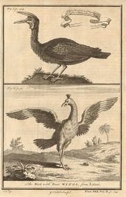
Gambian birds. Monoceros. A bird with four wings. CHILD 1745 old antique printJasper524.5(9.8k)See Sold PriceFeb 28, 2024
NORTH AFRICA. 'Biledulgerid', a former North African country. MALLET 1683 mapJasper524.5(9.8k)See Sold PriceFeb 28, 2024
Pre-SECOND WORLD WAR AFRICA. European colonies & German mandates 1942 old mapJasper524.5(9.8k)See Sold PriceFeb 28, 2024
NILE VALLEY. Upper & Lower. Egypt Sinai Nubia Sudan Abyssinia. BLACKIE 1882 mapJasper524.5(9.8k)See Sold PriceFeb 28, 2024
SUB-SAHARAN AFRICA. 'Ancienne Ethiopie'. Ancient Ethiopia. MALLET 1683 old mapJasper524.5(9.8k)See Sold PriceFeb 28, 2024
AFRICA. French North Africa and Morocco 1907 old antique map plan chartJasper524.5(9.8k)See Sold PriceFeb 28, 2024
SOUTHERN AFRICA Monomotapa (Mutapa Kingdom) Cafrerie (Kaffraria) MALLET 1683 mapJasper524.5(9.8k)See Sold PriceFeb 28, 2024


![Ptolomaeus and Ruscelli]Tabula Europæ ll (1 of 1)](https://p1.liveauctioneers.com/410/10165/2289180_1_x.jpg?height=282&quality=70)

![Tabula Europae I.[British Isles] (1 of 1)](https://p1.liveauctioneers.com/457/2714/1174220_1_x.jpg?height=282&quality=70)