ATLAS of ANTIENT GEOGRAPHY by SAMUEL BUTLER 1843John McInnis Auctioneers,LLC4.6(502)See Sold PriceFeb 24, 2024
18TH C. ANTIQUE MAP: FRENCH & INDIAN WAR, FRAMEDThomaston Place Auction Galleries4.4(386)See Sold PriceFeb 24, 2024
Rand McNally Railroad Map Cabinet w/ 21 Railroad MapsRail & Road Auctions4.6(165)See Sold PriceMar 08, 2024
Keith Haring - Ink on New York Map, Best Buddies, Inscribed, Signed, and DatedSapphire Auction Gallery4(67)See Sold PriceMar 02, 2024
LATE 17TH C. FRENCH MAP OF THE NEW WORLD BY ALEXIS-HUBERT JAILLOT (1632-1712)Thomaston Place Auction Galleries4.4(386)See Sold PriceFeb 24, 2024
Central Railroad of New Jersey Map of Sandy Hook Route-ca. 1903JM Hobby Supply and Railroad Artifact Auctions4.4(126)See Sold PriceFeb 24, 2024
Lot of Six Mixed Atlas Box Cars-HO Scale-New in BoxJM Hobby Supply and Railroad Artifact Auctions4.4(126)See Sold PriceFeb 25, 2024
Rand McNally/Santa Fe Railroad Map of Iowa-1912JM Hobby Supply and Railroad Artifact Auctions4.4(126)See Sold PriceFeb 24, 2024
NICOLAES VISSCHER (NETHERLANDS, 1618-1709) MAP OF THE NEW WORLDThomaston Place Auction Galleries4.4(386)See Sold PriceFeb 24, 2024
17TH C. WORLD MAP BY NICOLAES VISSCHER (NETHERLANDS, 1618-1709)Thomaston Place Auction Galleries4.4(386)See Sold PriceFeb 24, 2024
Lot of Six Mixed Atlas Cabooses-HO Scale-New in BoxJM Hobby Supply and Railroad Artifact Auctions4.4(126)See Sold PriceFeb 25, 2024
SoldMauritania, Numidia Et Africa Propria Antique Map 1826Antique Map of Mauritania, Numidia Et Africa Propria. Size: 11 X 8.5 inches approx. Unframed. Printed 1826.See Sold Price
Mauritania, Numidia Et Africa Propria Antique Map 1826Antique Map of Mauritania, Numidia Et Africa Propria. Size: 11 X 8.5 inches approx. Unframed. Printed 1826.See Sold Price
Mauritania, Numidia Et Africa Propria Antique Map 1826Antique Map of Mauritania, Numidia Et Africa Propria. Size: 11 X 8.5 inches approx. Unframed. Printed 1826.See Sold Price
Mauritania, Numidia Et Africa Propria Antique Map 1826Antique Map of Mauritania, Numidia Et Africa Propria. Size: 11 X 8.5 inches approx. Unframed. Printed 1826.See Sold Price
Mauritania, Numidia Et Africa Propria Antique Map 1826Antique Map of Mauritania, Numidia Et Africa Propria. Size: 11 X 8.5 inches approx. Unframed. Printed 1826.See Sold Price
Mauritania, Numidia Et Africa Propria Antique Map 1826Antique Map of Mauritania, Numidia Et Africa Propria. Size: 11 X 8.5 inches approx. Unframed. Printed 1826.See Sold Price
1826 Hall map of Northern Africa -- Mauritania,Title/Content of Map: 1826 Hall map of Northern Africa -- Mauritania, Numidia, et Africa Propria Date: 1826, London Cartographer: S Hall Size: 7.4 X 9.6 in. A very nice map of Northern Africa from todSee Sold Price
1826 Hall map of Northern Africa -- Mauritania,Reserve Reduced! Title/Content of Map: 1826 Hall map of Northern Africa -- Mauritania, Numidia, et Africa Propria Date: 1826, London Cartographer: S Hall Size: 7.4 X 9.6 in. A very nice map of NortherSee Sold Price
SoldWells' map of ancient North Africa c.1704Title: A New Map of the North Part of Antient Africa Shewing the Chiefe People, Cities, Towns, Rivers, Mountains &c. in Mauritania, Numidia, Africa Propria, Lybia Propria, and Egypt Author: Wells, EdwSee Sold Price
Sold1779 Antique Map of Africa Propria and NumidiaCreated by Isaac Basie. Depicts modern Tunisia, Sicily, Malta, and Algeria. Frame measures 13 1/4 x 17 1/4 inches. Map measures approximately 9 x 12 inches.See Sold Price
PELOPONNESUS ET GRECIA MERIDIONALIS Antique Map 1826Size: 11 X 8.5 inches approx. Unframed. Printed 1826.See Sold Price
PELOPONNESUS ET GRECIA MERIDIONALIS Antique Map 1826Size: 11 X 8.5 inches approx. Unframed. Printed 1826.See Sold Price
PELOPONNESUS ET GRECIA MERIDIONALIS Antique Map 1826Size: 11 X 8.5 inches approx. Unframed. Printed 1826.See Sold Price
PELOPONNESUS ET GRECIA MERIDIONALIS Antique Map 1826Size: 11 X 8.5 inches approx. Unframed. Printed 1826.See Sold Price
PELOPONNESUS ET GRECIA MERIDIONALIS Antique Map 1826Size: 11 X 8.5 inches approx. Unframed. Printed 1826.See Sold Price
PELOPONNESUS ET GRECIA MERIDIONALIS Antique Map 1826Size: 11 X 8.5 inches approx. Unframed. Printed 1826.See Sold Price
Sold1796 Map Africa PropriaANTIQUE MAP “AFRICA PROPRIA” CARTGAHE LIBYA, TRIPOLI, MALTA, BY CELLARIUS 1796. From: Geographia Antiqua London. Very Good, measures 15 x 10”, central fold. No Reserve Free shipping for this iteSee Sold Price
Antique Map Print - Africa - Map of Mauritania - Egypt - Africa Minor - 1701Title/Artist: Antique Map Print - Africa - Map of Mauritania - Egypt - Africa Minor - 1701 Date/Period: 1701 Material: Paper Dimensions: 15 cm x 13 cm Description: A detailed small map from ”IntSee Sold Price
SoldAntique Map: Imperium Turcicum in Europa, Asia etMiddle East.- Homann Heirs (publisher) Imperium Turcicum in Europa, Asia et Africa Regiones Proprias, Tributarias, Clientelares ..., detailed map centred on the Levant and Arabian Peninsula, with theSee Sold Price
De Jode, Rare, pub. 1593 - Map of Africa (Africae Vera Forma, et Situs)Trillium Antique Prints & Rare Books4.5(30)See Sold PriceFeb 24, 2024
Afrique. Partie du Désert de Sahara #13. Mauritania Mali. VANDERMAELEN 1827 mapJasper524.5(9.8k)See Sold PriceFeb 28, 2024
Coste Occidentale d’Afrique…' Arguin Bay Cap Blanc Mauritania. BELLIN 1746 mapJasper524.5(9.8k)See Sold PriceFeb 28, 2024
Partie de la Coste d'Afrique depuis Tanit…' Southern Mauritania BELLIN 1746 mapJasper524.5(9.8k)See Sold PriceFeb 28, 2024
Afrique. Partie du Sahara #12. Mauritania. Western Sahara. VANDERMAELEN 1827 mapJasper524.5(9.8k)See Sold PriceFeb 28, 2024
West coast of Africa from Cape Blanco… Arguin bay, Mauritania. LABAT 1745 mapJasper524.5(9.8k)See Sold PriceFeb 28, 2024
Partie de la Coste d'Afrique'. Southern Mauritania BELLIN/SCHLEY 1747 old mapJasper524.5(9.8k)See Sold PriceFeb 28, 2024
ANCIENT AFRICA cum Aegypto et Insulis. Nigritae Aethiopia. ARROWSMITH 1828 mapJasper524.5(9.8k)See Sold PriceFeb 28, 2024
La Barbarie de la Nigritie et de la Guinée'. West Africa. DE L’ISLE 1745 mapJasper524.5(9.8k)See Sold PriceFeb 28, 2024
Plan du Portendic, appellé aussi…' Portendick Mauritania. BELLIN 1746 old mapJasper524.5(9.8k)See Sold PriceFeb 28, 2024
Coste Occidentale d’Afrique'. Bay of Arguin, Mauritania. BELLIN/SCHLEY 1747 mapJasper524.5(9.8k)See Sold PriceFeb 28, 2024
Côte occidentale de l'Afrique. W Africa.Senegal Gambia rivers.D’ANVILLE 1751 mapJasper524.5(9.8k)See Sold PriceFeb 28, 2024
Royaumes, Etats et Pays de la Haute Guinée. Gulf of Guinea. BONNE 1788 old mapJasper524.5(9.8k)See Sold PriceFeb 28, 2024
Afrique. Bambara #20 Niger River. Western Mali. Mauritania VANDERMAELEN 1827 mapJasper524.5(9.8k)See Sold PriceFeb 28, 2024
Plan du Portendic, appellé aussi…' Portendick Mauritania BELLIN/SCHLEY 1747 mapJasper524.5(9.8k)See Sold PriceFeb 28, 2024
Carte de l'Afrique propre, de la Numidie… North Africa. LAPIE 1829 old mapJasper524.5(9.8k)See Sold PriceFeb 28, 2024
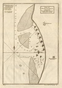
Plan de la Baye & Isle d'Arguim'. Mauritania. Arguin island. BELLIN 1746 mapJasper524.5(9.8k)See Sold PriceFeb 28, 2024
Carte de L'Algérie et de la Régence de Tunis' ANDRIVEAU-GOUJON Algeria 1850 mapJasper524.5(9.8k)See Sold PriceFeb 28, 2024
Plan of Portendic… Portu d'Addi or Penia. Portendick Mauritania. LABAT 1745 mapJasper524.5(9.8k)See Sold PriceFeb 28, 2024
Homme et Femme Hottentots'. Southern Africa. Khoikhoi man & woman 1748 printJasper524.5(9.8k)See Sold PriceFeb 28, 2024
Western coast of Africa… to the River Sanaga. Southern Mauritania LABAT 1745 mapJasper524.5(9.8k)See Sold PriceFeb 28, 2024
Carte de la Haute et de la Basse Guinée. Gulf of Guinea Africa. BONNE 1780 mapJasper524.5(9.8k)See Sold PriceFeb 28, 2024
Plan de Fort d'Arguim'. Mauritania. Arguin fort. BELLIN 1746 old antique mapJasper524.5(9.8k)See Sold PriceFeb 28, 2024
Egypte, Nubie et Abissinie. Egypt, Nubia & Abyssinia. Sudan. BONNE 1788 mapJasper524.5(9.8k)See Sold PriceFeb 28, 2024