ATLAS of ANTIENT GEOGRAPHY by SAMUEL BUTLER 1843John McInnis Auctioneers,LLC4.5(505)See Sold PriceFeb 24, 2024
18TH C. ANTIQUE MAP: FRENCH & INDIAN WAR, FRAMEDThomaston Place Auction Galleries4.4(393)See Sold PriceFeb 24, 2024
Rand McNally Railroad Map Cabinet w/ 21 Railroad MapsRail & Road Auctions4.6(165)See Sold PriceMar 08, 2024
Keith Haring - Ink on New York Map, Best Buddies, Inscribed, Signed, and DatedSapphire Auction Gallery4.1(67)See Sold PriceMar 02, 2024
LATE 17TH C. FRENCH MAP OF THE NEW WORLD BY ALEXIS-HUBERT JAILLOT (1632-1712)Thomaston Place Auction Galleries4.4(393)See Sold PriceFeb 24, 2024
Central Railroad of New Jersey Map of Sandy Hook Route-ca. 1903JM Hobby Supply and Railroad Artifact Auctions4.4(127)See Sold PriceFeb 24, 2024
Lot of Six Mixed Atlas Box Cars-HO Scale-New in BoxJM Hobby Supply and Railroad Artifact Auctions4.4(127)See Sold PriceFeb 25, 2024
Rand McNally/Santa Fe Railroad Map of Iowa-1912JM Hobby Supply and Railroad Artifact Auctions4.4(127)See Sold PriceFeb 24, 2024
NICOLAES VISSCHER (NETHERLANDS, 1618-1709) MAP OF THE NEW WORLDThomaston Place Auction Galleries4.4(393)See Sold PriceFeb 24, 2024
17TH C. WORLD MAP BY NICOLAES VISSCHER (NETHERLANDS, 1618-1709)Thomaston Place Auction Galleries4.4(393)See Sold PriceFeb 24, 2024
Lot of Six Mixed Atlas Cabooses-HO Scale-New in BoxJM Hobby Supply and Railroad Artifact Auctions4.4(127)See Sold PriceFeb 25, 2024
SoldEncyclo. Britannica C1830 Set of 4 Maps on 8 SheetsIncl England/Wales, France, Ireland and Germany. Steel Engraved Map Published 1830-42, Edinburgh for "Encyclopedia Britannica" Seventh Edition. Centre fold as issued. Paper Size: 16 x 11 inch (40 x 28See Sold Price
SoldEncyclo. Britannica C1830 Set 2 Maps of Spain PortugalCopper Engraved Maps Published 1830-42, Edinburgh for "Encyclopedia Britannica" Seventh Edition. Centre fold as issued. Paper Size: 16 x 11 inch (40 x 28cm) Some toning, otherwise fineSee Sold Price
Encyclo. Britannica C1830 Set 6 Maps UK France GermanySteel Engraved Map Published 1830-42, Edinburgh for "Encyclopedia Britannica" Seventh Edition. Centre fold as issued. Paper Size: 16 x 11 inch (40 x 28cm) Minor toning/margin water staining, otherwiseSee Sold Price
Encyclo. Britannica C1830 Set 6 Maps UK France GermanySteel Engraved Map Published 1830-42, Edinburgh for "Encyclopedia Britannica" Seventh Edition. Centre fold as issued. Paper Size: 16 x 11 inch (40 x 28cm) Minor toning/margin water staining, otherwiseSee Sold Price
SoldEncyclo. Britannica C1830 Set of 2 Maps of ScotlandSteel Engraved Maps Published 1830-42, Edinburgh for "Encyclopedia Britannica" Seventh Edition. Centre fold as issued. Paper Size: 16 x 11 inch (40 x 28cm) Good conditionSee Sold Price
SoldEncyclo. Britannica C1830 Set of 2 Maps of the USACopper Engraved Maps Published 1830-42, Edinburgh for "Encyclopedia Britannica" Seventh Edition. Centre fold as issued. Paper Size: 16 x 11 inch (40 x 28cm) Some toning/offsetting, otherwise fineSee Sold Price
SoldEncyclo. Britannica C1830 Set of 2 Maps of RussiaSteel Engraved Maps Published 1830-42, Edinburgh for "Encyclopedia Britannica" Seventh Edition. Centre fold as issued. Paper Size: 16 x 11 inch (40 x 28cm) Good conditionSee Sold Price
Encyclo. Britannica C1830 Set of 2 Maps of IrelandSteel Engraved Map Published 1830-42, Edinburgh for "Encyclopedia Britannica" Seventh Edition. Centre fold as issued. Paper Size: 16 x 11 inch (40 x 28cm) Loss to image on centre foldSee Sold Price
Encyclo. Britannica C1830 Set of 2 Maps of IrelandSteel Engraved Map Published 1830-42, Edinburgh for "Encyclopedia Britannica" Seventh Edition. Centre fold as issued. Paper Size: 16 x 11 inch (40 x 28cm) Loss to image on centre foldSee Sold Price
SoldEncyclo. Britannica C1830 Set of 2 Maps of ItalySteel Engraved Map Published 1830-42, Edinburgh for "Encyclopedia Britannica" Seventh Edition. Centre fold as issued. Paper Size: 16 x 11 inch (40 x 28cm) Good conditionSee Sold Price
Encyclo. Britannica C1830 Set of 2 Maps of ScotlandSteel Engraved Maps Published 1830-42, Edinburgh for "Encyclopedia Britannica" Seventh Edition. Centre fold as issued. Paper Size: 16 x 11 inch (40 x 28cm) Good conditionSee Sold Price
SoldEncyclo. Britannica C1830 Lot of 4 European MapsIncl Prussia, Denmark, Austrian Dominions and Greece. Steel Engraved Map Published 1830-42, Edinburgh for "Encyclopedia Britannica" Seventh Edition. Centre fold as issued. Paper Size: 16 x 11 inch (40See Sold Price
Baldwin & Cradock/SDUK: Ancient Italy in 3 SheetsPlace/Date: London / 1832/1852 Size: 14 7/8" x 11 1/4" (largest of the three maps) Condition: b&w; overall age toning, minor staining and some light overprinting A set of three fascinating maps of ancSee Sold Price
SoldEncyclo. Britannica C1830 Map of The WorldThe World on Mercator's Projection. Steel Engraved Map Published 1830-42, Edinburgh for "Encyclopedia Britannica" Seventh Edition. Centre fold as issued. Paper Size: 16 x 11 inch (40 x 28cm) Minor tonSee Sold Price
SoldEncyclo. Britannica C1830 Map of The World HemisphereSteel Engraved Map Published 1830-42, Edinburgh for "Encyclopedia Britannica" Seventh Edition. Centre fold as issued. Paper Size: 16 x 11 inch (40 x 28cm) Some toning, otherwise fineSee Sold Price
SoldEncyclo. Britannica C1830 Map of Australia AustralasiaSteel Engraved Map Published 1830-42, Edinburgh for "Encyclopedia Britannica" Seventh Edition. Centre fold as issued. Paper Size: 16 x 11 inch (40 x 28cm) Very minor toning at top. Good conditionSee Sold Price
SoldEncyclo. Britannica C1830 Map of EgyptSteel Engraved Map Published 1830-42, Edinburgh for "Encyclopedia Britannica" Seventh Edition. Centre fold as issued. Paper Size: 16 x 11 inch (40 x 28cm) Very Minor toning, otherwise fineSee Sold Price
SoldEncyclo. Britannica C1830 Map North America.USA CanadaSteel Engraved Map Published 1830-42, Edinburgh for "Encyclopedia Britannica" Seventh Edition. Centre fold as issued. Paper Size: 16 x 11 inch (40 x 28cm) Good conditionSee Sold Price
SoldEncyclo. Britannica C1830 Map of East Indies & Burma"Eastern Islands, Birmah &c" Steel Engraved Map Published 1830-42, Edinburgh for "Encyclopedia Britannica" Seventh Edition. Centre fold as issued. Paper Size: 16 x 11 inch (40 x 28cm) Good conditionSee Sold Price
SoldEncyclo. Britannica C1830 Map of IndiaSteel Engraved Map Published 1830-42, Edinburgh for "Encyclopedia Britannica" Seventh Edition. Centre fold as issued. Paper Size: 16 x 11 inch (40 x 28cm) Minor toning, otherwise fineSee Sold Price
SoldEncyclo. Britannica C1830 Map of MexicoSteel Engraved Map Published 1830-42, Edinburgh for "Encyclopedia Britannica" Seventh Edition. Folds as issued. Paper Size: 16 x 11 inch (40 x 28cm) Minor toning, otherwise fineSee Sold Price
SoldEncyclo. Britannica C1830 Map of AsiaSteel Engraved Map Published 1830-42, Edinburgh for "Encyclopedia Britannica" Seventh Edition. Centre fold as issued. Paper Size: 16 x 11 inch (40 x 28cm) Good conditionSee Sold Price
Encyclo. Britannica C1830 Map of AsiaSteel Engraved Map Published 1830-42, Edinburgh for "Encyclopedia Britannica" Seventh Edition. Centre fold as issued. Paper Size: 16 x 11 inch (40 x 28cm) Good conditionSee Sold Price
Encyclo. Britannica C1830 Map of IndiaSteel Engraved Map Published 1830-42, Edinburgh for "Encyclopedia Britannica" Seventh Edition. Centre fold as issued. Paper Size: 16 x 11 inch (40 x 28cm) Minor toning, otherwise fineSee Sold Price
Roman Silver Ring with 'of him who is virtuous, beautiful' Garnet GemstoneTimeLine Auctions Ltd.4.6(183)See Sold PriceMar 05, 2024
5pc Nightmare Before Christmas Invitations, Magnets + CardsLion and Unicorn4.8(1.9k)See Sold PriceFeb 29, 2024
[BUSINESS]. Travel Guide of Negro Hotels and Guest Houses. Published by Afro-American Newspapers ofFreeman's | Hindman4.4(1.6k)See Sold PriceFeb 27, 2024
Tomoo Inagaki Woodblock Set - Camellia JaponicaFloating World Auctions4.7(236)See Sold PriceMar 01, 2024
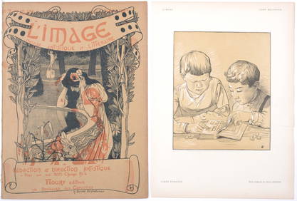
Tony Beltrand & Henry Bellery-Desfontaines - Libre echange, 1897 / L’image, 1897NCAG4.4(33)See Sold PriceMar 10, 2024
Pierre Bonnard - La Vie de Sainte Monique #4, 1930 - Set of 3 lithographsNCAG4.4(33)See Sold PriceMar 10, 2024
Henri Evenepoel - Les Maitres de l'Affiche : Anvers et son exposition, 1897NCAG4.4(33)See Sold PriceMar 10, 2024
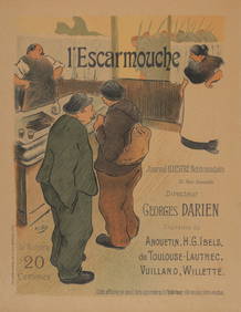
Henri-Gabriel Ibels - Les Maitres de l'Affiche : l'Escarmouche, 1895NCAG4.4(33)See Sold PriceMar 10, 2024
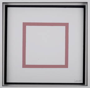
Sol LeWitt -Five Geometric Figures in Five Colors, Plate #4, 1986NCAG4.4(33)See Sold PriceMar 10, 2024
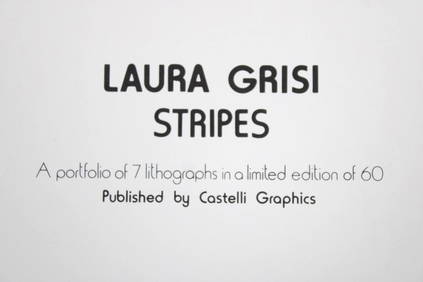
Set of 7 Laura Grisi Signed 'Stripes' Lithographs, Castelli Graphics, 3 of 4PUBLIC SALE4.7(226)See Sold PriceMar 02, 2024
[Constructivism]. The general plan of reconstruction of Moscow. - Moscow: Moscow Worker, 1936. -ARTMAXIMUM4.3(4)See Sold PriceMar 14, 2024


![[BUSINESS]. Travel Guide of Negro Hotels and Guest Houses. Published by Afro-American Newspapers of (1 of 4)](https://p1.liveauctioneers.com/197/319238/171467937_1_x.jpg?height=282&quality=70&version=1707520367)


![[Constructivism]. The general plan of reconstruction of Moscow. - Moscow: Moscow Worker, 1936. - (1 of 6)](https://p1.liveauctioneers.com/6171/320219/172084257_1_x.jpg?height=282&quality=70&version=1708525949)