ATLAS of ANTIENT GEOGRAPHY by SAMUEL BUTLER 1843John McInnis Auctioneers,LLC4.5(505)See Sold PriceFeb 24, 2024
18TH C. ANTIQUE MAP: FRENCH & INDIAN WAR, FRAMEDThomaston Place Auction Galleries4.4(393)See Sold PriceFeb 24, 2024
Rand McNally Railroad Map Cabinet w/ 21 Railroad MapsRail & Road Auctions4.6(165)See Sold PriceMar 08, 2024
Keith Haring - Ink on New York Map, Best Buddies, Inscribed, Signed, and DatedSapphire Auction Gallery4(67)See Sold PriceMar 02, 2024
LATE 17TH C. FRENCH MAP OF THE NEW WORLD BY ALEXIS-HUBERT JAILLOT (1632-1712)Thomaston Place Auction Galleries4.4(393)See Sold PriceFeb 24, 2024
Central Railroad of New Jersey Map of Sandy Hook Route-ca. 1903JM Hobby Supply and Railroad Artifact Auctions4.4(127)See Sold PriceFeb 24, 2024
Lot of Six Mixed Atlas Box Cars-HO Scale-New in BoxJM Hobby Supply and Railroad Artifact Auctions4.4(127)See Sold PriceFeb 25, 2024
Rand McNally/Santa Fe Railroad Map of Iowa-1912JM Hobby Supply and Railroad Artifact Auctions4.4(127)See Sold PriceFeb 24, 2024
NICOLAES VISSCHER (NETHERLANDS, 1618-1709) MAP OF THE NEW WORLDThomaston Place Auction Galleries4.4(393)See Sold PriceFeb 24, 2024
17TH C. WORLD MAP BY NICOLAES VISSCHER (NETHERLANDS, 1618-1709)Thomaston Place Auction Galleries4.4(393)See Sold PriceFeb 24, 2024
Lot of Six Mixed Atlas Cabooses-HO Scale-New in BoxJM Hobby Supply and Railroad Artifact Auctions4.4(127)See Sold PriceFeb 25, 2024
SoldNautical Map / Sea Chart, #362 Block Island Sound andDescription: Nautical Map / Sea Chart, United States East Coast, New York, Long Island, Block Island Sound and Gardiner's Bay, 6th edition, Feb 10/69; Shipping: $20; different rate to California, AlasSee Sold Price
Nautical Map / Sea Chart, #362 Block Island Sound andDescription: Nautical Map / Sea Chart, United States East Coast New York - Long Island Block Island Sound and Gardiners Bay 2nd edition oct 15th/62 edition, stamped knutson marine center inc. mill damSee Sold Price
Nautical Map / Sea Chart, #362 Block Island Sound andDescription: Nautical Map / Sea Chart, United States East Coast, New York, Long Island, Block Island Sound and Gardiner's Bay, 6th edition, Feb 10/69; Shipping: $20; different rate to California, AlasSee Sold Price
Nautical Map / Sea Chart, #362 Block Island Sound andDescription: Nautical Map / Sea Chart, United States East Coast, New York, Long Island, Block Island Sound and Gardiner's Bay, 6th edition, Feb 10/69; Shipping: $20; different rate to California, AlasSee Sold Price
Nautical Map / Sea Chart, #362 Block Island Sound andDescription: Nautical Map / Sea Chart, United States East Coast, New York, Long Island, Block Island Sound and Gardiner's Bay, 6th edition, Feb 10/69; Shipping: $20; different rate to California, AlasSee Sold Price
Nautical Map / Sea Chart, #362 Block Island Sound andDescription: Nautical Map / Sea Chart, United States East Coast, New York, Long Island, Block Island Sound and Gardiner's Bay, 6th edition, Feb 10/69; Shipping: $20; different rate to California, AlasSee Sold Price
Nautical Map / Sea Chart, #362 Block Island Sound andDescription: Nautical Map / Sea Chart, United States East Coast, New York, Long Island, Block Island Sound and Gardiner's Bay, 6th edition, Feb 10/69; Shipping: $20; different rate to California, AlasSee Sold Price
Nautical Map / Sea Chart, #362 Block Island Sound andDescription: Nautical Map / Sea Chart, United States East Coast New York - Long Island Block Island Sound and Gardiners Bay 2nd edition oct 15th/62 edition, stamped knutson marine center inc. mill damSee Sold Price
Nautical Map / Sea Chart, #362 Block Island Sound andDescription: Nautical Map / Sea Chart, United States East Coast, New York, Long Island, Block Island Sound and Gardiner's Bay, 6th edition, Feb 10/69; Shipping: $20; different rate to California, AlasSee Sold Price
SoldNautical Map / Sea Chart, #1211 MarthaDescription: Nautical Map / Sea Chart, United States East Coast, Rhode Island - Connecticut - New York, Block Island Sound and Approaces9th edition, dec 23/63 stamped CORRECTED ONLY FOR AIDS & HAZARDSSee Sold Price
Nautical Map / Sea Chart, #1211 MarthaDescription: Nautical Map / Sea Chart, United States East Coast, Rhode Island - Connecticut - New York, Block Island Sound and Approaces9th edition, dec 23/63 stamped CORRECTED ONLY FOR AIDS & HAZARDSSee Sold Price
Nautical Map / Sea Chart, #1211 MarthaDescription: Nautical Map / Sea Chart, United States East Coast, Rhode Island - Connecticut - New York, Block Island Sound and Approaces9th edition, dec 23/63 stamped CORRECTED ONLY FOR AIDS & HAZARDSSee Sold Price
Nautical Map / Sea Chart, #1211 MarthaDescription: Nautical Map / Sea Chart, United States East Coast, Rhode Island - Connecticut - New York, Block Island Sound and Approaces9th edition, dec 23/63 stamped CORRECTED ONLY FOR AIDS & HAZARDSSee Sold Price
Nautical Map / Sea Chart, #1211 MarthaDescription: Nautical Map / Sea Chart, United States East Coast, Rhode Island - Connecticut - New York, Block Island Sound and Approaces9th edition, dec 23/63 stamped CORRECTED ONLY FOR AIDS & HAZARDSSee Sold Price
Nautical Map / Sea Chart, #1211 MarthaDescription: Nautical Map / Sea Chart, United States East Coast, Rhode Island - Connecticut - New York, Block Island Sound and Approaces9th edition, dec 23/63 stamped CORRECTED ONLY FOR AIDS & HAZARDSSee Sold Price
Nautical Map / Sea Chart, #269 Block IslandDescription: Nautical Map / Sea Chart, United States East Coast, Rhode Island - Block Island, 1st edition july 7 /52 ; revised 6/25/56, stamped "huntington hardware corp agents for U.S coast & geodetiSee Sold Price
Nautical Map / Sea Chart, #1212 Long Island Sound -Description: Nautical Map / Sea Chart, United States East Coast, Connecticut - New York, Long Island Sound East, New London Harbor, Long Island Sound Eastern Part, 8th edition Jul/29/63 stamped w/ NOTSee Sold Price
Nautical Map / Sea Chart, #1212 Long Island Sound -Description: Nautical Map / Sea Chart, United States East Coast, Connecticut - New York, Long Island Sound East, New London Harbor, Long Island Sound Eastern Part, 8th edition Jul/29/63 stamped w/ NOTSee Sold Price
Nautical Map / Sea Chart, #1212 Long Island Sound -Description: Nautical Map / Sea Chart, United States East Coast, Connecticut - New York, Long Island Sound East, New London Harbor, Long Island Sound Eastern Part, 8th edition Jul/29/63 stamped w/ NOTSee Sold Price
Nautical Map / Sea Chart, #1212 Long Island Sound -Description: Nautical Map / Sea Chart, United States East Coast, Connecticut - New York, Long Island Sound East, New London Harbor, Long Island Sound Eastern Part, 8th edition Jul/29/63 stamped w/ NOTSee Sold Price
Nautical Map / Sea Chart, #1212 Long Island Sound -Description: Nautical Map / Sea Chart, United States East Coast, Connecticut - New York, Long Island Sound East, New London Harbor, Long Island Sound Eastern Part, 8th edition Jul/29/63 stamped w/ NOTSee Sold Price
Nautical Map / Sea Chart, #1212 Long Island Sound -Description: Nautical Map / Sea Chart, United States East Coast, Connecticut - New York, Long Island Sound East, New London Harbor, Long Island Sound Eastern Part, 8th edition Jul/29/63 stamped w/ NOTSee Sold Price
CHART "LONG ISLAND SOUND FROM NEW YORK TO MONTOCK POINT ..." New York, 1830 21" x 77" sight. FramedEldred's4.7(419)See Sold PriceFeb 27, 2024
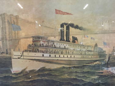
Iron Mountain Of Long Island Sound Litho J GleasonThe Benefit Shop Foundation Inc.4.3(2.9k)See Sold PriceMar 06, 2024
West Indies Windward Lesser Antilles. Martinique (Belonging to France)Jasper524.5(9.9k)See Sold PriceFeb 27, 2024
Southern Africa Cape of Good Hope-Madagascar ADMIRALTY sea chart 1935 (1955) mapJasper524.5(9.9k)See Sold PriceFeb 28, 2024
Gulf of Guinea. Ghana Togo Benin Nigeria. ADMIRALTY sea chart 1928 (1954) mapJasper524.5(9.9k)See Sold PriceFeb 28, 2024
South Namibia coast. Walvis Bay-Orange River ADMIRALTY sea chart 1881 (1954) mapJasper524.5(9.9k)See Sold PriceFeb 28, 2024
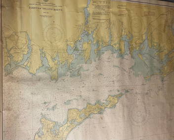
CHART: UNITED STATES - EAST COAST/ RHODE ISLAND - CONNECTICUT - NEW YORK/ Fishers IslandChurchill Galleries3.7(217)See Sold PriceFeb 26, 2024