SoldAn Accurate Map of the Islands of St. Christopher andAn Accurate Map of the Islands of St. Christopher and Nevis in the West Indies, 1782A map of the islands Nevis and St. Kitts with topographical information for both. A depiction of both the French fleSee Sold Price
MAP, Bermuda & St. Kitts, BowenBermuda & St. Kitts. Emanuel Bowen, A New & Accurate Map of Bermudas or Sommer's Islands... [on sheet with] An Accurate Map of the Island of St. Christopher, Vulgarly Called St. Kits..., 1747 (circa).See Sold Price
1750 Bowen Map of Bermuda and St. Kitts -- A New & Accurate Map of Bermudas or Sommer's Islands...Title: 1750 Bowen Map of Bermuda and St. Kitts -- A New & Accurate Map of Bermudas or Sommer's Islands... [on sheet with] An Accurate Map of the Island of St. Christopher… Cartographer: E BowenSee Sold Price
1750 Bowen Map of Bermuda and St. Kitts -- A New & Accurate Map of Bermudas or Sommer's Islands...Title: 1750 Bowen Map of Bermuda and St. Kitts -- A New & Accurate Map of Bermudas or Sommer's Islands... [on sheet with] An Accurate Map of the Island of St. Christopher… Cartographer: E BowenSee Sold Price
Chatelain: Map of Island of St. Christopher, 1715Map: 1715 Particularitez Curieuses de L’Ile de St. Christophle et de la Province de Bemarin dans les Antilles. By: Henri Abraham Chatelain Date: 1715 (Published) Amsterdam Dimensions: 14.75 x 19 incSee Sold Price
Sold[Map, Large] Island of St. Christopher, 1758Bellin. "Carte Reduite de L'Isle de Saint Christophe…." Paris, 1758. Measured from plate-marks 35.5" x 24". Hand-colored, on laid. Two holes near crease, some repairs to verso (refer to photos), cleSee Sold Price
SoldA Map of the Islands of St. Christopher and Nevis, WestA Map of the Islands of St. Christopher and Nevis, West Indies, February 7, 1782.Framed dimensions: H: 18 5/8 x W: 21 1/2 in.H: 12 5/8 W: 15 3/8 in.See Sold Price
SoldEman Bowen: 1 sheet, 2 images: Bermudas/St. Kits.[Bowen]. 2 Maps on 1 Sheet: A New & Accurate Map of Bermudas or Sommers Islands, taken from Actual Survey ; wherein the Errors of former Charts are Corrected./ An Accurate Map of the Island of St. ChrSee Sold Price
1782 Cary Map of St. Kitts and Nevis -- An Accurate MapTitle: 1782 Cary Map of St. Kitts and Nevis -- An Accurate Map of the Islands of St. Christophers and Nevis in the West Indies Cartographer: J Cary Year / Place: 1782, London Map Dimension (in.): 12.1See Sold Price
Carte de l'Isle de St Christophle'. St Christopher / St Kitts. BELLIN 1759 mapTITLE/CONTENT OF MAP: 'Carte de l'Isle de St Christophle [Map of the island of St Christopher (St Kitts)]' DATE PRINTED: 1759 IMAGE SIZE: Approx 20.5 x 32.0cm, 8 x 12.5 inches (Large); Please note thaSee Sold Price
Carte de l'Isle de St Christophle'. St Christopher / St Kitts. BELLIN 1759 mapTITLE/CONTENT OF MAP: 'Carte de l'Isle de St Christophle [Map of the island of St Christopher (St Kitts)]' DATE PRINTED: 1759 IMAGE SIZE: Approx 20.5 x 32.0cm, 8 x 12.5 inches (Large); Please note thaSee Sold Price
J.N. Bellin: Map of St. Christopher Island, 1758Carte Réduite De L'Isle De Saint Christophe is a highly detailed large-scale engraved map of St. Christopher island (a.k.a. St. Kitts) with topography, several place names, and a beautiful title cartSee Sold Price
SoldMap of Cuba, Hispaniola & Puerto Rico, 1747Heading: Author: Bowen, Emanuel Title: A New & Accurate Map of the Island of Cuba [on sheet with] A New & Accurate Map of the Islands of Hispaniola or St. Domingo, and Porto Rico Place Published: LonSee Sold Price
St Kitts Nevis St Eustatius Saba Leeward Islands ADMIRALTY chart 1864 (1961) mapTITLE/CONTENT OF MAP: 'West Indies - Leeward Islands - St. Eustatius, St. Christopher & Nevis // Basseterre Bay // Saba // St. Eustatius - Orange Baai' DATE PRINTED: Surveyed 1848-1959. Published 1864See Sold Price
Bowen: Antique Map of Gulf of St. Lawerence, 1752Title: A New & Accurate Map of the Islands of Newfoundland, Cape Briton, St. John and Anticosta; Together with the Neighbouring Countries of Nova Scotia, Canada &c...1752 Bowen Gulf of St. Lawerence wSee Sold Price
SoldAmerica.- Bowen (Emanuel) A New & Accurate Map ofAmerica.- Bowen (Emanuel) A New & Accurate Map of Louisiana, with Part of Florida and Canada, and the Adjacent Countries; A New & Accurate Map of the Islands of Newfoundland, Cape Breton, St. John andSee Sold Price
SoldBOWEN, EMANUEL. A New & Accurate Map of the IsBOWEN, EMANUEL. A New & Accurate Map of the Islands of Newfoundland, Cape Breton, St. John and Anticosta. Double-page engraved map, 355x435 mm, wide margins. First state. Kershaw III:693. London, 1747See Sold Price
SoldBOWEN,CUBA,HISPANIOLA,HAND COL. ENG,C.1747Artist: Emanuel Bowen, Title: A New and Accurate Map of the Islands of Cuba, Hispaniola, or St. Domingo, and Porto Rico, Pub: Emanuel Bowen, Date: C.1747, Medium: Hand-colored engraving, Sight size: 1See Sold Price
SDUK: Map of British West Indies Islands, 1846Title/Content of Map: 'THE BRITISH ISLANDS IN THE WEST INDIES; Jamaica, Trinidad, Virgin Islands, Leeward Islands (St Christopher, Nevis, Barbuda, Antigua), St Lucie, St Vincent, Barbadoes, Tobago, DoSee Sold Price
SDUK: Antique Map of the West Indies Islands, 1846Title/Content of Map: 'THE BRITISH ISLANDS IN THE WEST INDIES; Jamaica, Trinidad, Virgin Islands, Leeward Islands (St Christopher, Nevis, Barbuda, Antigua), St Lucie, St Vincent, Barbadoes, Tobago, DoSee Sold Price
BRITISH WEST INDIES Jamaica Trindad Antilles Virgin Cayman Islands SDUK 1844 mapTITLE/CONTENT OF MAP: 'BRITISH WEST INDIES; Jamaica, Trinidad, Virgin Islands, Leeward Islands (St Christopher, Nevis, Barbuda, Antigua), St Lucie, St Vincent, Barbadoes, Tobago, Dominica, Anguila, RoSee Sold Price
BRITISH WEST INDIES ISLANDS. Jamaica Antilles Virgin Caymans. SDUK 1851 mapTITLE/CONTENT OF MAP: 'THE BRITISH ISLANDS IN THE WEST INDIES; Jamaica, Trinidad, Virgin Islands, Leeward Islands (St Christopher, Nevis, Barbuda, Antigua), St Lucie, St Vincent, Barbadoes, Tobago, DoSee Sold Price
BRITISH WEST INDIES ISLANDS. Jamaica Antilles Virgin Caymans. SDUK 1851 mapTITLE/CONTENT OF MAP: 'THE BRITISH ISLANDS IN THE WEST INDIES; Jamaica, Trinidad, Virgin Islands, Leeward Islands (St Christopher, Nevis, Barbuda, Antigua), St Lucie, St Vincent, Barbadoes, Tobago, DoSee Sold Price
BRITISH WEST INDIES Jamaica Virgin Cayman Leeward Islands Trinidad SDUK 1844 mapTITLE/CONTENT OF MAP: 'BRITISH WEST INDIES; Jamaica, Trinidad, Virgin Islands, Leeward Islands (St Christopher, Nevis, Barbuda, Antigua), St Lucie, St Vincent, Barbadoes, Tobago, Dominica, Anguila, RoSee Sold Price
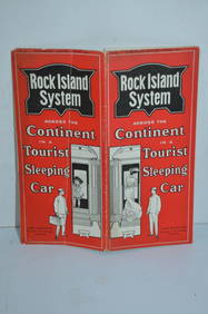
Chicago Rock Island and Pacific RY August 1903 Westbound Edition Public TimetableJM Hobby Supply and Railroad Artifact Auctions4.4(127)See Sold PriceFeb 24, 2024
19thc Colton Map, Comparitive Size of Lakes & IslandsConnoisseur Auctions3.9(337)See Sold PriceFeb 24, 2024
[ARCTIC]. BOWEN, Emanuel. A New & Accurate Map of the North...Potter & Potter Auctions4.6(550)See Sold PriceMar 07, 2024
(2) 14K Chains, (1) With St. Christopher 14 K, (1) With Cross 10KRalph Fontaine Heritage Auctions Inc.4.7(236)See Sold PriceFeb 25, 2024
1764 Bellin Map of Lesser Antilles Northern Portion -- Petites Antilles ou Isles du Vent 3e. Partie.Jasper524.5(9.9k)See Sold PriceFeb 27, 2024
1750 Bowen Map of Bermuda and St. Kitts -- A New & Accurate Map of Bermudas or Sommer's Islands...Jasper524.5(9.9k)See Sold PriceFeb 27, 2024
New and Correct Map of North America With the West India Islands,Jasper524.5(9.9k)See Sold PriceFeb 27, 2024
Geographical Statistical and Historical Map of the Windward IslandsJasper524.5(9.9k)See Sold PriceFeb 27, 2024
WEST AFRICA. Guinea. Nigeria Ghana Benin Togo Sierra Leone. MALLET 1683 mapJasper524.5(9.9k)See Sold PriceFeb 28, 2024
Johnson's Africa. Colonies & tribes. Liberia Nile Delta Cape Colony 1866 mapJasper524.5(9.9k)See Sold PriceFeb 28, 2024
Partie Occidentale de l’Afrique. West Africa coast Canary islands BONNE 1788 mapJasper524.5(9.9k)See Sold PriceFeb 28, 2024
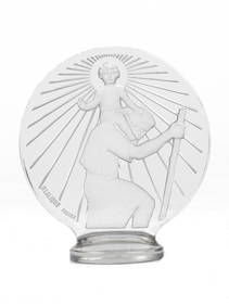
A St Christopher glass mascot by Rene Lalique, French, introduced 1st March 1928,Bonhams4.1(326)See Sold PriceMar 01, 2024


![[Map, Large] Island of St. Christopher, 1758 (1 of 4)](https://p1.liveauctioneers.com/3532/146911/74242534_1_x.jpg?height=282&quality=70&version=1564368564)


![[ARCTIC]. BOWEN, Emanuel. A New & Accurate Map of the North... (1 of 1)](https://p1.liveauctioneers.com/928/318880/171360917_1_x.jpg?height=282&quality=70&version=1707501302)