ATLAS of ANTIENT GEOGRAPHY by SAMUEL BUTLER 1843John McInnis Auctioneers,LLC4.5(505)See Sold PriceFeb 24, 2024
18TH C. ANTIQUE MAP: FRENCH & INDIAN WAR, FRAMEDThomaston Place Auction Galleries4.4(393)See Sold PriceFeb 24, 2024
Rand McNally Railroad Map Cabinet w/ 21 Railroad MapsRail & Road Auctions4.6(165)See Sold PriceMar 08, 2024
Keith Haring - Ink on New York Map, Best Buddies, Inscribed, Signed, and DatedSapphire Auction Gallery4(67)See Sold PriceMar 02, 2024
LATE 17TH C. FRENCH MAP OF THE NEW WORLD BY ALEXIS-HUBERT JAILLOT (1632-1712)Thomaston Place Auction Galleries4.4(393)See Sold PriceFeb 24, 2024
Central Railroad of New Jersey Map of Sandy Hook Route-ca. 1903JM Hobby Supply and Railroad Artifact Auctions4.4(127)See Sold PriceFeb 24, 2024
Lot of Six Mixed Atlas Box Cars-HO Scale-New in BoxJM Hobby Supply and Railroad Artifact Auctions4.4(127)See Sold PriceFeb 25, 2024
Rand McNally/Santa Fe Railroad Map of Iowa-1912JM Hobby Supply and Railroad Artifact Auctions4.4(127)See Sold PriceFeb 24, 2024
NICOLAES VISSCHER (NETHERLANDS, 1618-1709) MAP OF THE NEW WORLDThomaston Place Auction Galleries4.4(393)See Sold PriceFeb 24, 2024
17TH C. WORLD MAP BY NICOLAES VISSCHER (NETHERLANDS, 1618-1709)Thomaston Place Auction Galleries4.4(393)See Sold PriceFeb 24, 2024
Lot of Six Mixed Atlas Cabooses-HO Scale-New in BoxJM Hobby Supply and Railroad Artifact Auctions4.4(127)See Sold PriceFeb 25, 2024
Sold18TH CENTURY HAND-DRAWN SURVEY "A Survey of the Lands18TH CENTURY HAND-DRAWN SURVEY England, 1780 "A Survey of the Lands and a Mansion house of Mr. Charlton Holmes. Situate in the Parish of Glemsford in the County of Suffolk 1780". Titled within a decorSee Sold Price
Sold18th Century Harrisburg Land SurveyDESCRIPTION: 18th century Harrisburg, Pennsylvania hand drawn and titled land survey on woven fabric and applied paper. With green and pink outlines and red seal. Signed by Surveyor General Campbell aSee Sold Price
18th Century Harrisburg Land SurveyDESCRIPTION: 18th century Harrisburg, Pennsylvania hand drawn and titled land survey on woven fabric and applied paper. With green and pink outlines and red seal. Signed by Surveyor General Campbell aSee Sold Price
Sold1759+1762 Hand-Drawn Surveys to John Hart Phila.Colonial America Two French and Indian War Hand-Drawn Land Surveys "Survey'd to John Hart" 1759 & 1762 Philadelphia County 1759 & 1762-Dated French and Indian War Colonial Period, Two Hand-Drawn LandSee Sold Price
Early 18th C. Hand Drawn MapEarly 18th century, hand drawn map, ink on paper, "Map of Land Belonging to Letty Read and Heirs, Townsend Harbor", surveyed by James Thompson, Groton MA, in period frame, 18 1/2"h x 23"w (sheet), 24"See Sold Price
Sold1815 South Carolina Land Survey & 1829 DeedPen & ink, hand drawn survey map with coloring, dated July 28, 1815 describing 211 acres on Tiger River in Union District belonging to William Linam, William Lucas and heirs of Jeremiah Hamilton, Esq.See Sold Price
Sold1746 Hand-Drawn Land Survey1746 Hand-Drawn Survey of a Plot of Land, Fine. 6.5" x 8.25", show-through from some tape repairs on the back. A quaint, hand-drawn survey from an indeterminate place which shows the location of someSee Sold Price
SoldHand Drawn Land Survey Hand Drawn Land Survey American, 1818. A hand drawn land survey by Henry Elliot/95th surveyor, dated Nov. 20th, 1818. Depicts a plot of land around the Mississippi River; 15.75 x 9.5 in.See Sold Price
Sold1856 Hand drawn land survey map Herrin Family EdgefieldFramed hand drawn land survey map involving lands belonging to the Herrin family of Edgefield District SC. Other names mentioned include J. Herrin, Margaret Herrin, William Daniel, and William Mobley.See Sold Price
Sold1815 South Carolina Land Survey & 1829 DeedHand drawn land survey, South Carolina, Union District, dated July 28, 1815; unusually decorated with hand drawn and colored compass rose and compass divider indicating scale, colored borders; 211 acrSee Sold Price
SoldDAVID REDICK, 1785 Hand-drawn Land SurveyAutographs1785 Hand-drawn Land Survey Washington County in SW Pennsylvania Signed By David Redick DAVID REDICK. Commissioner Appointed by George Washington to negotiate with the Whiskey Rebellion InsuSee Sold Price
Sold18th Century Kentucky Land Survey with Daniel BooneThe Kentucky Land Survey, from Franklin, Kentucky, was conducted with Abraham Lincoln and the Daniel Boone Association by the state surveyor James Thompson. The two surveys include a 1,000-acre tractSee Sold Price
18th Century Kentucky Land Surveys with Abraham LincolnThe Kentucky Land Survey, from Franklin, Kentucky, was conducted with Abraham Lincoln and the Daniel Boone Association by the state surveyor James Thompson. The two surveys include a 1,000-acre tractSee Sold Price
SoldEarly hand drawn and hand colored land survey map ofEarly hand drawn and hand colored land survey map of upstate NY, probably Albany area, with settlement dates listed between 1802 and 1857 - family names include Sybrant VanShiack, John Ehle, David ArcSee Sold Price
MN - 1880-1900 - Surveyor's Master Township BookSurvey book of surveyed lands including Townships 52-69N, etc. From the 4th Meridian. Many of the pages are copied with hand drawn notes and additions. Survey includes the Fon du lac Indian ReservatioSee Sold Price
Sold18th Century Indenture-PhiladelphiaVellum land indenture between Thomas Mifflin Jr. and Elizabeth Mifflin for Tenement Wharf and plot of land in Southwark, Philadelphia. Document dated January 30, 1798, 2pp (one hand drawn map). DocumeSee Sold Price
1869 Survey Map Pine Grove Plantation, Camden, SCoriginal, hand drawn survey by S.M. Boykin of 774 acres of land in Camden, SC surrounded by Confederate General John Doby Kennedy (1840-1896). created at the request of Confederate Captain Louis D DesSee Sold Price
SoldEarly 19th Century Louisiana Land SurveyDistrict North of Red River, La., 1829, hand drawn map depicting plots of land along the Mississippi River, one area labeled "Jon's Plantation", with central "Table of Contents" listing each land sectSee Sold Price
Sold1817 Kentucky Land Survey Connecting Land of GreenLot of 2: 1817 Land survey, 7pp, 8 x 12.5 in., with hand-drawn map on second page. Estate of John Cunningham, for lands adjacent to the land of Green Clay (Kentucky's largest land and slave owner-fatSee Sold Price
Sold18th Century Bucks County Land Documents.Grouping of 18th century manuscript pages, 7 leaves (both sides) related to land surveys in Bucks County, Pennsylvania. All sheets copied period by Moses Moon and show maps and surveys of land. Sold wSee Sold Price
Survey of land in South Carolina 1784Title: Survey of land in South Carolina for James Cantey, 1784 Author: Mitchell, Ephraim Description: 1 pp. printed and autograph document. 10¼x8¼. Land survey of a 100 acre plot, drawn by hand, andSee Sold Price
SoldKent - a late 18th/early 19th century hand-colourKent - a late 18th/early 19th century hand-coloured estate map on vellum showing "certain lands at Biddenden, Smarden and Frittenden", a survey of James Suley incorporating decorative cartouche, a vigSee Sold Price
SoldTerritorial Comstock Location Claim with Hand-Drawn MapThis survey done by county surveyor E. L. Mason is a description of a plot of land made for E. W. Keyes. This 145.52 acre survey starts from corner of old hospital. Hand drawn map on top of survey. OnSee Sold Price
Territorial Location Claim with Hand-Drawn Map 99437This survey done by county surveyor E. L. Mason is a description of a plot of land made for E. W. Keyes. This 145.52 acre survey starts from corner of old hospital. Hand drawn map on top of survey. OnSee Sold Price
Continental Porcelain Trinket Box w/ Patinated Bronze Hinges, 18th-19th CenturyTaylor & Harris4.7(161)See Sold PriceMar 10, 2024
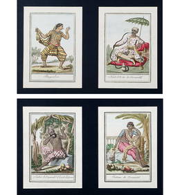
Charles Dupuis French 18th century, Pair Hand Colored Engravings, ArchitecturalGlobal Auctions Company4.3(36)See Sold PriceMar 03, 2024
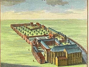
18th Century Hess Germany Hand colored Engraved MapGlobal Auctions Company4.3(36)See Sold PriceMar 03, 2024
18th century ARABIC MANUSCRIPT antique HAND WRITTEN SHARH AL WIQAYA by MAHBUBIJasper524.5(9.9k)See Sold PriceFeb 27, 2024
18th century ARABIC MANUSCRIPT antique HAND WRITTEN POETRY by JAMIJasper524.5(9.9k)See Sold PriceFeb 27, 2024
17th-18th century PORTRAIT of FRANCIS BORGIA OIL on CANVAS 17 x 22" antiqueJasper524.5(9.9k)See Sold PriceFeb 27, 2024
Nottingham.- Ordnance Survey Office (publisher) Collection 8 geological maps on the environs ofForum Auctions4.3(53)See Sold PriceFeb 29, 2024
(2 Pc) 1930s Tarcisio Tosin Italian Porcelain FigurinesAkiba Galleries4.7(1.8k)See Sold PriceFeb 29, 2024
RUSSIAN ICON 18th century MILK GIVER THEOTOKOS or HELPER in CHILDBIRTH antiqueJasper524.5(9.9k)See Sold PriceFeb 27, 2024
RUSSIAN ICON of JESUS IMAGE NOT MADE BY HANDS 18th CENTURY ANTIQUE MANDYLIONJasper524.5(9.9k)See Sold PriceFeb 27, 2024
Possible 18th Century French Porcelain Sevres CachepotCoral Gables Auction4.5(520)See Sold PriceFeb 28, 2024
18th Century Hand Colored Engraving. "Minnebroeders Klooster"Clark's Auction Company4.6(443)See Sold PriceMar 03, 2024
0.75 ctw Certified VS/SI Cushion Diamond Halo Ring 18k Rose GoldPacific Global Auction3.9(280)See Sold PriceJul 27, 2024