ATLAS of ANTIENT GEOGRAPHY by SAMUEL BUTLER 1843John McInnis Auctioneers,LLC4.6(502)See Sold PriceFeb 24, 2024
18TH C. ANTIQUE MAP: FRENCH & INDIAN WAR, FRAMEDThomaston Place Auction Galleries4.4(386)See Sold PriceFeb 24, 2024
Rand McNally Railroad Map Cabinet w/ 21 Railroad MapsRail & Road Auctions4.6(165)See Sold PriceMar 08, 2024
Keith Haring - Ink on New York Map, Best Buddies, Inscribed, Signed, and DatedSapphire Auction Gallery4(67)See Sold PriceMar 02, 2024
LATE 17TH C. FRENCH MAP OF THE NEW WORLD BY ALEXIS-HUBERT JAILLOT (1632-1712)Thomaston Place Auction Galleries4.4(386)See Sold PriceFeb 24, 2024
Central Railroad of New Jersey Map of Sandy Hook Route-ca. 1903JM Hobby Supply and Railroad Artifact Auctions4.4(126)See Sold PriceFeb 24, 2024
Lot of Six Mixed Atlas Box Cars-HO Scale-New in BoxJM Hobby Supply and Railroad Artifact Auctions4.4(126)See Sold PriceFeb 25, 2024
Rand McNally/Santa Fe Railroad Map of Iowa-1912JM Hobby Supply and Railroad Artifact Auctions4.4(126)See Sold PriceFeb 24, 2024
NICOLAES VISSCHER (NETHERLANDS, 1618-1709) MAP OF THE NEW WORLDThomaston Place Auction Galleries4.4(386)See Sold PriceFeb 24, 2024
17TH C. WORLD MAP BY NICOLAES VISSCHER (NETHERLANDS, 1618-1709)Thomaston Place Auction Galleries4.4(386)See Sold PriceFeb 24, 2024
Lot of Six Mixed Atlas Cabooses-HO Scale-New in BoxJM Hobby Supply and Railroad Artifact Auctions4.4(126)See Sold PriceFeb 25, 2024
Sold1894 Map of ChicagoAuthor: Cram Title: 1894 Map of Chicago Medium: Ink on Paper Dimensions: 14.5"X21.5" Map of Chicago dated 1894. Engraved and published by George Cram in Chicago. Double folio map. Inset of downtown. CSee Sold Price
1894 Map of ChicagoAuthor: Cram Title: 1894 Map of Chicago Medium: Ink on Paper Dimensions: 14.5"X21.5" Map of Chicago dated 1894. Engraved and published by George Cram in Chicago. Double folio map. Inset of downtown. CSee Sold Price
Sold1894 Map of AustraliaTitle: 1894 Map of Australia Medium: Ink on Paper Dimensions: 13.5"X11" Map of Australia dated 1894. Engraved and published by George Cram in Chicago. This map is engraved in the blue hue, the most deSee Sold Price
Sold1894 Map of MontanaTitle: 1894 Map of Montana Medium: Ink on Paper Dimensions: 21.5"X14.5" Description: Map of Montana dated 1894. Printed by George Cram for the Imperial Atlas. Published in Chicago. Key lower left. ColSee Sold Price
Sold1894 Map of MontanaAuthor: Cram Title: 1894 Map of Montana Medium: Ink on Paper Dimensions: 21.5"X14" Description: Map of Montana dated 1894. Engraved and published by George Cram in Chicago. Double folio map with map kSee Sold Price
Sold1894 Map of IcelandAuthor: Cram Title: 1894 Map of Iceland Medium: Ink on Paper Dimensions: 14.5"X11.5" Description: Map of Iceland dated 1894. Engraved and published by George Cram in Chicago. Part of his World Atlas.See Sold Price
1894 Map of MontanaAuthor: Cram Title: 1894 Map of Montana Materials: Ink on Paper Dimensions: 21.5"14" Description: Map of Montana dated 1894. Engraved and published by George Cram in Chicago. Double folio map with mapSee Sold Price
1894 Map of the New Mexico TerritoryAuthor: Cram Title: 1894 Map of the New Mexico Territory Medium: Ink on Paper Dimensions: 14.5"X22" Map of the New Mexico territory dated 1894. Engraved and published by George Cram in Chicago. Part oSee Sold Price
1894 Map of MontanaAuthor: Cram Title: 1894 Map of Montana Medium: Ink on Paper Dimensions: 21.5"X14" Map of Montana dated 1894. Engraved and published by George Cram in Chicago. Double folio map. Key located lower leftSee Sold Price
Sold1894 Map of WyomingAuthor: Cram Title: 1894 Map of Wyoming Medium: Ink on Paper Dimensions: 22"X14.5" Map of Wyoming dated 1894. Engraved and published by George Cram in Chicago. Part of his World Atlas. Double folio maSee Sold Price
1894 Map of New Mexico territoryAuthor: Cram Title: 1894 Map of New Mexico territory Medium: Ink on Paper Dimensions: 14.5"X22" Map of the New Mexico territory dated 1894. Engraved and published by George Cram in Chicago. Part of CrSee Sold Price
1894 Map of AustraliaTitle: 1894 Map of Australia Author: Cram Materials: Ink on Paper Dimensions: 14.5"X11" Description: Map of Australia dated 1894. Engraved and published by George Cram in Chicago. Part of his World AtSee Sold Price
1894 Map of EdinburghAuthor: Cram Title: 1894 Map of Edinburgh Medium: Ink on Paper Dimensions: 14.5"X11.5" Description: Map of Edinburgh dated 1894. Engraved and published by George Cram in Chicago. Part of his World AtlSee Sold Price
1894 Map of IcelandAuthor: Cram Title: 1894 Map of Iceland Medium: Ink on Paper Dimensions: 14.5"X11.5" Map of Iceland dated 1894. Engraved and published by George Cram in Chicago. Key lower right. Very detailed. VividSee Sold Price
Sold1894 Map of ItalyAuthor: Cram Title: 1894 Map of Italy Medium: Ink on Paper Dimensions: 11"X14.5" Map of Italy dated 1894. Engraved and published by George Cram in Chicago. Key lower left. Color coded for territorialSee Sold Price
1894 Map of St. LouisAuthor: Watson Title: 1894 Map of St. Louis Medium: Ink on Paper Dimensions: 11.5"X14.5" Map of St. Louis dated 1894. Printed and published by Watson in Chicago. Part of his World Atlas. With Steam anSee Sold Price
1894 Map of St. LouisTitle: 1894 Map of St. Louis Author: Watson Medium: Ink on Paper Dimensions: 11"X14.5" Description: Map of St. Louis dated 1894. Printed and published by Watson in Chicago. Part of his World Atlas. WiSee Sold Price
1894 Map of EdinburghAuthor: Cram Title: 1894 Map of Edinburgh Medium: Ink on PaperDimensions: 14.5"X11.5" Map of Edinburgh dated 1894. Engraved and published by George Cram in Chicago. Part of his World Atlas. Color codeSee Sold Price
1894 Map of FranceAuthor: Cram Title: 1894 Map of France Medium: Ink on Paper Dimensions: 14.5"X11" Map of France dated 1894. Engraved and published by George Cram in Chicago. Key upper right. Color coded for territoriSee Sold Price
1894 Map of AustraliaAuthor: Cram Title: 1894 Map of Australia Medium: Ink on Paper Dimensions: 14.5"X11" Map of Australia dated 1894. Engraved and published by George Cram in Chicago. Key upper left. Color coded for terrSee Sold Price
1894 Map of St. LouisTitle: 1894 Map of St. Louis Author: Watson Medium: Ink on Paper Dimensions: 11.5"X14.5" Description: Map of St. Louis dated 1894. Printed and published by Watson in Chicago. Part of his World Atlas.See Sold Price
Rand McNally: Antique Map of India [verso] China, 1894Title/Content of Map: 1894 Rand McNally Map of India [verso] China, Palestine -- British India [verso] Palestine; China Date Printed: 1894 Chicago Cartographer: Rand McNally Size: 19.8 x 13 in. A verySee Sold Price
Rand McNally Map of British ColumbiaRand McNally & Co. Map of British Columbia. Lithographed Map with hand color. Chicago, 1894. 15 1/2" x 21 3/4" sheet.See Sold Price
1894 Western Hemisphere MapAuthor: Watson Title: 1894 Western Hemisphere Map Medium: Ink on Paper Dimensions: 11.5"X14.5" Map of the Western hemisphere dated 1894. Published by Watson in Chicago and part of the Universal WorldSee Sold Price
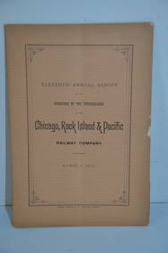
Chicago Rock Island and Pacific RR 11th Annual Report-April 1, 1891JM Hobby Supply and Railroad Artifact Auctions4.4(126)See Sold PriceFeb 24, 2024
Cincinnati Hamilton and Dayton RR Map -USGC 1889JM Hobby Supply and Railroad Artifact Auctions4.4(126)See Sold PriceFeb 24, 2024
Rand McNally/Santa Fe Railroad Map of Iowa-1912JM Hobby Supply and Railroad Artifact Auctions4.4(126)See Sold PriceFeb 24, 2024
Chicago and Northwestern RY Travelers Companion Notebook-1880JM Hobby Supply and Railroad Artifact Auctions4.4(126)See Sold PriceFeb 24, 2024
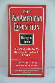
Chicago Burlington and Quincy RR Pan-American Exposition Flyer-1901JM Hobby Supply and Railroad Artifact Auctions4.4(126)See Sold PriceFeb 24, 2024
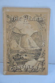
Chicago Burlington and Quincy RR The Heart of the Continent Book-1882JM Hobby Supply and Railroad Artifact Auctions4.4(126)See Sold PriceFeb 24, 2024
Chicago Milwaukee and St Paul RY To the Lakes of Wisconsin and Minnesota Book-1909JM Hobby Supply and Railroad Artifact Auctions4.4(126)See Sold PriceFeb 24, 2024
Chicago Milwaukee and St Paul RY Why and Wherefore Book-1886JM Hobby Supply and Railroad Artifact Auctions4.4(126)See Sold PriceFeb 24, 2024
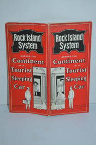
Chicago Rock Island and Pacific RR Book Sunshine and Moonlight-1889JM Hobby Supply and Railroad Artifact Auctions4.4(126)See Sold PriceFeb 24, 2024
Chicago Burlington and Quincy RR July 5, 1894 Public TimetableJM Hobby Supply and Railroad Artifact Auctions4.4(126)See Sold PriceFeb 24, 2024
Chicago Rock Island and Pacific RY November 4, 1899 Public TimetableJM Hobby Supply and Railroad Artifact Auctions4.4(126)See Sold PriceFeb 24, 2024
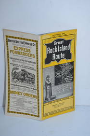
Chicago Rock Island and Pacific RY August 1903 Westbound Edition Public TimetableJM Hobby Supply and Railroad Artifact Auctions4.4(126)See Sold PriceFeb 24, 2024
Pair of Early Railroad Maps - 1862 Pittsburgh, Ft. Wayne & Chicago Railway and 1873 PennsylvaniaRail & Road Auctions4.6(165)See Sold PriceMar 07, 2024
Group of Ten Railroad Photographs, Maps, and Prints - New Jersey, Long Island, and New YorkRail & Road Auctions4.6(165)See Sold PriceMar 07, 2024
Eight Louisville, New Albany & Chicago and Chicago, Indianapolis & Louisville Annual ReportsRail & Road Auctions4.6(165)See Sold PriceMar 08, 2024
Early 1990s Chicago Transit Authority Fiberglass Line MapRail & Road Auctions4.6(165)See Sold PriceMar 08, 2024
1894 World's Congress of Religions at the World's Columbian Exposition 1st EditionNorth American Artifact Auctions4.6(182)See Sold PriceApr 20, 2024
[CHICAGO]. Rare Pre-Fire Illinois Map: “Blanchard’s Map of ...Potter & Potter Auctions4.6(539)See Sold PriceMar 07, 2024
1905 20th Century Atlas of Boone County IllinoisMatthew Bullock Auctioneers4.7(1.8k)See Sold PriceFeb 24, 2024
Africa. Congo Free Trade Area. British South Africa Company. STANFORD 1894 mapJasper524.5(9.8k)See Sold PriceFeb 28, 2024


![Rand McNally: Antique Map of India [verso] China, 1894 (1 of 3)](https://p1.liveauctioneers.com/5584/115413/59308634_1_x.jpg?height=282&quality=70&version=1516757305)


![[CHICAGO]. Rare Pre-Fire Illinois Map: “Blanchard’s Map of ... (1 of 2)](https://p1.liveauctioneers.com/928/318880/171361260_1_x.jpg?height=282&quality=70&version=1707501302)


