ATLAS of ANTIENT GEOGRAPHY by SAMUEL BUTLER 1843John McInnis Auctioneers,LLC4.6(502)See Sold PriceFeb 24, 2024
18TH C. ANTIQUE MAP: FRENCH & INDIAN WAR, FRAMEDThomaston Place Auction Galleries4.4(386)See Sold PriceFeb 24, 2024
Rand McNally Railroad Map Cabinet w/ 21 Railroad MapsRail & Road Auctions4.6(165)See Sold PriceMar 08, 2024
Keith Haring - Ink on New York Map, Best Buddies, Inscribed, Signed, and DatedSapphire Auction Gallery4(67)See Sold PriceMar 02, 2024
LATE 17TH C. FRENCH MAP OF THE NEW WORLD BY ALEXIS-HUBERT JAILLOT (1632-1712)Thomaston Place Auction Galleries4.4(386)See Sold PriceFeb 24, 2024
Central Railroad of New Jersey Map of Sandy Hook Route-ca. 1903JM Hobby Supply and Railroad Artifact Auctions4.4(126)See Sold PriceFeb 24, 2024
Lot of Six Mixed Atlas Box Cars-HO Scale-New in BoxJM Hobby Supply and Railroad Artifact Auctions4.4(126)See Sold PriceFeb 25, 2024
Rand McNally/Santa Fe Railroad Map of Iowa-1912JM Hobby Supply and Railroad Artifact Auctions4.4(126)See Sold PriceFeb 24, 2024
NICOLAES VISSCHER (NETHERLANDS, 1618-1709) MAP OF THE NEW WORLDThomaston Place Auction Galleries4.4(386)See Sold PriceFeb 24, 2024
17TH C. WORLD MAP BY NICOLAES VISSCHER (NETHERLANDS, 1618-1709)Thomaston Place Auction Galleries4.4(386)See Sold PriceFeb 24, 2024
Lot of Six Mixed Atlas Cabooses-HO Scale-New in BoxJM Hobby Supply and Railroad Artifact Auctions4.4(126)See Sold PriceFeb 25, 2024
Rocque (John): 'A Topographical Survey of the County ofRocque (John): 'A Topographical Survey of the County of Berks [Berkshire] in Eighteen Sheets In which is expressed, His Majesty`s Royal Palace of Windsor, its Parks and Forrest; the Seats of the NobilSee Sold Price
Rocque (John) A Topographical Survey of the County ofRocque (John) A Topographical Survey of the County of Berks, title in red & black, engraved pictorial dedication (plate XV), pp.ii-xiii letterpress text on rectos only, 17 engraved map sheets, the firSee Sold Price
SoldJohn Rocque, British c.1709-1762- ''A TopographicalJohn Rocque, British c.1709-1762- ''A Topographical Survey pf the County of Berks, in Eighteen Sheets in which is expressed His Majesty's Royal Palace of Windsor, its Parks and Forrest; the Seats of tSee Sold Price
SoldMiddlesex.- Rocque (John) A Topographical Map of theMiddlesex.- Rocque (John) A Topographical Map of the County of Middlesex, titled also in French, showing from Richmond Park to Rickmansworth, and Stoke Heath across to Waltham Abbey, with decorative tSee Sold Price
1754 Rocque Map of Paris on Linen -- A Plan of ParisTitle: 1754 Rocque Map of Paris on Linen -- A Plan of Paris &c. This Survey has been Reduced to the Same Scale and that of London & the County Arount It Survey'd and Publish'd in 16 Sheets by John RocSee Sold Price
1754 Rocque Map of Paris on Linen -- A Plan of ParisTitle: 1754 Rocque Map of Paris on Linen -- A Plan of Paris &c. This Survey has been Reduced to the Same Scale and that of London & the County Arount It Survey'd and Publish'd in 16 Sheets by John RocSee Sold Price
SoldLondon.- Bartlett (J.A.) Topographical Survey of theLondon.- Bartlett (J.A.) & Britton (John) Topographical Survey of the Borough of St. Marylebone, ... from Surveys & Drawings by J.A. Bartlett under the direction of John Britton F.S.A &c., from OxfordSee Sold Price
SoldRocque (John) An exact Survey of the Cities of LonRocque (John) An exact Survey of the Cities of London and Westminster. the Borough of Southwark,with The Country near Ten Miles round, 2nd edition with corrected title in red and black with enSee Sold Price
SoldLondon.- Rocque (John) [An exact Survey of the CitiesLondon.- Rocque (John) [An exact Survey of the Cities of London and Westminster ...], nine double-page maps only (of 16), engravings on cream laid paper with Strasbourg lily watermarks, each platemarkSee Sold Price
SoldRocque (John) An Exact Survey ...of LondonRocque (John) An Exact Survey ...of London Facsimile Edition with Introductory Notes by James Howgego, 16 map sheets, printed wrappers, oblong folio, Harry Margary, Phillimore & Co., 1971.See Sold Price
Sold-. Rocque (John) An Exact Survey of the City's of-. Rocque (John) An Exact Survey of the City's of London...,Facsimile Edition with Introductory Notes by James Howgego, double-page maps, occasional spotting, contemporary rexine with paper laSee Sold Price
Sold(2) Late 18th c. English engravings of KentPair of late 18th century English engravings by W. Watts after T. Sandby, first published in 'The History and Topographical Survey of the County of Kent' 1778-1799, the first titled 'Montreal near SevSee Sold Price
Sold(2) Late 18th c. English engravings of KentPair of late 18th century English engravings by W. Watts after T. Sandby, first published in 'The History and Topographical Survey of the County of Kent' 1778-1799, the first titled 'Chilham Castle, iSee Sold Price
Sold(2) Late 18th c. English engravings of KentPair of late 18th century English engravings by W. Watts after T. Sandby, first published in 'The History and Topographical Survey of the County of Kent' 1778-1799, the first titled 'Langley Park, neaSee Sold Price
Sold(3) Late 18th c. English engravings of KentThree late 18th century English engravings by W. Watts after T. Sandby, first published in 'The History and Topographical Survey of the County of Kent' 1778-1799, the first titled 'Mersham Hatch, in tSee Sold Price
Sold-. Hasted (Edward) The History and Topographical S-. Hasted (Edward) The History and Topographical Survey of the County of Kent,vol. 1-3, only, of 4, maps and plates, contemporary calf, rubbed, boards detached, folio, Canterbury, 1778-1780; sSee Sold Price
SoldHasted.Hist. & Topog. Survey of.. Kent,1778Hasted (Edward) The History and Topographical Survey of the County of Kent,4 vol., first edition, list of subscribers, 39 engraved maps and plans only (of 40, lacking large folding county mapSee Sold Price
SoldHasted (Edward) The History and Topographical SurHasted (Edward) The History and Topographical Survey of the County of Kent,Hasted (Edward) The History and Topographical Survey of the County of Kent, vol. 3 & 4 only, vignette titles, 15See Sold Price
SoldHASTED (E), THE HISTORY AND TOPOGRAPHICAL SURVEYHASTED (E), THE HISTORY AND TOPOGRAPHICAL SURVEY OF THE COUNTY OF KENT, Vol III only, folio, with twelve folding maps and eleven full page engraved plates, front board detached, spine defective, CanteSee Sold Price
SoldKent.- Hasted (Edward) The History and TopographicalKent.- Hasted (Edward) The History and Topographical Survey of the County of Kent, 4 vol., first edition, large folding map hand-coloured in outline, 85 engraved maps, plates and plans only (of 99), eSee Sold Price
SoldHasted Survey of the County of KentHasted (Edward) The History and Topographical Survey of the County of Kent,4 vol., first edition, large folding engraved map hand-coloured in outline, 44 engraved maps and plans, many folding,See Sold Price
SoldHasted.Hist/Topog.Survey..Kent,4v,1778-99Hasted (Edward) The History and Topographical Survey of the County of Kent,4 vol., first edition, list of subscribers, large folding engraved county map hand-coloured in outline and 99 engraveSee Sold Price
Hasted. The History...County of Kent. Atlas Volume[Map/England] Hasted, Edward. The History and Topographical Survey of the County of Kent. 34 maps. Atlas volume complied in the late 19th century. Folio. Table of contents in manuscript. Quarter leathSee Sold Price
SoldHasted (Edward) County of KentHasted (Edward) The History and Topographical Survey of the County of Kent,4 vol., first edition, large folding engraved map hand-coloured in outline, 98 engraved plates, plans and maps, someSee Sold Price
John Witt (NY,IN,1840-1901) oil painting antiqueBroward Auction Gallery4.8(277)See Sold PriceMar 17, 2024
DEMOCRATIC NATIONAL COMMITTEE WOMEN'S ACTIVITIESJohn McInnis Auctioneers,LLC4.6(502)See Sold PriceFeb 25, 2024
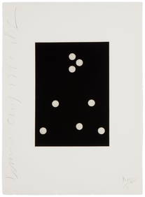
Donald Sultan (b. 1951), "Dominoes # 19" from the "Dominoes Portfolio," 1990, Aquatint on woveJohn Moran Auctioneers, Inc.4.7(453)See Sold PriceFeb 27, 2024
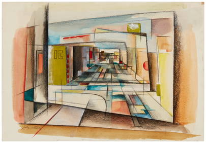
20th Century American School, "Downtown Los Angeles," circa 1952, Mixed media on sketching boardJohn Moran Auctioneers, Inc.4.7(453)See Sold PriceFeb 27, 2024
Rand McNally & Co's New Ideal State and County Survey and Atlas 1911North American Artifact Auctions4.6(182)See Sold PriceApr 20, 2024
8 5/8" Dover Blade. Found by John Putrum in the 1950s.Tony Putty Artifacts4.7(404)See Sold PriceMar 09, 2024
5 3/8" Pickwick. Burke County, Georgia. Putty COATony Putty Artifacts4.7(404)See Sold PriceMar 09, 2024
2 1/16" Middle Woodland Point. Pictured. Ex John Arends and Jake Vahle.Tony Putty Artifacts4.7(404)See Sold PriceMar 09, 2024
[JASPER, John. (1812 - 1901)]. Cabinet card of formerly enslaved Reverend John Jasper. New York, NY:Freeman's | Hindman4.4(1.6k)See Sold PriceFeb 27, 2024
[JASPER, John. (1812 - 1901)]. Photograph of formerly enslaved Reverend John Jasper. N.p., n.d., caFreeman's | Hindman4.4(1.6k)See Sold PriceFeb 27, 2024
[RECONSTRUCTION]. Manuscript legal document outlining the use of campaign funds by African AmericanFreeman's | Hindman4.4(1.6k)See Sold PriceFeb 27, 2024
Two Pine Valley Golf Course Golf Club Porcelain Plates by Lenox, 1991 Warner Shelly Bowl, 2005 JohnHoch LTD.4.5(73)See Sold PriceFeb 25, 2024
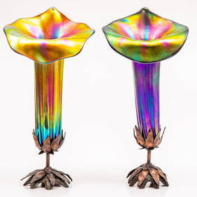
A Pair of John Cook Phoenix Studio Art Glass LampsGray's Auctioneers4.5(186)See Sold PriceMar 06, 2024
DALTON, JOHN CALL. 1825-1889. Topographical Anatomy of the Brain. Philadelphia: Judah Dobson, 1...Bonhams4.1(305)See Sold PriceJun 18, 2024


![[JASPER, John. (1812 - 1901)]. Cabinet card of formerly enslaved Reverend John Jasper. New York, NY: (1 of 2)](https://p1.liveauctioneers.com/197/319238/171467959_1_x.jpg?height=282&quality=70&version=1707520367)
![[JASPER, John. (1812 - 1901)]. Photograph of formerly enslaved Reverend John Jasper. N.p., n.d., ca (1 of 2)](https://p1.liveauctioneers.com/197/319238/171467960_1_x.jpg?height=282&quality=70&version=1707520367)
![[RECONSTRUCTION]. Manuscript legal document outlining the use of campaign funds by African American (1 of 4)](https://p1.liveauctioneers.com/197/319238/171468096_1_x.jpg?height=282&quality=70&version=1707520367)