ATLAS of ANTIENT GEOGRAPHY by SAMUEL BUTLER 1843John McInnis Auctioneers,LLC4.6(502)See Sold PriceFeb 24, 2024
18TH C. ANTIQUE MAP: FRENCH & INDIAN WAR, FRAMEDThomaston Place Auction Galleries4.4(386)See Sold PriceFeb 24, 2024
Rand McNally Railroad Map Cabinet w/ 21 Railroad MapsRail & Road Auctions4.6(165)See Sold PriceMar 08, 2024
Keith Haring - Ink on New York Map, Best Buddies, Inscribed, Signed, and DatedSapphire Auction Gallery4(67)See Sold PriceMar 02, 2024
LATE 17TH C. FRENCH MAP OF THE NEW WORLD BY ALEXIS-HUBERT JAILLOT (1632-1712)Thomaston Place Auction Galleries4.4(386)See Sold PriceFeb 24, 2024
Central Railroad of New Jersey Map of Sandy Hook Route-ca. 1903JM Hobby Supply and Railroad Artifact Auctions4.4(126)See Sold PriceFeb 24, 2024
Lot of Six Mixed Atlas Box Cars-HO Scale-New in BoxJM Hobby Supply and Railroad Artifact Auctions4.4(126)See Sold PriceFeb 25, 2024
Rand McNally/Santa Fe Railroad Map of Iowa-1912JM Hobby Supply and Railroad Artifact Auctions4.4(126)See Sold PriceFeb 24, 2024
NICOLAES VISSCHER (NETHERLANDS, 1618-1709) MAP OF THE NEW WORLDThomaston Place Auction Galleries4.4(386)See Sold PriceFeb 24, 2024
17TH C. WORLD MAP BY NICOLAES VISSCHER (NETHERLANDS, 1618-1709)Thomaston Place Auction Galleries4.4(386)See Sold PriceFeb 24, 2024
Lot of Six Mixed Atlas Cabooses-HO Scale-New in BoxJM Hobby Supply and Railroad Artifact Auctions4.4(126)See Sold PriceFeb 25, 2024
Rogue River Drainage Basin Oregon Land Use Map andThis is a Water Resources Dept. land use map of the Rogue River Basin dated 1978. Printed in color by the WRD in 130000 scale. Originally taken in 1974 by U-2 spy plane photos and colorized. Updated iSee Sold Price
Gunther Barbed Clear Agate ArrowheadOffered is an excellent example of a Gunther Barbed Arrowhead. This arrowhead was found in the Rogue River Basin of Southern Oregon. The arrowhead is 1-1/8" x 7/8" made of clear agate and isSee Sold Price
SoldClassic Gunther Barbed Arrowhead - OregonOffered is a classic example of a Gunther Barbed Arrowhead. The arrowhead is 1-1/4" x 3/4" and made of Brown Jasper. This arrowhead was found in the Rogue River Basin of Southern Oregon by FSee Sold Price
Asia & Europe river systems. Watersheds drainage basins. JOHNSTON 1856 old mapTITLE/CONTENT OF MAP: 'The River Systems of Asia and Europe' DATE PRINTED: 1856 IMAGE SIZE: Approx 53.0 x 63.0cm, 20.75 x 24.75 inches (Large); Please note that this is a folding map. TYPE: Antique maSee Sold Price
Asia & Europe river systems. Watersheds drainage basins. JOHNSTON 1856 old mapTITLE/CONTENT OF MAP: 'The River Systems of Asia and Europe' DATE PRINTED: 1856 IMAGE SIZE: Approx 53.0 x 63.0cm, 20.75 x 24.75 inches (Large); Please note that this is a folding map. TYPE: Antique maSee Sold Price
1936 Composite Data Map CT River Basin1936 Composite Data Map of the Connecticut River Drainage Basin, New England Regional Planning Commission, top right corner lost, tear along top edge, minor losses lower right edge, 86" x 35 1/2"See Sold Price
SoldHydro-electric development in Truckee River basinHeading: (California - Lake Tahoe) Author: United States Forest Survey Title: Map of the Drainage Basin of Truckee River, California and Nevada, showing hydro-electric developments Place Published: WaSee Sold Price
SoldLand development map of southeastern Idaho 1901Heading: (Idaho) Author: Title: Southeastern Idaho Lands in the Great Snake River Valley along the Oregon Short Line Railroad Place Published: Denver, CO Publisher:Frank G. Pabor, Publisher DateSee Sold Price
SoldReport on Oregon Placer Mine 1912Title: Preliminary Report on the Flanagan Placer Mine, and Possible Dredging Lands in the Rogue River Adjacent Thereto, Josephine County, Oregon Author: Newsom, J[ohn] F. Description: [8], 14 leaves,See Sold Price
AMERICAS.North & South America river systems. Drainage divides/basins 1850 mapTITLE/CONTENT OF MAP: 'The river systems of America, showing the boundaries & comparative extent of the river basins, and the different oceans &c to which they contribute their waters.' DATE PRINTED:See Sold Price
SoldMap of Colusa Basin (Sacramento Valley) 1895Title: Colusa Basin: Compiled from surveys made and data collected by the late State Engineer Department, from public land, rail road and private irrigation and drainage district surveys Author: HenkeSee Sold Price
SoldRare Paleo CrescentRare Paleo Crescent very well made , Size: 1.15" long .53" wide. From Jackson County Oregon along the Rogue River 1920's - 1930's Ex Byron Anderson collection, Byron can be found in Who's who's in IndSee Sold Price
SoldColumbia River Gem PointBird Point, Size: 1.21" long .93" wide. From Jackson County Oregon along the Rogue River 1920's - 1930's Ex Byron Anderson Collection.See Sold Price
SoldRare Paleo CrescentRare Paleo Crescent very well made , Size: 1.05" long .56" wide. From Jackson County Oregon along the Rogue River 1920's - 1930's Ex Byron Anderson Collection.See Sold Price
Sold2 1/8" Rogue River - Jackson G-10 COASuperb example from Curry Co., Oregon. Jackson G-10 COA. Killer.See Sold Price
SoldFramed Hudson River Map PrintPiece depicts a map of the HUDSON RIVER. PIECE Is professionally framed with black toned metal frame. Map, map print, framed map. Glass has small cracks near corner. Piece measures approximately 44 inSee Sold Price
Sold1699 Bible Commentary Holy Land Maps Gospel Harmony1699 Bible Commentary Holy Land Maps Gospel Harmony Latin Bernard Lamy Bernard Lamy was a 17th-century French theologian whose book ‘Harmonia, sive Concordia’ struck controversy among many FrenchSee Sold Price
SoldCHINESE IMARI IRONSTONE CENTERPIECEVintage hand painted Chinese Ironstone Basin, use for table centerpiece, stamped on verso ‘Ironstone - China’ # 8 and #2. 4.75 in ht. App 14 in diameter. No surface issues. This item was generouslSee Sold Price
SoldGroup of six finely woven American Indian basketsGroup of six finely woven American Indian baskets, the largest of cone form 12”h. with label “Modock-Klamath Near Sprague River Oregon”.See Sold Price
SoldThomas Jefferson NOTES ON THE STATE OF VIRGINIA WITH ANThomas Jefferson NOTES ON THE STATE OF VIRGINIA WITH AN APPENDIX 1801 Leatherbound Antique Fold-Out Tables Native American Tribes Madisons Cave Ohio River Map Birds of Virginia Topography Climate CommSee Sold Price
SoldThousand Islands & St. Lawrence River Books & Mapincludes: 1890 St. Lawrence River Pocket Map; The Thousand Islands of the St. Lawrence by Hough, 1880; Trip Through the Lakes and the River St. Lawrence, 1857. From the collection of Everett G. FosterSee Sold Price
Sold1872 1ed NIAGARA Falls River Geology MAP Canada Indians1872 1ed NIAGARA Falls River Geology MAP Canada Indians Toronto Ontario Erie George Holley’s ‘Niagara’ is a rare 19th-century account of famous waterfall and river in America’s Northeast. ThisSee Sold Price
Sold1 1/2" Dagger Point, Columbia River Valley, Oregon, Ex1 1/2" Dagger Point, Columbia River Valley, Oregon, Ex Chapman Family, Jeff Smith, Gem Grade Arrowhead, Native American ArtifactSee Sold Price
Cloud brocade, stone and green land with hundreds of blessingsHimalayan Auction House4.6(194)See Sold PriceFeb 25, 2024
DEVINE c1856 Dr Salters Map Of Lake Huron Ontario Indian Lands etc. No. 7 ScarceLuis Porretta Fine Arts4.3(10)See Sold PriceMar 02, 2024
MATTHEWS c1856 Map Of Upper Canada Ontario Indian Land Agency Divisions Scarce!Luis Porretta Fine Arts4.3(10)See Sold PriceMar 02, 2024
Antique Chinese Hongshan Culture Jade Effigy Carving; Asian; Vintage; Hand-made; The HongshanHeartland Artifact Auctions Inc4.7(780)See Sold PriceMar 10, 2024
Antique Chinese Hongshan Culture Jade Effigy Carving; Asian; Vintage; Hand-made; The HongshanHeartland Artifact Auctions Inc4.7(780)See Sold PriceMar 10, 2024
Antique Chinese Hongshan Culture Jade Effigy Carving; Asian; Vintage; Hand-made; The HongshanHeartland Artifact Auctions Inc4.7(780)See Sold PriceMar 10, 2024
Antique Chinese Hongshan Culture Jade Effigy Carving; Asian; Vintage; Hand-made; The HongshanHeartland Artifact Auctions Inc4.7(780)See Sold PriceMar 10, 2024
1849 Mitchell School ATLAS 24 MAPS America Holy Land France Africa Egypt AsiaSchilb Antiquarian Rare Books4.8(421)See Sold PriceMar 31, 2024
Collection of 42 Zane Grey Books Published by Walter J. BlackNorth American Artifact Auctions4.6(182)See Sold PriceApr 20, 2024
[BUSINESS]. Travel Guide of Negro Hotels and Guest Houses. Published by Afro-American Newspapers ofFreeman's | Hindman4.4(1.6k)See Sold PriceFeb 27, 2024
GEORGE ANDREW CORLEY (DATES UNKNOWN) U.S. TEAM SKI TRYOUTS / MT. HOOD OREGON. 1939.Swann Auction Galleries4.4(65)See Sold PriceFeb 29, 2024
Alfred Salzman, Etc. JNF Tin Tzedakah Boxes, 3Auctions at Showplace4.5(726)See Sold PriceApr 07, 2024
Goode, George Brown 1884 Lot of 4 Natural History & Meteorology MapsAlbion Auctions4.6(336)See Sold PriceMar 01, 2024
John Senex Map of Louisiana & Mississippi RiverWillow Auction House4.5(283)See Sold PriceMar 14, 2024
Vintage 1920s Rand McNally Auto Trails MapThe Benefit Shop Foundation Inc.4.3(2.9k)See Sold PriceMar 20, 2024
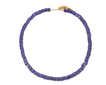
A strand of Russian/Eastern European blue glass trade beadsJohn Moran Auctioneers, Inc.4.7(453)See Sold PriceMar 12, 2024


![[BUSINESS]. Travel Guide of Negro Hotels and Guest Houses. Published by Afro-American Newspapers of (1 of 4)](https://p1.liveauctioneers.com/197/319238/171467937_1_x.jpg?height=282&quality=70&version=1707520367)