ATLAS of ANTIENT GEOGRAPHY by SAMUEL BUTLER 1843John McInnis Auctioneers,LLC4.6(504)See Sold PriceFeb 24, 2024
18TH C. ANTIQUE MAP: FRENCH & INDIAN WAR, FRAMEDThomaston Place Auction Galleries4.4(389)See Sold PriceFeb 24, 2024
Rand McNally Railroad Map Cabinet w/ 21 Railroad MapsRail & Road Auctions4.6(165)See Sold PriceMar 08, 2024
Keith Haring - Ink on New York Map, Best Buddies, Inscribed, Signed, and DatedSapphire Auction Gallery4.1(67)See Sold PriceMar 02, 2024
LATE 17TH C. FRENCH MAP OF THE NEW WORLD BY ALEXIS-HUBERT JAILLOT (1632-1712)Thomaston Place Auction Galleries4.4(389)See Sold PriceFeb 24, 2024
Central Railroad of New Jersey Map of Sandy Hook Route-ca. 1903JM Hobby Supply and Railroad Artifact Auctions4.4(126)See Sold PriceFeb 24, 2024
Lot of Six Mixed Atlas Box Cars-HO Scale-New in BoxJM Hobby Supply and Railroad Artifact Auctions4.4(126)See Sold PriceFeb 25, 2024
Rand McNally/Santa Fe Railroad Map of Iowa-1912JM Hobby Supply and Railroad Artifact Auctions4.4(126)See Sold PriceFeb 24, 2024
NICOLAES VISSCHER (NETHERLANDS, 1618-1709) MAP OF THE NEW WORLDThomaston Place Auction Galleries4.4(389)See Sold PriceFeb 24, 2024
17TH C. WORLD MAP BY NICOLAES VISSCHER (NETHERLANDS, 1618-1709)Thomaston Place Auction Galleries4.4(389)See Sold PriceFeb 24, 2024
Lot of Six Mixed Atlas Cabooses-HO Scale-New in BoxJM Hobby Supply and Railroad Artifact Auctions4.4(126)See Sold PriceFeb 25, 2024
1873 Map of Central Europe and the MediterraneanAuthor: Bartholomew Title: 1873 Map of Central Europe and the Mediterranean Medium: Ink on Paper Dimensions: 18.5"X14" Map of Central Europe and the Mediterranean dated 1873. Edited and by J.G. BarthoSee Sold Price
1873 Map of Central EuropeAuthor: Bartholomew Title: 1873 Map of Central Europe Medium: Ink on Paper Dimensions: 18.5"X14" Description: Map of Central Europe and the Mediterranean dated 1873. Edited and by J.G. Bartholomew. PuSee Sold Price
1873 Map of the MediterraneanAuthor: Bartholomew Title: 1873 Map of the Mediterranean Medium: Ink on Paper Dimensions: 18.5"X14" Map of Central Europe and the Mediterranean dated 1873. Edited and by J.G. Bartholomew. Published bySee Sold Price
1873 Map of the MediterraneanAuthor: Bartholomew Title: 1873 Map of the Mediterranean Medium: Ink on Paper Dimensions: 18.5"X14" Map of Central Europe and the Mediterranean dated 1873. Edited and by J.G. Bartholomew. Published bySee Sold Price
SOUTHERN EUROPE & MEDITERRANEAN. inset Gibraltar & Malta. BARTHOLOMEW 1898 mapTITLE/CONTENT OF MAP: 'Central Europe and The Mediterranean; Gibraltar; Maltese Islands' DATE PRINTED: 1898 IMAGE SIZE: Approx 32.5 x 43.0cm, 12.75 x 17 inches (Large); Please note that this is a foldSee Sold Price
SOUTHERN EUROPE & MEDITERRANEAN. inset Gibraltar & Malta. BARTHOLOMEW 1898 mapTITLE/CONTENT OF MAP: 'Central Europe and The Mediterranean; Gibraltar; Maltese Islands' DATE PRINTED: 1898 IMAGE SIZE: Approx 32.5 x 43.0cm, 12.75 x 17 inches (Large); Please note that this is a foldSee Sold Price
Map[S] of Cook's ToursPublication Date: 1882 Title: Map[S] of Cook's Tours Cartographer: FISK & CO. Publisher: THOS. COOK & SON Height: Width: Maps of Central Europe, England and Scotland, Mediterranean and the Levant, PalSee Sold Price
SoldCentral Europe The Mediterranean Map 36 x 26 – 1939Description: “Central Europe The Mediterranean” Map compiled and drawn – The National Geographic Society for The National Geographic Magazine- Gilbert Grosvenor, Editor. 36” x 26”. Year: 193See Sold Price
Sold1939 Nat Geo WWII Eve Map of Europe and theTitle/Content of Map: 1939 Nat Geo WWII Eve Map of Europe and the Mediterranean -- Central Europe and the Mediterranean as of September 1, 1939 Cartographer: National Geographic Society Year/Place: 19See Sold Price
1939 Nat Geo Map of Europe and the Mediterranean --Title/Content of Map: 1939 Nat Geo Map of Europe and the Mediterranean -- Central Europe and the Mediterranean as of September 1, 1939 Cartographer: National Geographic Society Year/Place: 1939, WashiSee Sold Price
SoldGross, Alexander 1920 Mixed Lot of 7 Large MapsIncl Austria, Europe, Europe - Political, Central Europe - Railways, Mediterranean Sea, South Atlantic Ocean, and North Atlantic Ocean. Large Lithograph Maps Published 1920, London for "The Daily TeleSee Sold Price
Sold19th & Early 20thc Maps of EuropePair of original maps of Europe. - a hand-colored, reference Map ( No.14 ) of Central Europe, from THE COMMON-SCHOOL GEOGRAPHY - 1873 - early 20thc fold-out Map of Europe measuring British miles. 9" XSee Sold Price
19th & Early 20thc Maps of EuropePair of original maps of Europe. - a hand-colored, reference Map ( No.14 ) of Central Europe, from THE COMMON-SCHOOL GEOGRAPHY - 1873 - early 20thc Fold-out Map of Europe measuSee Sold Price
19th & Early 20thc Maps of EuropePair of original maps of Europe. - a hand-colored, reference Map ( No.14 ) of Central Europe, from THE COMMON-SCHOOL GEOGRAPHY - 1873 - early 20thc fold-out Map of Europe measuring British miles. 9" XSee Sold Price
19th & Early 20thc Maps of EuropePair of original maps of Europe. - a hand-colored, reference Map ( No.14 ) of Central Europe, from THE COMMON-SCHOOL GEOGRAPHY - 1873 - early 20thc Fold-out Map of Europe measuring British miles. 9" XSee Sold Price
19th & Early 20thc Maps of EuropePair of original maps of Europe. - a hand-colored, reference Map ( No.14 ) of Central Europe, from THE COMMON-SCHOOL GEOGRAPHY - 1873 - early 20thc Fold-out Map of Europe measuring British miSee Sold Price
SoldGERMANY general Map. Central Europe. Hungary.TITLE/CONTENT OF MAP: 'GERMANY, General map' The top image on the right hand side shows the entire map. To view a close up of the map showing the level of printed detail, please click on the bottom imSee Sold Price
SoldMAP, Central Europe, MercatorCentral Europe, Germany. Mercator/Hondius, Germania, 1619 (published). Hand Color. This beautifully engraved map covers Germany and the heart of Europe, extending from France and Holland to Poland, anSee Sold Price
MAP, Central Europe, OrteliusCentral Europe, Germany. Abraham Ortelius, Germaniae Veteris, Typus, 1587 (dated). Hand Color. This is Ortelius' second map of ancient Germany. The region covered takes in all of central Europe from BSee Sold Price
MAP, Central Europe, WWII, CutterCartographic Miscellany, World War II, Central Europe. James Cutter, Reach to the Reich, 1945 (dated). Printed Color. This fascinating World War II map is an enlarged version of one by James Cutter thSee Sold Price
MAP, Central Europe, ChatelainCentral Europe, Austria. Henry Abraham Chatelain, Carte de l'Etat de la Cour Imperiale et des Etats Hereditaires de la Maison d'Autriche avec Leurs Diverses Chanceleries, 1720 (circa). Black & White.See Sold Price
MAP, Central Europe, HomannCentral Europe. Johann Baptist Homann, Danubii Fluminis (a Fontibus Prope Doneschingam usq Posonium Urbem Designati) Pars Superior..., 1716 (published). Hand Color. This map of central and southern EuSee Sold Price
SoldMAP, Central Europe, ChiquetCentral Europe, Germany. Jacques Chiquet, L'Empire d'Allemagne Divise en ses dix Cercle et Autres Estats..., 1719 (published). Hand Color. A delicately engraved small map of central Europe including GSee Sold Price
SoldAntique Map : Europe & Mediterranean - 1855Antique Map : Europe & Mediterranean - 1855 by Gaspar Y. Roig Size : 14" x 10.5"See Sold Price
MAP - PIETER SCHENK / VALK / JANSSEN Hand Colored superb Map Central Italy c1702Luis Porretta Fine Arts4.3(10)See Sold PriceMar 02, 2024
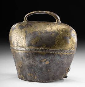
Extremely Large Bronze Age Pin with Knop FinialTimeLine Auctions Ltd.4.6(182)See Sold PriceMar 05, 2024
Group of Ten Railroad Photographs, Maps, and Prints - New Jersey, Long Island, and New YorkRail & Road Auctions4.6(165)See Sold PriceMar 07, 2024
COLONIAL EAST AFRICA. German/British/Portuguese East Africa. Tanzania 1895 mapJasper524.5(9.8k)See Sold PriceFeb 28, 2024
CENTRAL EAST AFRICA French Belgian Congo British German Kenya Tanzania 1909 mapJasper524.5(9.8k)See Sold PriceFeb 28, 2024
SOUTHERN AFRICA. Congo British/Portuguese/German East Africa Rhodesia 1912 mapJasper524.5(9.8k)See Sold PriceFeb 28, 2024
Clarke & Neele 1815 Map. Europe - Recent Political ChangesAlbion Auctions4.6(341)See Sold PriceMar 01, 2024
Theodor Fischer (1862 - 1938) - Set of 4 Bird Prints - Haliaetos Albicilla - Strix LapponicaProverde Auctions4.3(3)See Sold PriceFeb 28, 2024
Theodor Fischer (1862 - 1938) - Set of 4 Bird Prints - Pernis Apivorus - Falco ArcticusProverde Auctions4.3(3)See Sold PriceFeb 28, 2024


![Map[S] of Cook's Tours (1 of 1)](https://p1.liveauctioneers.com/5584/180928/91034028_1_x.jpg?height=282&quality=70&version=1602020174)