John Ogiley hand-colored map- 18th c.
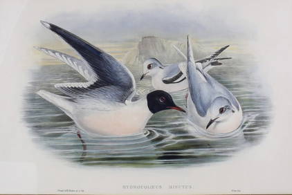
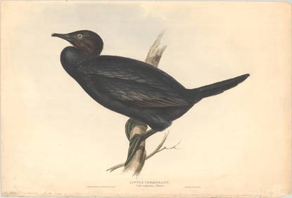
LATE 18TH C. VERY LARGE CHART OF NORTHEAST CANADA BY DES BARRES (1721-1824), 1780, FRAMEDFeb 24, 202417TH C. WORLD MAP BY NICOLAES VISSCHER (NETHERLANDS, 1618-1709)Feb 24, 2024LATE 17TH C. FRENCH MAP OF THE NEW WORLD BY ALEXIS-HUBERT JAILLOT (1632-1712)Feb 24, 2024EARLY 18TH C. DUTCH CHART OF PACIFIC OCEAN BY FREDERIK DE WIT (1629-1706) WITH CALIFORNIA AS ANFeb 24, 202417TH C. ANTIQUE MAP SIEGE OF LA ROCHELLE, FRANCE, FRAMEDFeb 24, 2024EARLY 18TH C. MAP OF ITALY, FRAMEDFeb 24, 202418TH C. ANTIQUE MAP: FRENCH & INDIAN WAR, FRAMEDFeb 24, 202417TH C. ENGLISH LINEAR MAP BY OGILBY, FRAMEDFeb 24, 2024John Gould & H.C. Richter Hand Colored Bird Lithograph Hydrocoloeus MinutusMar 03, 2024An early Dutch hand colored engraving map by Georg Balthasar Probst (1732-1801)Feb 27, 2024Hand Colored Map of the city of Amsterdam 1720Mar 03, 202418th Century Hess Germany Hand colored Engraved MapMar 03, 2024Johann Homann Hand-Colored Map Engraving, c. 1730Mar 17, 2024Willem Blaeu, Etc. 17th C. Antiquarian Maps, 2Mar 17, 2024Map: An 18thC engraved and hand coloured map of Buckinghamshire after Robert Morden. Approx. 8 1/4"Feb 26, 2024Map: An 18thC engraved and hand coloured map of Northamptonshire, with description ofFeb 26, 2024Map: An 18thC engraved and hand coloured map of North America and South America, titled DeFeb 26, 2024Johnson's California & West hand-colored map 1861Mar 07, 2024Sanson/Jaillot map of North America 1719Mar 07, 2024Northeast Asia & western America, 1595Mar 07, 2024De Wit map of Scandinavia c.1680Mar 07, 2024Bernard Scale (Irish 18th c.) mapsMar 02, 2024Johann Weinmann, hand-colored engraving, 18th c.Mar 07, 2024ENGRAVING, Birds, GouldMar 12, 2024