ATLAS of ANTIENT GEOGRAPHY by SAMUEL BUTLER 1843John McInnis Auctioneers,LLC4.6(502)See Sold PriceFeb 24, 2024
18TH C. ANTIQUE MAP: FRENCH & INDIAN WAR, FRAMEDThomaston Place Auction Galleries4.4(386)See Sold PriceFeb 24, 2024
Rand McNally Railroad Map Cabinet w/ 21 Railroad MapsRail & Road Auctions4.6(165)See Sold PriceMar 08, 2024
Keith Haring - Ink on New York Map, Best Buddies, Inscribed, Signed, and DatedSapphire Auction Gallery4(67)See Sold PriceMar 02, 2024
LATE 17TH C. FRENCH MAP OF THE NEW WORLD BY ALEXIS-HUBERT JAILLOT (1632-1712)Thomaston Place Auction Galleries4.4(386)See Sold PriceFeb 24, 2024
Central Railroad of New Jersey Map of Sandy Hook Route-ca. 1903JM Hobby Supply and Railroad Artifact Auctions4.4(126)See Sold PriceFeb 24, 2024
Lot of Six Mixed Atlas Box Cars-HO Scale-New in BoxJM Hobby Supply and Railroad Artifact Auctions4.4(126)See Sold PriceFeb 25, 2024
Rand McNally/Santa Fe Railroad Map of Iowa-1912JM Hobby Supply and Railroad Artifact Auctions4.4(126)See Sold PriceFeb 24, 2024
NICOLAES VISSCHER (NETHERLANDS, 1618-1709) MAP OF THE NEW WORLDThomaston Place Auction Galleries4.4(386)See Sold PriceFeb 24, 2024
17TH C. WORLD MAP BY NICOLAES VISSCHER (NETHERLANDS, 1618-1709)Thomaston Place Auction Galleries4.4(386)See Sold PriceFeb 24, 2024
Lot of Six Mixed Atlas Cabooses-HO Scale-New in BoxJM Hobby Supply and Railroad Artifact Auctions4.4(126)See Sold PriceFeb 25, 2024
SoldAmerica.- West Indies.- Sayer (Robert) and JohnAmerica.- West Indies.- Sayer (Robert) and John Bennett. A New and Correct Map of North America, with the West India Islands. Divided According to the Last Treaty of Peace..., large detailed 4 sheet mSee Sold Price
Americas.- Sayer (Robert) and John Bennett. A New MapAmericas.- Sayer (Robert) and John Bennett. A New Map of the Whole Continent of America, Divided into North and South and West Indies, large-scale 4 sheet map, with extensive details and rococo-styleSee Sold Price
Sayer. New Map of North America & West IndiesSayer (Robert) A New Map of North America with the West India Islands according to the Preliminary Articles of Peace Signed at Versailles, 20 Jan, 1783,wherein are particularly Distinguished TSee Sold Price
SoldThe West-India Atlas...The West-India Atlas: or, A Compendious Description of the West-Indies... JEFFERYS, Thomas (1719-1771). London: Robert Sayer and John Bennett, 1775. Folio (22 x 16 4/8 inches).Physical Description: FoSee Sold Price
SoldSAMUEL DUNN FOR ROBERT SAYER, A MAP OF NORTH AMERSAMUEL DUNN FOR ROBERT SAYER, A MAP OF NORTH AMERICA WITH THE WEST INDIES, LONDON, 1786, engraved map with hand colored outlining illustrating the United States as well as the territorial possessionsSee Sold Price
SoldAmericas.- Sayer (Robert) A Map of the Whole ContinentAmericas.- Sayer (Robert) A Map of the Whole Continent of America divided into North and South and West Indies with a copious table, large wall map with impressive detail, based on the cartography ofSee Sold Price
SoldSayer & Bennett - Map of North America, 1779published by Robert Sayer (1725?1794) and John Bennett (c. 1745?1787),ÿA New Map of North America, with the West India IslandsÿDivided according to the last Treaty of Peace, Concluded at Paris, 10thSee Sold Price
Emanuel John Bowen GibsonEmanuel John Bowen Gibson. An accurate map of North America […] British and Spanish dominions and […] also all the West India Island. London: printed for Robert Sayer, 1775. Incisione in rame coSee Sold Price
Sold(Maps and Charts, America), Sayer, Robert & Bennet(Maps and Charts, America), Sayer, Robert & Bennett, John, A Map of Pennsylvania...from the late Map of W. Scull Published in 1770, London, 1775, hand-colored, three sheets joined, framed, sight sizeSee Sold Price
Sold1775 THOMAS JEFFERYS WEST INDIES MAPJEFFERYS, Thomas, (1719-1771): An Index Map to the Following Sixteen Sheets; being a Compleat Chart of the West Indies map. London: Robert Sayer, 1775. Copper engraving, 14 1/2'' x 25'' ins., Hand colSee Sold Price
1875 Framed Map of Central AmericaTitle: 1875 Framed Map of Central America Medium: Ink on Paper/Glass/Wood Dimensions: 20.5"X17" Map of Central America and West Indies dated 1875. Engraved by John Bartholomew for The Edinburgh GeorgrSee Sold Price
1875 Framed Map of Central America and the West IndiesAuthor: Bartholomew Title: 1875 Framed Map of Central America and the West Indies Medium: Ink on paper/Glass/Wood Dimensions: 20"X17" Map of Central America and West Indies dated 1875. Engraved by JohSee Sold Price
[WEST INDIES and the CARIBBEAN. – a collection of 19Robert John Lechmere GUPPY, P. BIOLLEY, C.T. RAMSDEN and others. [WEST INDIES and the CARIBBEAN. – a collection of 19 malacological works, in 16 volumes, some signed, most off-prints]. Robert JSee Sold Price
[WEST INDIES: three works in two volumes (one with anR. J. L. GUPPY (1836-1916). [WEST INDIES: three works in two volumes (one with an 'addenda')] Robert John Lechmere GUPPY (1836-1916). [TRINIDAD.- two works in one, drop-head title ] On the TerrestrialSee Sold Price
SoldLife and Services of General Lord Harris by LushingtonHeading: Author: Lushington, S. R. Title: The Life and Services of General Lord Harris, G.C.B., During his Campaigns in America, The West Indies, and India Place Published: London Publisher:John W. PSee Sold Price
ROBERT SAYER...A COMPLETE MAP OF THE WEST INDIES, 1776Robert Sayer...A Complete Map Of The West Indies, 1776...40 X 27 1/4 In.... Gallery Stretched Giclée PrintSee Sold Price
SoldBartholomew, John 1922 Lot of 12 Large MapsIncl Scandinavia/Denmark, Poland/Czechoslovakia, Baltic States/East Prussia, Romania, Lower Ganges, North America Political, West Indies, South America Politcal, South America - Northern Section, SoutSee Sold Price
SoldJohn Senex (1678-1740), "A New Map of the EnglishJohn Senex (1678-1740), "A New Map of the English Empire in the Ocean of America or West Indies, A New Map of the Island of Jamaica," c. 1798, hand colored, H.- 22 in., W.- 26 1/4 in.See Sold Price
Sold"Holster Atlas" with 6 maps of America 1776Heading: Author: Sayer, Robert and John Bennet Title: The American Military Pocket Atlas; being an Approved Collection of Correct Maps, both General and Particular, of the British Colonies; EspeciallSee Sold Price
ROBERT SAYER - A COMPLETE MAP OF THE WEST INDIES, 1776Robert Sayer - A Complete Map Of The West Indies, 1776 - 44 X 29 7/8 In. This is a Giclée on Canvas. Very Large Piece!See Sold Price
ROBERT SAYER - A COMPLETE MAP OF THE WEST INDIESRobert Sayer - A Complete Map Of The West Indies, 1776 - Giclée On Canvas - 40 X 27 1/4 In. A Giclée Print Is The Highest Quality Print Available Today. Because There Is No Visible Dot Screen PatterSee Sold Price
SoldRobert Sayer Map, 1790Robert Sayer, "A New General Chart of the West Indies from the Latest Marine Journals and Surveys...", London, 1790, hand-colored in outline, printed on two separate sheets, very detailed large-formatSee Sold Price
ROBERT SAYER - A COMPLETE MAP OF THE WEST INDIES, 1776Robert Sayer - A Complete Map Of The West Indies, 1776 - 44 X 29 7/8 In. - Giclée Print - Gallery Stretched - Ready to hang.See Sold Price
SoldRobert Sayer Map, 1790Robert Sayer, "A New General Chart of the West Indies from the Latest Marine Journals and Surveys...", London, 1790, hand-colored in outline, printed on two separate sheets, very detailed large-formatSee Sold Price
Carey, pub. 1796 - A Chart of the West IndiesTrillium Antique Prints & Rare Books4.5(30)See Sold PriceFeb 24, 2024
Carey, pub. 1796 - Map of the State of MarylandTrillium Antique Prints & Rare Books4.5(30)See Sold PriceFeb 24, 2024
Carey, pub. 1796 - Map of GeorgiaTrillium Antique Prints & Rare Books4.5(30)See Sold PriceFeb 24, 2024
Carey, pub. 1796 - Map of The State of South CarolinaTrillium Antique Prints & Rare Books4.5(30)See Sold PriceFeb 24, 2024
Carey, pub. 1796 - Map of KentuckyTrillium Antique Prints & Rare Books4.5(30)See Sold PriceFeb 24, 2024
Carey, pub. 1796 - Map of the Tennassee State formerly part of North Carolina (Tennessee)Trillium Antique Prints & Rare Books4.5(30)See Sold PriceFeb 24, 2024
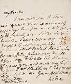
Rodney (Admiral Sir George Rodney, first Baron) Autograph Letter signed “Rodney?? to “MrForum Auctions4.3(52)See Sold PriceFeb 29, 2024
1862 North America Anthony Trollope West Indies AND Spanish Main CANADA NIAGARAJasper524.5(9.8k)See Sold PriceFeb 27, 2024
Map of Mexico, Central America, New Grenada, Venzuela and the West IndiesJasper524.5(9.8k)See Sold PriceFeb 27, 2024
Mexico, Central America and West Indies Physical PoliticalJasper524.5(9.8k)See Sold PriceFeb 27, 2024