ATLAS of ANTIENT GEOGRAPHY by SAMUEL BUTLER 1843John McInnis Auctioneers,LLC4.6(502)See Sold PriceFeb 24, 2024
18TH C. ANTIQUE MAP: FRENCH & INDIAN WAR, FRAMEDThomaston Place Auction Galleries4.4(386)See Sold PriceFeb 24, 2024
Rand McNally Railroad Map Cabinet w/ 21 Railroad MapsRail & Road Auctions4.6(165)See Sold PriceMar 08, 2024
Keith Haring - Ink on New York Map, Best Buddies, Inscribed, Signed, and DatedSapphire Auction Gallery4(67)See Sold PriceMar 02, 2024
LATE 17TH C. FRENCH MAP OF THE NEW WORLD BY ALEXIS-HUBERT JAILLOT (1632-1712)Thomaston Place Auction Galleries4.4(386)See Sold PriceFeb 24, 2024
Central Railroad of New Jersey Map of Sandy Hook Route-ca. 1903JM Hobby Supply and Railroad Artifact Auctions4.4(126)See Sold PriceFeb 24, 2024
Lot of Six Mixed Atlas Box Cars-HO Scale-New in BoxJM Hobby Supply and Railroad Artifact Auctions4.4(126)See Sold PriceFeb 25, 2024
Rand McNally/Santa Fe Railroad Map of Iowa-1912JM Hobby Supply and Railroad Artifact Auctions4.4(126)See Sold PriceFeb 24, 2024
NICOLAES VISSCHER (NETHERLANDS, 1618-1709) MAP OF THE NEW WORLDThomaston Place Auction Galleries4.4(386)See Sold PriceFeb 24, 2024
17TH C. WORLD MAP BY NICOLAES VISSCHER (NETHERLANDS, 1618-1709)Thomaston Place Auction Galleries4.4(386)See Sold PriceFeb 24, 2024
Lot of Six Mixed Atlas Cabooses-HO Scale-New in BoxJM Hobby Supply and Railroad Artifact Auctions4.4(126)See Sold PriceFeb 25, 2024
SoldSTANLEY FREDERICK: (1841-1908) 16th Earl of Derby.STANLEY FREDERICK: (1841-1908) 16th Earl of Derby. British Politician, Governor General of Canada 1888-93. An avid sportsman, Stanley is famous in North America for presenting Canada with the StanleySee Sold Price
SoldTallis, John (Pub) 1852 Map. British America. CanadaSteel Engraved Map with Original Outline Hand Color Published 1852-56 by John Tallis, London for "The Universal Pronouncing Dictionary" by Thomas Wright. Drawn & Engraved by John Rapkin. Centre fold aSee Sold Price
SoldBritish America Specialty AlbumBritish America specialty stamp album with many valuable stamps. This sale will be broadcast live on sale day with an auctioneer and caller calling full descriptions of each lot being sold, as well asSee Sold Price
SoldBritish America. Shows Hudson's Bay Company Forts MapBritish America. Shows Hudson's Bay Company Forts.canada Tallis/rapkin, 1849 Map. Approx 27.0 x 33.5cm, 10.5 x 13.25 inches (Large); Please note that this is a folding map. Antique engraved map by J RSee Sold Price
SoldBritish America, London Printing Co. 19th CTitle: British America Subject: British America Maker: London Printing & Publishing Co. Date: Late 19th Century Materials: Steel engraving Size: 13 x 9.5 inches No Reserve: This lot starts at $1 and hSee Sold Price
SoldBRITISH AMERICA. Shows Hudson's Bay CompanyTITLE/CONTENT OF MAP: 'British America' The key indicates that the orange dots are forts and principal stations of the Hudson's Bay Company. Vignettes: Whale fishing; Esquimaux; Polar bears; Seal; MonSee Sold Price
SoldJohn Rapkin: Map of British America, 1851Map: British America Cartographer: John Rapkin Illustrator: H. Warren Publisher: John Tallis & Company Published: London and New York, 1851 Size: 10 x 13 inches Extremely clean, authentic antique mapSee Sold Price
Tallis: Antique Map of British America, 1865Title/Content of Map: British America Publication Date: 1865 ca. Authors: JOHN TALLIS & CO., TALLIS, JOHN Publisher: JOHN TALLIS & CO. Size: Quarto – 8.80 H x 12.80 W Inches V. scarce issue. 3rSee Sold Price
SoldThree Volumes of British America, 1839"A Historical and Descriptive Account of British America, Comprehending Canada Upper and Lower, Novia Scotia...". Oliver and Boyd, Edinburgh 1839. First edition. In three volumes with engraved title pSee Sold Price
Rand McNally: Map of British America, 1898Map: British America Cartographer: Rand McNally Date: 1898 Origin: Chicago Size: 12.2 x 19 inches An attractive map of Canada, color coding the provinces. It offers a great deal of topographic detail,See Sold Price
SoldBritish AmericaReserve Reduced! Title: British America Publication Date: 1865 ca. Cartographer: TALLIS, JOHN Publisher: JOHN TALLIS & CO. Size: 8.8 x 12.8 V. scarce issue. 3rd state, 1st issue. Montreal replaces BosSee Sold Price
SoldTallis: Map of Canada (British America), 1853Canada (British America). Original lithograph by John Tallis & Company of London, c. 1853. Map vignettes feature City of Boston, Fury and Hecla, 'Esquimaux' (Eskimoes), whale fishing, polar bears andSee Sold Price
SoldBA (British America) Porcelain Identification Sign.DSP sign. Good color and some gloss with small chips and wear. (7.5). 72" Dia.See Sold Price
SoldBritish America Assurance Tin Litho CalendarCanadian. 1930s. Embossed and die-cut. 14" x 20". Complete with cardboard date cards, never used. Faint scuffs to lower edge. Offered from the collection of Ryan McNabb. Est. $200-300.See Sold Price
SoldTallis: Antique Map of British America, 1850Map: British America Publication Date: 1850 ca. Authors: JOHN TALLIS & CO., TALLIS, JOHN Publisher: JOHN TALLIS & CO. Size: Quarto – 8.00 H x 11.80 W Inches Vignettes of Montreal, Fury and Hecla, PoSee Sold Price
Sold(lot of 3) Grouping of British America in three Scott(lot of 3) Grouping of British America in three Scott specialty albums. Includes St. Kitts-Nevis, Virgin Islands, Montserrat, Leeward Islands and Nevis. Mostly mint LH/NH. Includes Leewards 46-57, 103See Sold Price
British AmericaTitle: British America Publication Date: 1835 Cartographer: Bradford, T.G. Publisher: William D. Ticknor Size: 7.8 Height - 10.1 Width Map showing states or districts separately colored, details townsSee Sold Price
Sold1899 Map of British AmericaAuthor: Miller Title: 1899 Map of British America Medium: Ink on Paper Dimensions: 22.5"X16.5" Description: Map of British America, modern day Canada dated 1899. Published by J. Martin Miller and CompSee Sold Price
SoldJohn MacGregor, British America, 1832, Edinburgh.John MacGregor, British America, 1832, Edinburgh. Calf, lacks labels, maps.-- Dimensions: --- US Shipping charge: $35See Sold Price
SoldEarthquakes & Volcanoes in Central America 1888Title: Tremblements de terre et éruptions volcaniques au Centre-Amérique depuis la conquête espagnole jusqu'à nos jours Author: Montessus de Ballore, Fernand Description: [2], 293 pp. With 2 maps,See Sold Price
SoldTallis, John - British America, shows Hudson BayTallis, John (1817-1876) British America, shows Hudson Bay Company forts (1851) Gravure sur papier rehaussée à l'aquarelle, tirée de Tallis's Illustrated Atlas and Modern History of the WorldSee Sold Price
Sold2 British 1888 Mk III Enfield BayonetsBoth marked Wilkinson, London. Both in nice condition with various issue marks on blades. No scabbards. 12 blades, overall 16 7/8".See Sold Price
BRITISH AMERICA. Shows Hudson's Bay CompanyTITLE/CONTENT OF MAP: 'British America' The key indicates that the orange dots are forts and principal stations of the Hudson's Bay Company. Vignettes: Whale fishing; Esquimaux; Polar bears; Seal; MonSee Sold Price
SoldWestern & British America Insurance 'Fire Mark' SignsTwo (2). Canadian. 1950s. Single-sided lithographed tin, embossed. Mounted to wood backing. Western back pasted with "History of the Fire Mark". 10.5 x 8.25"; 11.25 x 7.75". Each exhibits very minor sSee Sold Price
Alfred Fowler Patten (British, 1826-Died After 1888)World of Antiques, Inc.3.9(74)See Sold PriceFeb 29, 2024
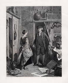
[SHIPWRECKS]. Manuscript testimony (court duplicate) of Thomas Kent, a Black man aboard theFreeman's | Hindman4.4(1.6k)See Sold PriceFeb 27, 2024
Alfred Fowler Patten, "Maria Composing the Letter"Stefek's Auctioneers & Appraisers4.5(105)See Sold PriceFeb 28, 2024
Arrowsmith & Lewis - Map of PolynesiaTrillium Antique Prints & Rare Books4.5(30)See Sold PriceFeb 24, 2024
Arrowsmith & Lewis - Map of North AmericaTrillium Antique Prints & Rare Books4.5(30)See Sold PriceFeb 24, 2024
Arrowsmith & Lewis - Map of the World on Mercator's ProjectionTrillium Antique Prints & Rare Books4.5(30)See Sold PriceFeb 24, 2024
Arrowsmith & Lewis - Map of LouisianaTrillium Antique Prints & Rare Books4.5(30)See Sold PriceFeb 24, 2024
Arrowsmith & Lewis - Map of the United StatesTrillium Antique Prints & Rare Books4.5(30)See Sold PriceFeb 24, 2024
Four Alfonso Iannelli, Italy / America (1888-1965), Meehan's Canines, color lithographic posterCV Auction LLCSee Sold PriceMar 09, 2024
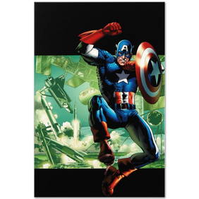
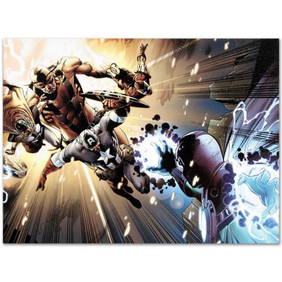
Marvel Comics "Captain America: Man Out Of Time #4" Numbered Limited Edition Giclee on Canvas byRobinhood Auctions4.7(783)See Sold PriceFeb 25, 2024
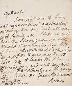
Rodney (Admiral Sir George Rodney, first Baron) Autograph Letter signed “Rodney?? to “MrForum Auctions4.3(52)See Sold PriceFeb 29, 2024
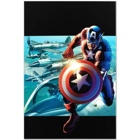
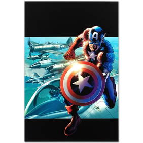
Marvel Comics "Captain America: Man Out of Time #5" Numbered Limited Edition Giclee on Canvas byRobinhood Auctions4.7(783)See Sold PriceFeb 27, 2024
ROBERT HERDMAN 1800s Engraving Stern Jonathan Oldbuck FRAMED SignedKCM Galleries4.7(164)See Sold PriceFeb 25, 2024
1800s Peter Paul Rubens Engraving Summer Landscape Framed SignedKCM Galleries4.7(164)See Sold PriceFeb 25, 2024
SIGNED 1800s Robert HERDMAN Engraving The Glove Scene FRAMEDKCM Galleries4.7(164)See Sold PriceFeb 25, 2024
Captain America: Man Out of Time #5 by Marvel ComicsFederal Assets Auctioneers4.4(411)See Sold PriceFeb 28, 2024
Marvel Comics "Captain America: Man Out Of Time #5" Numbered Limited Edition Giclee on Canvas byRobinhood Auctions4.7(783)See Sold PriceMar 03, 2024
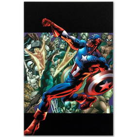
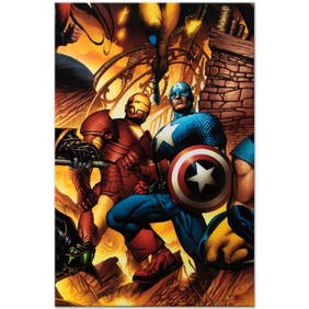
Marvel Comics "New Avengers #6" Numbered Limited Edition Giclee on Canvas by Bryan Hitch with COA.Robinhood Auctions4.7(783)See Sold PriceMar 03, 2024
Marvel Comics "Captain America: Man Out Of Time #2" Numbered Limited Edition Giclee on Canvas byRobinhood Auctions4.7(783)See Sold PriceMar 03, 2024
Captain America: Man Out Of Time #2 by Marvel ComicsFederal Assets Auctioneers4.4(411)See Sold PriceFeb 29, 2024


![[SHIPWRECKS]. Manuscript testimony (court duplicate) of Thomas Kent, a Black man aboard the (1 of 5)](https://p1.liveauctioneers.com/197/319238/171468014_1_x.jpg?height=282&quality=70&version=1707520367)