ATLAS of ANTIENT GEOGRAPHY by SAMUEL BUTLER 1843John McInnis Auctioneers,LLC4.6(502)See Sold PriceFeb 24, 2024
18TH C. ANTIQUE MAP: FRENCH & INDIAN WAR, FRAMEDThomaston Place Auction Galleries4.4(386)See Sold PriceFeb 24, 2024
Rand McNally Railroad Map Cabinet w/ 21 Railroad MapsRail & Road Auctions4.6(165)See Sold PriceMar 08, 2024
Keith Haring - Ink on New York Map, Best Buddies, Inscribed, Signed, and DatedSapphire Auction Gallery4(67)See Sold PriceMar 02, 2024
LATE 17TH C. FRENCH MAP OF THE NEW WORLD BY ALEXIS-HUBERT JAILLOT (1632-1712)Thomaston Place Auction Galleries4.4(386)See Sold PriceFeb 24, 2024
Central Railroad of New Jersey Map of Sandy Hook Route-ca. 1903JM Hobby Supply and Railroad Artifact Auctions4.4(126)See Sold PriceFeb 24, 2024
Lot of Six Mixed Atlas Box Cars-HO Scale-New in BoxJM Hobby Supply and Railroad Artifact Auctions4.4(126)See Sold PriceFeb 25, 2024
Rand McNally/Santa Fe Railroad Map of Iowa-1912JM Hobby Supply and Railroad Artifact Auctions4.4(126)See Sold PriceFeb 24, 2024
NICOLAES VISSCHER (NETHERLANDS, 1618-1709) MAP OF THE NEW WORLDThomaston Place Auction Galleries4.4(386)See Sold PriceFeb 24, 2024
17TH C. WORLD MAP BY NICOLAES VISSCHER (NETHERLANDS, 1618-1709)Thomaston Place Auction Galleries4.4(386)See Sold PriceFeb 24, 2024
Lot of Six Mixed Atlas Cabooses-HO Scale-New in BoxJM Hobby Supply and Railroad Artifact Auctions4.4(126)See Sold PriceFeb 25, 2024
Sold1865 Montana Territory Map by W.W. de LacyFor your consideration is a 1865 Montana Territory Map by De Lacy, W. W. (Walter Washington), 1819-1892, In the bottom left the map shows the full title and description "Map of the Territory of MontanSee Sold Price
SoldDeLacy map of Montana 1879Heading: Author: DeLacy, W.W. Title: Map of the Territory of Montana with Portions of the Adjoining Territories Compiled and Drawn by W.W. DeLacy Civil Engineer & Surveyor, Helena, M.T. Place PublishSee Sold Price
Sold1865 Montana Territory MapThis is an original Montana Territory map from 1865. The map is marked "Johnson's Nebraska, Dakota, Idaho and Montana / Published by A.J. Johnson, New York". The map is hand tinted and shows the verySee Sold Price
Sold1865 Montana Territory MapThis is an original Montana Territory map from 1865. The map is marked "Johnson's Nebraska, Dakota, Idaho and Montana / Published by A.J. Johnson, New York". The map is hand tinted and shows the verySee Sold Price
Sold1865 Montana Territory MapThis is an original Montana Territory map from 1865. The map is marked "Johnson's Nebraska, Dakota, Idaho and Montana / Published by A.J. Johnson, New York". The map is hand tinted and shows the verySee Sold Price
SoldColton's Map Montana Territory circa 1865This is a scarce edition of Colton’s map of the Northwest, showing a massive Dakota, pre-dating the formation of Wyoming and with the newly created Territory of Montana. The piece is titled, "ColtonSee Sold Price
Map of Ore., Wash., Idaho & Montana, Mitchell 1860Nice map of the northwestern states from Mitchell's 1865 New General Atlas published by S. Augustus Mitchell. One of the earliest maps to suggest the new Territory of Montana. Maps from this period ofSee Sold Price
Sold1895 W.M. DeLacy Helena, Montana CalendarThe calendar was put out by DeLacy. DeLacy was known for his very impressive maps done in the 1860-1870's (his map works sell for excess of $10,000). The calendar is from 1895 in Helena, Montana showiSee Sold Price
1865 Railroad map of Nebraska, Dakota, Idaho and MontanaJohnson’s important map of the upper western United States. This is the first state of this map. During the Civil War the massive Washington and Nebraska territories had been chopped up into smaSee Sold Price
Sold1883 Montana Territory MapThis is an 1883 map of the Montana Territory. The map is marked "Department of the Interior General Land Office N.C. McFarland, Commissioner Montana Territory 1883". The map shows the distinct countySee Sold Price
SoldMontana Territory MapDepartment of the interior General Land Office, JA Williamson, Commissioner. Complied from the official records of the General Land Office and other sourches by C. Roeser, Principal Daughtsman. 16.5x2See Sold Price
Sold1873 Montana Territory MapThis is an 1873 Montana Territory map. The map is marked "Atlas of the United States / County Map of Idaho, Montana and Wyoming / Warner & Beers Publishers". The map shows early territorial borders wiSee Sold Price
CANFIELD. Map of the Country West of Dakota....Map from Secret Report of the Northern Pacific Railroad Explorations in Washington & Montana Territory 277. &See Sold Price
SoldGeneral Land Office Map of Montana Territory 1883This is an 1883 map of the Montana Territory complied from the official records of the General Land Office, and other sources. G.P. Strum, Principal Draughtsman, G.L.O. This photo lithograph print isSee Sold Price
SoldMap of Montana Territory 1879Title: Montana Territory Author: U.S. State Surveys Description: Color lithographed map. Compiled by C. Roeser from the official records of the General Land Office. Lithographed by Julius Bien. 57x80See Sold Price
SoldGLO map of Montana Territory 1879Title: Montana Territory Author: Roeser, C., compiler Description: Lithographed map. 38x53 cm. (15x21").Early territorial map of Montana, naming only ten of its eventual 56 counties. Four huge IndianSee Sold Price
SoldOriginal 1888 Butte City Mont. Territory Plat MapThis is an original plat map of Butte City, Montana Territory from 1888. The map shows what was once a bustling business district in Butte that included saloons, cigar stores, billiard halls, brewerieSee Sold Price
Scarce 1881 map of Montana by McNallyScarce and highly detailed map of Montana Territory. Shows towns, rivers, railroads, mountains, lakes, Indian reservations, forts, gold regions, topographical details, wagon roads, mountain passes, trSee Sold Price
SoldMitchell: Antique Map of Territory of Montana, 1880Title/Content of Map: Territory of Montana Date Printed: 1880 Cartographer: Augustus Mitchell Material/Medium: Hand Coloured Engraving Size: 11 7/8" x 15" Small folio, has small tears along margin, noSee Sold Price
SoldTerritory of Montana Map, Compiled; C. Roeser 1876Provided for you in this lot is a Territory of Montana map, originating from 1876, and compiled by C. Roeser. The map dates to the anniversary year of the Battle of Little Bighorn, and shows the GrosSee Sold Price
SoldMap of Territory of MontanaMap of Territory of Montana Color Map Dated: 19th century Dimensions: 10 x 6 1/2" Condition Report Good. Text on verso. Subject ReferencSee Sold Price
SoldJohn S. Lott Montana Vigilante 1865 Territory SlipThis is an original 1865 Territory of Montana, Madison County money order from the Treasurer to John S. Lott for $50. Joh S. Lott led the Vigilante Party that hung Henry Plummer, Ned Ray and Buck StinSee Sold Price
SoldJohnson's Map of Montana & Surrounding States 1865This is a hand colored original 1865 map titled, "Johnson's Nebraska, Dakota, Idaho, Montana and Wyoming. Published by A.J. Johnson, New York." The bottom right of the map is marked, "Entered accordinSee Sold Price
SoldMap of the Territory of Montana. 1879Map of the Territory of Montana. Washington: 187950 mile scaleDimensions: 10 1/2" X 14 1/4"Inv.99See Sold Price
EARLY 18TH C. DUTCH CHART OF PACIFIC OCEAN BY FREDERIK DE WIT (1629-1706) WITH CALIFORNIA AS ANThomaston Place Auction Galleries4.4(386)See Sold PriceFeb 24, 2024
CHARLES ROLLIN c1828 Ceasar Hand Colored Africa Military MapLuis Porretta Fine Arts4.3(10)See Sold PriceMar 02, 2024
RIGOBERT BONNE c1787 Original Colored Map Germany & Region 15" x 12"Luis Porretta Fine Arts4.3(10)See Sold PriceMar 02, 2024
LEROY, Servais (Jean Henri Servais LeRoy, 1865 – 1953). Com...Potter & Potter Auctions4.6(539)See Sold PriceFeb 24, 2024
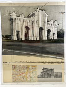
Christo Vladimirov Javacheff (1935-2020) and Jeanne-Claude Denat de Guillebon (1935-2009), known asNeely Auction4.6(224)See Sold PriceFeb 25, 2024
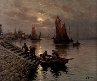
Antique original oil on canvas of Montana Rue Chevalier de la Barre Paris. Artist signed illegiblyNeely Auction4.6(224)See Sold PriceFeb 25, 2024
[MAPS]. DUFOUR, Auguste-Henri (1795-1865). Bound Volume of ...Potter & Potter Auctions4.6(539)See Sold PriceMar 07, 2024
[LINCOLN, Abraham (1809-1865), subject]. [BRADY, Matthew (1...Potter & Potter Auctions4.6(539)See Sold PriceMar 07, 2024
De Jode, Rare, pub. 1593 - Map of the Czech Republic or Kingdom of Bohemia (Chorographia insignisTrillium Antique Prints & Rare Books4.5(30)See Sold PriceFeb 24, 2024
De Jode, Rare, pub. 1593 - Map of the Middle East, Eastern Asia (Primae Partis Asiae accurataTrillium Antique Prints & Rare Books4.5(30)See Sold PriceFeb 24, 2024
De Jode, Rare, pub. 1593 - Map of Africa (Africae Vera Forma, et Situs)Trillium Antique Prints & Rare Books4.5(30)See Sold PriceFeb 24, 2024
Robert de Vaugondy - Map of Canada - Mer de l' Ouest or Sea of the West and a Northwest PassageProverde Auctions4.3(3)See Sold PriceFeb 28, 2024
Antique Map of Poland, 1700 by Guillaume De Lisle, ParisAntiques Online Auctions4.6(407)See Sold PriceMar 14, 2024
The Kingdom of Dalmatia Territories Map, 1700Antiques Online Auctions4.6(407)See Sold PriceMar 14, 2024


![[MAPS]. DUFOUR, Auguste-Henri (1795-1865). Bound Volume of ... (1 of 2)](https://p1.liveauctioneers.com/928/318880/171361279_1_x.jpg?height=282&quality=70&version=1707501302)
![[LINCOLN, Abraham (1809-1865), subject]. [BRADY, Matthew (1... (1 of 1)](https://p1.liveauctioneers.com/928/318880/171361543_1_x.jpg?height=282&quality=70&version=1707501302)