MAP - PIETER SCHENK / VALK / JANSSEN Hand Colored superb Map Central Italy c1702Luis Porretta Fine Arts4.3(10)See Sold PriceMar 02, 2024
CHARLES ROLLIN c1828 Ceasar Hand Colored Africa Military MapLuis Porretta Fine Arts4.3(10)See Sold PriceMar 02, 2024
MAP - Dufour, A. H. ( Malte / Brun ) :MAP - ESPAGNE PARTIE SUD DIVISEE EN PROVINCES ANCIENNES ( MAPLuis Porretta Fine Arts4.3(10)See Sold PriceMar 02, 2024
RIGOBERT BONNE c1787 Original Colored Map Germany & Region 15" x 12"Luis Porretta Fine Arts4.3(10)See Sold PriceMar 02, 2024
AMBROISE TARDIEU c1822 Napoleonic War Map GermanyLuis Porretta Fine Arts4.3(10)See Sold PriceMar 02, 2024
MAP - AMBROISE TARDIEU c1822 Napoleonic Miltary Map GermanyLuis Porretta Fine Arts4.3(10)See Sold PriceMar 02, 2024
1822 Rare Map by Ambroise Tardieu Napoleon Caldiero Battle of Vento 17" x 11Luis Porretta Fine Arts4.3(10)See Sold PriceMar 02, 2024
PIETER SCHENK / VALK / JANSSEN Hand Colored Map of Rhodes Greece ca1702 vgcLuis Porretta Fine Arts4.3(10)See Sold PriceMar 02, 2024
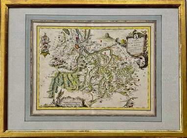
Map: Carte du Canton de Bale, Jacques Clermont, Paris, 1788Kensington Estate Auction4.6(216)See Sold PriceFeb 26, 2024
Manuscript Map of French Island Belle IsleUNKNOWN ARTIST. Carte Generale de Belle Isle. Manuscript map in ink with original wash. French, c. late 18th century. 27" x 44 3/4" sheet. Belle-Isle is an island off the coast of Brittany in northwesSee Sold Price
[18th Century French Manuscript] Unique and Beautifully[18th Century French Manuscript] Unique and Beautifully Written Manuscript of 650 Quarto Pages - Unpublished History of Belle-Isle-En-Mer, 1754 With Watercolor Illustration, Bound by Bauzonnet-TrautzSee Sold Price
French Manuscript Map of Minorca[French, 18th Century] Anonymous. Plan of Fort St. Philip on the island of Minorca. Manuscript Map, Pen and ink with wash colors. Paris, c. 1756. 16 3/4" x 22" sheet, 26 1/2" x 31 1/2" framed. ManuscrSee Sold Price
Bellin: Isle de la Guadeloupe, 1758Title of the Map: 'Carte de l'Isle de la Guadeloupe Pour servir à l'Histoire Générale des Voyages par M. B. Ingr. de la Marine 1758' A map of the French Caribbean islands of Guadeloupe, Marie-GalanSee Sold Price
Isle de la Guadeloupe'. Marie-Galante & Îles desTITLE OF THE MAP: 'Carte de l'Isle de la Guadeloupe Pour servir à l'Histoire Générale des Voyages par M. B. Ingr. de la Marine 1758' A map of the French Caribbean islands of Guadeloupe, Marie-GalanSee Sold Price
"Les Isles de la Guadeloupe, de Marie Galante" Îles desTITLE/CONTENT OF MAP: 'Les Isles de la Guadeloupe, de Marie Galante, de la Désirade: Colonie Françoise dans les Antilles' A map of the French Caribbean islands of Guadeloupe, Marie Galante and the �See Sold Price
"Les Isles de la Guadeloupe, de Marie Galante" Îles desTITLE/CONTENT OF MAP: 'Les Isles de la Guadeloupe, de Marie Galante, de la Désirade: Colonie Françoise dans les Antilles' A map of the French Caribbean islands of Guadeloupe, Marie Galante and the �See Sold Price
Les Isles de la Guadeloupe, de Marie Galante Îles desTITLE/CONTENT OF MAP: 'Les Isles de la Guadeloupe, de Marie Galante, de la Désirade: Colonie Françoise dans les Antilles' A map of the French Caribbean islands of Guadeloupe, Marie Galante and tSee Sold Price
Les Isles de la Guadeloupe, de Marie Galante… Îles des Saintes. BONNE 1780 mapTITLE/CONTENT OF MAP: 'Les Isles de la Guadeloupe, de Marie Galante, de la Désirade: Colonie Françoise dans les Antilles' A map of the French Caribbean islands of Guadeloupe, Marie Galante aSee Sold Price
Les Isles de la Guadeloupe, de Marie Galante… Îles des Saintes. BONNE 1780 mapTITLE/CONTENT OF MAP: 'Les Isles de la Guadeloupe, de Marie Galante, de la Désirade: Colonie Françoise dans les Antilles' A map of the French Caribbean islands of Guadeloupe, Marie Galante aSee Sold Price
Carte de l'Isle de la Martinique, Colonie Françoise…. Antilles. BONNE 1780 mapTITLE/CONTENT OF MAP: 'Carte de l'Isle de la Martinique, Colonie Françoise dans les Isles Antilles' A map of the French Caribbean island of Martinique DATE PRINTED: 1780 IMAGE SIZE: Approx 34.5 xSee Sold Price
Carte de l'Isle de la Martinique, Colonie Françoise…. Antilles. BONNE 1780 mapTITLE/CONTENT OF MAP: 'Carte de l'Isle de la Martinique, Colonie Françoise dans les Isles Antilles' A map of the French Caribbean island of Martinique DATE PRINTED: 1780 IMAGE SIZE: Approx 34.5 xSee Sold Price
Bellin: Antique Map of Guadeloupe, 1758Title/Content of Map: 'Carte de l'Isle de la Guadeloupe Pour servir à l'Histoire Générale des Voyages par M. B. Ingr. de la Marine 1758' A map of the French Caribbean islands of Guadeloupe, Marie-GSee Sold Price
Bonne: Antique Map of Guadeloupe, Marie Galante 1780TITLE/CONTENT OF MAP: 'Les Isles de la Guadeloupe, de Marie Galante, de la Désirade: Colonie Françoise dans les Antilles' A map of the French Caribbean islands of Guadeloupe, Marie Galante and the �See Sold Price
SoldA mixed group of 10 manuscript maps,3 similar decorative French maps of the British Isles, France and Italy, 5 others, similar, of Africa, North America, Brazil, Scandinavia and Switzerland, with one of Europe and another of Italy, penSee Sold Price
French Letter - Charles Louis Auguste Fouquet1759 AD. A manuscript letter on paper from the celebrated French military commander, the duc de Belle-Isle (1684-1761), dated Versailles, 22 May 1759; discussing regimental affairs; with old collectioSee Sold Price
SoldPost Medieval French Military Letter - Charles Louis Au1759 AD A manuscript letter on paper from the celebrated French military commander, the duc de Belle-Isle (1684-1761), dated Versailles, 22 May 1759; discussing regimental affairs; with old collectionSee Sold Price
SoldRGS - Geographical Journal C1945 Lot 16 Manuscript MapsIncl Canada, Isle of Wight, Burma, Norway, Gough Island, Fiji, Tibet, Leeward Islands, South Africa, Antarctic, Uganda, Morocco, Canada, and Brazil. Lot of 16 Hand Drawn Manuscript (one is printed) AlSee Sold Price
SoldNautical Chart: N. America inc. Boston, Nova ScotiaNautical Map: A Chart of the Course of North America, from the Strait of Belle Isle to Boston, Banks and Island of Newfoundland, The Gulf and River of St. Lawrence, Nova Scotia, Bay of Fundie &c, ConsSee Sold Price
French Engraved Map of The Virgin Islands, c. 176French Engraved Map of The Virgin Islands, c. 1764 or later, by Jacques Bellin, entitled "Carte des Isles des Vierges", uncolored, folio, 17 3/4 by 12 3/4 in., unframed.See Sold Price
Manuscript Plan of of Fort Philippe (Menorca).[French, 18th Century] Anonymous. Plan of Fort St. Philip on the island of Menorca. Manuscript Map, Pen and ink with wash colors. Paris, c. 1756. 16 3/4 x 22 inches sheet, 26 1/2 x 31 1/2 inches frameSee Sold Price
SoldBellin: Cayenne Island, French GuianaMap Title: Carte de l'Isle de Cayenne. Cartographer: Bellin Place / Date: Paris / 1764 Size: 12 1/2" x 9 1/2" The beautifully colored, double-page Cayenne Island map from Bellin's Petit Atlas MaritimeSee Sold Price
Bellin: Cayenne Island, French GuianaReserve Reduced! Title of Map: Carte de l'Isle de Cayenne. Cartographer: Bellin Place / Date: Paris / 1764 Size: 12 1/2" x 9 1/2" Condition: wash color; light overall age toning The beautifully coloreSee Sold Price
Bellin: Cayenne Island, French GuianaMap Title: Carte de l'Isle de CaienneCartographer: Bellin Place/Date: Paris / 1753/1760 Size: 11" x 8 1/2" Condition: b&w; light overall age toning and few spots; a tiny, barely visible puncture holeSee Sold Price
Illuminated Manuscript Leaf of John the EvangelistSchmidt's Antiques Inc. Since 19114.8(431)See Sold PriceMar 02, 2024
LATE 17TH C. FRENCH MAP OF THE NEW WORLD BY ALEXIS-HUBERT JAILLOT (1632-1712)Thomaston Place Auction Galleries4.4(386)See Sold PriceFeb 24, 2024
1760 MAP CARTE PARTICULIERE DE L'ISLE DE JUAN FERNANDES antique Robinson CrusoeJasper524.5(9.8k)See Sold PriceFeb 27, 2024
1764 Bellin Map of Lesser Antilles Northern Portion -- Petites Antilles ou Isles du Vent 3e. Partie.Jasper524.5(9.8k)See Sold PriceFeb 27, 2024
1764 Bellin Map of Mari-Galante Near Guadeloupe -- Carte de l'Isle de Mari-GalanteJasper524.5(9.8k)See Sold PriceFeb 27, 2024
1845 Delisle/Bauche Map of Martinique -- Carte de l'Isle de la Martinique Colonie Francoise de l'uneJasper524.5(9.8k)See Sold PriceFeb 27, 2024
Coast & Islands between Cape Roxo. Guinea-Bissau & Bissagos. KITCHIN 1745 mapJasper524.5(9.8k)See Sold PriceFeb 28, 2024
Carte de la Guinée, contenant…'. Guinea & Cape Verde islands. BONNE 1771 mapJasper524.5(9.8k)See Sold PriceFeb 28, 2024
Le Canal de Mosambique, l'Isle de Madagascar… Mozambique. Africa. BONNE 1788 mapJasper524.5(9.8k)See Sold PriceFeb 28, 2024
Plan de la Baye & Isle d'Arguim'. Mauritania. Arguin island. BELLIN 1746 mapJasper524.5(9.8k)See Sold PriceFeb 28, 2024
Le Canal de Mosambique, l'Isle de Madagascar… Mozambique. Africa. BONNE 1790 mapJasper524.5(9.8k)See Sold PriceFeb 28, 2024
Partie Occidentale de l’Afrique. West Africa coast Canary islands BONNE 1788 mapJasper524.5(9.8k)See Sold PriceFeb 28, 2024
1792 OLD INDIA HISTORY ANTIQUE ILLUSTRATED WITH MAPS OF THE EIGHTEENTH CENTURY IN FRENCHNY Elizabeth 4.3(84)See Sold PriceMar 03, 2024
James Cook - Map of the Friendly Isles - Tonga IslandsProverde Auctions4.3(3)See Sold PriceFeb 28, 2024
Jacques Nicolas Bellin - Antique Map - Vue de la Rade de Tiniam, double antique coast view of theProverde Auctions4.3(3)See Sold PriceFeb 28, 2024


![[18th Century French Manuscript] Unique and Beautifully (1 of 5)](https://p1.liveauctioneers.com/46/113409/58240881_1_x.jpg?height=282&quality=70&version=1512492316)


