ATLAS of ANTIENT GEOGRAPHY by SAMUEL BUTLER 1843John McInnis Auctioneers,LLC4.6(502)See Sold PriceFeb 24, 2024
18TH C. ANTIQUE MAP: FRENCH & INDIAN WAR, FRAMEDThomaston Place Auction Galleries4.4(386)See Sold PriceFeb 24, 2024
Rand McNally Railroad Map Cabinet w/ 21 Railroad MapsRail & Road Auctions4.6(165)See Sold PriceMar 08, 2024
Keith Haring - Ink on New York Map, Best Buddies, Inscribed, Signed, and DatedSapphire Auction Gallery4(67)See Sold PriceMar 02, 2024
LATE 17TH C. FRENCH MAP OF THE NEW WORLD BY ALEXIS-HUBERT JAILLOT (1632-1712)Thomaston Place Auction Galleries4.4(386)See Sold PriceFeb 24, 2024
Central Railroad of New Jersey Map of Sandy Hook Route-ca. 1903JM Hobby Supply and Railroad Artifact Auctions4.4(126)See Sold PriceFeb 24, 2024
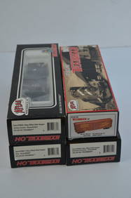
Lot of Six Mixed Atlas Box Cars-HO Scale-New in BoxJM Hobby Supply and Railroad Artifact Auctions4.4(126)See Sold PriceFeb 25, 2024
Rand McNally/Santa Fe Railroad Map of Iowa-1912JM Hobby Supply and Railroad Artifact Auctions4.4(126)See Sold PriceFeb 24, 2024
NICOLAES VISSCHER (NETHERLANDS, 1618-1709) MAP OF THE NEW WORLDThomaston Place Auction Galleries4.4(386)See Sold PriceFeb 24, 2024
17TH C. WORLD MAP BY NICOLAES VISSCHER (NETHERLANDS, 1618-1709)Thomaston Place Auction Galleries4.4(386)See Sold PriceFeb 24, 2024
Lot of Six Mixed Atlas Cabooses-HO Scale-New in BoxJM Hobby Supply and Railroad Artifact Auctions4.4(126)See Sold PriceFeb 25, 2024
Fisher Map of Delaware BayFISHER, Joshua (1707-1783).A Chart of the Delaware Bay and River.... Engraved map.London: Faden, 1776.21 3/4" x 29 3/4" sheet.Fine example of William Faden's important early chart of the Delaware RiveSee Sold Price
SoldJOSHUA FISHER DELAWARE BAY MAP1777 "Bay de la Delaware"; color highlights; matted and framed; center fold; light staining; image: 19" x 26", framed size: 29" x 36", VGSee Sold Price
Sold(Maps and Charts, Delaware), Fisher, Joshua, A Cha(Maps and Charts, Delaware), Fisher, Joshua, A Chart of Delaware Bay and River...from the Capes to Philadephia, London: Andrew Dury, 30th November, 1776, double-page folio, engraved by William Haydon,See Sold Price
SoldU S Coast Survey 1896 Map. Delaware Bay, Salt Lake Utah"Sketch Showing Extension of Triangulation of Delaware Bay with sub-sketches of Salina and Salt Lake Bases" Large Lithograph Map Published 1896, Washington for "U.S. Coast and Geodetic Survey" Folds aSee Sold Price
Gentlemans Magazine: Map of Delaware Bay, 1779Title/Content of Map: Revolutionary War era chart of Delaware Bay and River Date Printed: 1779 Cartographer: Gentlemans Magazine Size (inches): 9 x 7 Old hand-color Small antique chart of Delaware BaySee Sold Price
Sold1779 Map of Delaware Bay and RiverMapsMap of “Delaware Bay and River” July 1779, THE GENTLEMAN’S MAGAZINE, London, England, Very Fine. 8.5” x 5,” two-column layout, pp. 329-376, disbound, lacking covers.See Sold Price
MAP OF "DELAWARE BAY AND RIVER"[MAPS] July 1779, THE GENTLEMAN'S MAGAZINE, London, England. 8" x 5," two-column layout, pp. 329-376, disbound, lacking covers. "By Sylvanus Urban, Printed for D. Henry, at St. John's Gate." A RevolutSee Sold Price
Eldridge's Map of Delaware Baypublished by S. Thaxter & Son Boston, 1884 48" x 32" with hand stitched cloth edging neatly highlighted and notated, routes and points of interest SHIPPING: Shipping available within the Continental USee Sold Price
1779 Gentlemans Magazine, LondonMap of Delaware Bay and River July 1779, THE GENTLEMAN'S MAGAZINE, London, England, Very Fine. 8" x 5," two-column layout, pp. 329-376, disbound, lacking covers. "By Sylvanus Urban, Printed for D. HenSee Sold Price
SoldANTIQUE HAGGER & BRO CHESAPEAKE DELAWARE BAY MAPBALTIMORE CORRECTED 1852 - LINEN BACKED - VARIOUS STAINING SEE PIC - MEASURES 29"T X 49"WSee Sold Price
Sold1916 Annotated Flight Maps, Delaware and Chesapeake1916 Annotated Flight Maps, Delaware and Chesapeake Bay. 1915 Coast and Geodetic Survey Map of the Delaware and Chesapeake Bay, with inked notations from Coast Lieut. W. B. Hall plotting 168-mile fligSee Sold Price
SoldTwo 18c Delaware Maps Framed Fisher & Meridian1) "From the original by Mr. Fisher - Philadelphia - 1776" (Joshua Fisher reprint on hand-made watermarked paper & has characteristics of an original). Measures: 7.5" high by 9.25" wide inside mattingSee Sold Price
SoldFISHER, Joshua. A Chart of Delaware Bay and RiverFISHER, Joshua. A Chart of Delaware Bay and River, Containing a full & exact description of the Shores, Creeks, Harbours, Soundings, Shoals, Sands and Bearings of the most considerable Land Marks, fSee Sold Price
SoldFIELDING LUCAS (AMERICAN, 1781-1854) NAUTICAL CHART /FIELDING LUCAS (AMERICAN, 1781-1854) NAUTICAL CHART / MAP OF THE CHESAPEAKE AND DELAWARE BAYS, titled "A Chart / OF THE / CHESAPEAKE / AND / DELAWARE / Bays" in upper left corner, with "COMPILED AND PSee Sold Price
Sold1910-1920 Hog Island Shipyard Photos, Maps, Epheme1910-1920 Hog Island Shipyard Photos, Maps, Ephemera. Hog Island, Philadelphia PA ephemera including 60+ 8 X 10 photos of construction, 6+ maps including Delaware river, Chincoteague Delaware Bay. GEOSee Sold Price
SoldRevolutionary War era chart of Delaware Bay and RiverTitle/Content of Map: Revolutionary War era chart of Delaware Bay and River Date Printed: 1779 Cartographer: Gentlemans Magazine Size (in): 9 x 7 Small antique chart of Delaware Bay and River. DerivedSee Sold Price
SoldScare Map of the Chesapeake BayTo the American Philosophical Society, this map of the peninsula between Delaware & Chesopeak bays, with the said bays and shores adjacent drawn from the most accurate surveys is humbly inscribed by JSee Sold Price
SoldGroup of Early Maps of the State of Delaware.[Delaware] Group of four early maps of Delaware. Includes: (1, 2) The Bay and River of Delaware. 2 states. 1804, 1809. Published by Edmund M. Blunt. (3) Delaware. From Matthew Carey's American PocketSee Sold Price
Sold3 Maps of the Delaware River and Narragansett Bat3 Maps of the Delaware River and Narragansett Bay. 32'' x 32'' and 42'' x 30''. Some staining, wrinkling, wear, etc.See Sold Price
General Chart of Delaware and Chesapeake Bays and theReserve Reduced! Title/Content of Map: General Chart of Delaware and Chesapeake Bays and the Seacoast from Cape May to Cape Henry Date: 1866 Cartographer: BACHE, A.D./HASSLER, F.R. Publisher: U.S. COASee Sold Price
SoldFaden, William. Map of the Southern States, of NorthFaden, William. Map of the Southern States, of North America......Comprehending Maryland, Virginia, North and South Carolina from Delaware Bay to Savanna River (London: W. Faden, 1814), second editionSee Sold Price
Sold18th Century Chart of the Delaware Bay and RiverFramed 18th C. chart of the Delaware Bay and River. From the original by Mr. Fisher of Philadelphia, 1776. 22" x 29".See Sold Price
Engraved Map of New York HarborEngraved map of New York Harbor from the U.S. Coast Surveys, by Charles Copley hydrographer, also includes coastline north through Portland, ME, entrance to Delaware Bay, Portland Harbor, etc, 36" h xSee Sold Price
SoldJuly 1779, THE GENTLEMANS MAGAZINE with MapMapsMap of "Delaware Bay and River" July 1779, THE GENTLEMAN'S MAGAZINE, London, England, Very Fine. 8" x 5," two-column layout, pp. 329-376, disbound, lacking covers. "By SylSee Sold Price
4-Pack of Mixed Hopper/Boxcars-Atlas TM-UP/DH/NJC/ERIE-HO Scale-New in BoxJM Hobby Supply and Railroad Artifact Auctions4.4(126)See Sold PriceFeb 25, 2024
LARGE LATE 17TH C. DUTCH CHART OF CANADA, GREAT LAKES, NEW FRANCE, LABRADOR, HUDSON BAY, BY PIERREThomaston Place Auction Galleries4.4(386)See Sold PriceFeb 24, 2024
Proposed Sportsground Map - Haifa, Palestine - 1926Levy Auction House4.3(11)See Sold PriceFeb 27, 2024
Pair of Early Railroad Maps - 1874 Delaware, Lackawanna & Western and 1876 Pennsylvania RailroadRail & Road Auctions4.6(165)See Sold PriceMar 07, 2024
Oyster Bay Long Island NY Vintage Color Reproduction Map 12 x 18Mynt Auctions4.6(680)See Sold PriceFeb 23, 2024
D'Entrecasteaux - Tasmania, Australia: Map of the Northern Portion of Recherche Bay. 5Trillium Antique Prints & Rare Books4.5(30)See Sold PriceFeb 24, 2024
STAR WARS: A NEW HOPE (1977) - Framed Hand-Drawn Joe Johnston Docking Bay StoryboardPropstore4.2(6)See Sold PriceMar 13, 2024
1764 Bellin Chart of Three South Haitian Bays -- Carte des Bayes du Mesle des Flamands et deJasper524.5(9.8k)See Sold PriceFeb 27, 2024
Coste Occidentale d’Afrique…' Arguin Bay Cap Blanc Mauritania. BELLIN 1746 mapJasper524.5(9.8k)See Sold PriceFeb 28, 2024
West coast of Africa from Cape Blanco… Arguin bay, Mauritania. LABAT 1745 mapJasper524.5(9.8k)See Sold PriceFeb 28, 2024
Coste Occidentale d’Afrique'. Bay of Arguin, Mauritania. BELLIN/SCHLEY 1747 mapJasper524.5(9.8k)See Sold PriceFeb 28, 2024
South Namibia coast. Walvis Bay-Orange River ADMIRALTY sea chart 1881 (1954) mapJasper524.5(9.8k)See Sold PriceFeb 28, 2024
Perry, Matthew C. 1856 Large Map. Shah Bay, Lew Chew I. JapanAlbion Auctions4.6(336)See Sold PriceMar 01, 2024
Mary Jane Thomas Stokes - Map of Lighthouses of the Chesapeake Bay. Past and PresentProverde Auctions4.3(3)See Sold PriceFeb 28, 2024